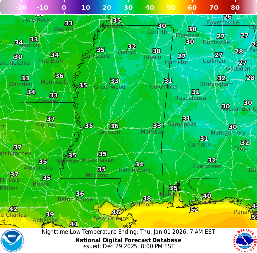
Happy New Year’s Eve Eve! We’re almost out of the “which day is it?” timeframe! High pressure will keep us dry for the celebrations, but before we even get to the new year, we have one last chilly morning of 2025. As you can see from the image below from the Jackson NWS, there’s a very high chance that we will see our low tonight and into tomorrow morning below 28 degrees!


Tonight’s Forecast
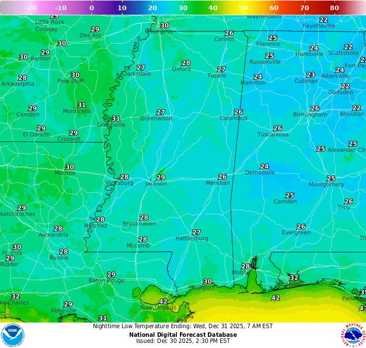
Temperatures drop to around 25-30 degrees for most, with above-freezing temperatures for New Orleans and other spots closer to the coast. Skies are expected to be crystal clear, with no cloud cover, which will allow for temperatures to drop this low.
New Year’s Eve Forecast: Wednesday, December 31
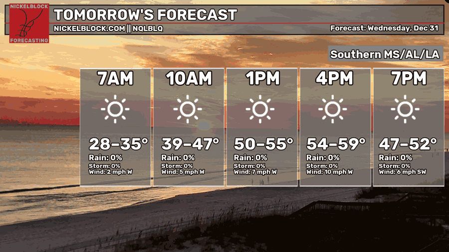
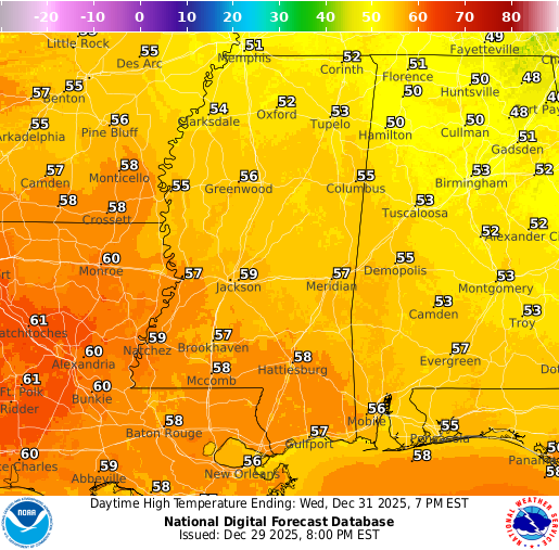
For New Year’s Eve, temperatures will slowly warm up throughout the day, reaching a high in the upper 50s. We’ll continue to have clear and sunny skies with no rain in the forecast. The low temperature into the new year will be in the mid-30s.
New Year’s Day Forecast: Thursday, January 1
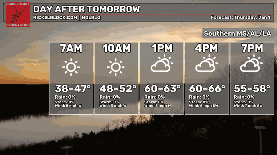
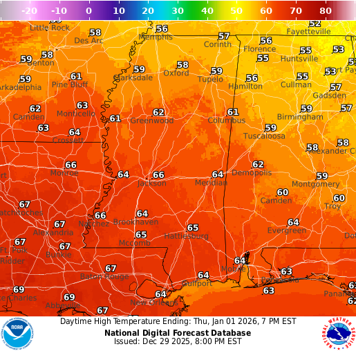
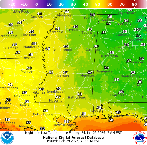
For Thursday, January 1st, we’ll trend slightly warmer, with highs in the mid to upper 60s. Overnight lows dip into the mid 40s, with some spots farther southwest staying closer to around 50. High pressure stays in control, so we’ll remain dry, but clouds will gradually increase through the day. Overall, it stays quiet with light winds as we ring in the new year.
Extended Local Outlook
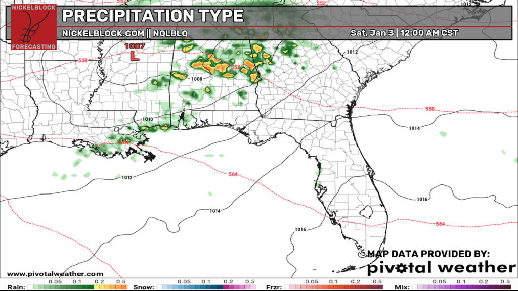
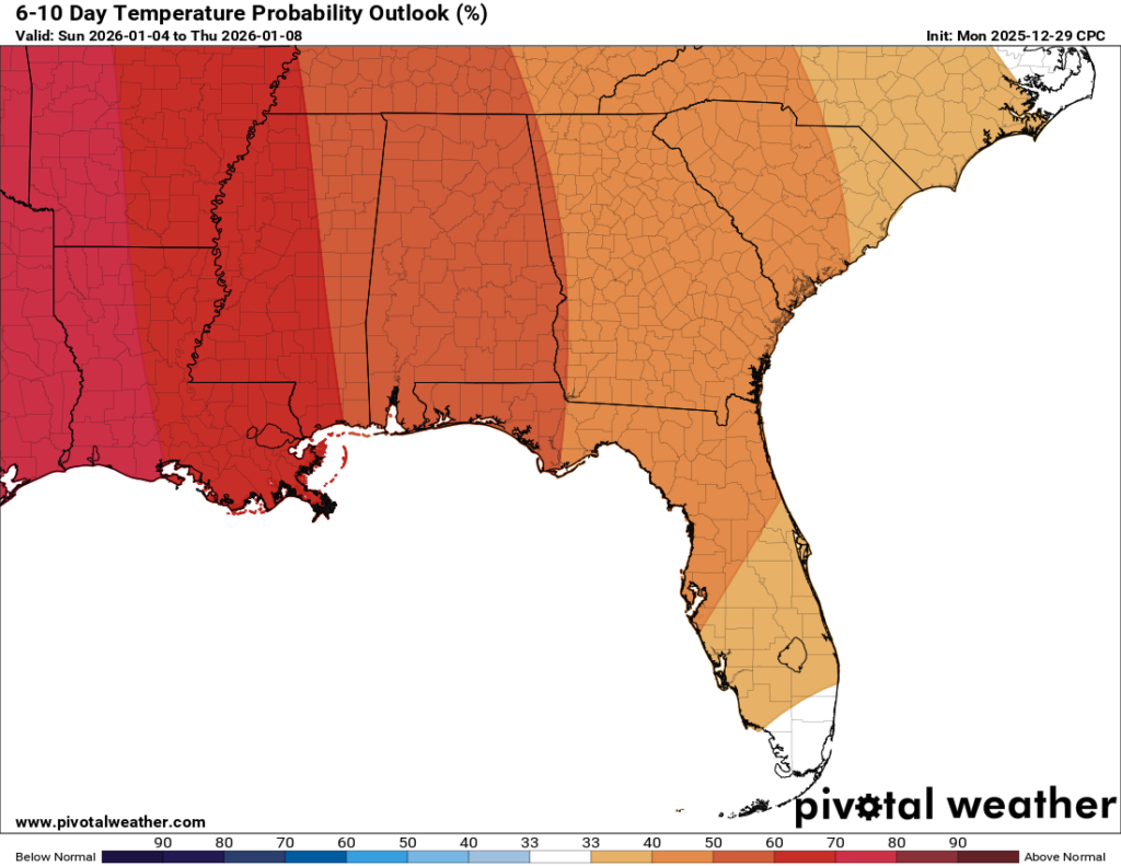
Heading into Jan 2 and beyond, we stay on the mild side with highs pushing into the lower 70s on Friday as clouds increase ahead of the next front. That boundary slides through Friday night into Saturday morning and could bring a few showers and a couple rumbles of thunder before things dry back out later Saturday. After that, the weekend and early next week look warm and mostly quiet overall, and the 6-10 day outlook continues to lean warmer than average, which supports temperatures climbing back into the 70s again during that stretch. Happy New Year!

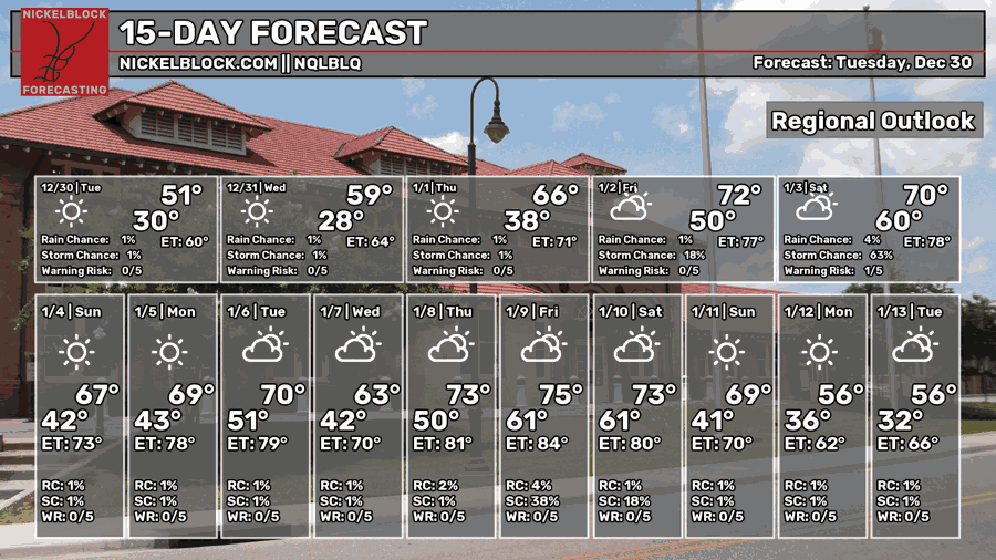
REGIONAL DAY TO DAY FORECAST
Tonight: Clear, with a low in the upper 20s. Northwest wind around 5 mph becoming calm in the evening.
New Year’s Eve: Sunny, with a high in the upper 50s. Calm wind becoming west around 5 mph.
2025 –> 2026 Overnight: Clear, with a low in the lower 30s. Calm wind becoming west-southwest around 5 mph.
New Year’s Day: Mostly sunny, with a high in the mid-60s. Calm wind becoming west-southwest around 5 mph.
Thursday Night: Mostly cloudy, with a low in the lower 40s. Calm wind becoming south around 5 mph after midnight.
Friday: A chance of showers after noon. Mostly cloudy, with a high near 70. South wind 5 to 10 mph, with gusts as high as 20 mph. Chance of rain 20 percent.
Friday Night: Showers likely and possibly a thunderstorm. Cloudy, with a low in the upper 50s. Southwest wind 5 to 10 mph, with gusts as high as 20 mph. Chance of rain 70 percent.
Saturday: A chance of showers before noon. Partly sunny, with a high in the lower 70s. Chance of rain 20 percent.
Saturday Night: Partly cloudy, with a low in the mid 40s.
Sunday: Mostly sunny, with a high in the upper 60s.
Sunday Night: Mostly clear, with a low in the mid-40s.
Monday: Mostly sunny, with a high near 70.


