General Central/Eastern Kansas Forecast
Short-Term (Tuesday-Wednesday)
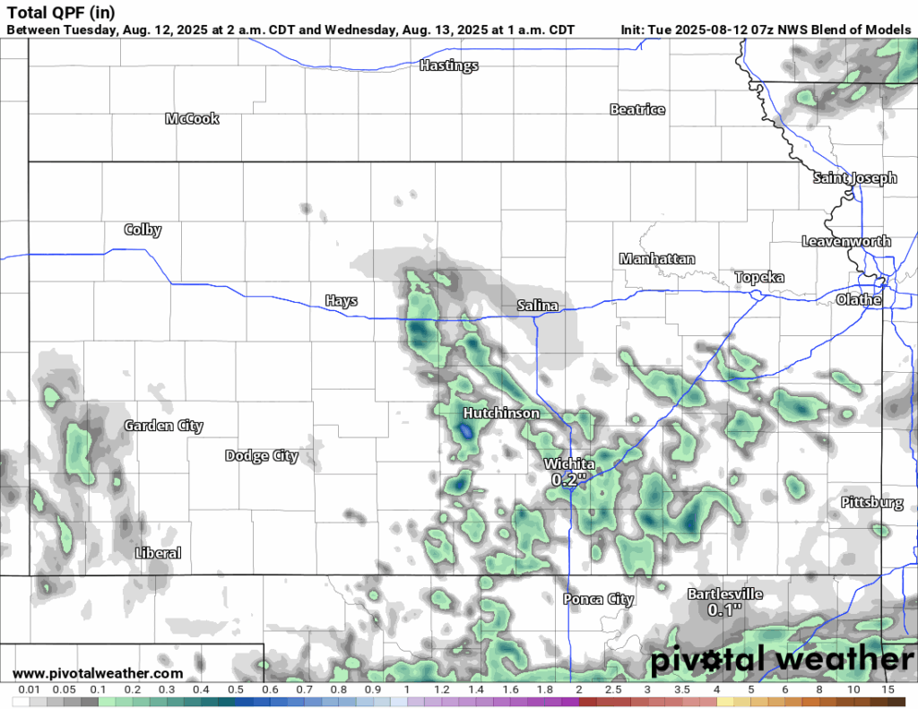
Scattered showers and thunderstorms near McPherson will make their way through central and south central Kansas this morning before slowly dissipating by the late morning to early afternoon hours. These slow-moving storms may cause some locally heavy rainfall, which could lead to some flash flooding concerns. Some later development along an outflow boundary across south-central Kansas may be possible this afternoon, with the majority of these storms just being garden variety thunderstorms. Otherwise the rest of the region will continue with drier conditions today as the trough responsible for our rainfall moves off to the southeast. High pressure will then begin to fill in behind it and start shutting down rain chances for good by tomorrow.
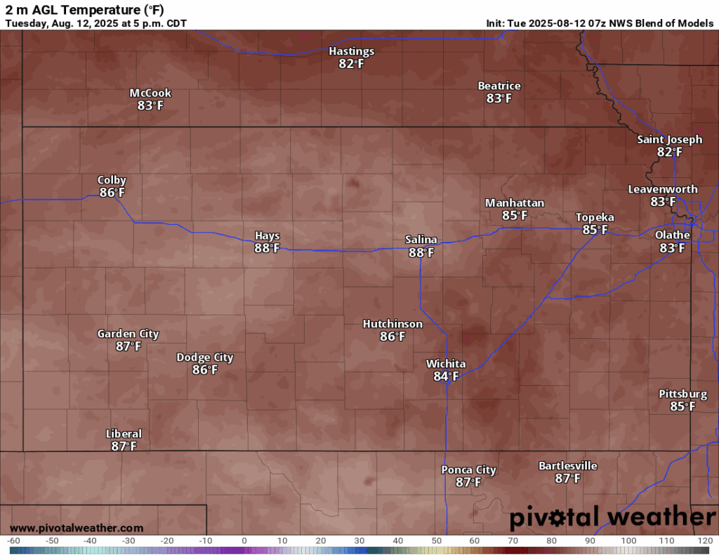
Temperatures today will still be below average for this time of year, topping out in the low to mid 80s this afternoon, with winds out of the north-northwest at around 5 mph. Overnight lows will be cool, with low temperatures in the low to upper 60s. By tomorrow, temperatures look to be a touch warmer, especially out west with high temperatures in the low to upper 80s in the afternoon. Winds will be out of the east-southeast at around 5 to 10 mph. Low temperatures tomorrow night will be a touch warmer, with low temperatures in the mid 60s to low 70s.

Long-Term (Thursday-Monday)
Precipitation chances will be near zero through the second half of the week and into the early weekend as high pressure builds in over the state. Temperatures will climb back into the low to mid 90s by the end of the week, leading to heat indices creeping back into the low 100s once again. This does not too last too long though, as rain chances will return by Sunday-Monday with some weak, mid-level disturbances transiting through the state.
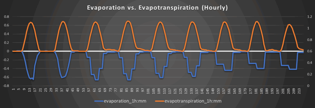
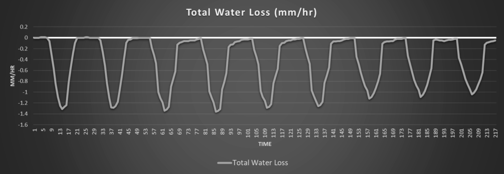
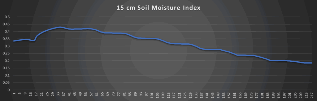
Regional Soil Moisture Outlook
Around Westmoreland


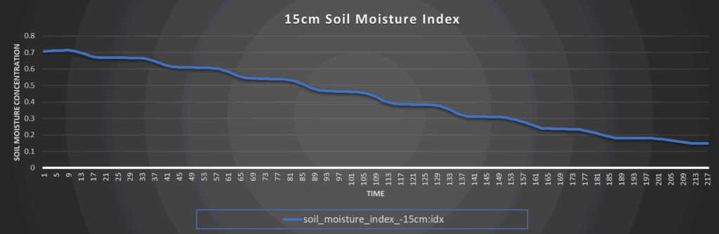
Around Scranton
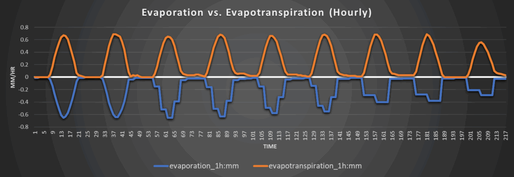


Around Burlington


Around Altoona