General Central/Eastern Kansas Forecast
Short-Term (Wednesday-Thursday)
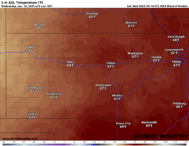
Shower activity continues to depart far eastern Kansas this morning while drier conditions begin to set in. Temperatures will be somewhat lower today due to the passing of a weak cold front overnight last night, with high temperatures today in the upper 70s to low 80s. Winds will be generally westerly at around 5 mph throughout the day today. This front did not do much to punch out our moisture in the atmosphere, with dew point temperatures remaining in the mid to upper 60s (and perhaps low 70s still in southeast Kansas) and relative humidity values between 55-70%. Overnight low temperatures tonight will be quite pleasant in the mid 60s. Beginning tomorrow, high pressure from the west will move in over the state and mark the start of our warming period for the first days of summer. Temperatures tomorrow look to jump to the upper 80s to low 90s, with southerly winds of 5 to 15 mph. Moisture will begin to stream northward once again, bringing dew point temperatures in the upper 60s to low 70s and relative humidity values to between 40-60%.
Long-Term (Friday-Tuesday)
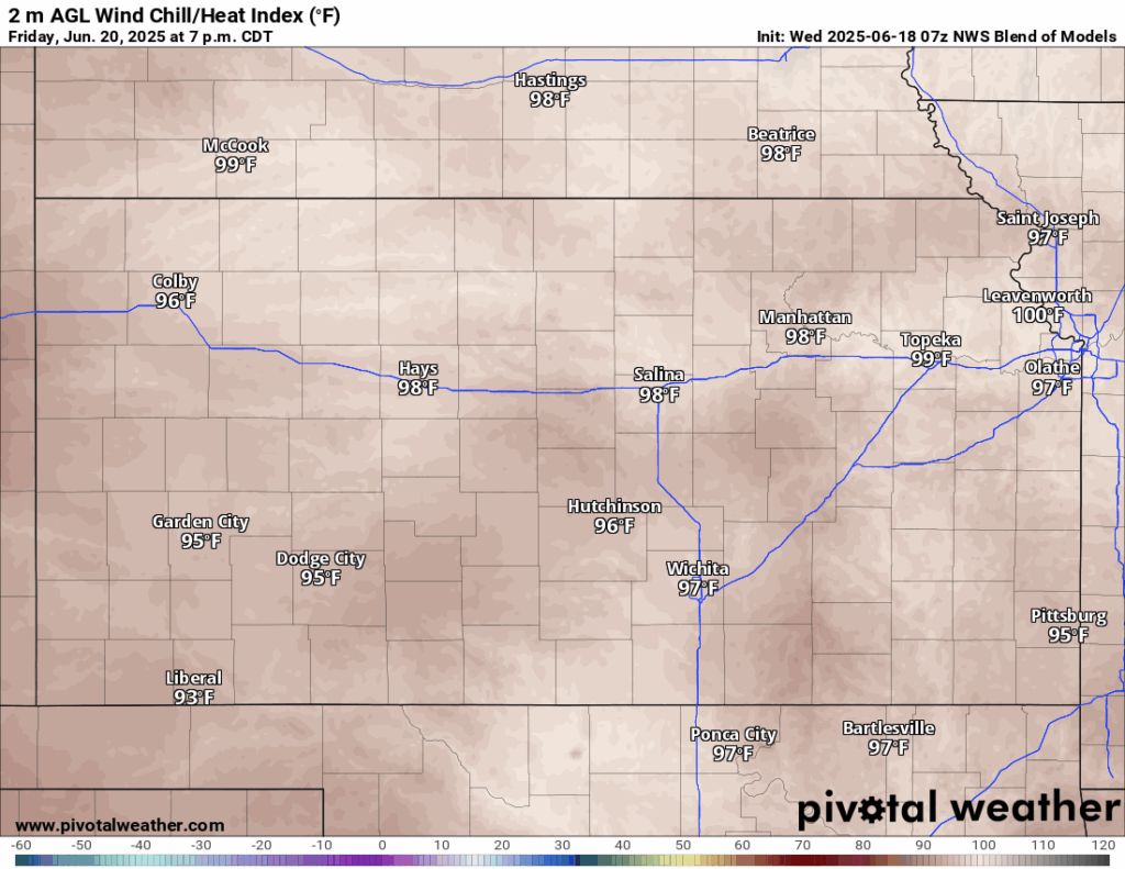
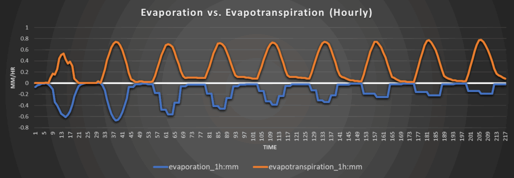
Outside of maybe an occasional diurnally driven pop-up shower or thunderstorm, no organized rain or thunderstorm activity is to be anticipated during the long-term period until perhaps next week, as high pressure fully sets in over us. Temperatures as a result will begin to feel more summer-like, with regular highs in the low to mid 90s during the day, with heat indices making daily runs into the upper 90s to low 100s. Contributing to the higher heat index, dew point temperatures will stay between the upper 60s to mid 70s to help increase the apparent temperature. Winds will also be quite strong daily, with winds over the long-term period ranging between 20-35 mph out of the south. By Monday and Tuesday, the high-pressure system may get displaced off to the east enough from over us far enough that we would reside again under southwest flow aloft. This will allow any potential disturbance in the flow to pass over us and help increase our chances for precipitation again, but overall chances are low.

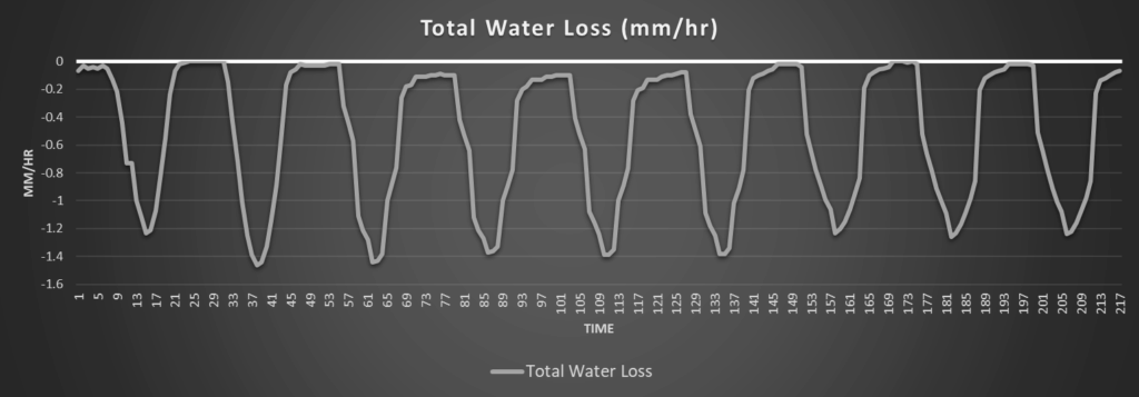
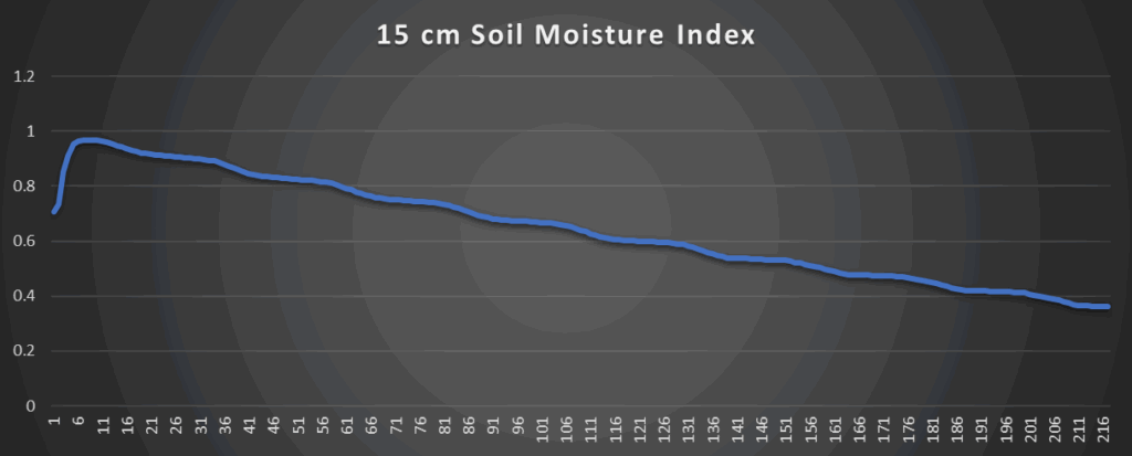
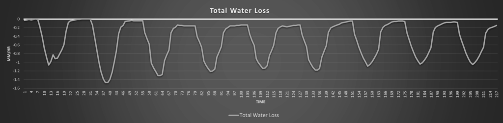
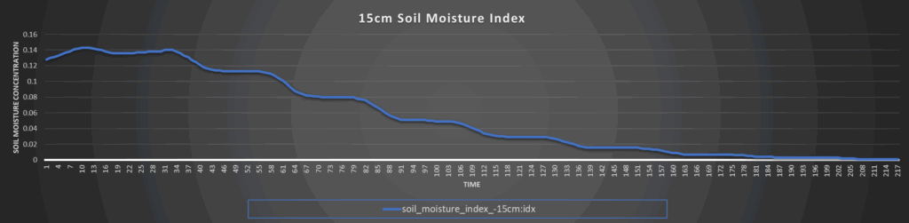
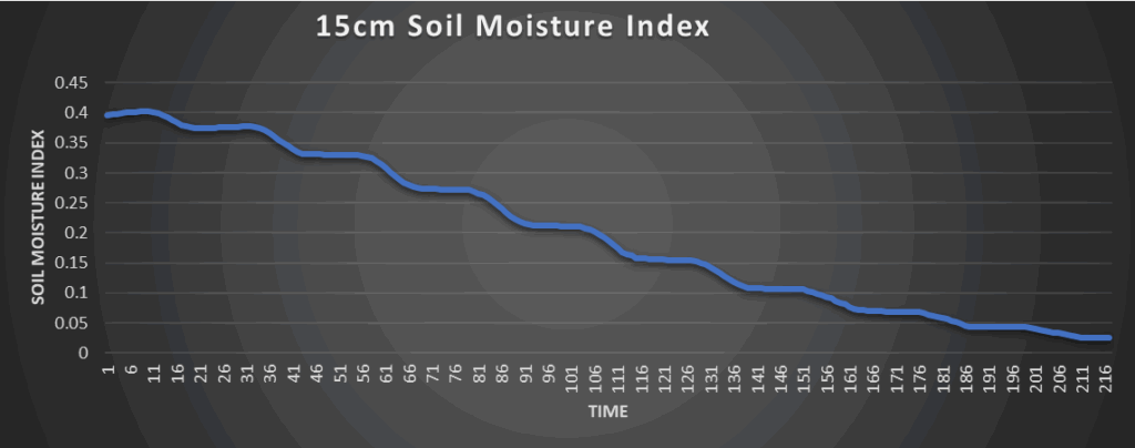
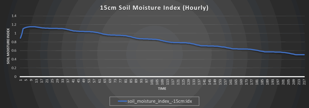
Regional Soil Moisture Update
After our last shot of rain last night, soils will consistently dry out due to the high temperatures and increased winds to the point that we may become nearly completely dry rather quickly. Areas in southern Kansas will not get as dry as fast due to the larger amounts of rainfall received over the last couple days, but those in northern Kansas are already nearly completely dry or at least will take far less time to reach that stage. If we can get consistent rain chances again by next week, maybe we could see some soil moisture recovery but the odds of that occurring right now are very low.
Around Westmoreland

Around Scranton
Around Burlington
Around Altoona