Rain is expected to come through our area today by the afternoon. A shortwave trough with a passing low pressure system will bring rounds of rain for the weekend. Temperatures will be soaring and feeling like the 100s! Let’s dive into the detailed forecast:
Today’s Overall Setup
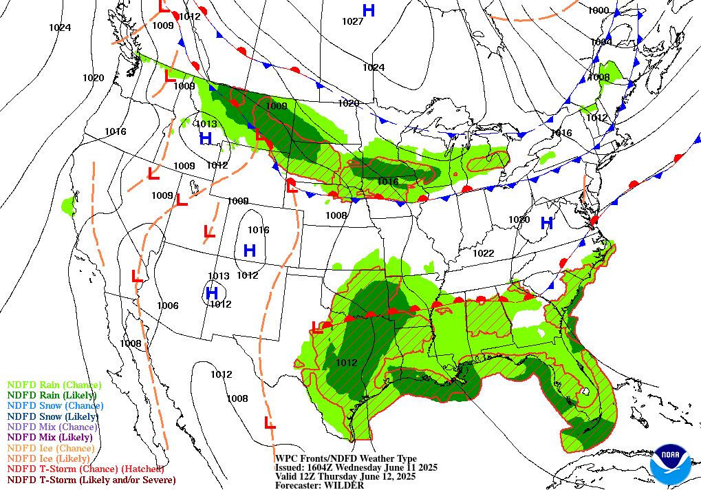
The surface setup for today is quite messy for our region. There is currently a low pressure system over Texas which a warm front is connected to, which spans through north Mississippi, Alabama, and Georgia. Everywhere along and near this front will see unsettled weather for at least some of your day.
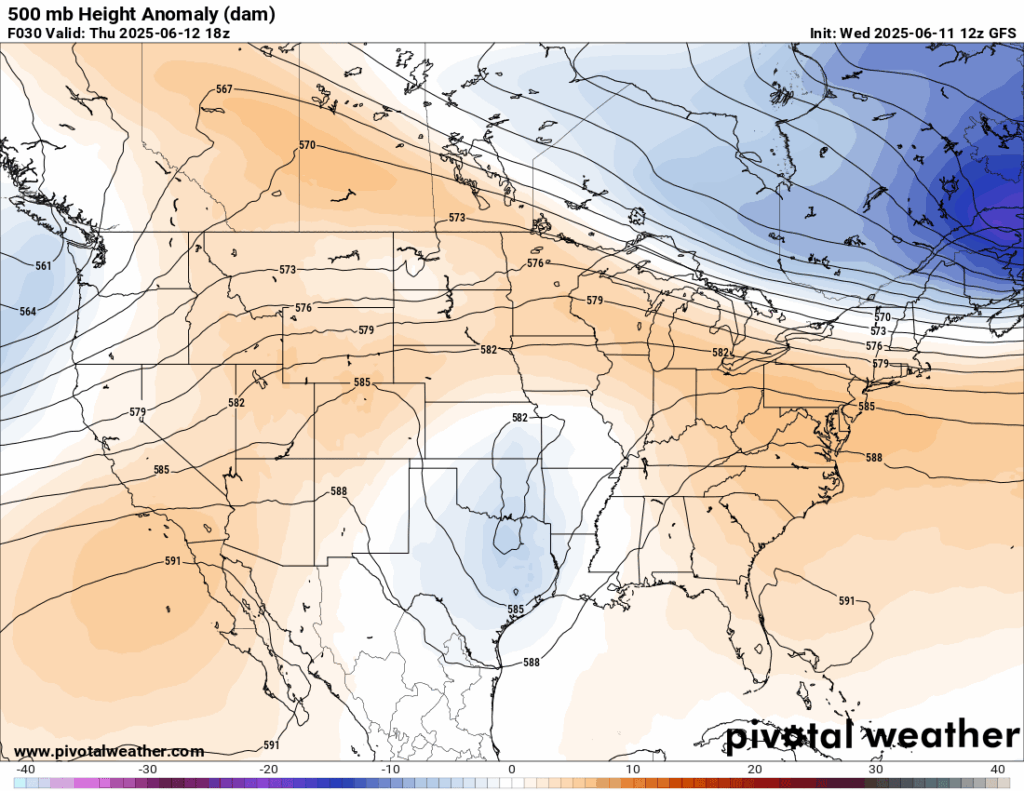
Looking at the 500 mb height anomalies, which show how mid-level atmospheric heights deviate from average, we can identify where ridging (higher heights) and troughing (lower heights) are occurring. The orange colors indicate increased ridging and the blue colors indicate increased troughing. Today, we see an area of increased troughing to our west, over Texas, which correlates to where that low pressure system is located. This generally means that temperatures will be cooler than average and there will be more than likely precipitation, if there’s moisture to work with. The troughing will be moving to the northeast today into tomorrow, and will bring some rain along it’s path.
Today’s Local Forecast
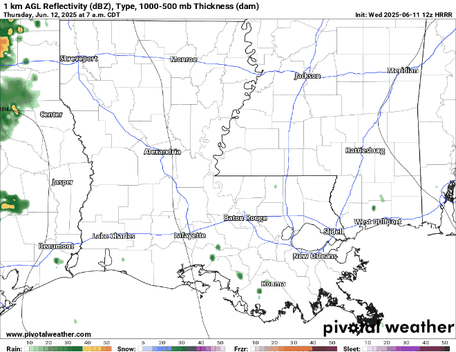
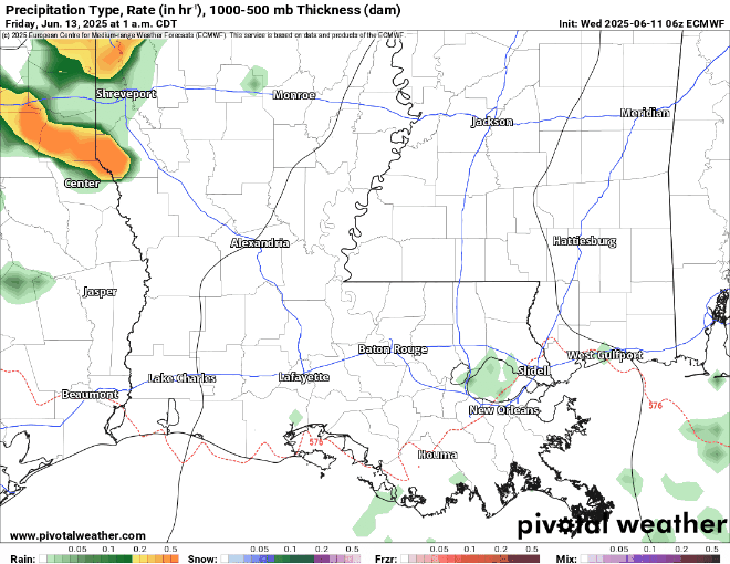
We start off the morning generally clear of showers and thunderstorms with mainly cloudy skies. Some thunderstorms will start to fire up ahead of the main line in the afternoon. These will be scattered and unlikely to be severe, but there will be heavy downpours and thunder/lightning with these cells. The main line of storms come through Louisiana around 12 pm and push east into Mississippi at around 5 or 6 pm, then finally exiting by midnight into Alabama.
While there is no severe risk from the SPC, I would keep a close eye on some of the cells on the main line of storms. I would be mainly concerned with isolated heavy winds and possibly small hail with any of these storms. Stay weather aware, and also stay indoors if possible in the afternoon/evening around Hattiesburg!

Here’s an hourly look at the forecast for today for the region
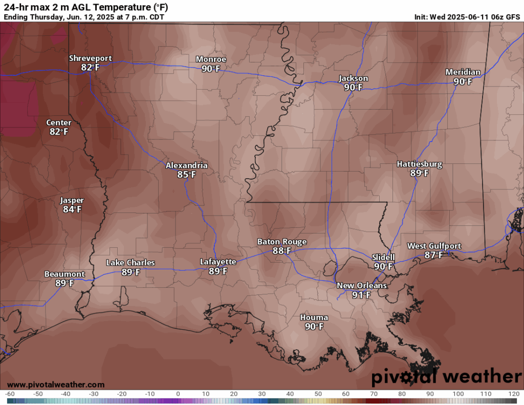
Highs today will reach the upper 80s to near 90 ahead of the approaching round of storms. Temperatures will drop noticeably once the storms move through, offering some temporary relief from the heat.
This Weekend’s Forecast
Above is a look at your temperatures for tomorrow and this weekend. We are expecting the usual upper 80s and lower 90s, with some areas reaching the mid 90s Saturday and Sunday. We are sitting slightly above average for our temperatures – at around 5 degrees above the average. There is increased ridging taking place this weekend for our region, which brings those temperatures up.
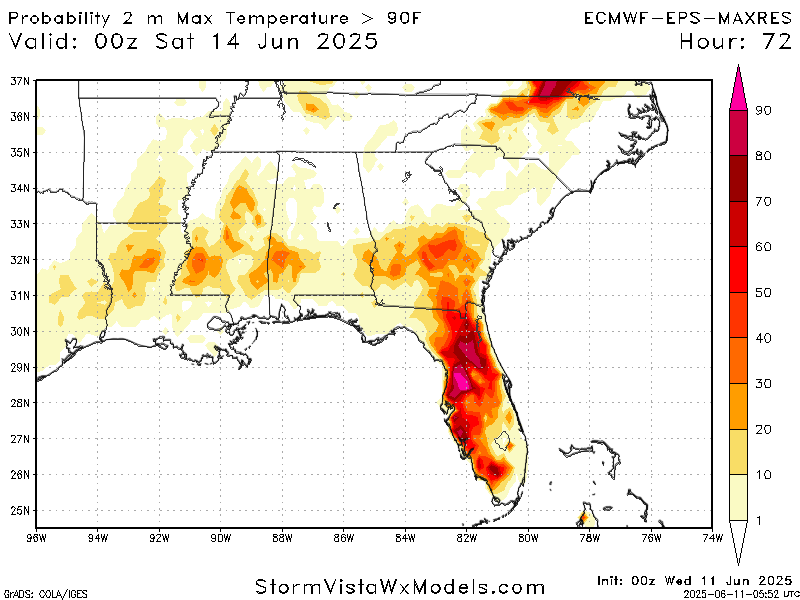
The above plot shows the probability of surface temperatures being greater than 90 degrees on Saturday. There is medium to high confidence that our region, mostly central Mississippi and northern Louisiana will experience their high temperature greater than 90 degrees. There is low confidence of temperatures breaking 95 degrees, though.

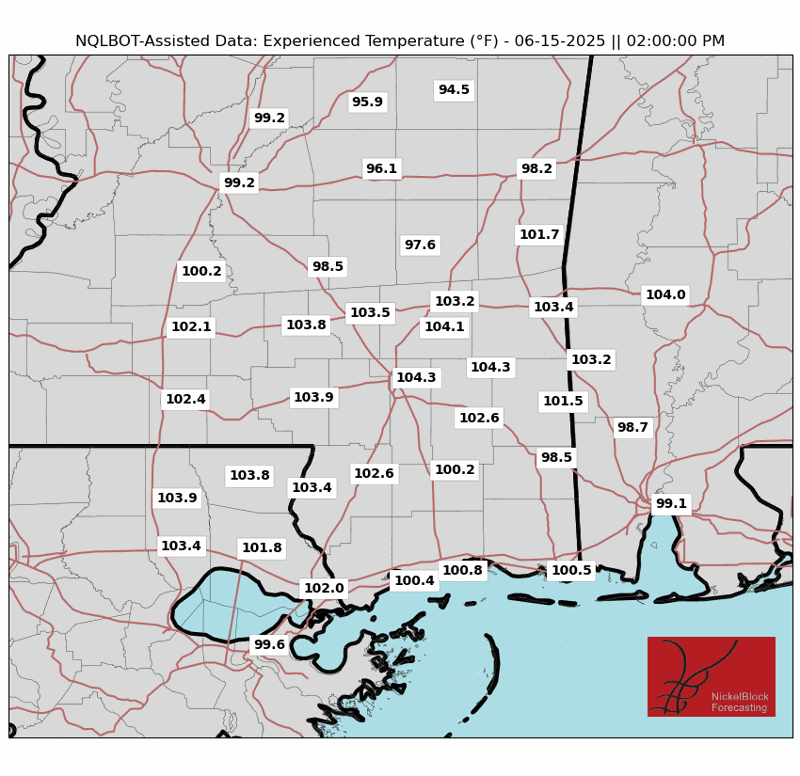
Our area is no stranger to humidity, and this weekend will be no exception. Dew points in the 70s will make it feel especially oppressive when combined with temperatures soaring into the 90s. Our NickelBlock Experienced Temperature plot has temperatures feeling like the 100s for peak afternoon on Saturday and Sunday. It’s the kind of heat that makes the air feel thick and uncomfortable. Staying hydrated will be a necessity this weekend!

In terms of rain for this weekend, each day we will see it. Who is to blame for that? The large area of spin that appears on the 500 mb vorticity map above. This large scale spin comes with rising air, which means unsettled weather. As shown by the green arrows drawn on the map, the flow into the vorticity maximum is from the south, meaning warm moist Gulf air is funneling through our area. This flow continues through the entire weekend, as the spin dissipates by Monday.
On Friday, showers fill in by the morning, leading to thunderstorms in the afternoon, then clearing up by the night. Saturday looks very similar, with spotty showers in the morning, followed by a line of thunderstorms in the afternoon. Yet again on Sunday, we see a similar story. I would not consider this weekend a washout, but if you plan your day around the afternoon thunderstorms, you should be in the clear. Be sure to watch the NickelBlock radar and turn on those alerts for instant lightning detection near your area.
Extended Local Outlook

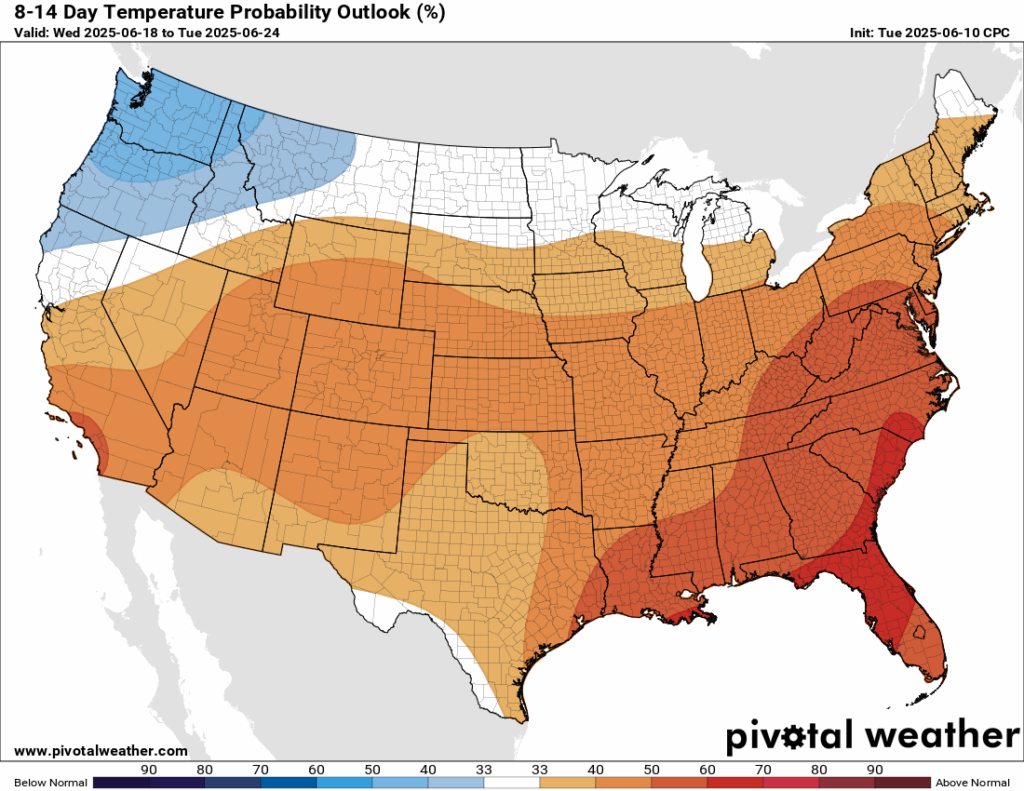
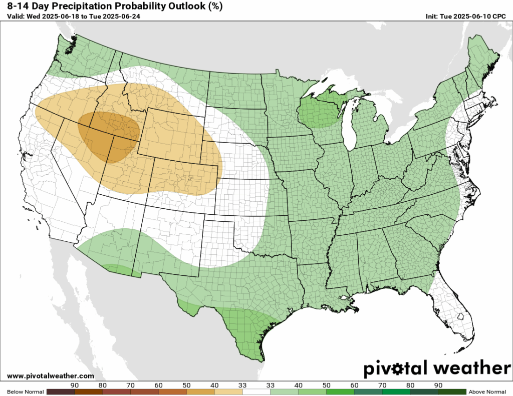
Looking ahead at the next 8-14 days, the Climate Prediction Center (CPC) is going for a 33-40 percent chance that precipitation in our area will be above normal. Temperatures are also expected to be above normal, with a 50-70 percent chance in our area. Summertime will be in full swing!
Latest Tropical Update
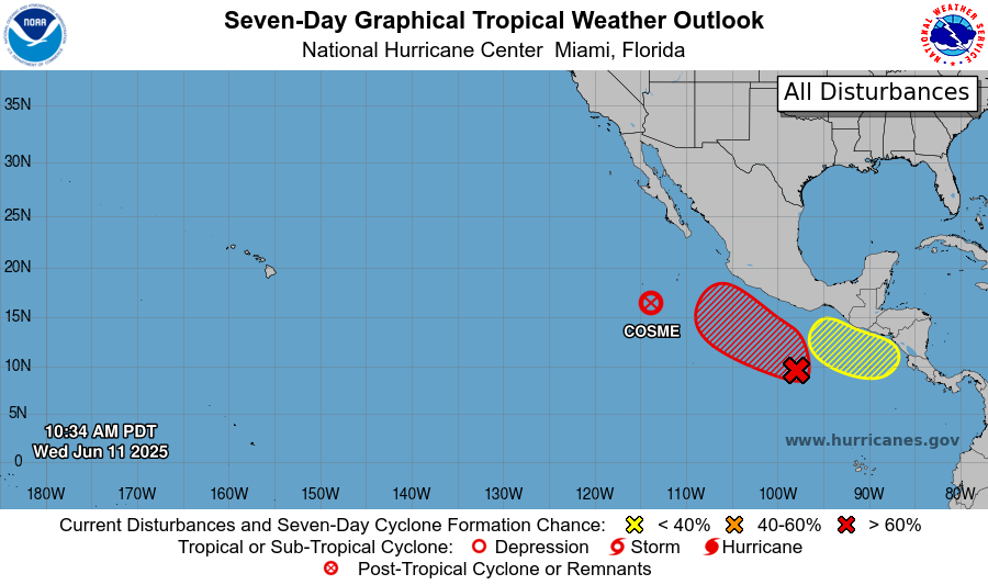
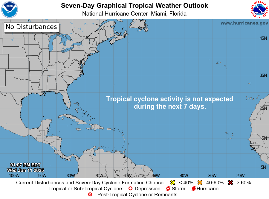
Currently in the tropics, we have two areas to watch and post-tropical storm Cosme in the Eastern Pacific. The Atlantic is quiet at the moment, and is expected to stay that way for the next 7 days.
Want the latest details on these systems? Check out our daily tropical updates for more in-depth information on the tropics!
REGIONAL DAY TO DAY FORECAST
Today: Showers and thunderstorms, mainly between 1pm and 4pm, then showers and possibly a thunderstorm after 4pm. Patchy fog before 8am. Highs in the low 90s. Calm winds becoming south southeast around 5 mph in the afternoon. Chance of rain 80 percent.
Tonight: Mostly cloudy with patchy fog. Lows in the low 70s. Calm winds.
Friday: Showers in the morning, thunderstorms in the afternoon. Highs in the low 90s. Calm winds becoming south around 5 mph in the afternoon. Chance of rain 80 percent.
Friday Night: Mostly cloudy. Lows in the mid 70s. South southeast winds around 5 mph becoming calm.
Saturday: Showers in the morning, thunderstorms in the afternoon. Highs in the mid 90s. Calm winds becoming south southwest around 5 mph in the afternoon. Chance of rain 80 percent.
Saturday Night: Mostly cloudy. Lows in the lower 70s. South winds around 5 mph becoming calm.
Sunday: Showers in the morning, thunderstorms in the afternoon. Highs in the mid 90s. Chance of rain 80 percent.
Sunday Night: Mostly cloudy. Chance of a rain shower. Lows in the mid 70s. Chance of rain 30 percent.
Monday: Showers and thunderstorms likely. Highs in the lower 90s. Chance of rain 80 percent.
Monday Night: Mostly cloudy with showers and thunderstorms possible. Lows in the mid 70s. Chance of rain 30 percent.
Tuesday: Partly sunny with scattered thunderstorms. Highs in the mid 90s. Chance of rain 70 percent.
Tuesday Night: Partly cloudy. Lows in the mid 70s. Calm winds.
Wednesday: Partly cloudy with scattered afternoon thunderstorms. Highs in the mid 90s. Chance of rain 40 percent.
Wednesday Night: Partly cloudy. Lows in the mid 70s. Calm winds.


