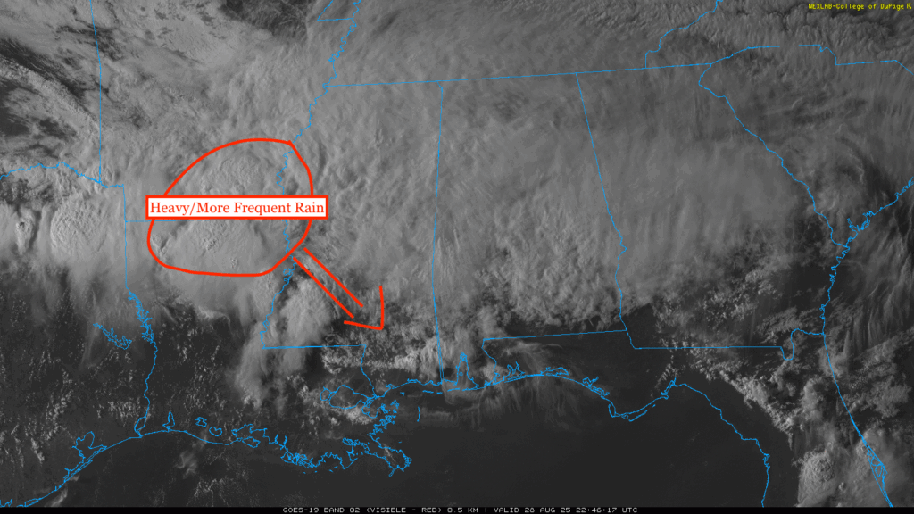
Storms are firing up in the region this evening along a stationary front, bringing some heavy downpours and gusty winds. The bulk of the rain is sitting over northern Louisiana and northeastern Mississippi currently, and will move to the southeast and fill in our area by the later evening into the overnight and will continue for the majority of the day tomorrow.
Overall Setup
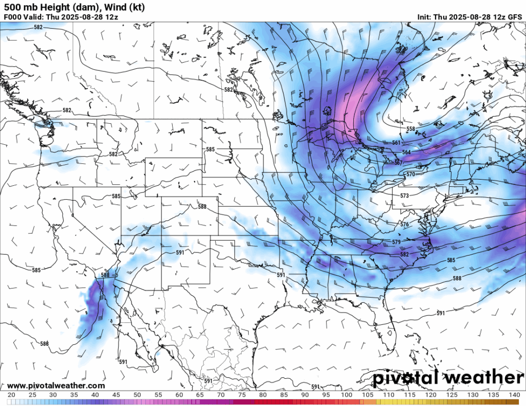
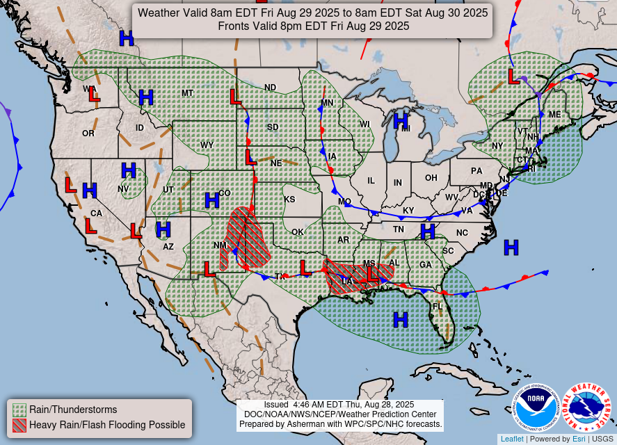
Northwesterly winds aloft are pushing a surface low pressure system and front that will stall out and stick with us through the weekend into our area. Most of the rain will fall tonight and tomorrow, but some effects from the front will still be felt on Saturday, Sunday, and even potentially Monday. It will eventually sink to the south, so there will be less and less of a chance of rain as we get to Labor Day. Flash flooding is possible due to frequent heavy rain tomorrow, so there is a Slight Risk zone highlighted over our area from the WPC.

Tonight’s Forecast
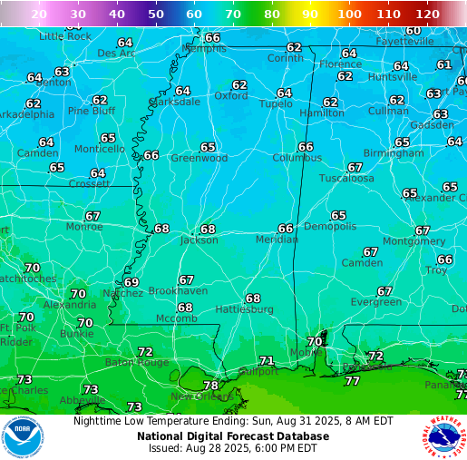
Tonight’s low will be in the high 60s. Scattered rain fills in overnight and it should become more widespread by the morning commute. Keep watch for heavy downpours and take your time driving if you will be.
Tomorrow’s Forecast
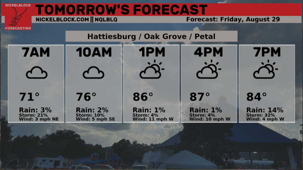
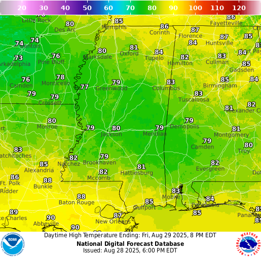
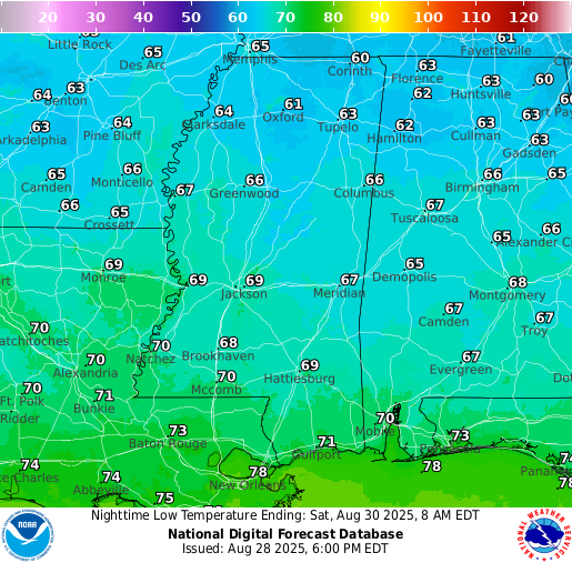
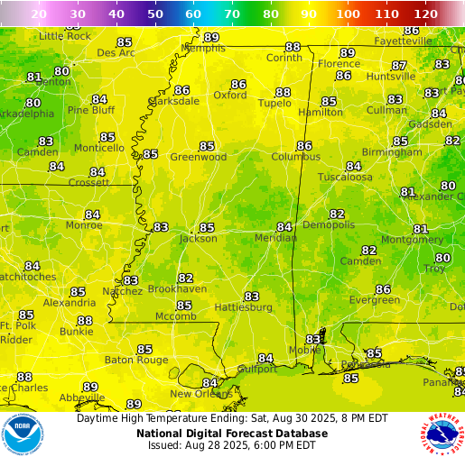
The NQLBOT is under contstruction, so the hourly forecast image above is defiently forgetting about the rain! It will be raining tomorrow for most of the region, maybe not all day, but some periods of heavy rain and showers scattered throughout the day. Showers start to disipate by the evening, but will still be in the area through midnight. Make sure the umbrella is handy throughout the day! High temperatures tomorrow will be limited to the lower 80s due to the cloud cover and rain, and lows tomorrow night will be near the high 60s.
Saturday’s Forecast
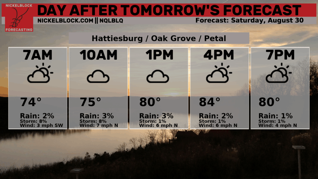
Some leftover rain showers and increased cloudiness will be felt on Saturday as the frontal system continues to hang around our area. There could be a few breaks in the sun, but there will be likely more clouds than sun. High temperatures will struggle to break 85 degrees as a result, and overnight lows will be in the mid 60s. It will still be very humid, despite the drop in high temperature, so no relief in the humidity department quite yet!
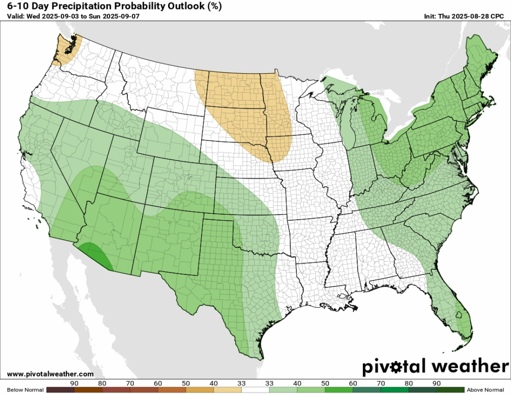
Extended Local Outlook
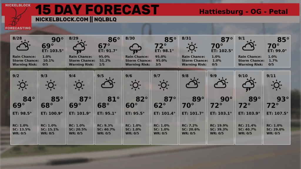
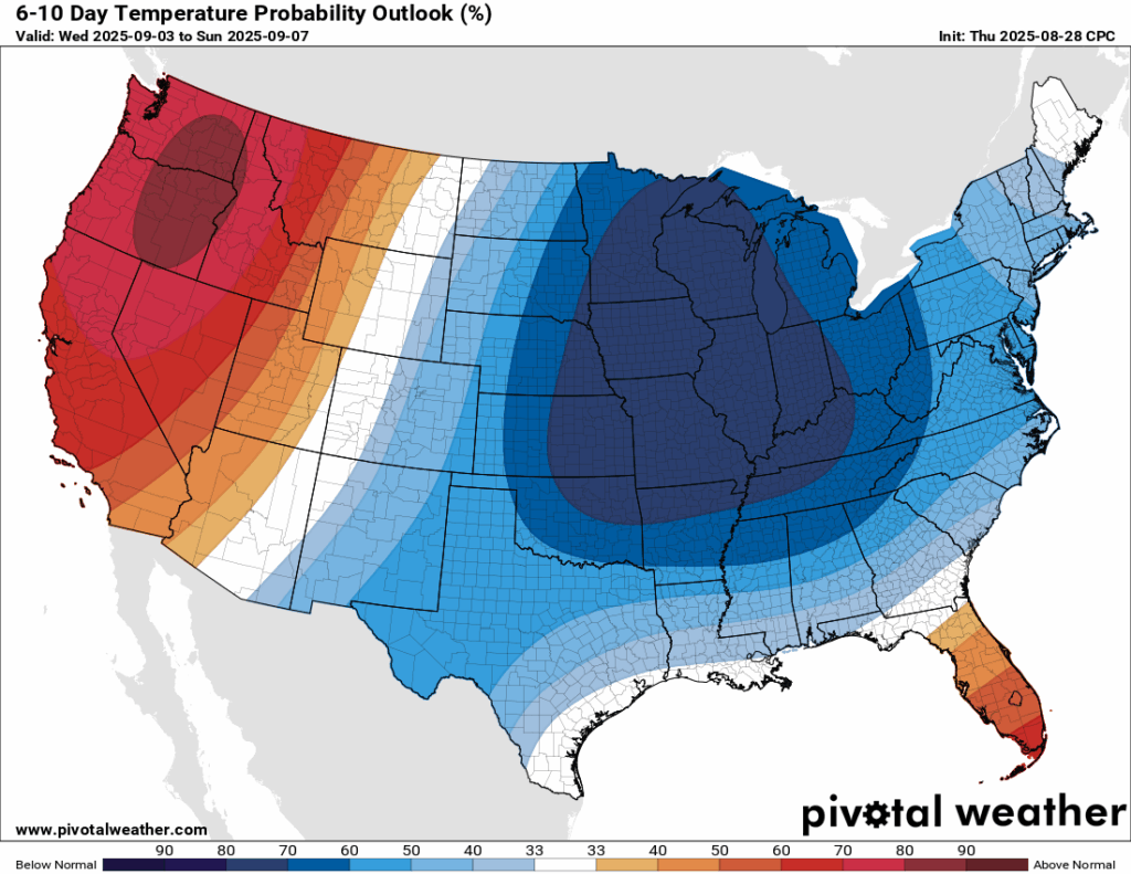
Another very strong cold front/trough will spill down into the eastern U.S. in the next 6-10 days, maximizing by the middle of next week. We could potentially see temperatures in the high 70s or low 80s by the end of next week (next Friday and Saturday)! That is one strong cold front, stronger than the one we saw earlier this summer. Current guidance shows dew points in the 40s and 50s next Friday in our area, which would feel simply amazing and give a nice break in the humidity.
Rainfall is trending near-average for the 6-10 day timeframe, not too much and not too little!
Latest Tropical Update
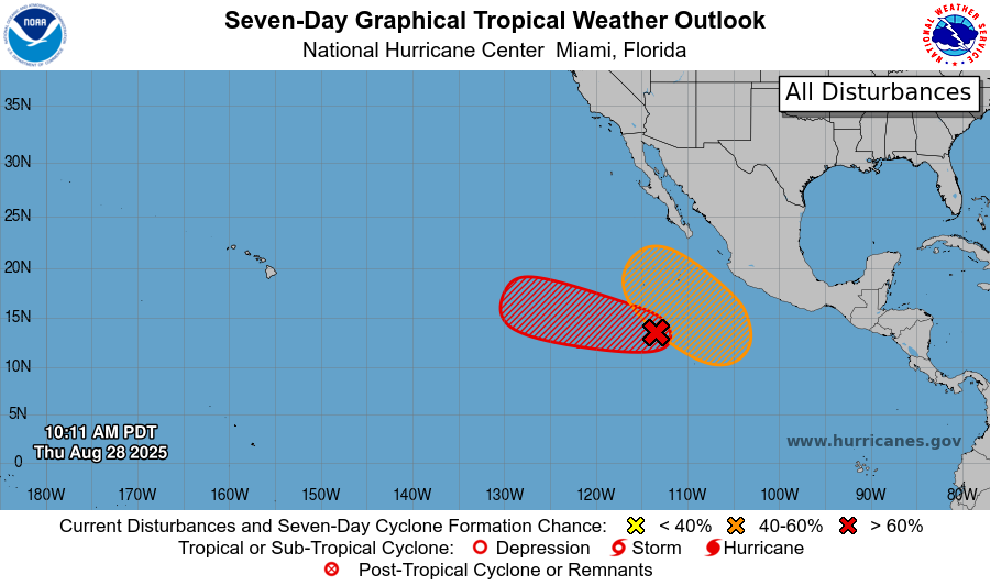
Eastern/Central Pacific:
There are two areas to watch in the Eastern/Central Pacifc Basin. The one in red (Invest 93E) has an 80 percent chance of developing into a tropical system in the next 7 days, and it is looking likely to become Tropical Storm Kiko by this weekend. It will likely max-out as a tropical storm, but regardless, this should stay clear of western North America and the Hawaiian Islands. The one in orange, not yet named as an Invest, has a 50 percent chance of developing in the next 7 days. We will watch this one closer, as it’s development region is awfully close to Baja California.
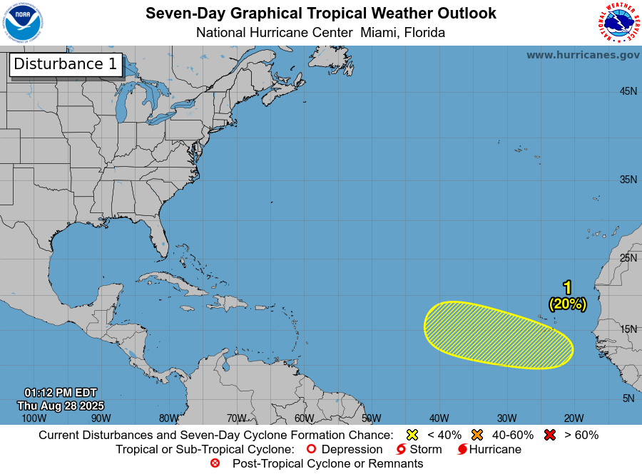
Atlantic:
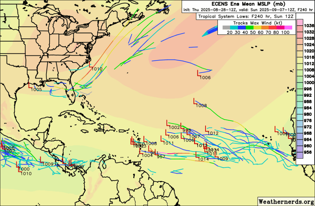
After Hurricane Erin passed by last week, we’ve been sitting in a little bit of a “lull”, which is nothing to complain about! However, there is a newly highlighted tropical wave off the coast of Africa that the NHC is watching. Models move this wave into the central Atlantic sometime in the second week of September, but it could develop before that. Chances are currently low, only 20 percent in the next 7 days, but that could certainly change as the wave will move into a favorable environment for development in the coming week. Models currently, (by the way, this is very far out), show the system being swept out to the north Atlantic by a passing cold front from the U.S, but things could always change.
REGIONAL DAY TO DAY FORECAST
Tonight: Cloudy with showers and thunderstorms. Lows in the high 60s. East northeast winds around 5 mph becoming calm. Chance of rain 60 percent.
Friday: Cloudy with scattered showers and storms through midday, then more numerous storms likely in the afternoon and evening. Highs in the lower 80s. Winds light, shifting to the east around 5 mph. Chance of rain 90 percent.
Friday Night: A few scattered showers and thunderstorms. Lows in the high 60s. Southeast winds near 5 mph. Chance of rain 60 percent.
Saturday: Isolated showers throughout the day, clearing up by the evening. Mostly cloudy. Highs in the low 80s. North winds around 5 mph. Chance of rain 40 percent.
Saturday Night: A few lingering storms early, then mostly cloudy overnight. Lows in the high 60s. Light northeast winds. Chance of rain 20 percent.
Sunday: Mostly cloudy. A chance of a shower or two. Highs in the mid 80s. Winds northeast near 5 mph. Chance of rain 20 percent.
Sunday Night: A few isolated showers early, otherwise mostly cloudy. Lows in the high 60s. Calm winds. Chance of rain 20 percent.
Labor Day: Chance of scattered rain showers in the afternoon. Otherwise partly sunny with highs in the mid 80s East northeast winds near 5-10 mph. Chance of rain 40 percent.
Monday Night: Partly cloudy with lows in the high 60s.
Tuesday: A few isolated showers or thunderstorms possible. Otherwise mostly sunny with highs in the mid 80s. Chance of rain 30 percent.
Tuesday Night: Mostly clear with lows near in the mid 60s.
Wednesday: Sunny with highs near in the high 80s.
Wednesday Night: Mostly clear with lows in the mid 60s.
Next Thursday: Sunny with highs in the high 80s.


