Current Conditions as of 3 PM
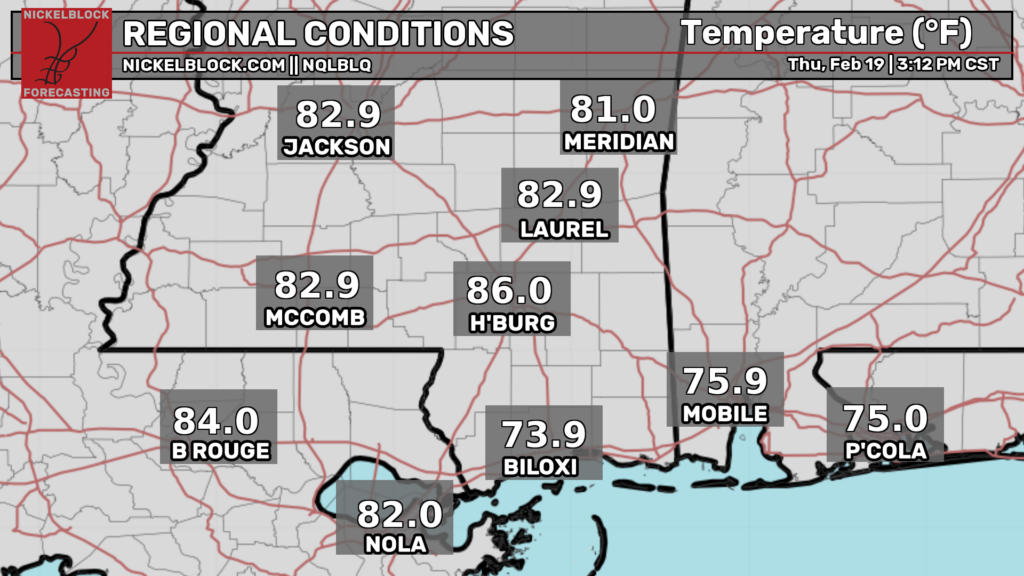
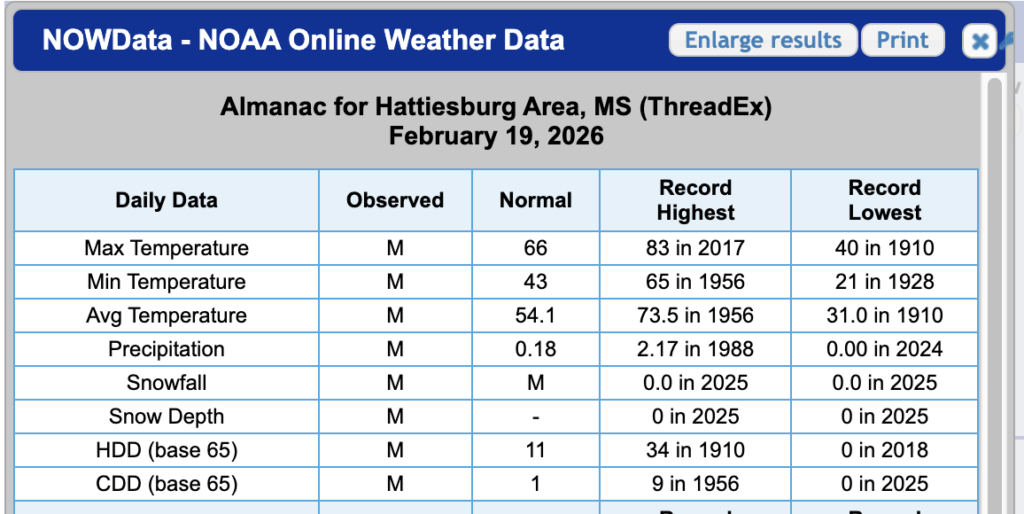
We’ve reached a high of 86 in Hattiesburg today, which officially has broken the record high of 83 set back in 2017! This is remarkable for February, and I have been told it feels like mid-spring in the region. I cannot relate here in Jersey, but I am certainly jealous! Tonight, we could also break a record warm low temperature. We have Hattiesburg at 66, and the record is 65 back in 1956!
It’s also quite windy down in the Pine Belt, with gusts of 30-35 mph. It just goes to show how strong our southerly flow is and how stubborn it can be!
Overall Setup
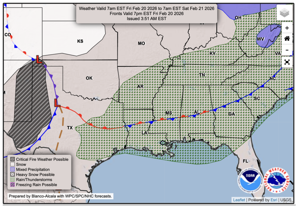
What’s driving this warm and moist flow? That would be the stationary front that is parked right over us, or at least will be tomorrow at this time. We will feel the presence of this front on Friday and Saturday with some spotty showers, and may see some isolated severe storms on Saturday in parts of the area. I’ll have more on that down below.

Tonight’s Forecast
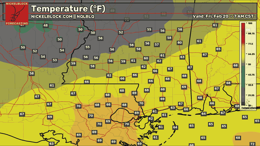
Are those low temperatures? Yes, that’s no mistake. We’ll see a low temperature tonight in the low-to-mid 60s, and approaching 70 further south! A line of showers will form along the stationary front as it moves into our area, allowing for some morning sprinkles or scattered showers tomorrow.

Tomorrow’s Forecast: Friday, February 20
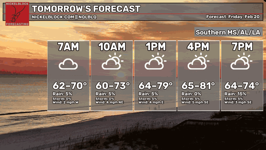
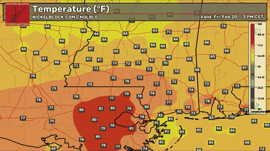
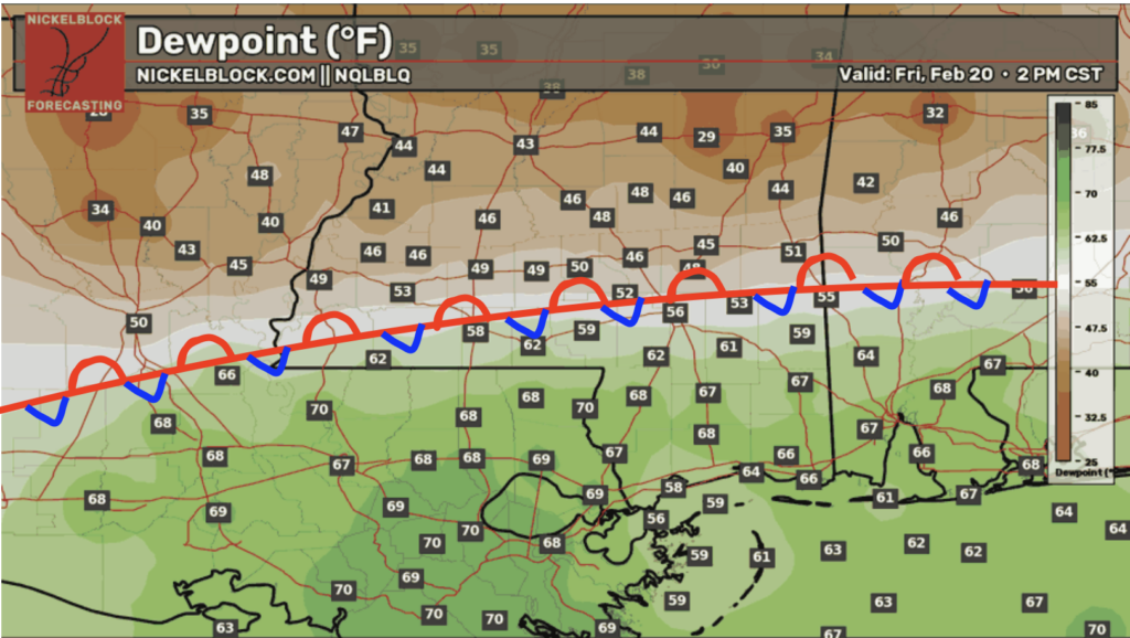
We’re going to keep those cloudy skies around tomorrow, with scattered showers on and off throughout the day. Not everyone will be raining at all times, but there will be some “blobs”, if you will, around for the whole day. Pack your umbrella as well as your shorts, because it’s still going to be a warm one! Highs will depend on your location, as will humidity levels. Those north of the stationary front I drew on the dew point map will see cooler highs in the 60s, and little humidity, but those south of the front will see 70s and 80s with intense humidity! It’s so interesting to see these fronts come through because a few miles could make such a big difference in temperatures and humidity!
Friday night will also be a mild one, with temps similar to tonight’s.
Saturday’s Forecast: February 21
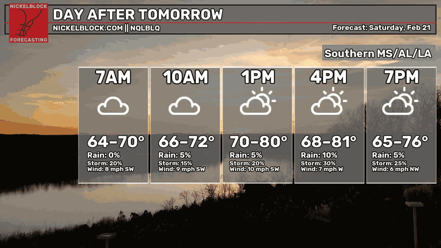
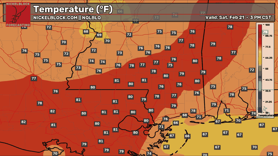
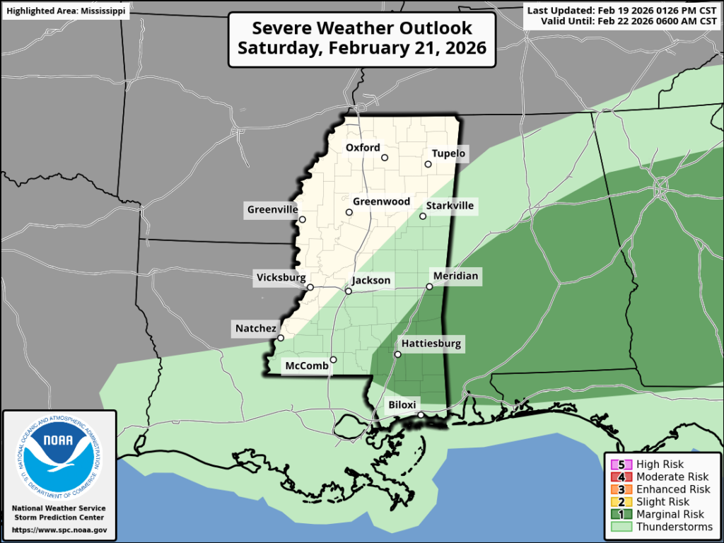
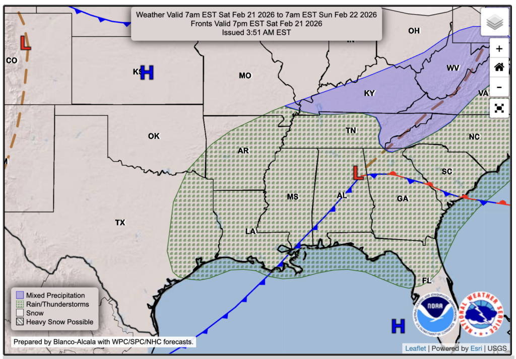
Saturday morning is where it gets interesting. We’re going to see another warm day in the upper 70s and low 80s, with high humidity all day; no one gets a break there! We’ll see another low-pressure system supply increased energy and shear Saturday morning, which could bring strong to severe storms. As of today, the SPC has issued a Marginal (1 out of 5) risk for severe weather. The main concern is strong to severe wind gusts, and possibly some severe hail. Storms will die down by the afternoon, and temperatures should drop into the 40s by Sunday morning. We will keep you updated with any changes.

Extended Local Outlook
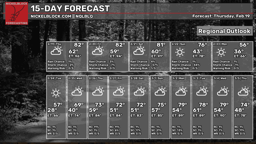
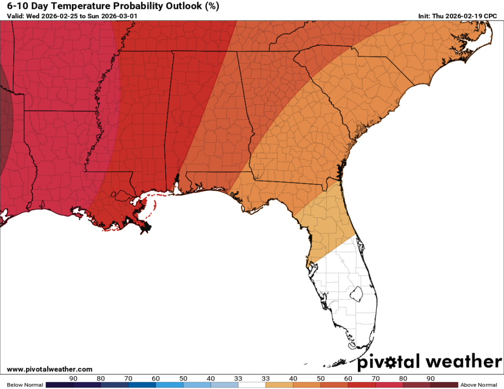
It’ll certainly be a cooler start next week with highs in the upper 50s for Monday and Tuesday. Wednesday warms up to near 70, and then low-to-mid 70s are in the forecast for the first week of March. This is obviously above average, so the CPC shows a very high chance of above-average temps from next Wednesday to next Sunday.


