The Setup
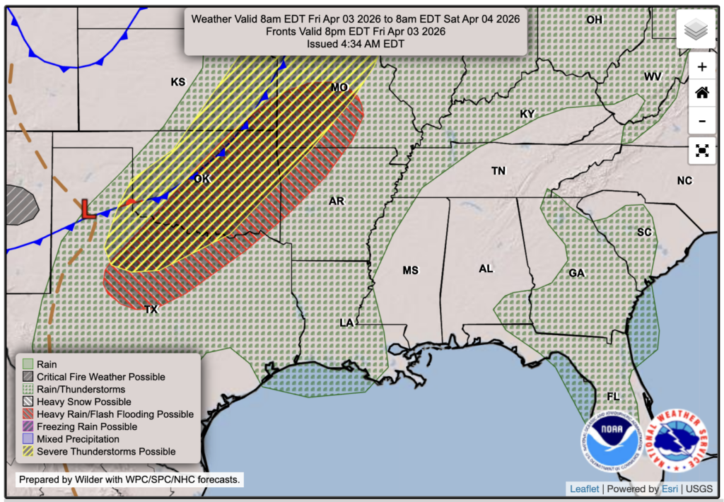
We saw a few heavy showers and isolated thunderstorms today, mainly across southwestern Mississippi and eastern Louisiana. Tomorrow, we could see more of the same, with scattered rain possible through the day as we stay ahead of a cold front pushing through the southern Plains. That front will bring a severe weather and heavy rain threat to areas farther west before moving closer to us by Saturday. As it does, we could see scattered strong-to-severe storms during the day, followed by a line of storms later Saturday night. More on that down below.

Tonight’s Forecast
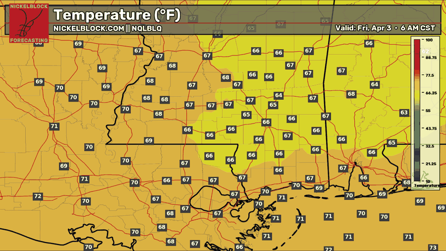
Tonight, we’ll see mostly cloudy skies, with the chance of rain diminishing as the sun goes down. Some patchy fog is possible late in the night. We’ll see a low in the mid-60s.

Tomorrow’s Forecast: Friday, April 3
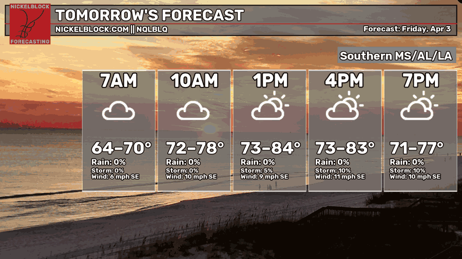
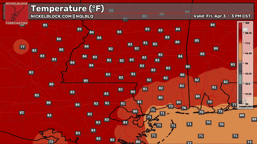
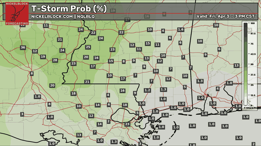
Friday will start off cloudy with that fog threat until around 9 AM. Then skies will gradually clear, and some of that instability could bring some pop-up showers or thunderstorms, which will be very isolated. Like today, there’s a higher probability of these cells popping up over western Mississippi and eastern Louisiana. High temperatures will reach the low-80s, as they have been!
Weekend Forecast
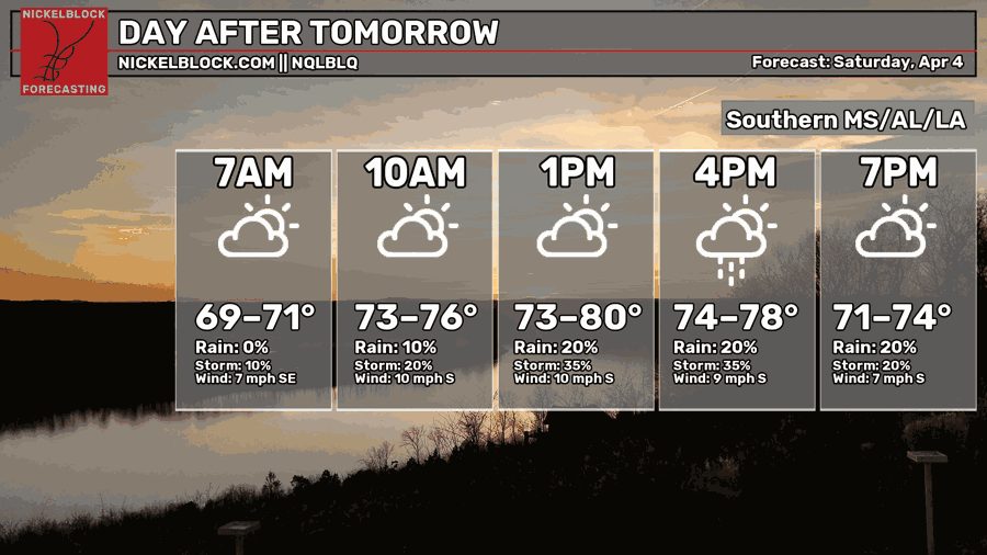
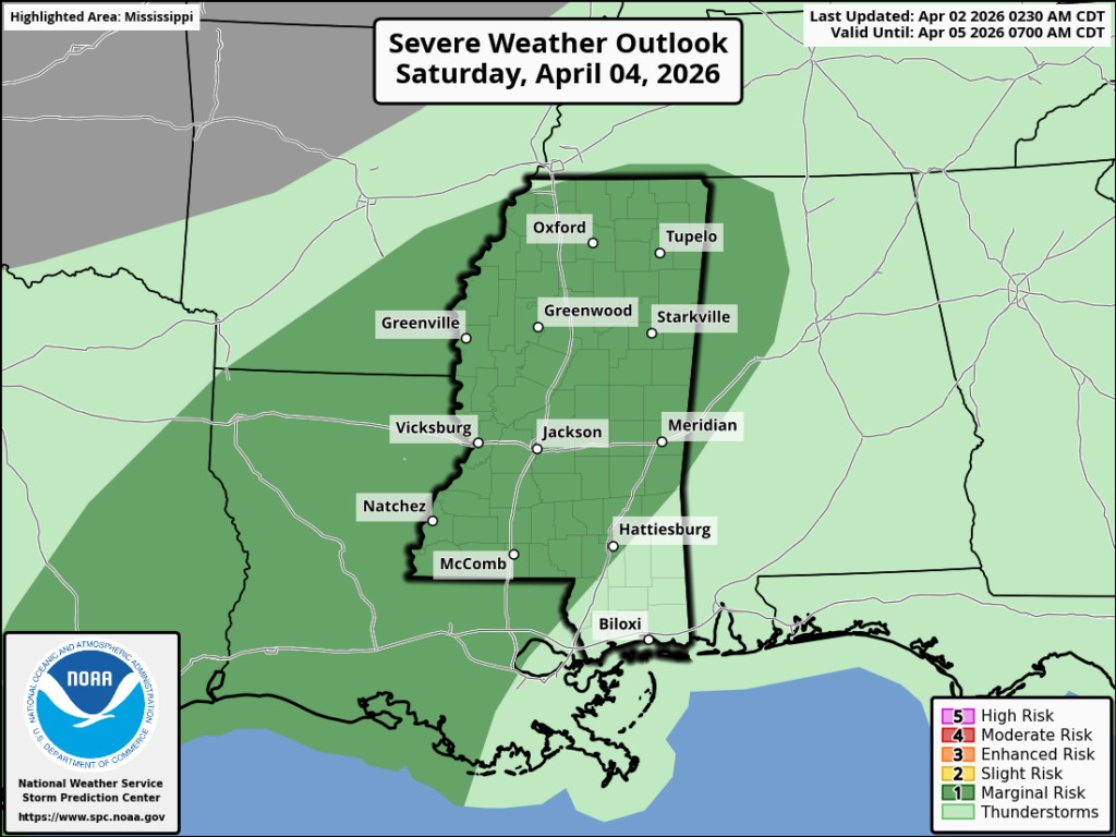
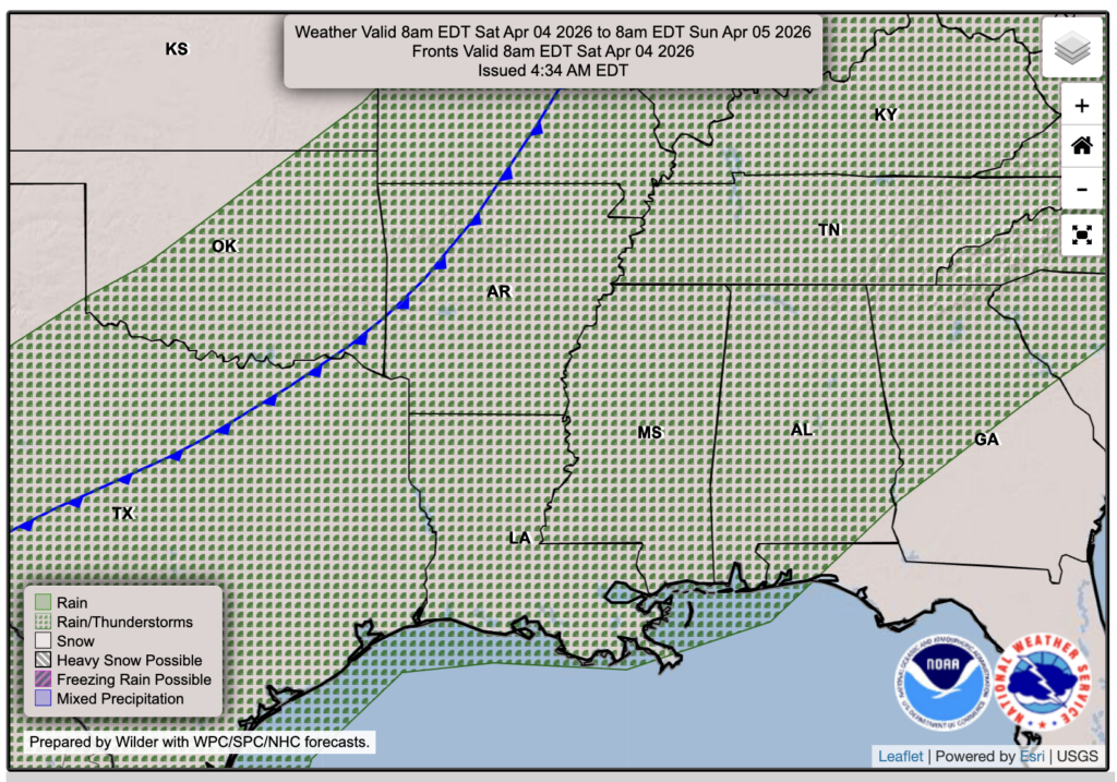
That front I mentioned earlier will eventually be moving southeastward towards our region by morning on Easter Sunday. It looks like there will be some pre-frontal cells forming on Saturday afternoon and evening, which could produce severe weather threats – primarily a wind and hail threat. The Euro model shows the main cluster of rain coming through at around 10-11 PM Saturday night, and continuing through the early afternoon on Sunday. Once the front comes through, we will see the typical humidity drop with a gusty northerly flow, which will be felt by mid-afternoon on Sunday.

Extended Local Outlook
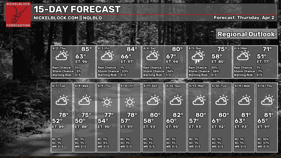
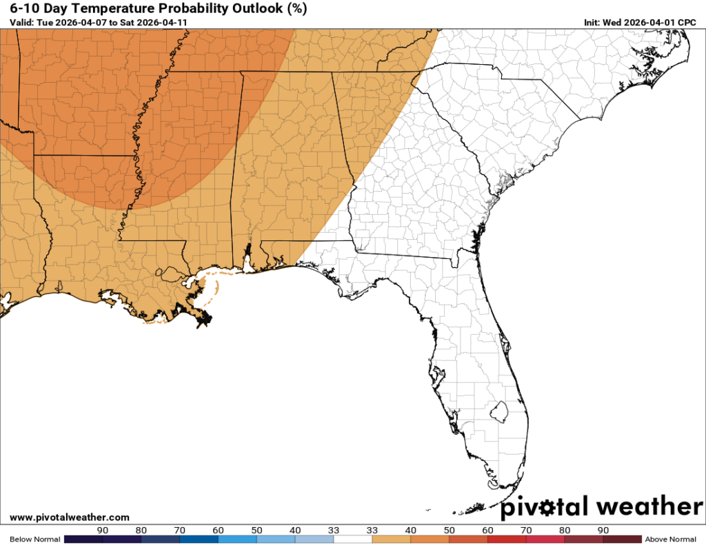
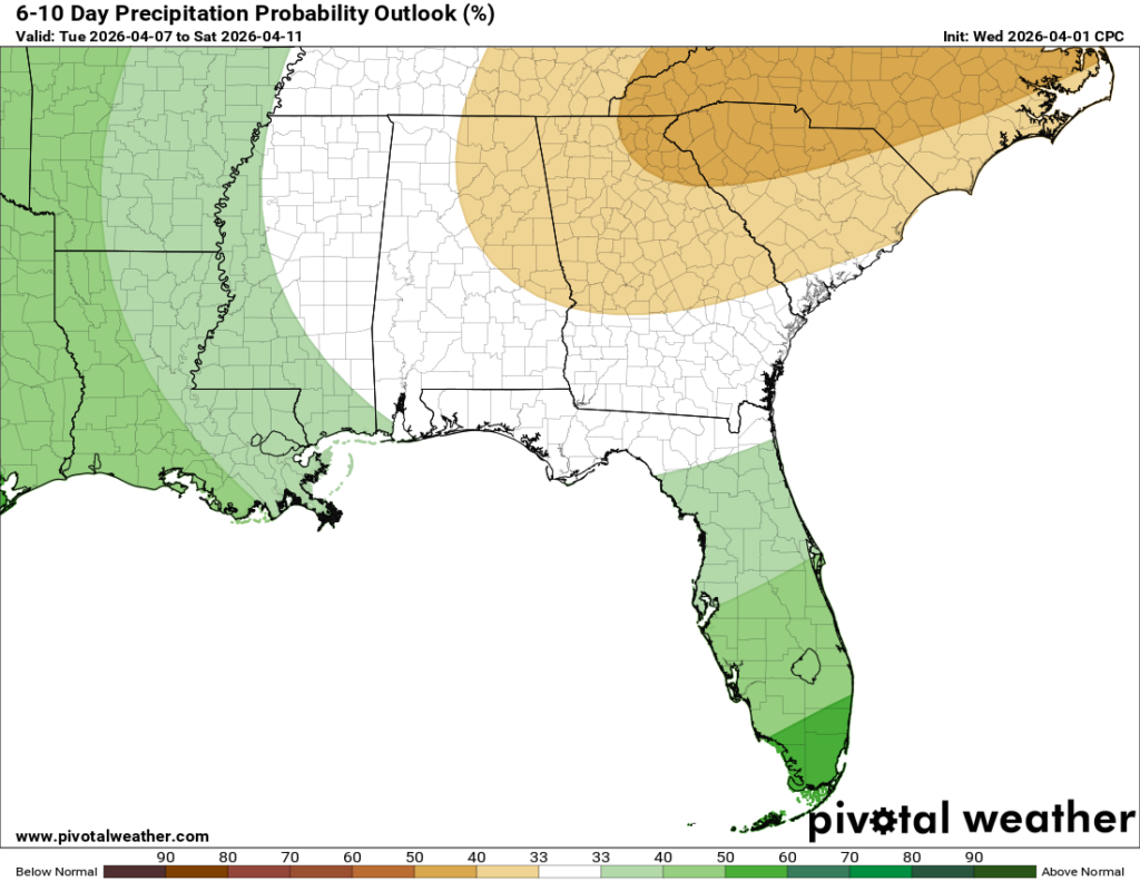
Would you look at that! We will see a below-average high temperature on Monday in the low-70s, with low humidity! The 6-10 day outlook shows a slight chance of above-normal temperatures for Tuesday through Next Saturday, but it looks to be only 1-2 degrees above our normal of 75 degrees, which is still much better than the 80-83 we’ve been experiencing. Plus, the lower humidity will stick around for next week!


