Hi everyone! This is my final forecast as an intern here at NickelBlock Forecasting. It’s definitely a bittersweet moment, but I’m so grateful that I had the chance to help keep you informed about the weather each day. I’ve learned a ton, gained valuable experience, and truly enjoyed every minute of it. So, for the last time, let’s dive into what’s going on out there today:
Today’s Overall Setup
The overall setup for today shows a surface boundary stretched across the Southeast with plenty of tropical moisture in place, along with ridging aloft over our region. That means a hot, humid setup with scattered showers and thunderstorms developing this afternoon and evening. Storms will be driven by daytime heating, and while they’ll be scattered, any that form could drop heavy rain and bring brief gusty winds before fading out tonight.

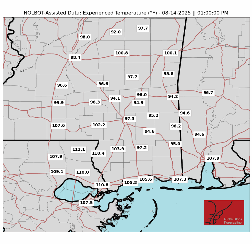
Current Conditions

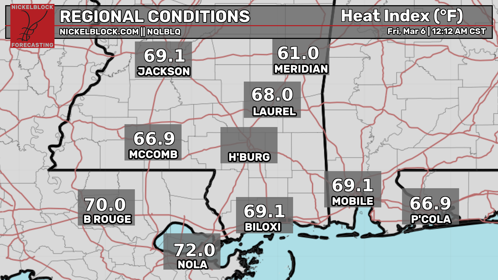
Here’s a look at the current temperatures and heat indices.
Today’s Local Forecast
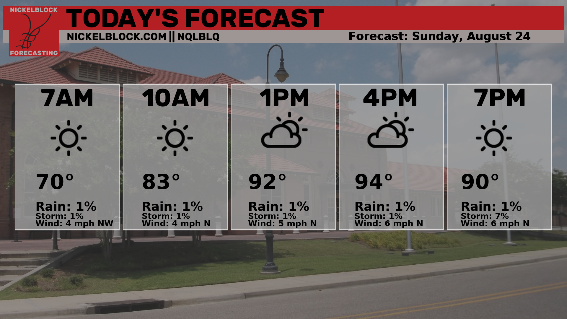
Here’s an hourly look at the forecast for today for the region.
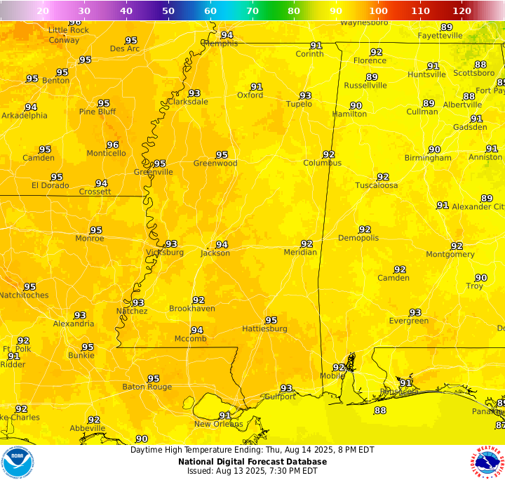
High temperatures today will reach the mid 90s. You’ll notice increased cloudiness today and scattered showers and thunderstorms in the afternoon, with more after around 5pm, ending by midnight. It will feel extremely humid today, with dew points in the mid 70s making it feel like the 110s when there is sun and between rain showers. Keep an eye out on the radar!
Friday & Saturday Forecast
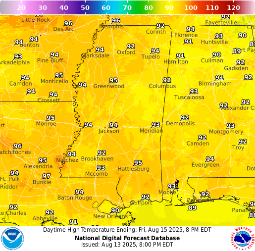
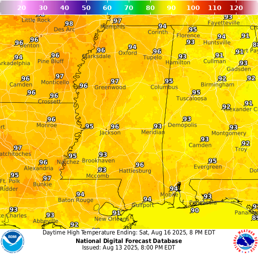
Temperatures on Friday and Saturday will be fairly similar to what we are seeing today, with highs in the mid 90s. The main difference will be the rain coverage. Friday is expected to have more widespread showers and storms, which should help keep temperatures a little lower. On Saturday, rain chances should be lower and more scattered, allowing for longer periods of sunshine and slightly warmer afternoon highs.
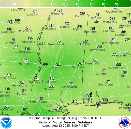
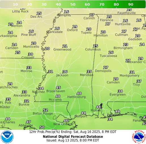
Showers and thunderstorms are expected to linger across the area on Friday and Saturday, fueled by a moist tropical airmass and a surface trough. It won’t be a total washout, but scattered storms will develop at times, especially during the afternoon and evening hours.
Extended Local Outlook

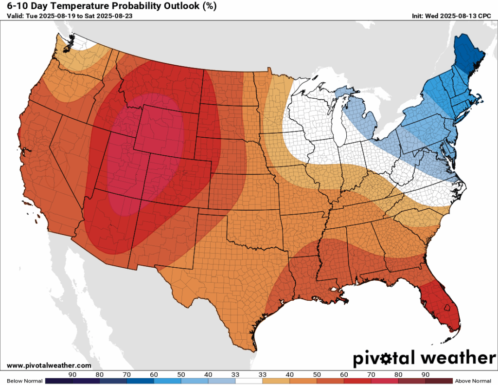
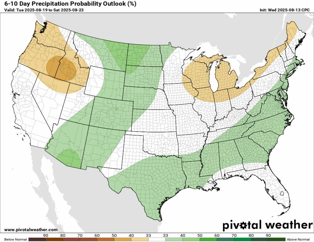
In the 6-10 day timeframe, temperatures are very likely to be above normal for our region, given the ridge that will build up. Some days we could see our high temperatures reach almost 100! The western region will see the most intense part of the ridge, so they have an extremely high probability of above normal temperatures. Rainfall is looking right around average for our region. Much of the same pattern as usual!
Latest Tropical Update
Eastern/Central Pacific:
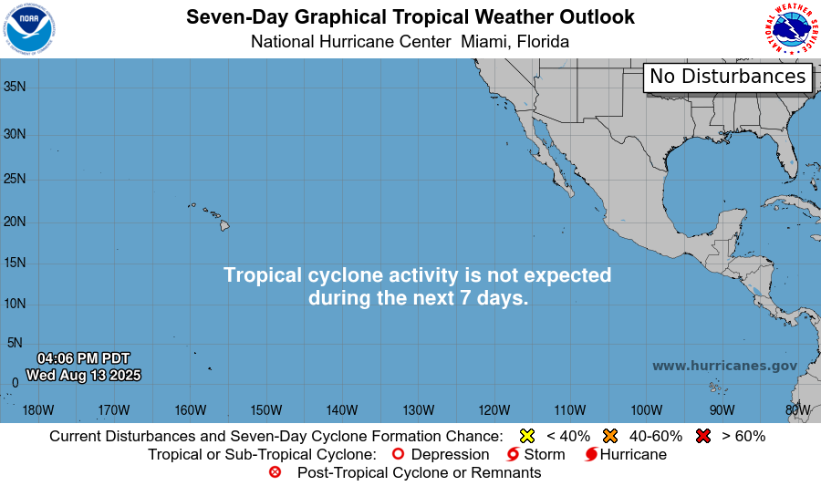
The Eastern and Central Pacific remain quiet, with no tropical cyclone activity expected over the next seven days.
Atlantic:
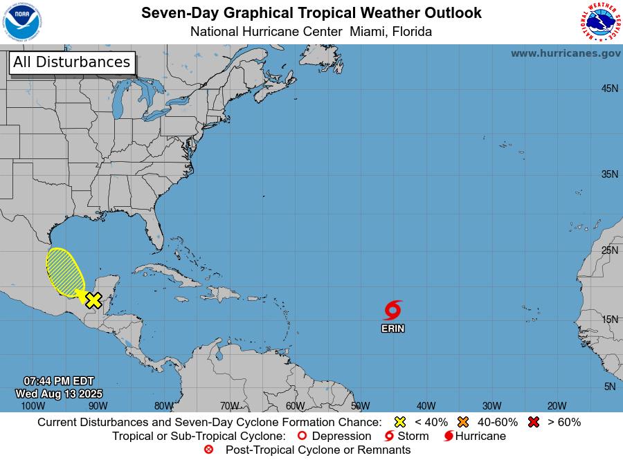
Tropical Storm Erin is tracking across the open Atlantic, and most guidance keeps it heading out to sea. A few ensemble models bring it a bit farther west, so we’ll continue to monitor in case the forecast shifts. Near the Bay of Campeche, a disturbance has a low chance of development over the next week, with the main impact likely being periods of heavy rain for nearby coastal areas.
Want the latest details on these systems? Check out our daily tropical updates for more in-depth information on the tropics!
REGIONAL DAY TO DAY FORECAST
Today: Mix of sun and clouds. Showers and thunderstorms possible, mainly after 5pm. Highs in the mid 90s. West wind around 5 mph. Chance of rain 50 percent.
Tonight: Partly cloudy. Showers and thunderstorms likely before 10pm, then a slight chance of showers between 10pm and 1am. Lows in the mid 70s. Calm wind. Chance of rain 60 percent.
Friday: Mostly sunny. Showers and thunderstorms likely after 1pm. Highs in the mid 90s. Calm wind. Chance of rain 70 percent.
Friday Night: Partly cloudy. Lows in the mid 70s. Calm wind.
Saturday: Mostly sunny. A chance of showers and thunderstorms after 1pm. Highs in the mid 90s. North northwest wind around 5 mph. Chance of rain 60 percent.
Saturday Night: Partly cloudy. Lows in the mid 70s. Calm wind.
Sunday: Mostly sunny. A chance of showers and thunderstorms after 1pm. Highs in the mid 90s. North northeast wind around 5 mph. Chance of rain 40 percent.
Sunday Night: Mostly clear. Lows in the low 70s. Calm wind.
Monday: Mostly sunny. A chance of showers and thunderstorms after 1pm. Highs in the mid 90s. Calm wind. Chance of rain 40 percent.
Monday Night: Mostly clear. Lows in the low 70s. Calm wind.
Tuesday: Sunny. A slight chance of showers and thunderstorms after 1pm. Highs in the mid 90s. Calm wind. Chance of rain 30 percent.
Tuesday Night: Mostly clear. Lows in the low 70s. Calm wind.
Wednesday: Sunny and hot. A slight chance of showers and thunderstorms after 1pm. Highs in the upper 90s. Calm wind. Chance of rain 30 percent.


