General Central/Eastern Kansas Forecast
Short-Term (Thursday-Friday)
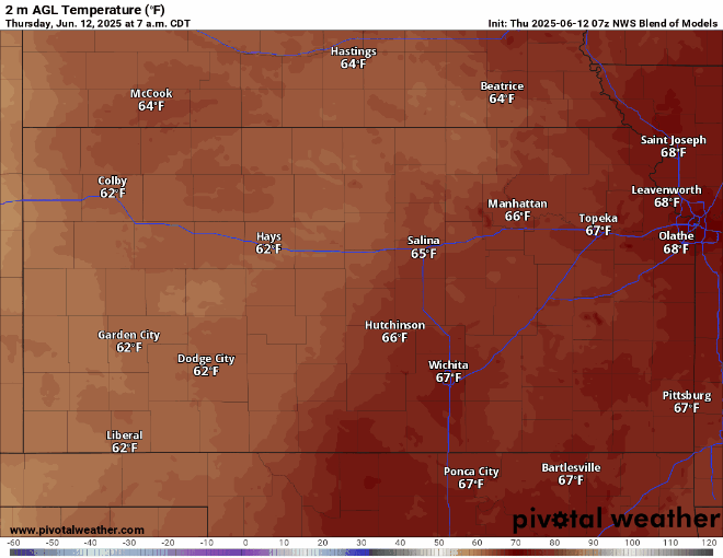
Most of the area will stay warm and dry through the short-term period. Off in the southeast corner of the state, however, showers and thunderstorms may be possible throughout the afternoon and evening from a weak upper-level low traversing across southeast KS. Severe weather would not be anticipated with these storms, but locally heavy rainfall may be possible given precipitable water values of 1.5+ inches. Otherwise, temperatures today will range in the mid 70s to low 80s, with a southeasterly wind of 5 to 10 mph. Overnight tonight, temperatures will fall into the low to mid 60s. Moisture will keep surging northward during the short-term period, with dew point temperatures in the upper 60s and low 70s and relative humidity values between 45-70%.
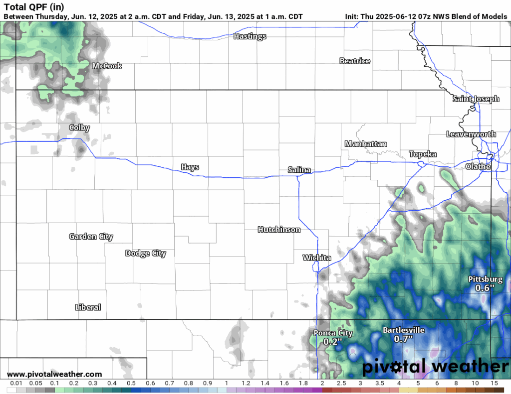
By tomorrow, more pockets of showers and thunderstorms will be possible in southeast Kansas as the upper-level low moves off to the east and, coupled with daytime heating, may provide a trigger for more activity during the afternoon. Otherwise, high temperatures across the area will increase to the upper 70s to upper 80s, with winds out of the southeast at 5 to 10 mph. Dew point temperatures will continue to increase into the upper 60s to potentially low/mid 70s. Relative humidity values will also continue to increase in response to between 50-75%.
Long-Term (Saturday-Wednesday)
Entering the weekend, a weak mid-level shortwave will enter into north central Kansas Saturday morning and may bring a complex of showers and thunderstorms with it. These showers will propagate east-southeast throughout the day, becoming more isolated with eastern extent. Another shortwave will follow the morning round and may bring more thunderstorm activity during the evening and overnight hours. Currently, the area’s most likely to see this second around are along and north of I-70. Beyond the weekend, the weak area of ridging looks to break down and potentially open the door for more sporadic rain chances through the early part of next week. Temperatures over the long-term period do not look to become overly hot just yet, with average daily highs in the mid 80s to low 90s through the middle of next week.
Regional Soil Moisture Forecast
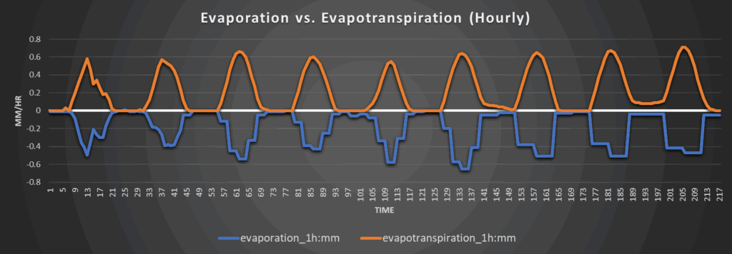
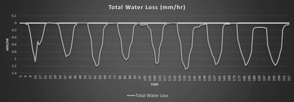
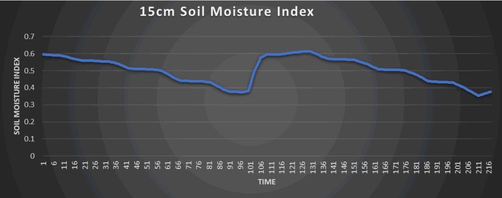
Around Westmoreland
Around Scranton
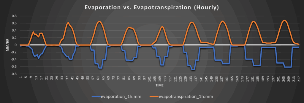
Around Burlington
Around Altoona