It’s going to get a bit more humid overnight tonight as the winds are coming out of the south. Lows will be in the mid 60s with a few clouds in the sky. Tomorrow looks to be another warm one with highs in the upper 80s and increasing clouds. Expect some gusty winds as well out of the south.

Severe Weather Weekend
As Nick has alluded to in his discussion earlier today, we’re currently under a marginal risk for severe weather (1/5) between Saturday and Sunday. This will be our first for the Fall. The SPC may upgrade our risk to a 2/5 risk depending on whether the ingredients come together.
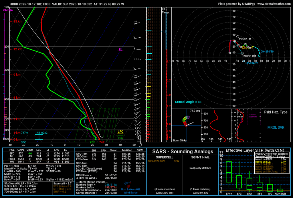
Skew-T’s are showing a decent amount of instability and helicity before the main event begins. Our main concern will be the cluster of storms ahead of the main line which would be the catalyst for a possible tornado and wind threat. So far, the threat remains low, but still possible for one to develop.
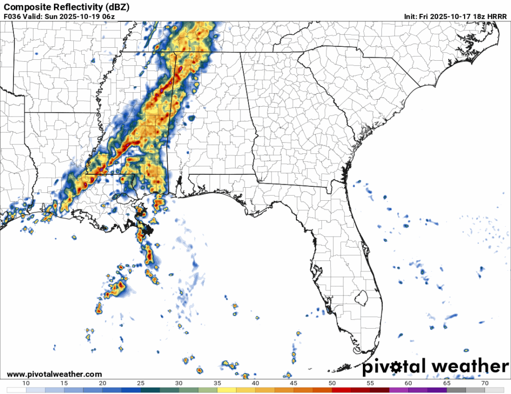
The storm cluster looks to develop after 10pm and move in past midnight. Some strong winds, heavy rain, and a tornado or two are possible at this point. Afterwards, the main line will roll in with some more heavy rain and thunderstorms possible. The same risks apply. The main line looks to leave before sunrise for most of Mississippi and western Alabama by early morning.
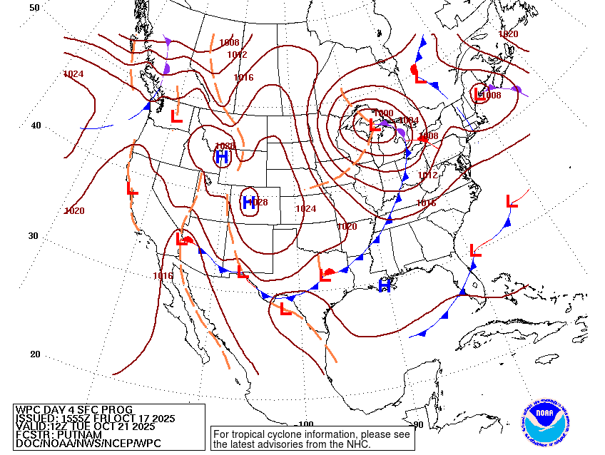
Afterwards, we won’t have rain for a little while! A mostly dry cold front will move in by Tuesday and cool things off even further. Temperatures will drop from around 80 to the upper 70s and lows into the low 50s and even some in the upper 40s, so extra pleasant for this time of year! This won’t last forever, but we’ll stay at a bit more of a comfortable average temperature in the low 80s for the rest of the week.

Regional Day-to-Day Forecast
Tonight – Mostly clear, with a low in the mid 60s. South wind 5 to 10 mph becoming light after midnight.
Saturday – A slight chance of showers beginning in the late morning. Mostly sunny, with a high in the upper 80s. Light southeast wind becoming south 10 to 15 mph in the morning. Winds could gust as high as 20 mph. Chance of precipitation is 20%.
Saturday Night – Showers and thunderstorms, some severe possible. Low in the upper 60s. South wind 5 to 10 mph, with gusts as high as 20 mph. Chance of precipitation is 80%. New rainfall amounts between a quarter and half of an inch possible.
Sunday – A 30 percent chance of showers and thunderstorms, mainly before sunrise. Mostly cloudy through mid morning, then gradual clearing, with a high near 80. West southwest wind 5 to 10 mph becoming north northwest in the afternoon. Winds could gust as high as 20 mph.
Sunday Night – Clear, with a low around 50. North wind around 5 mph.
Monday – Sunny, with a high near 80. Calm wind becoming east around 5 mph.
Monday Night – Clear, with a low in the low 50s. Calm wind.
Tuesday – Sunny, with a high in the low 80s. Light west wind becoming northwest 5 to 10 mph in the morning.
Tuesday Night – Mostly clear, with a low in the low 50s. North wind around 5 mph.
Wednesday – Sunny, with a high in the upper 70s.
Wednesday Night – Mostly clear, with a low in the mid to upper 40s.
Thursday – Sunny, with a high near 80.
Thursday Night – Mostly clear, with a low in the low 50s.
Friday – Mostly sunny, with a high in the low 80s.


