Hey everyone! I am here with your weekly CONUS weather forecast to bring you the latest on what is going on in the country weather-wise! We have a lot to talk about, including severe weather, fire weather, and potential tropical trouble in the Gulf later this week. Let’s take a look at all of the details:
Today’s Overall Setup
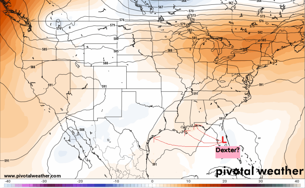
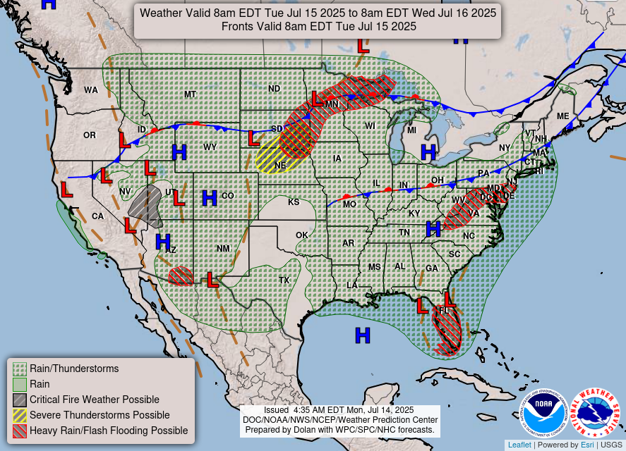
As you can see from the first plot showing the 500 mb height anomalies (orange being higher heights and blue being lower heights), most of the country is under some sort of increased ridging, asides from the lower heights shown in blue over Florida currently. However, even though ridging is slowly taking over again, the troughing is still in place, just weakening. The lower heights over Florida have to do with the low pressure system that we are watching very closely for tropical development by the end of the week. Some impressively heavy rainfall will fall today in Florida and brings a flash flood threat as this system contains a lot of moisture. Other than that, there is a threat for severe weather today in the northern plains, a flash flood threat in the northern plains, a flash flood threat in the mid-Atlantic, as well as in southeastern Arizona. It’s safe to say that we are in a soggy pattern, with two main stationary fronts causing this mess. Lastly to mention, there is a fire weather threat in Nevada and western Utah.
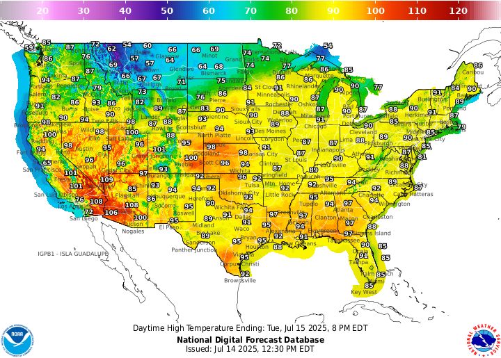
Here’s a look at the high temperatures today across the CONUS. Temperatures are, say, chilly in the northern tier in Montana and North Dakota, but mild or hot in most other locations.
Today’s Severe Weather Threat
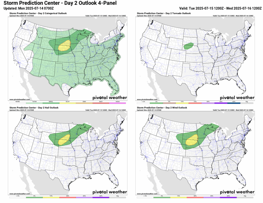
Today’s severe weather threat is focused on the northern Plains, with a Slight (2/5) risk zone for central/northern Nebraska and southeastern South Dakota. A Marginal (1/5) risk zone surrounds the Slight zone, from eastern Wyoming through the Great Lakes. This is mainly a hail and wind threat, with a 15 percent risk for each, but there is a 2 percent tornado risk in northwestern Nebraska and southern South Dakota.
Upper Plains Severe Weather
Here is how the high-resolution HRRR model is handling this severe weather event. Storms will fire up in the early afternoon hours and dump very heavy rain, hail, and strong winds to the region. A mesoscale convective vortex (MCV) is likely to develop, which essentially looks like a small-scale spinning low-pressure system on the radar. The bowing of the reflectivity would mean a damaging wind threat is likely, which is why the SPC has this as a wind driven Slight risk.
Fire Weather Forecast
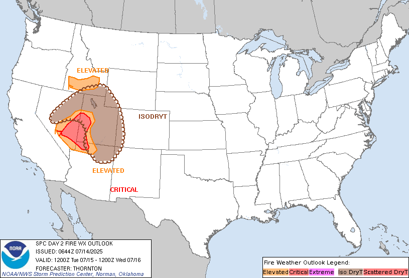
A mid-level system moving in Tuesday will bring stronger winds and dry thunderstorms across parts of the Great Basin. Critical fire weather conditions are most likely in eastern Nevada and western Utah, where southwest winds of 10–20 mph will combine with afternoon humidity around 10–15%. Northern Arizona may fall just short of criteria, but active fires and gusty outflow winds still pose a threat. Isolated dry thunderstorms are also expected from northern Arizona into Utah, Nevada, and southern Idaho, where dry fuels and limited rainfall could lead to new fire starts.
Tomorrow’s Severe Weather
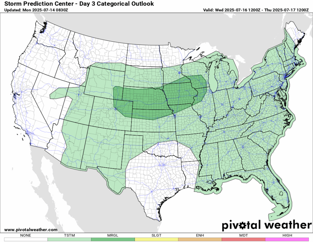
Strong to severe storms are possible Wednesday afternoon and evening from eastern Wyoming and Colorado through the Midwest. The leftover MCV from today’s storms will move across the Upper Midwest and into the Great Lakes. Another upper trough sliding out of the northern Rockies will add to the setup, with strong upper-level winds over a warm, humid, and unstable environment. A cold front and outflow boundary will also drift southeast across the region. The exact placement of storms is still a bit uncertain and depends on how today’s plays out. That said, the ingredients are there for scattered severe storms, and upgrades to the outlook may happen as we get closer.
Gulf Tropical Trouble?

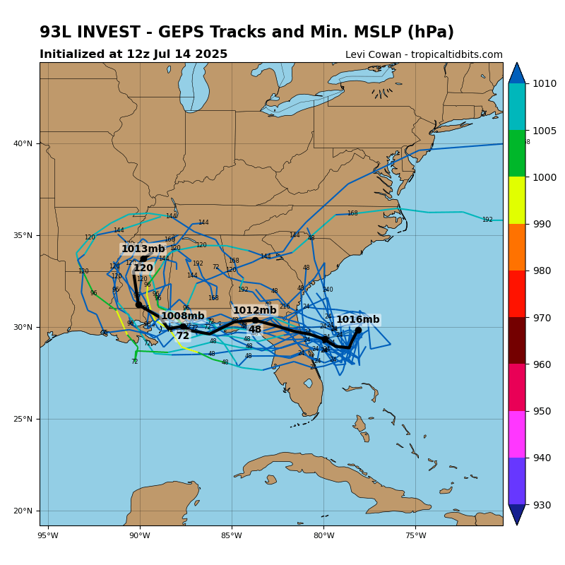
I’m sure you have seen the scary model outputs on social media, but it’s important to note that the models almost always spit out an outcome that is one, unrealistic, or two unlikely to happen. As of this post, the NHC has a 30 percent chance of tropical development in the next 2 days, and a 40 percent chance in the next 7 days. The models are having a hard time agreeing with the exact track and intensity. Current guidance has the track making landfall somewhere in coastal MS/AL or LA later in the week. Check out our latest tropical update for the latest.
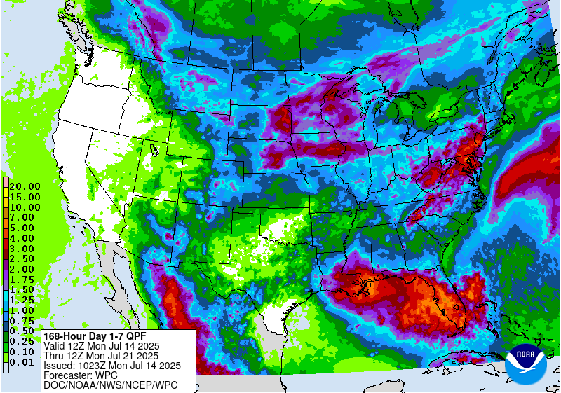
CONUS Weekly Precipitation Outlook
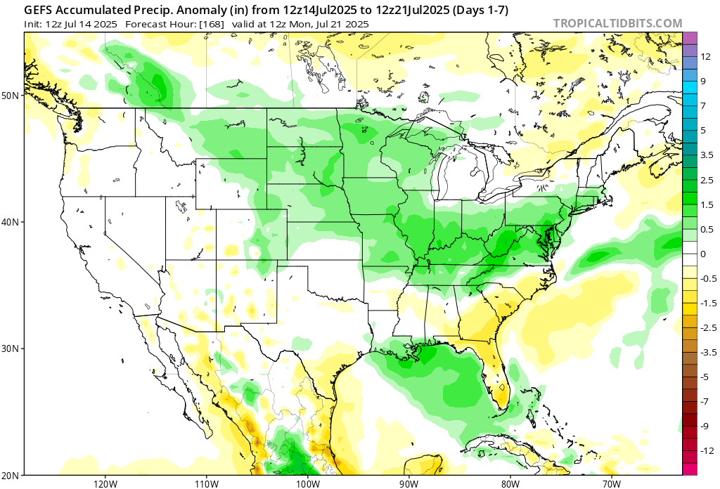
Here’s a look at the GEFS modeled precipitation anomalies through Monday 12z. Green indicates above average precipitation, white indicates average precipitation, and yellow indicates below average precipitation. Let’s look into the details by region:
Weekly Outlook: Western United States
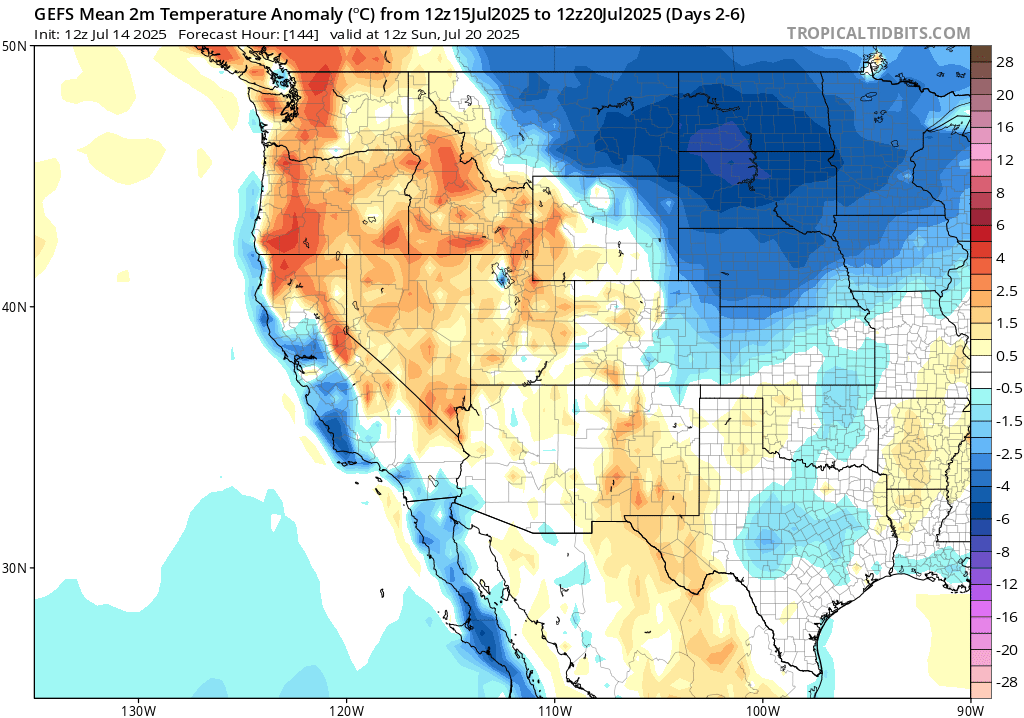
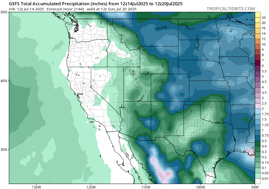
Temperature anomalies for the west are generally warmer than average for most, but towards the coast you can expect a cooler week than average. Rainfall is finally in the forecast this week for some of the desert southwest, but most of California will be bone-dry for the week.
Weekly Outlook: Central United States
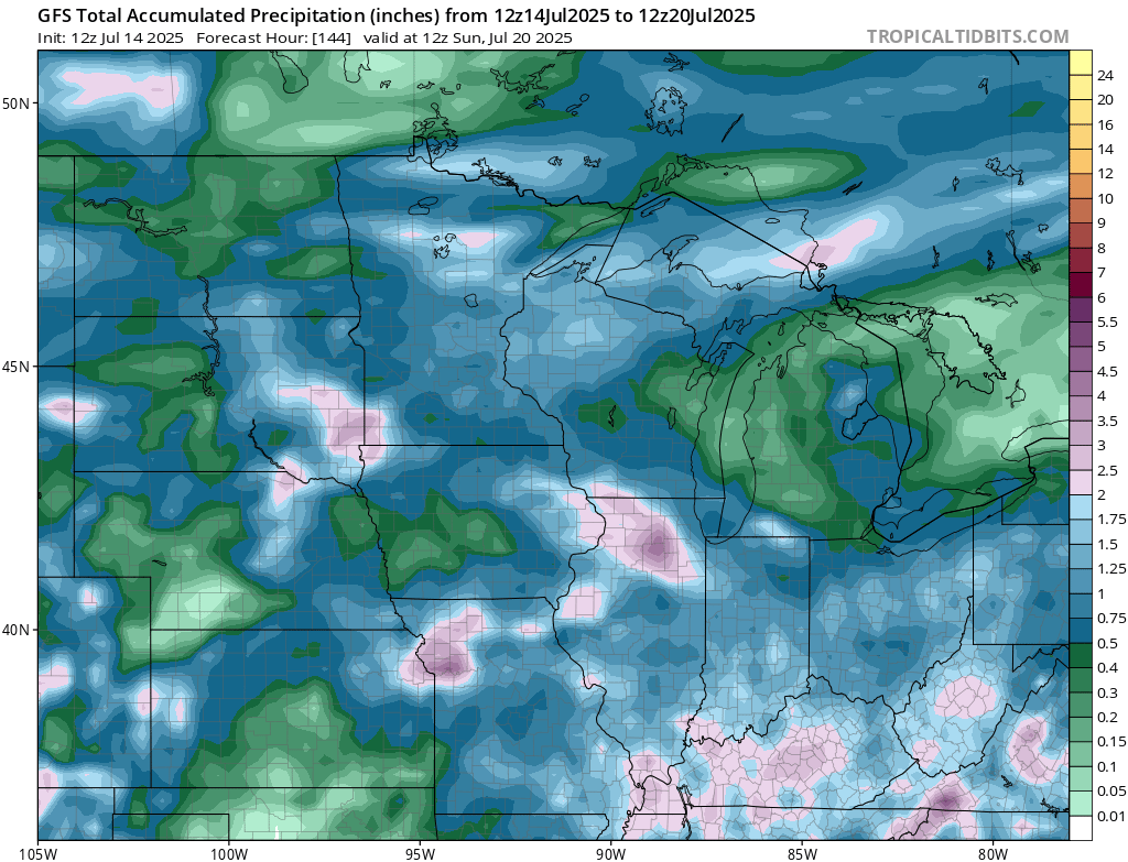
Multiple rounds of heavy rainfall and severe weather bring up the rain totals this week in the northern plains and midwest. Each day this week asides from Thursday and Friday will see rounds of rain, so make sure your umbrella is handy!
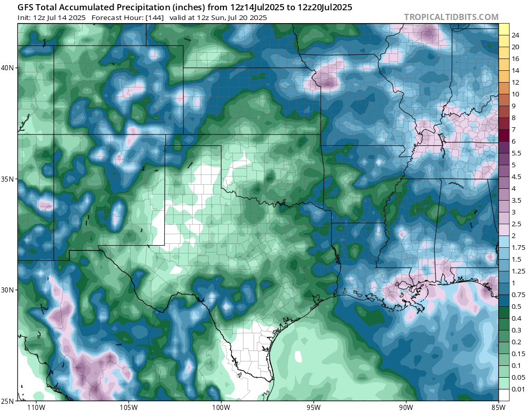
The central and southern plains will see around average rainfall for the week, with most of the rain coming today, tomorrow, and Thursday.
Weekly Outlook: Eastern United States
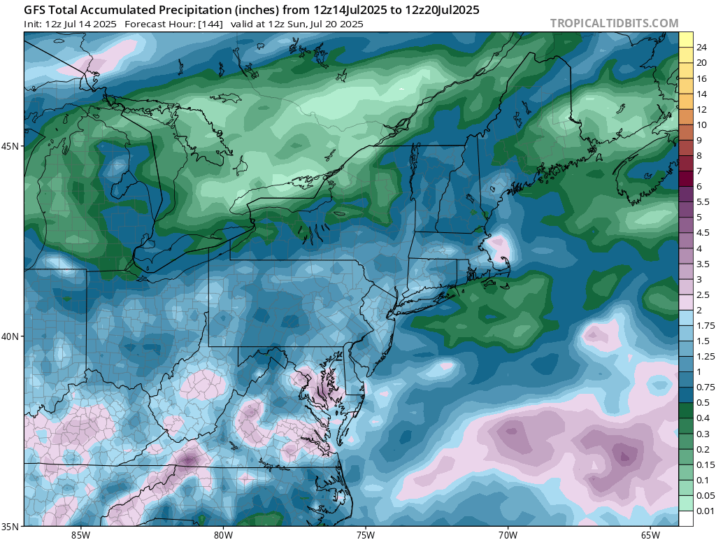
Each day this week will have some rain in the northeast and mid-Atlantic, as we are in an active soggy pattern.
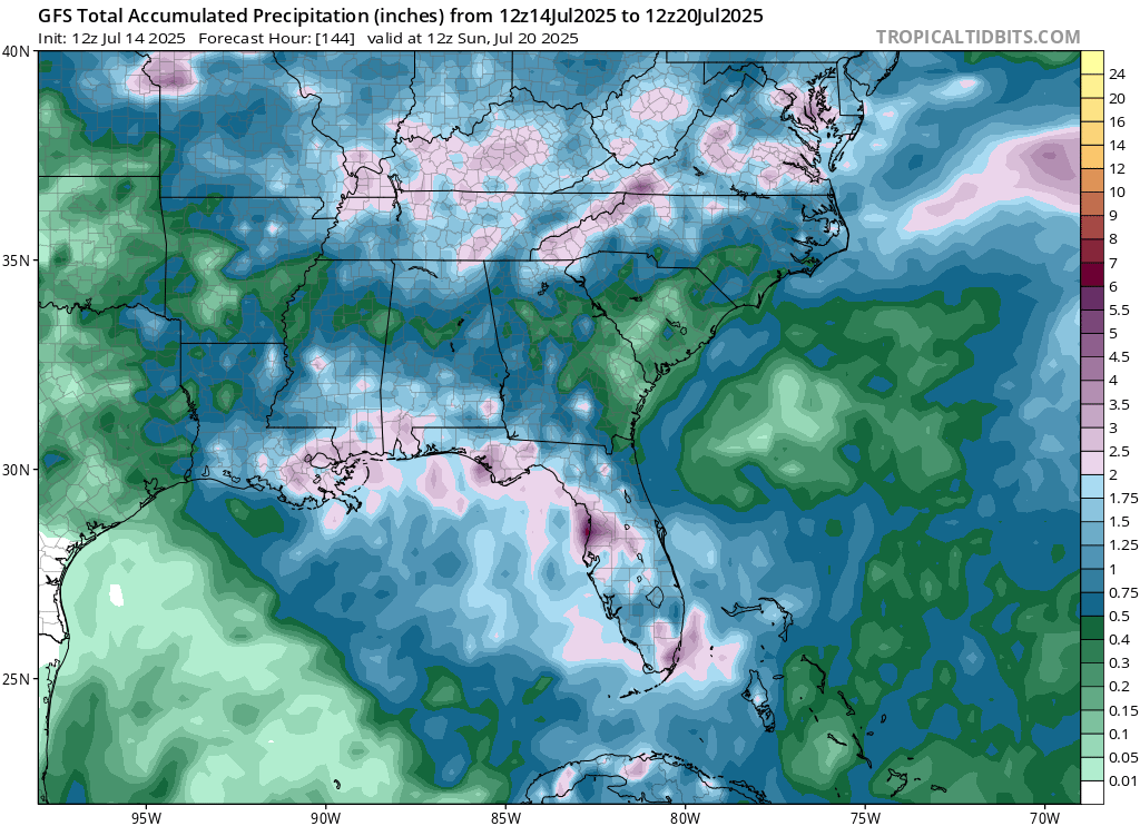
A lot of rainfall is expected in coastal areas of the Gulf due to the potential tropical low pressure system, with some areas of Florida possibly seeing up to 10 inches plus of rainfall in the next 7 days. Coastal MS/AL/LA could see 3-5 and locally higher amounts of rain this week.
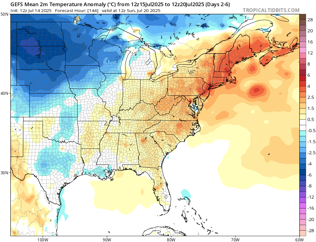
Temperatures are trending much cooler than average in the northern plains, given the increased amount of shortwaves going through the region over the week. The eastern half of the country, especially the northeast, is trending warmer than average, as increased ridging will take over the region this week.
Travel Outlook
In the Central Plains, storms may impact travelers on I-90 and I-29 through eastern South Dakota and northeast Nebraska, with damaging winds, hail, and heavy rain likely. Farther east, another area of concern stretches from eastern Minnesota into northern Wisconsin. Drivers along I-94 through the Twin Cities toward Eau Claire, and I-35 north of Minneapolis, should also be prepared for severe weather. Delays, reduced visibility, and sudden downpours are possible in both regions – check alerts and plan accordingly.
Extended Outlook
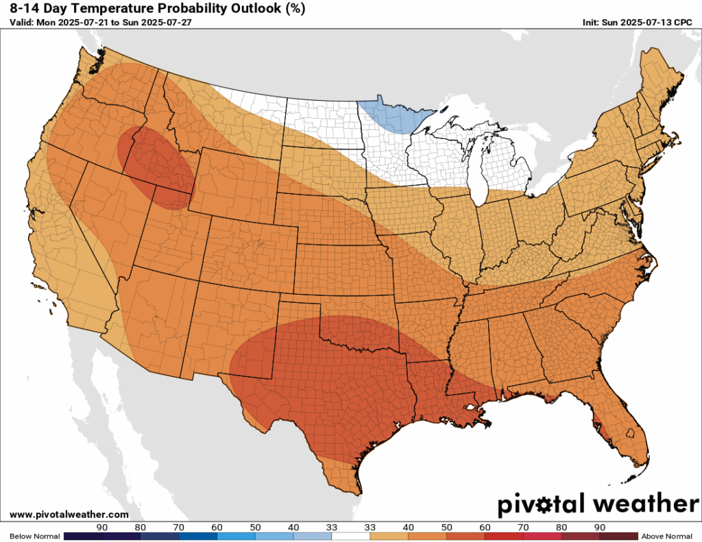
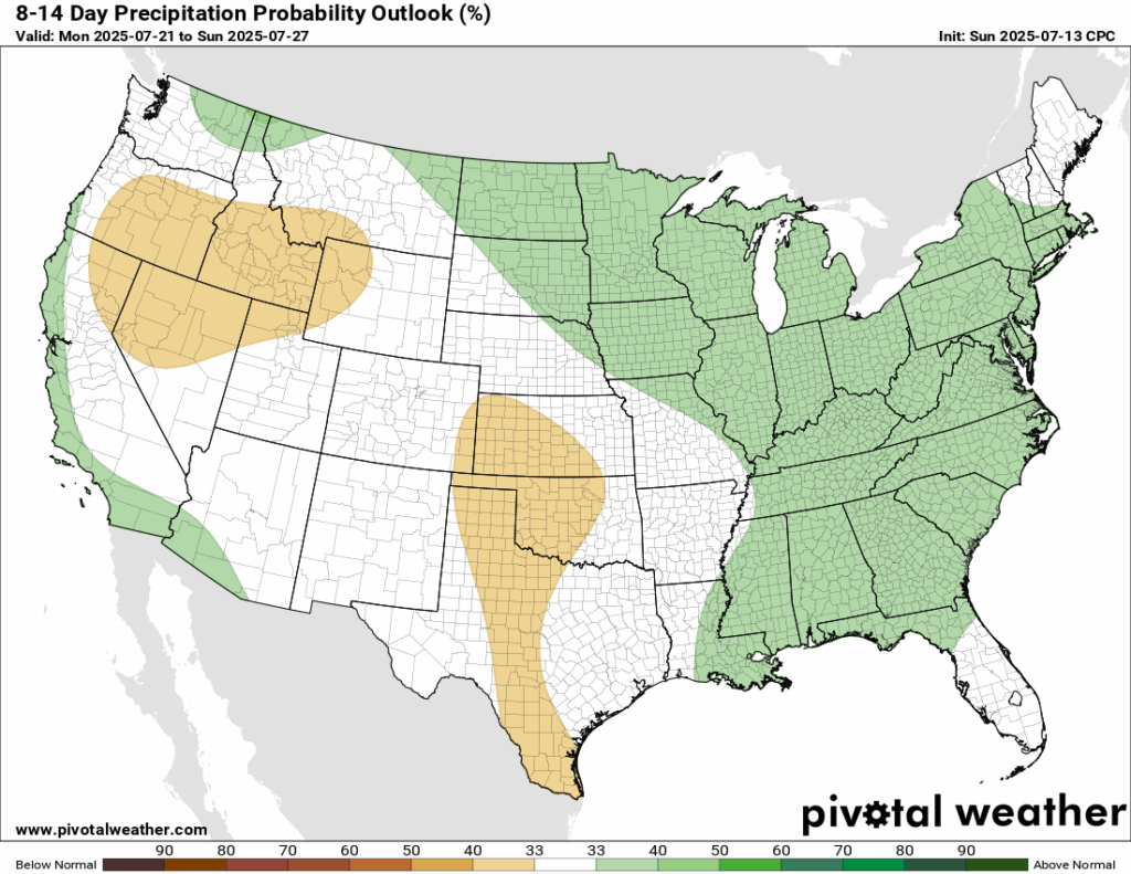
Looking ahead to the next 8-14 days into next week, temperatures are looking to be above average for much of the country, with high confidence over Texas and Louisiana. The eastern half of the country is also trending to see above normal precipitation, with most of the central and west regions seeing near normal or below normal preciptation, asides from coastal California and southwestern Arizona.
Thanks for tuning in to this National Forecast! Tune in to our local, tropical, and regional forecasts to stay updated on the latest!


