Overall Setup
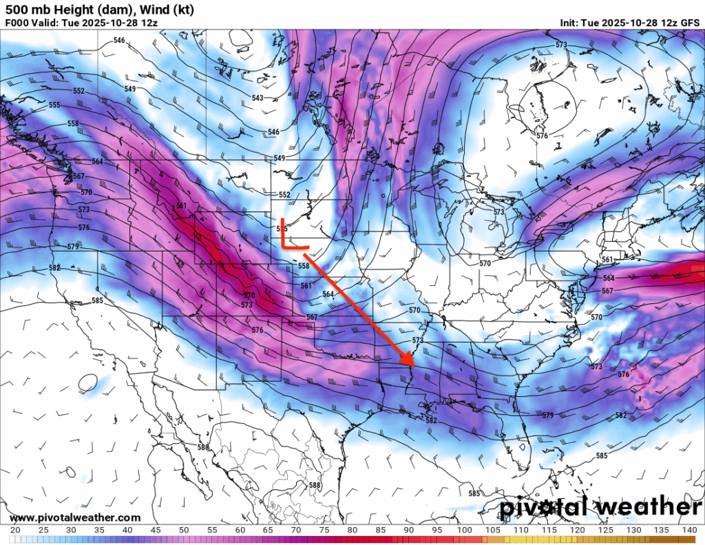
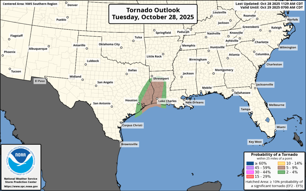
We’re watching the potential for some severe weather across central and western Louisiana this evening into tonight as a line of storms pushes through the region. A fast moving upper-level trough will dive south, helping to strengthen a surface low with a cold front extending southward from it.
This setup will trigger a line of thunderstorms later this evening, continuing into the overnight hours with frequent lightning. The greatest severe threat will be over central and western Louisiana, where there’s a 5-9 percent tornado risk along with the potential for damaging winds and hail. Gusty winds will ramp up into Wednesday throughout the region, leading to the NWS issuing a Wind Advisory through tomorrow. More details on timing are below.

Rest of the Afternoon into Tonight’s Forecast
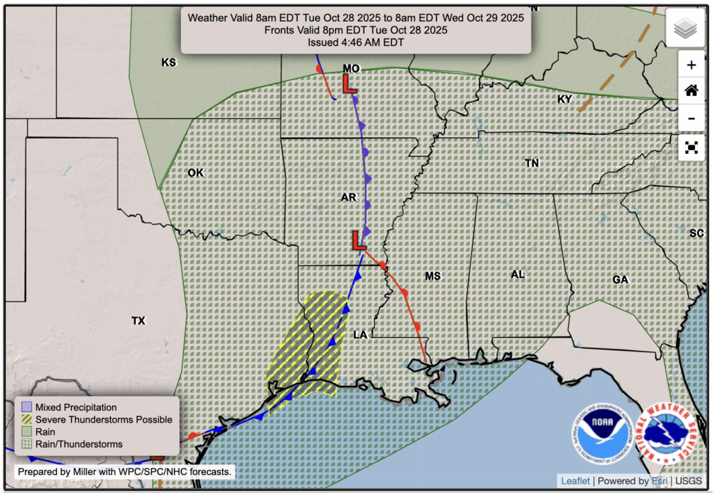
The cold front and associated line of storms, some of which could be supercells, is expected to start at Shreveport at around 4-5 pm, moving into the Alexandria and Lake Charles area at around 7 pm, and then further east into Lafayette and Baton Rouge closer to 9-10 pm.
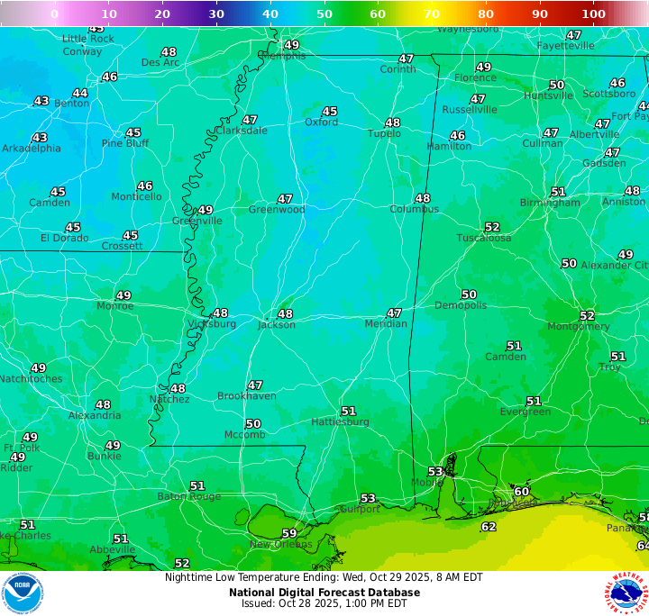
Any one of these cells along the front could produce a quick tornado, but otherwise gusty winds and some hail along with the heavy downpours is to be expected. Those around the Hattiesburg area or southern Mississippi can expect some heavy showers and lightning and thunder between about 2 and 4 a.m. Nothing severe is expected there, but some gusty winds are likely as the line moves through.
Tomorrow’s Forecast: Wednesday, October 29
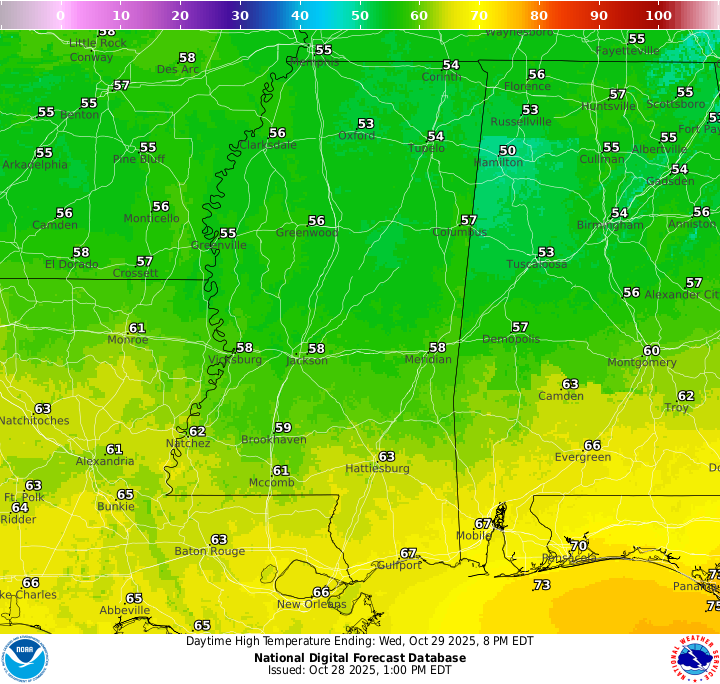
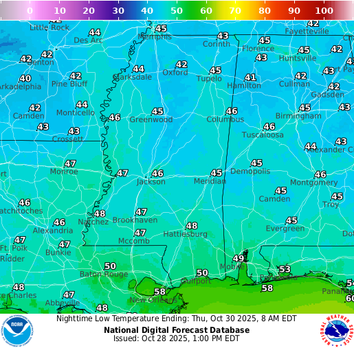
Behind the front tomorrow, you can expect some very gusty winds and a few lingering showers as the low-pressure system drops into our area, so ensure you tie down any outdoor Halloween decorations! These windy conditions are expected to continue throughout Wednesday and calm down by Thursday afternoon. Skies will stay cloudy throughout the day with temperatures holding in the upper 50s to low 60s, depending on your location. Wednesday night will be chilly, with lows dipping into the upper 40s!
Thursday’s Forecast: October 30
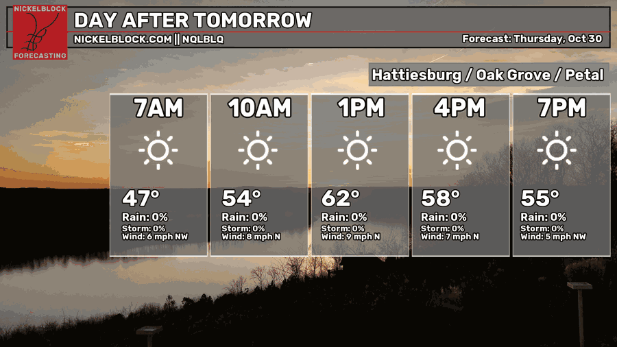
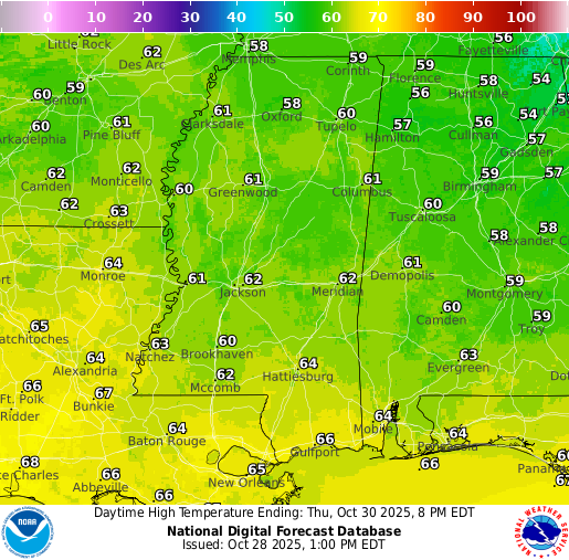
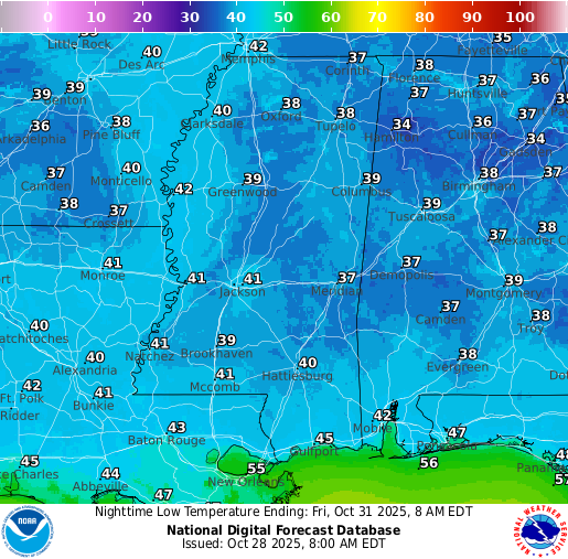
A much nicer forecast is in place for Thursday. The clouds will move off by the early morning and will leave us with a sunny and dry day. Temperatures will be well below average, only reaching the low-to-mid 60s for most of the region, and low’s could even get into the high 30s Thursday night!
Halloween & Extended Local Outlook
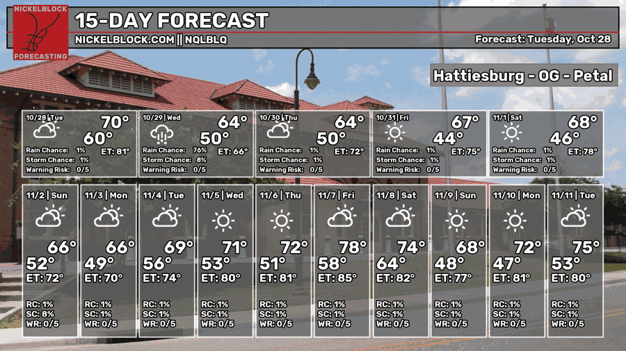
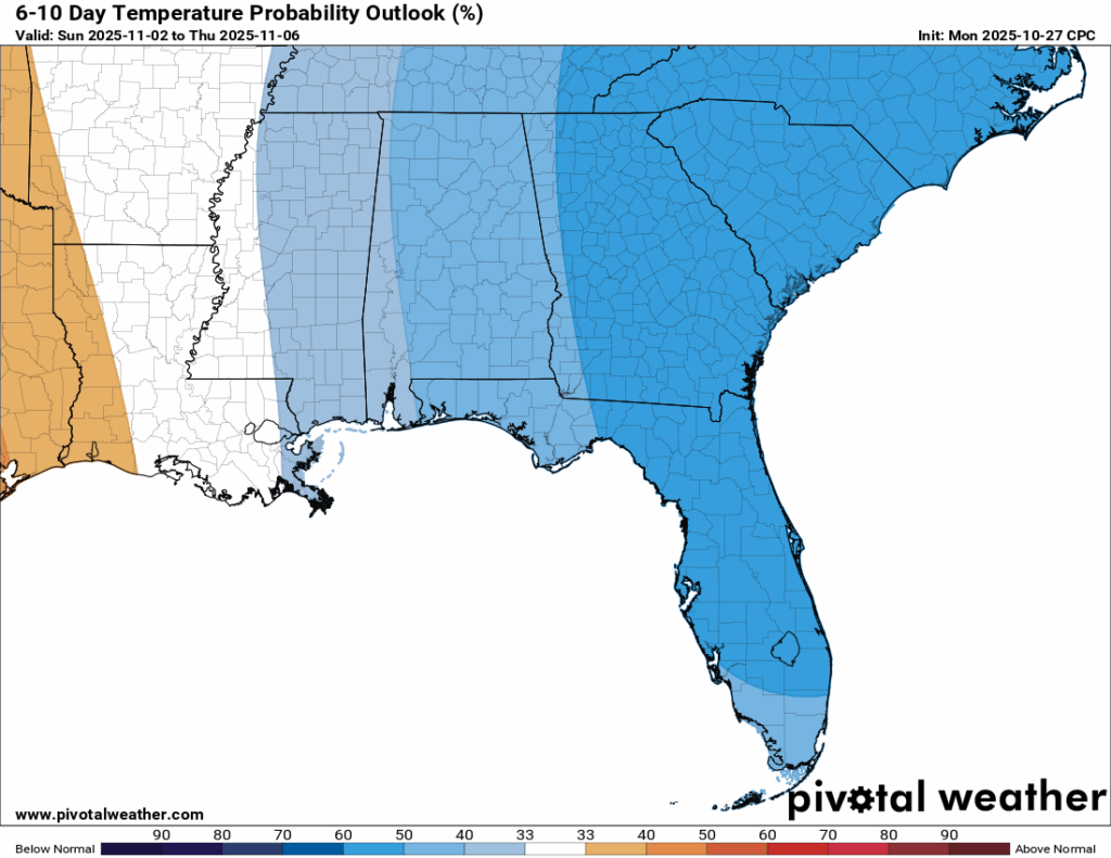
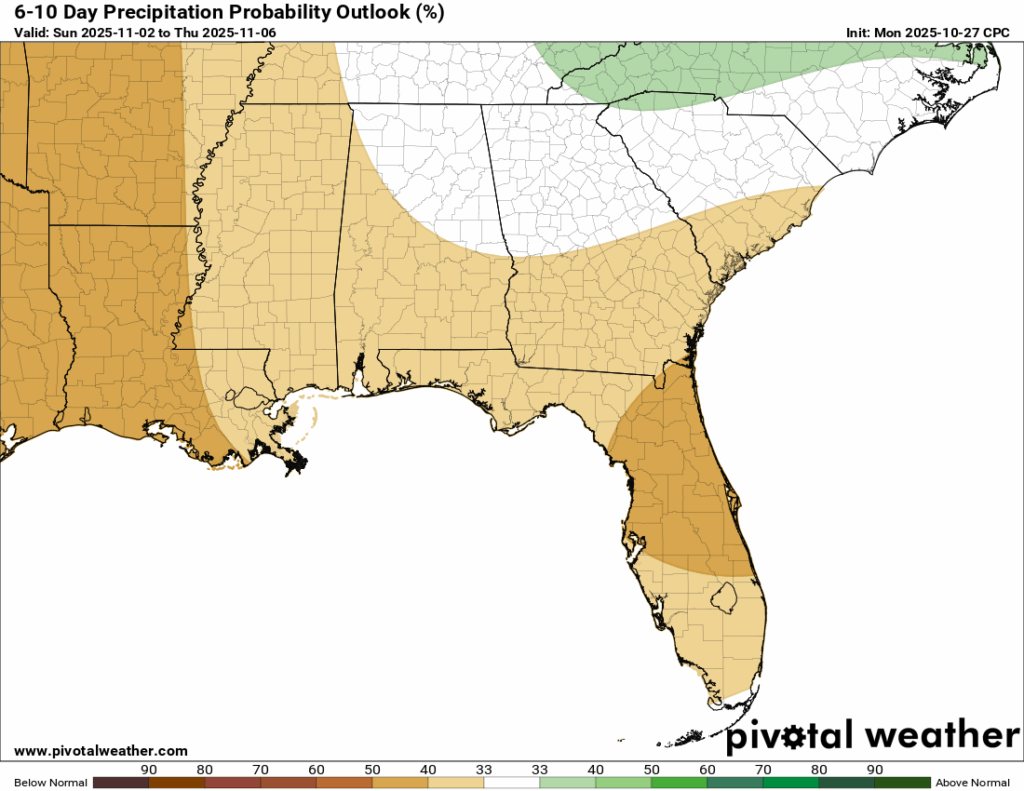
Looking ahead, dry conditions are expected Friday for Halloween and Saturday with temperatures staying below average and feeling fall-like in the mid to upper 60s. Another trough of low pressure is showing up in the latest model runs for Sunday, which could bring a round of rain to the area. After that, the pattern looks to stay cooler and drier than average through the next 6 to 10 days.

Latest Tropical Update
Hurricane Melissa
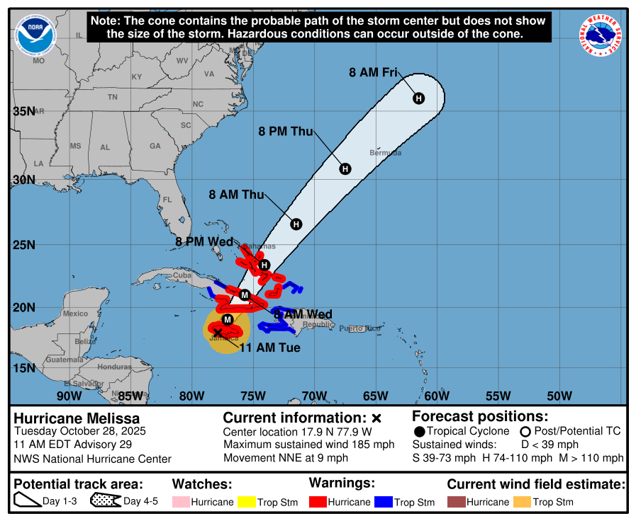
The only major topic in the tropics right now is the destructive Hurricane Melissa, which made landfall in western Jamaica earlier this afternoon as a Category 5 hurricane with sustained winds of 185 mph. Its central pressure dropped to 892 mb, the fourth lowest ever recorded in the Atlantic basin. Catastrophic damage is expected across the western part of Jamaica.
Melissa is forecast to make another landfall in Cuba by Wednesday morning as a powerful major hurricane before moving over the Turks and Caicos. It will eventually head out into the open Atlantic, but Bermuda could still see impacts by late Thursday as the storm passes nearby. Our hearts go out to those who are affected by this storm.
REGIONAL DAY TO DAY FORECAST
Tonight: Showers and thunderstorms, some of which could be severe, developing along a cold front. Lows in the lower 50s. Southeast winds 5 to 10 mph, becoming west-northwest after midnight. Winds could gust up to 30 mph. Chance of rain 90 percent.
Wednesday: A 10 percent chance of showers before 7 a.m., then mostly sunny. Highs in the lower 60s. West winds around 15 mph, with gusts up to 30 mph.
Wednesday Night: Mostly cloudy with lows in the upper 40s. West winds 10 to 15 mph, with gusts up to 25 mph.
Thursday: Mostly sunny with highs in the mid 60s. North-northwest winds 10 to 15 mph, with gusts up to 20 mph.
Thursday Night: Mostly clear with lows around 40. Northwest winds around 5 mph, becoming calm in the evening.
Friday: Sunny with highs near 70. Calm winds becoming west-northwest around 5 mph in the afternoon.
Friday Night: Clear with lows around 40. Calm winds.
Saturday: Sunny with highs in the lower 70s. Calm winds becoming west around 5 mph in the afternoon.
Saturday Night: Partly cloudy with lows in the mid 40s.
Sunday: Watching a potential rain chance, stay tuned. Highs in the mid 60s.
Sunday Night: Mostly clear with lows in the mid 40s.
Monday: Sunny with highs in the mid 70s.


