Hi everyone! Severe weather is in store for today in the central plains. Let’s take a look at the setup:
Today’s Overall Setup
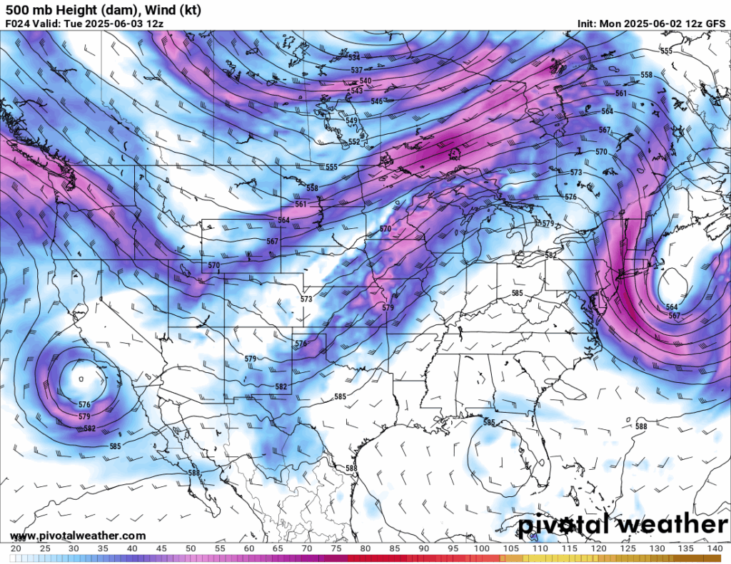
As we can see from the mid-level (500 mb) pattern for the CONUS, there is a well defined trough in the west, pointing down into the plains. There are enhanced mid-level winds out ahead of the trough, and a large ridge out in the east. This pattern is conducive for a typical severe weather threat in the central part of the country. Let’s see what ingredients are in place:
Severe Weather Threat
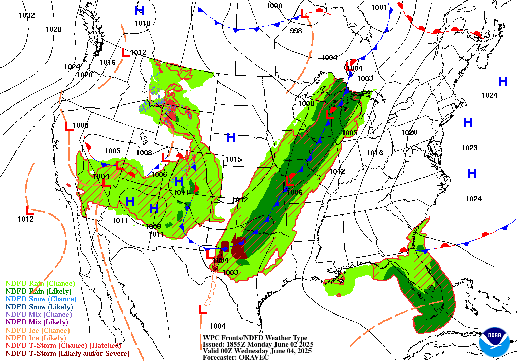
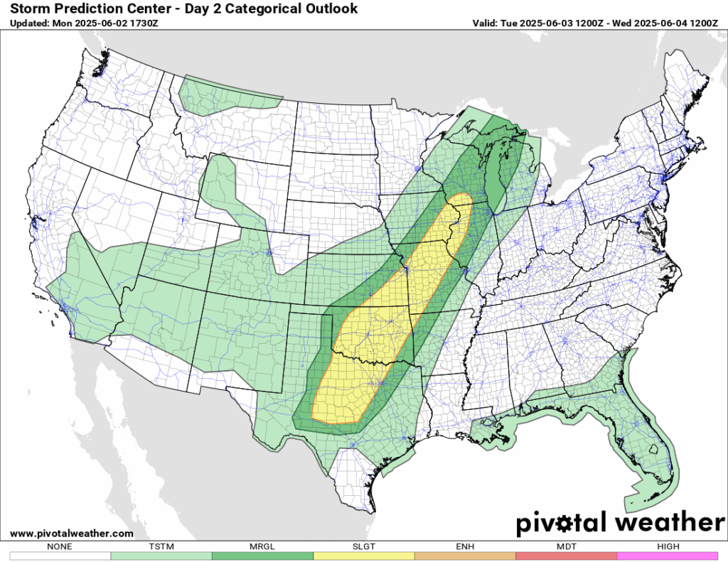
First, at the surface, we have a large cold front that is attached to a low pressure system just north of Wisconsin and stretches down toward into the plains and into northern Texas. There is also a dry line that is set up in western Texas, sparking up a severe storm threat down there. The high pressure along the eastern part of the country allows for the overall flow in the warm sector of the cold front to be southeasterly, since winds circulate clockwise around a high pressure system. The same applies to the high pressure system over Montana – it is forcing cooler/drier air towards the front on the cold side. Storms today are expected to fire up along the cold front, which is why the SPC has such a large but narrow risk zone (Slight 2/5) for severe weather today.

As we can see from the surface temperatures for today at 15z (10 AM CDT), there is an obvious cold front separating the warm/moist air from the southeasterly flow and the cooler/drier air from the northwesterly flow. This boundary will serve as a key focus for thunderstorm development later today, especially as daytime heating increases instability. Areas along and ahead of the front will be most at risk for severe weather.
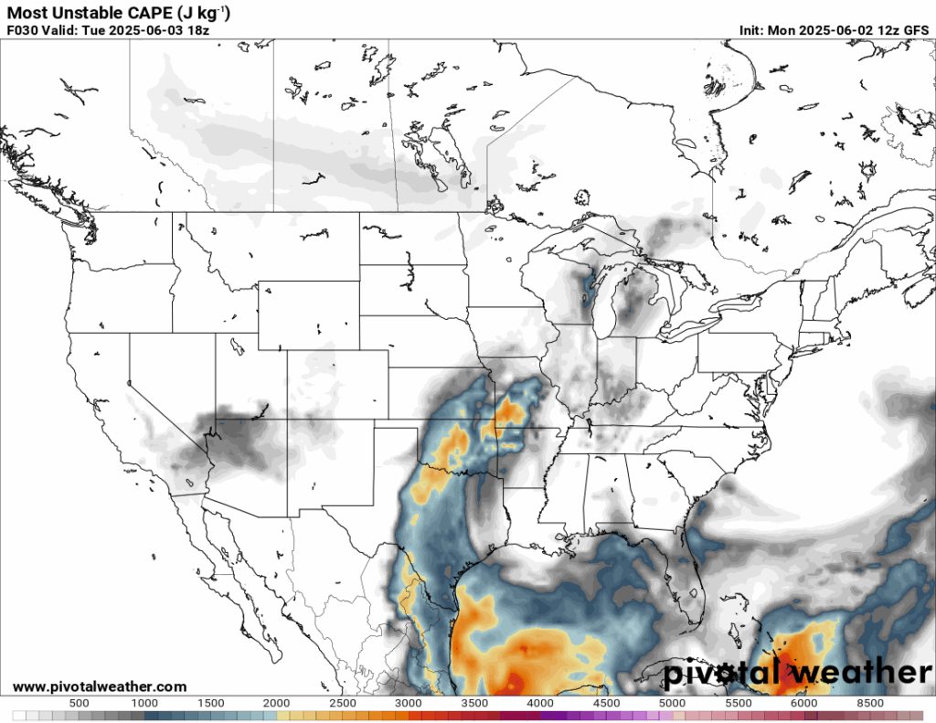
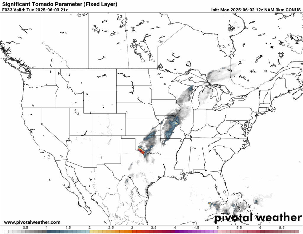
The Convective Available Potential Energy, or CAPE, is moderately high in the risk zone, with values up to 2500 J/kg. While this isn’t the highest CAPE, it’s enough to get storms fired up and lifted by the afternoon to the evening hours today. The Significant Tornado Parameter, a product that puts together all of the ingredients for the likelihood of significant (EF2+) tornadoes, is highest at around 21z (4 PM CDT), which means there is a chance of Sig Tor’s around that time in southern Oklahoma and northern Texas. Further northeast into Kansas, Missouri, Iowa, Illinois, and Wisconsin doesn’t show as high of a Sig Tor potential, but the ingredients are still there in some form nonetheless. Remember, the Sig Tor Parameter is not a perfect product; so it does not mean that these areas will definitely see EF2+ tornadoes today, but only that the ingredients are there.
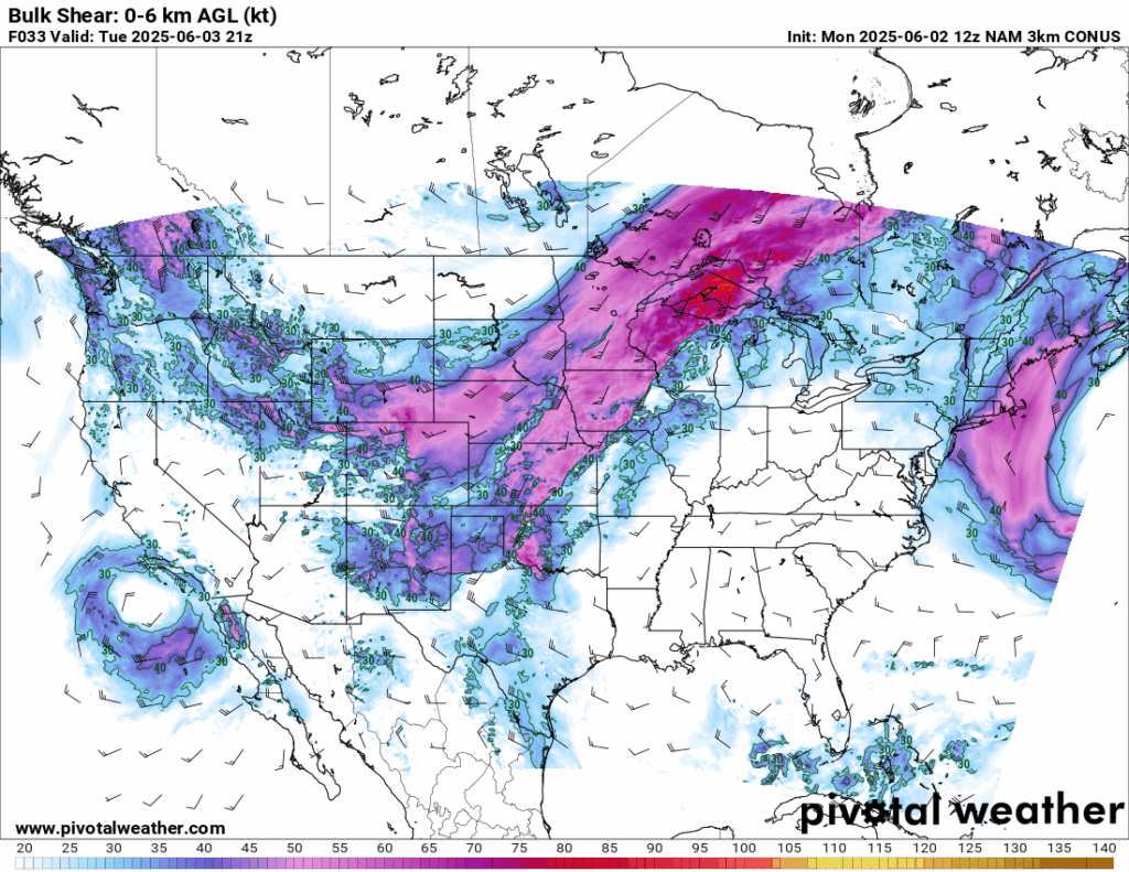
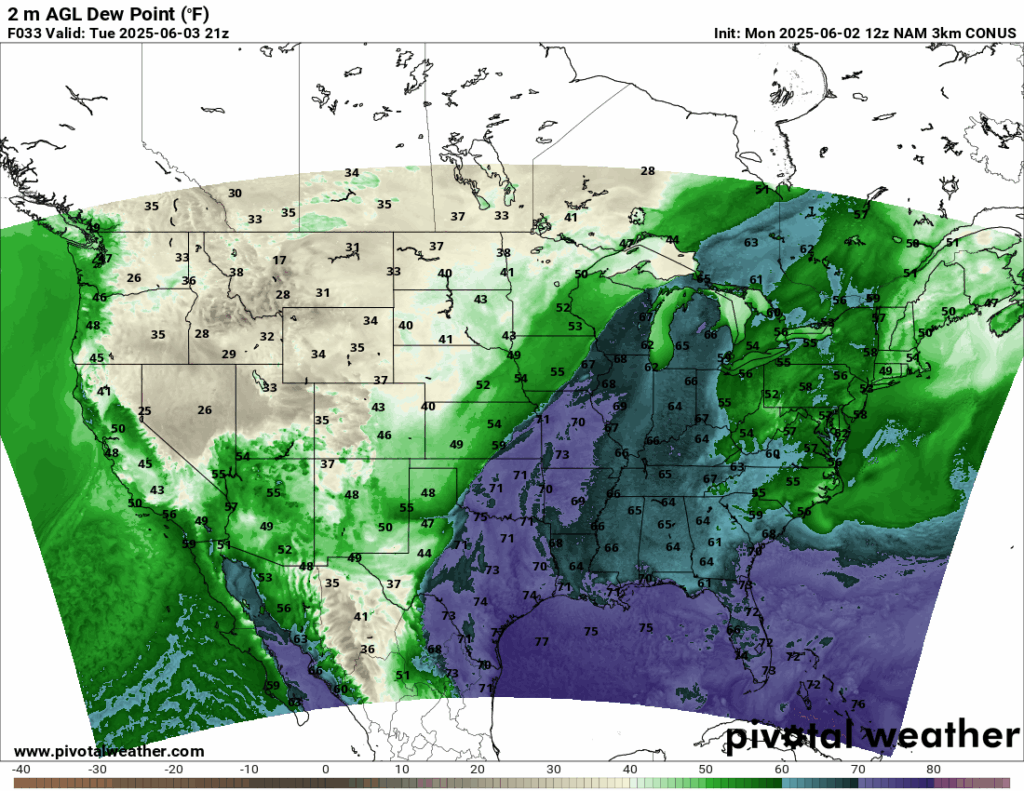
Around 50 knots of Bulk Shear is present during the severe threat in the area of concern, meaning supercells are likely to form; which will be the main factor in the tornado threat, which is given a 2% risk in the “Slight” zone. Additionally, there is a large moisture tongue stretching from the Gulf through the warm sector of the cold front. The dew points being in the 70’s allow for lot’s of moisture for the cold front boundary to work with. All of these ingredients are shaping up for a severe weather setup.
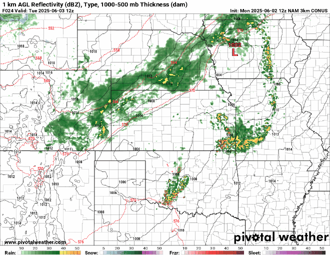
Here’s a look at the simulated reflectivity for tomorrow. Storms will start to fire up out ahead of the cold front and will push eastward throughout the day today. They will then clear out by Wednesday, where there is just a Marginal (1/5) risk of severe weather in the Great Lakes region that day. The main threat will be today in the plains and just east of them. For the round of storms today, keep an eye out for some damaging winds, hail, and some tornadoes. Some bow echoes look to be possible with the fast moving winds behind the line of storms pushing east, so tie down any loose outdoor furniture!
Western United States
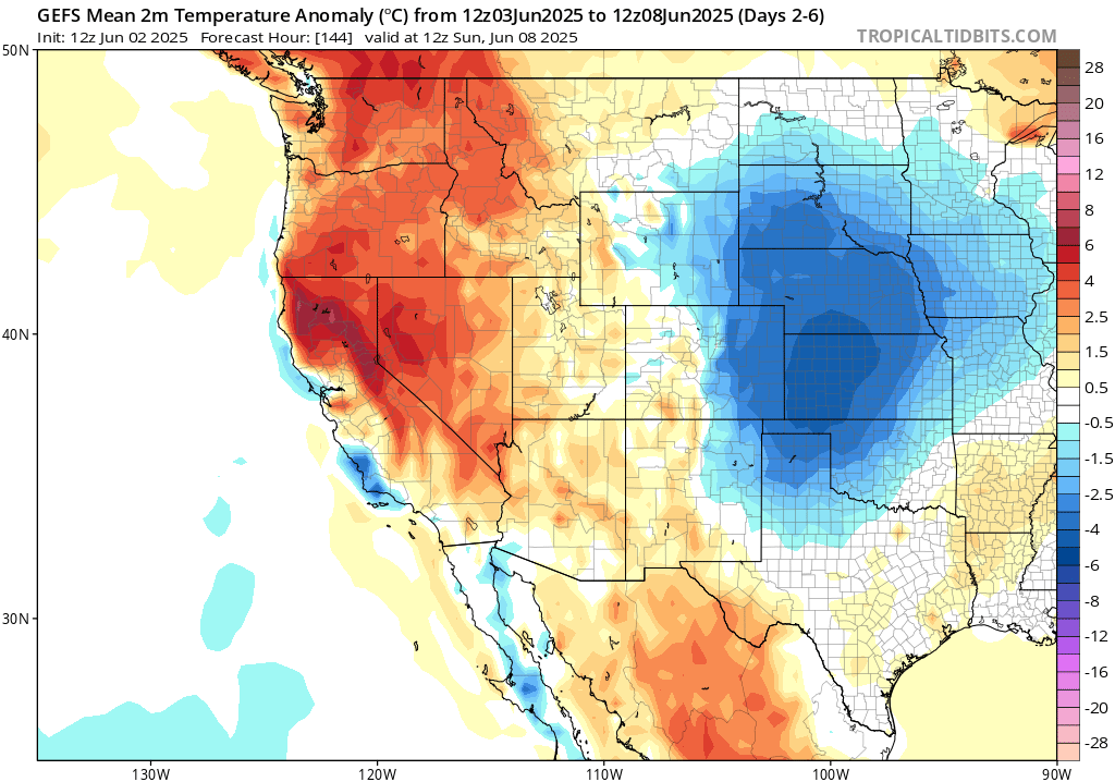
Looking into through the next 7 days, for the western CONUS, you can expect warmer than average temperatures, especially in northern California up towards Washington state. This is due to a large ridge of high pressure that is expected to form in the coming days. The high pressure will also be responsible for large tropospheric descent – meaning there will be very little rain falling in the next 7 days. Be sure to stay hydrated! The ridging is not as intense the more inland into the Rockies you go, so areas to the east of the mountain chain will be seeing slightly more precipitation in the next week.
Central United States
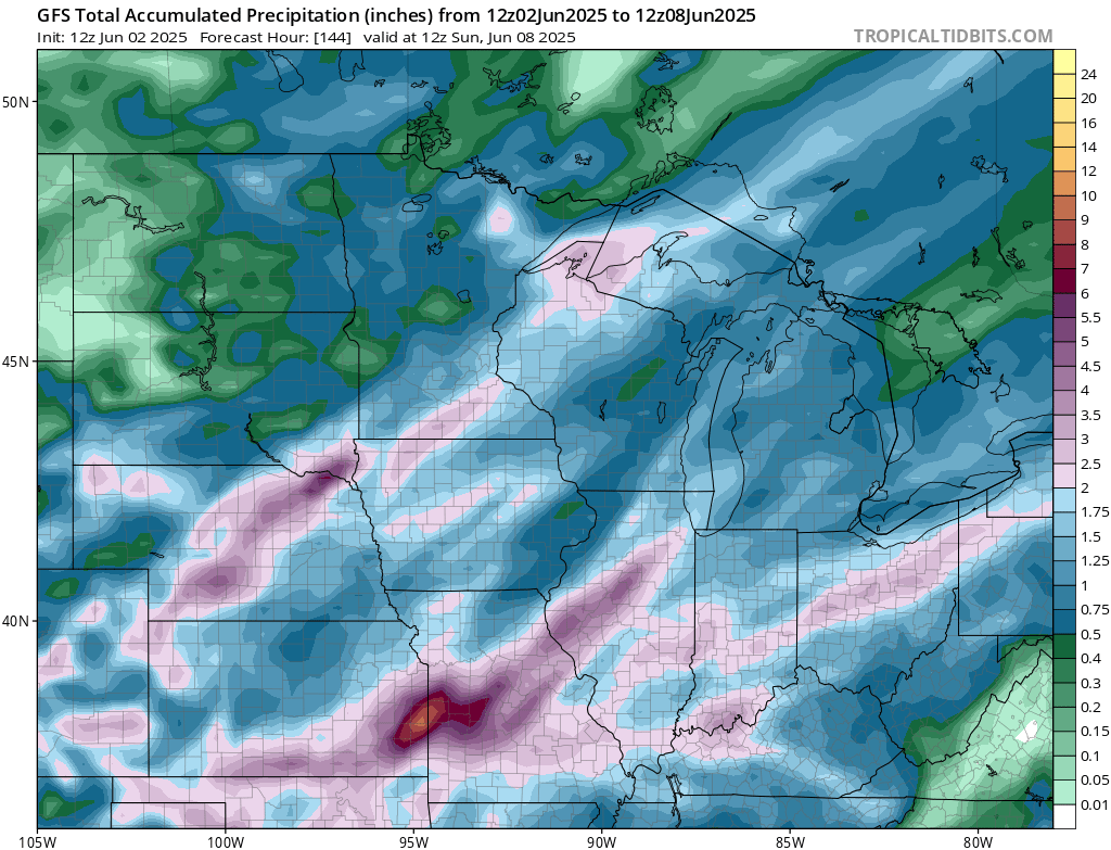
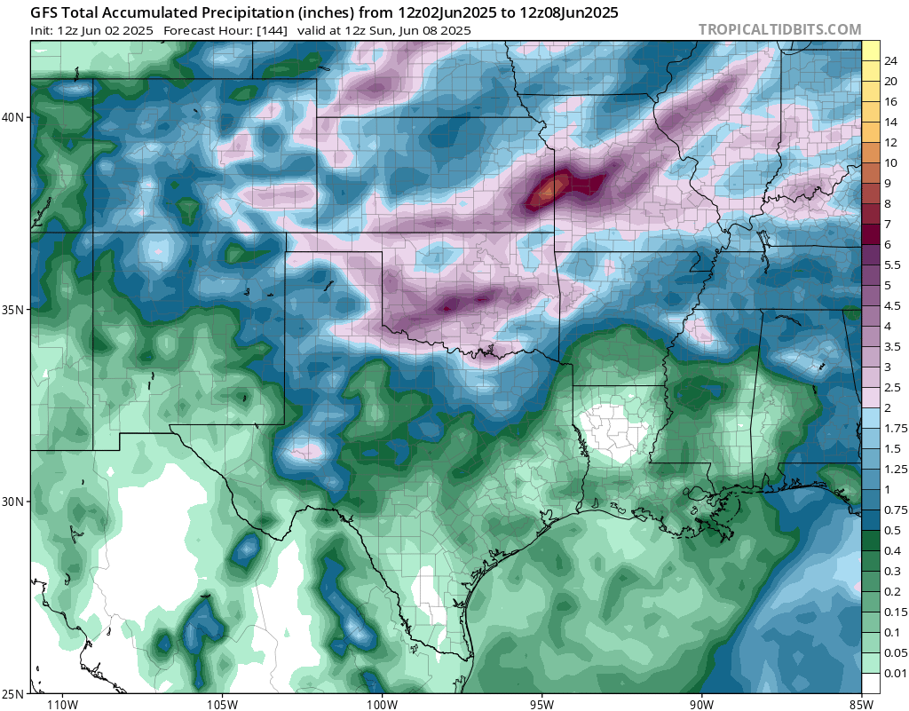
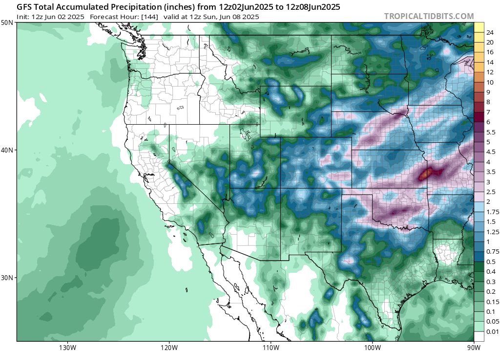
Lot’s of rain fall is expected in the central part of the country in the next week. With the severe weather threat today, followed by several days of rain chances from shortwaves underneath the overall troughing pattern, rain amounts are approaching a foot in eastern Kansas and western Missouri, with Oklahoma and northeastward getting their fair share of the rain as well. We will be monitoring any flood threats throughout the week.
Eastern United States
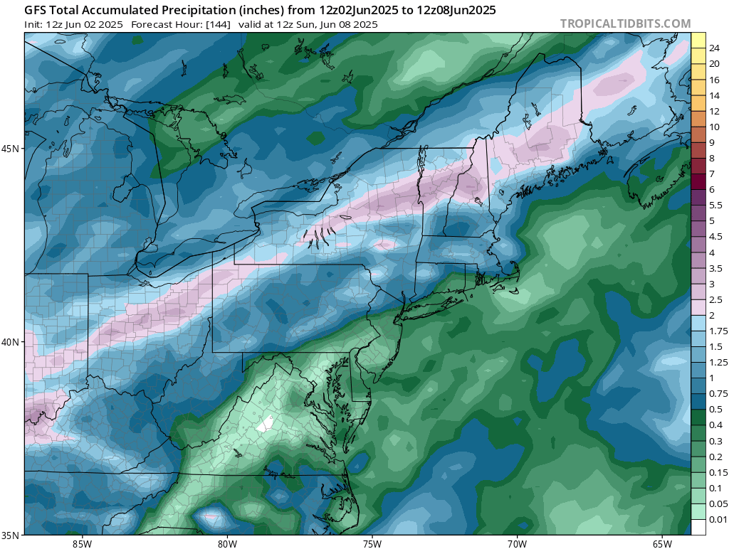
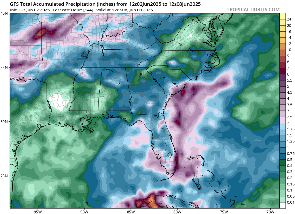
The Mid-Atlantic will see a drier week ahead, but rain does come in the area this weekend. Those in the southeast, towards Mississippi, Louisiana, and southeastern Texas will also see a fairly dry week this week, with just small amounts of precipitation forecasted for the week. We thank the increased ridging in these areas for this! Florida, however, will be receiving more precipitation this week, with almost 6 inches of rain possible – lot’s of moisture in the atmosphere to work with there.
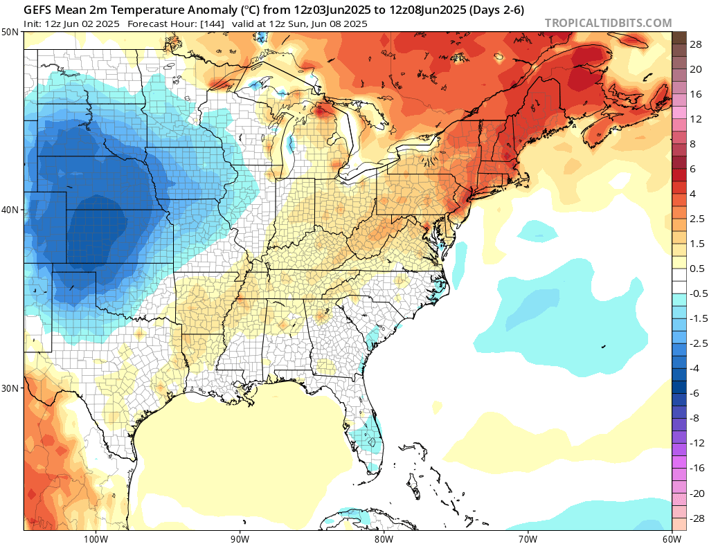
Summer is in full swing in the northeast, with above average temperatures for this week. Near average or slightly above average is the forecast for the midwest into the southeast. Some parts of Florida could be cooler than average thanks to all of the rain that is forecasted this week.
Travel Outlook
If you’re traveling today, keep an eye on the weather, especially if you’re on major interstates like I-35, I-44, I-70, or I-55. Strong storms are likely along this corridor from Texas through Missouri and into the Midwest. Damaging winds, hail, heavy rain, and even an isolated tornado are possible, mainly in the afternoon and evening. Expect slower travel, reduced visibility, and the chance for delays. Check the radar before you go and steer clear of any flooded roads.
Extended Outlook
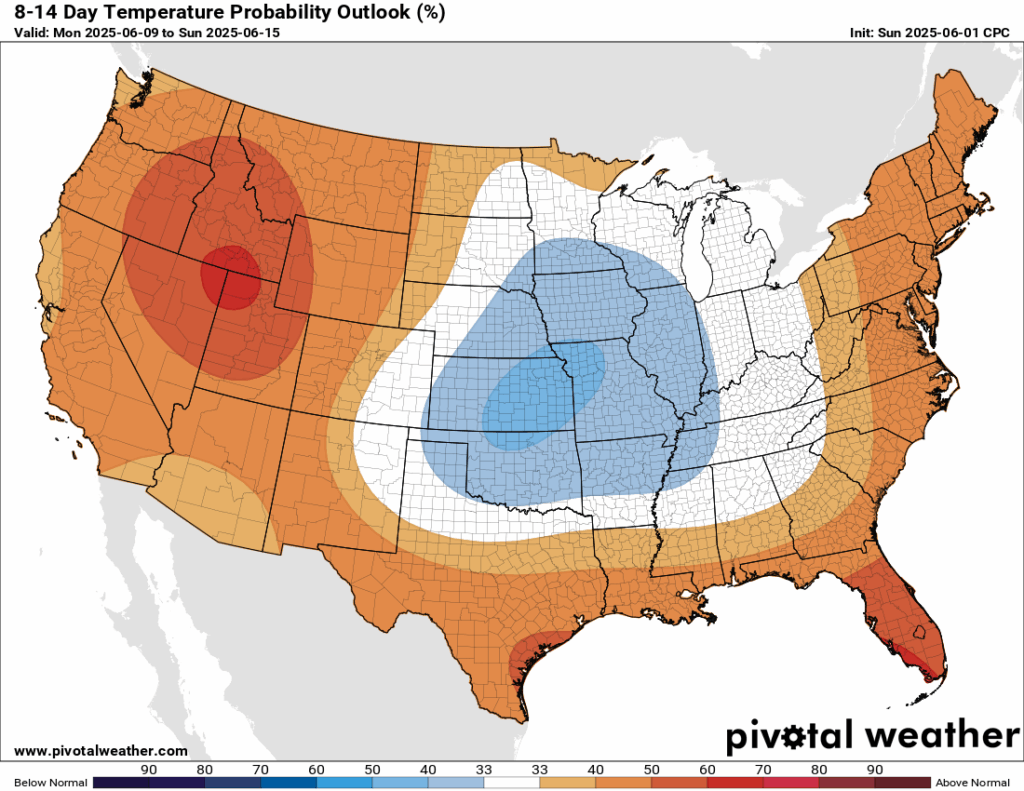
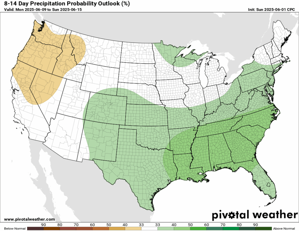
For the next 8-14 days, which will be the second into the third week of June, the Climate Prediction Center is in agreement that the west will be warmer and drier than average – the coasts being warmer than average, and the center of the country being cooler than average. The eastern half is expected to be wetter than average, with increased likeness in the southeast of more precipitation.
Thanks for tuning in to this National Forecast! Tune in to our local, tropical, and regional forecasts to stay updated on the latest!


