The SPC has put out their Day 1 outlook and expanded the slight (2/5) risk into Alabama. This severe weather event will hit later this afternoon into the evening hours with a chance for straightline winds up to 60mph and tornadoes possible up to EF-2. The chances for tornadoes look conditional and will depend on whether a supercell can fully develop ahead of the main line. Overall, the incoming system has the potential to bring severe weather to parts of Louisiana, Mississippi, and Alabama, but will need the right ingredients to pop off these storms.

Today and Tonight
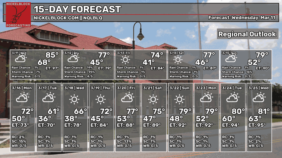
Today, we can expect humid conditions and partly to mostly cloudy skies. A few scattered showers are possible in the early afternoon before a cluster of thunderstorms in the evening hours. Overall, a warm and humid day with a high around 80. As the cold front moves through tonight, temperatures will drop to around 50.
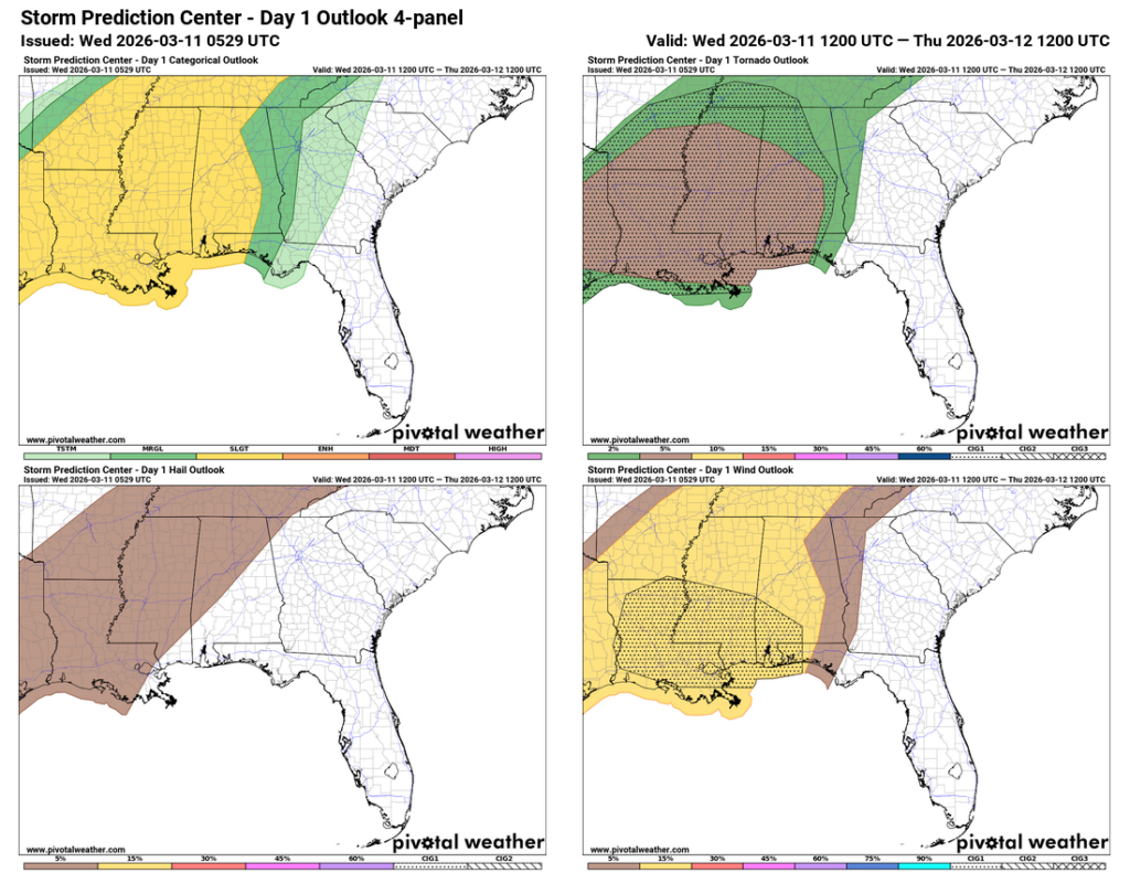
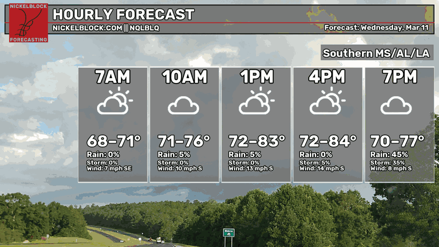
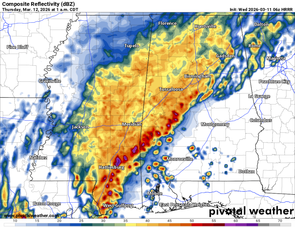
For this evening, we have a decent chance for severe weather. The SPC has highlighted much of MS/LA/AR for a chance of straight line wind gusts (around 60mph) and a 5-9% chance of seeing a tornado (some of which may reach EF-2 status). Hail is also possible in some storms. Our main concern so far will be any discrete cells that develop in front of the storm, so clusters of cells ahead of the main line. The HRRR model guidance has shown several developing around south central Louisiana moving further east into southeast LA and eventually south Mississippi.

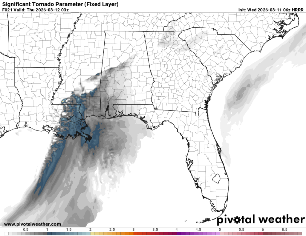
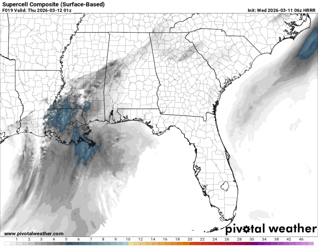

Looking at the images above, we have the Significant Tornado parameter and Supercell Composite. These very much coincide with each other meaning that supercells that develop will have a slight chance of a tornado. The tornado parameter remains mostly low with a few spots that spike to a medium chance, and this will be fairly conditional. Keep an eye out for tornado watches that are issued and take shelter if there is a tornado warning. Like Matt said yesterday, this is not a reason to panic, this is just to make you aware.
So far, our main hours of severe weather are between 5pm and 2am. Around 4, a few clusters of cells will develop out of south central Louisiana and will have the potential to intensify over the next few hours as they move towards southeast Louisiana and Mississippi. The good news is that the cells begin to fall behind and combine with the line. The bad news is that for those in south Alabama, another cluster of cells may develop firing off another chance of severe weather for them.

Tomorrow
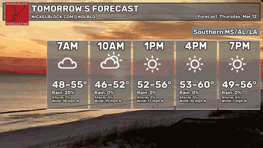
The rain will move out by the early morning hours tomorrow morning and leave us with some upper level clouds in the wake of the cold front. Overall, it’s going to be a cooler day outside but not without the after-cold-front wind. 30mph wind gusts are possible during the day from the north, so bring your jacket! Highs will be in the upper 50s to low 60s and the low will be in the low 40s.
Friday
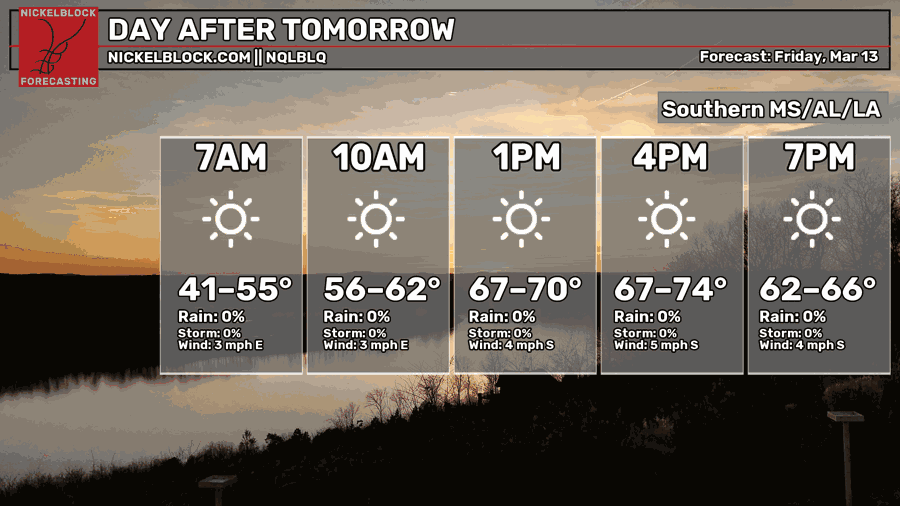
The winds will calm down fairly quickly as the cold front has passed and we’re going to have a period of calm for the next few days. It’s going to be a sunny day outside with a high in the low 70s, quite pleasant for early Spring! Overnight, we’ll fall into the upper 40s. For those that have to go between your heater and air conditioning during the day, it’s going to be one of those weekends.
This Weekend
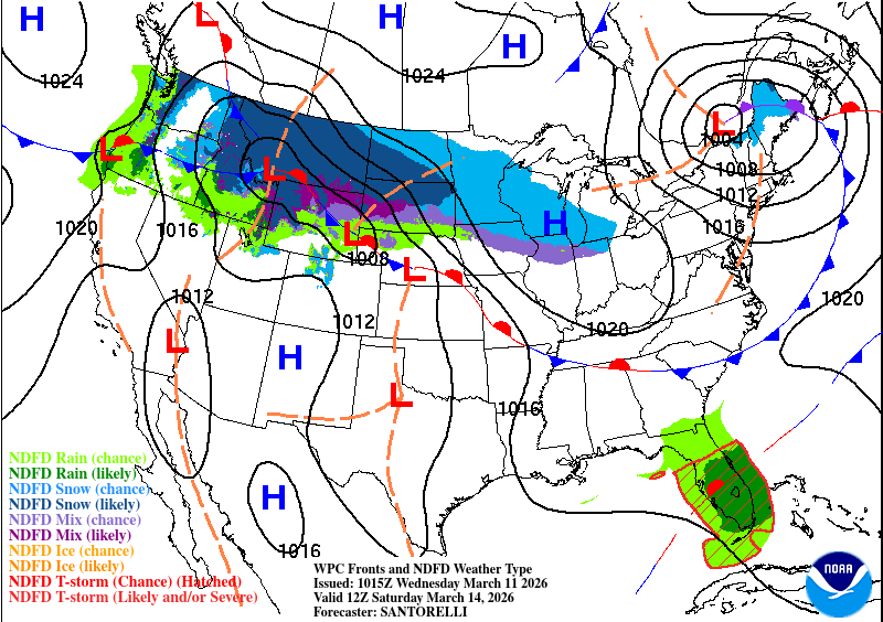
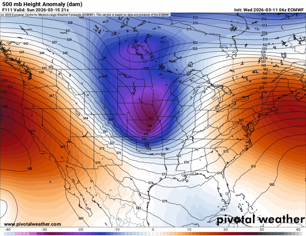
Looking at the upper levels and the surface, there’s another weak front moving through the Great Lakes into the New England area. This won’t mean much for us, however we’ll have another warm couple of days while we wait on the big cold front behind it (seen in Wyoming and Montana above). By Sunday, this front will grow exponentially thanks to a large trough that’s going to mull over the Midwest by Monday.

The front on Sunday will keep most of the moisture away from us, however areas in north Mississippi may see some showers and thunderstorms. Overall, it’ll be a warm weekend with a high in the low 80s and lows in the mid 50s on Saturday and the upper 40s by Monday. It’s going to be much cooler on Monday with the incoming cold front, so have your jacket ready!