Severe weather is expected today for southwestern Texas through Lousiana and the mid-Atlantic. Let’s take a look at the details:
Today’s Overall Setup
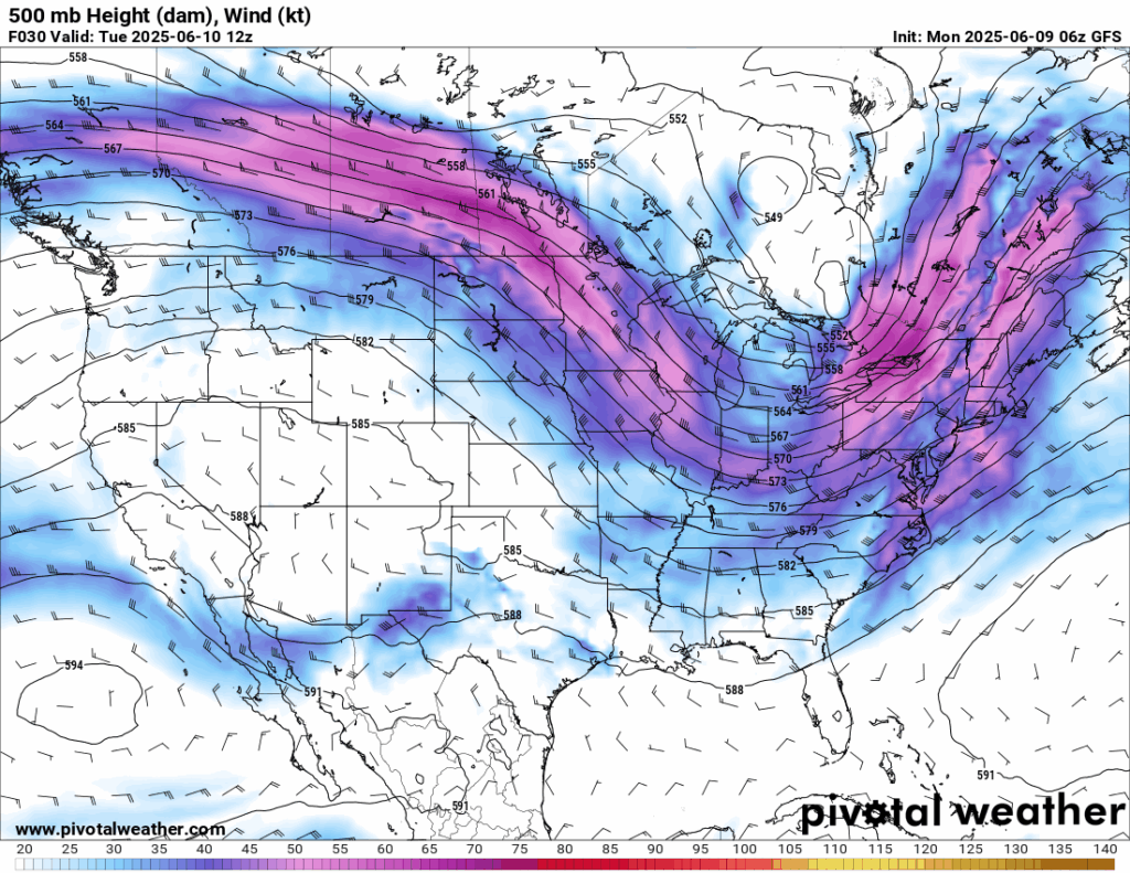
The overall atmospheric pattern includes a very large negatively tilted trough spanning down the eastern CONUS and a ridge in the west. A cutoff low pressure system is positioned with the trough, brining unsettled weather to the east. With these negatively tilted troughs, south of the mean jet stream, we would expect the trough to intensify, or dig more intensely. This enhancement is the cause for the severe weather threat in the mid-Atlantic. Enhanced flow from what seems to be the subtropical jet is also posing a severe weather threat to southwest Texas.
Today’s Severe Weather Threat
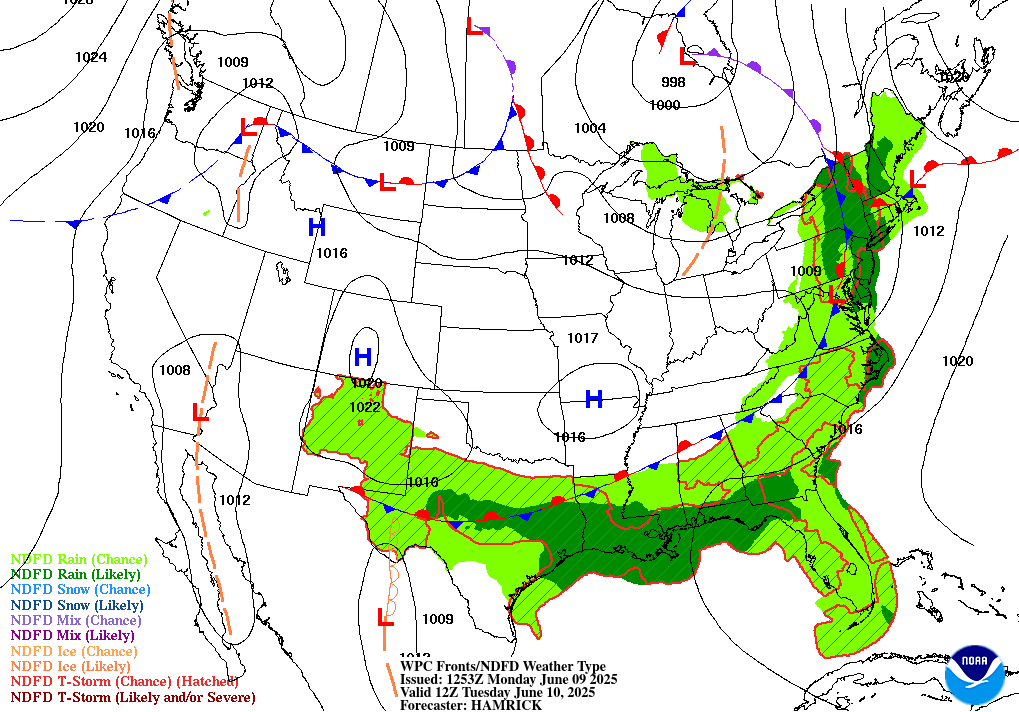
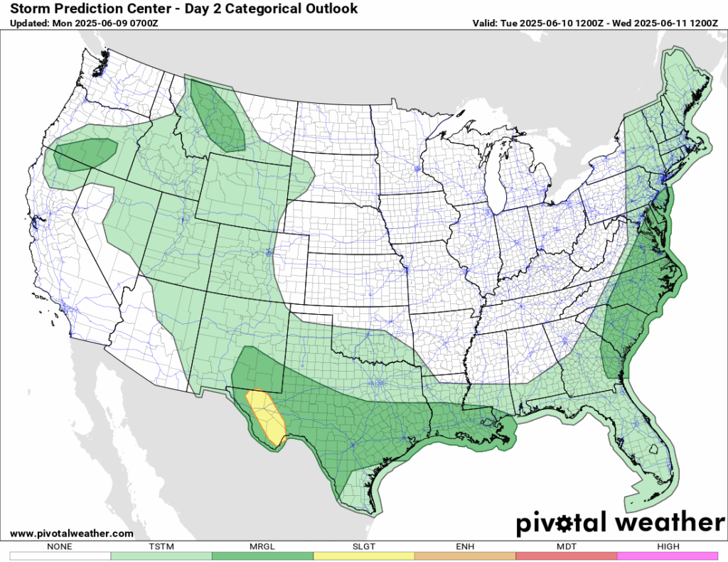
The cutoff low in eastern Canada drops down a very large cold front, stationary in parts of it, that stretches along the east coast through northern GA/AL/MS/LA and into Texas. All along this front, and points south/east of it, we are expecting showers and thunderstorms. The Storm Prediction Center (SPC) has a Marginal (level 1/5) risk of severe weather along the mid-Atlantic coast, from southern NJ to southeastern Georgia – where enhanced moisture flow converges with lifting from the frontal boundary. Dew points in that region will be in the 70s during that time. Areas from Louisiana west through southern Texas will see a Mesoscale Convective System (MCS) come through the region from west to east today. In the early morning hours it will travel across Texas, making its way through Louisiana in the afternoon and evening hours. A Marginal (1/5) risk is shaded for most of this MCS coverage, but a Slight (2/5) risk is shaded for extreme western Texas – as higher CAPE will intensify the storms more over there. We are not expecting 100 mph wind gusts from this MCS unlike Sunday’s derecho event, but severe winds are still not out of the question.
Texas to Louisiana Severe Threat
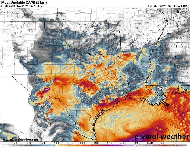
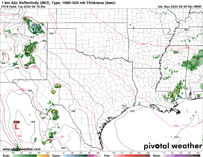
CAPE is explosive in southwest Texas during the time the MCS progresses through the region. Those thunderstorms will have no issues with rising very high up in the atmosphere. Because of the high CAPE, very large hail is possible in the region, with the SPC giving a 15 percent hatched risk of severe hail. Remember, hatched means that there is the risk of hail over 2 inches in diameter. That’s the size of golf balls to tennis balls, which is more than enough to damage cars, crack windows, or cause serious injury.
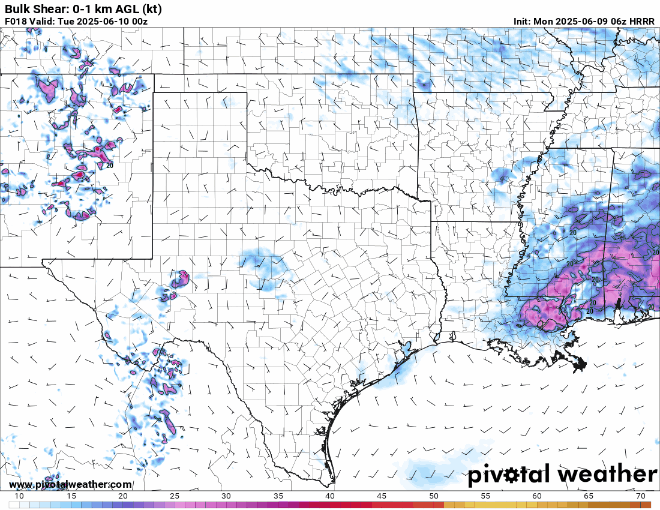
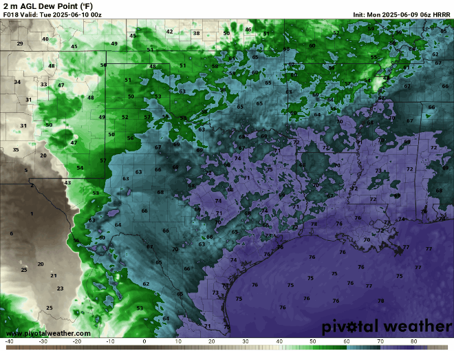
Wind shear is also very high in the southwest Texas region, with Bulk Shear values maxing out at around 50-55 kts, which is enough to cause a spin up of a tornado. The SPC has a 2 percent tornado risk for the region, so keep an eye out for a quick spin up out ahead of the squall line/MCS. Lastly, dew points in the general Marginal risk area are well into the 70s during the time of the storms. This moist inflow will be the main culprit to the initiation of this line to begin with.
Mid-Atlantic Severe Threat
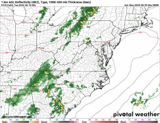
Above is the look at the simulated reflectivity from the high-resolution HRRR model. Storms will begin to fire up in the early morning along the front along the Appalachians, but those storms are less likely to be severe. The severe threat is more probable with the last minute stragglers later in the evening tonight. The built up heat energy from the day will lead to higher lapse rates, which will allow for the storms to develop more intensely. However, this will not be a tornado threat, only a isolated wind threat with some of the storms. Keep an eye out on the radar!
Are we done yet?
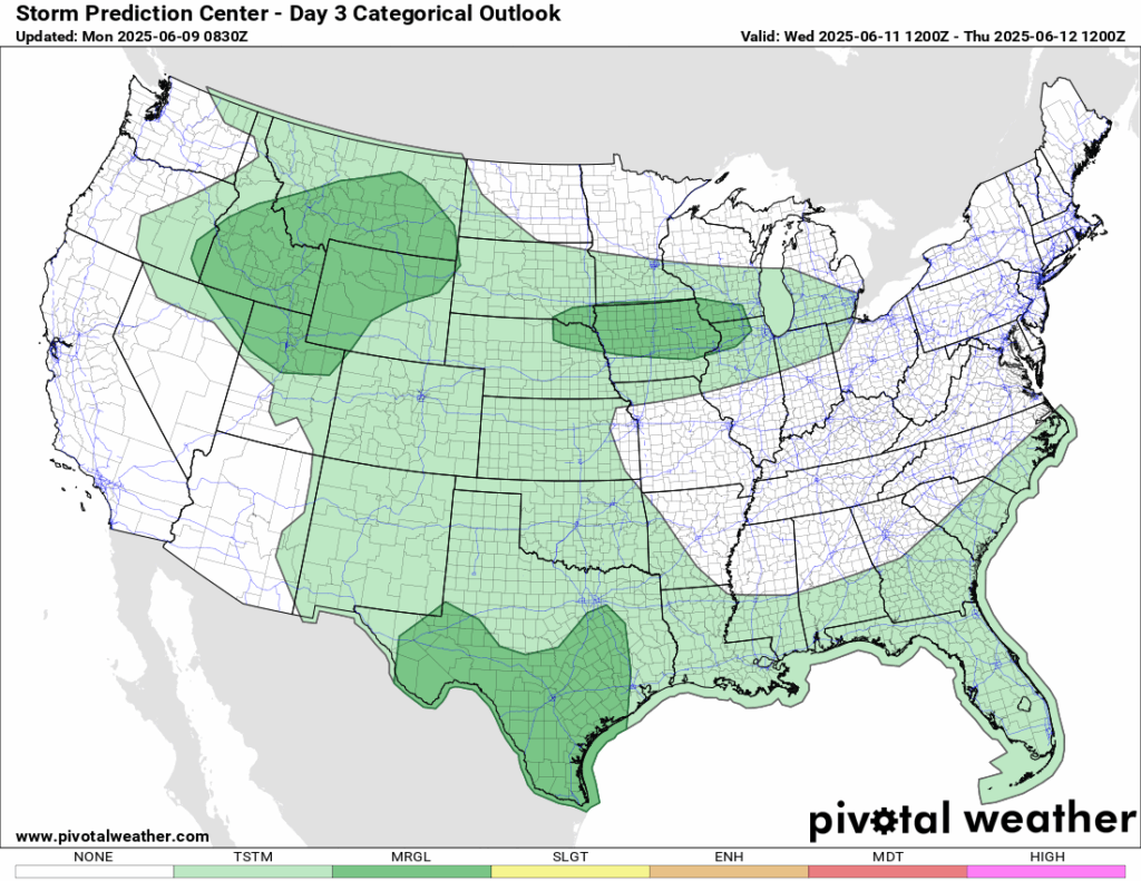
I know… each day you read these forecasts theres been a severe weather threat. Tomorrow, there is yet again another threat, but this time it is just Marginal (1/5) risks in southern Texas, Iowa and surrounding states, and the northern Rockies. These risk zones can be potentially upgraded or downgraded as the forecast develops, so stay tuned!
Western United States
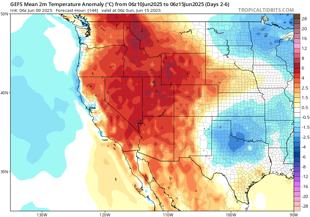
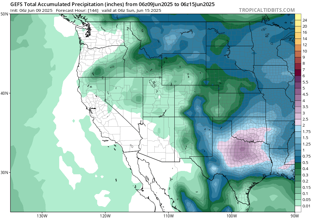
Taking a look through the week as a whole, the mean GEFS ensemble model is going for a warmer than average temperature in the west. Most of the warmer than average temperatures will occur early this week, with areas along the coast being 5-25 degrees above average! By mid-week, we start to aim closer to the average, but still slightly warmer than usual. Rainfall is very minimal for the week. Expect almost no rain in the desert regions, and little amounts through the Rockies. Keep hyrdrated this week and conserve your water usage!
Central United States
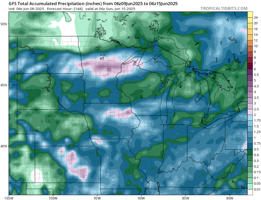
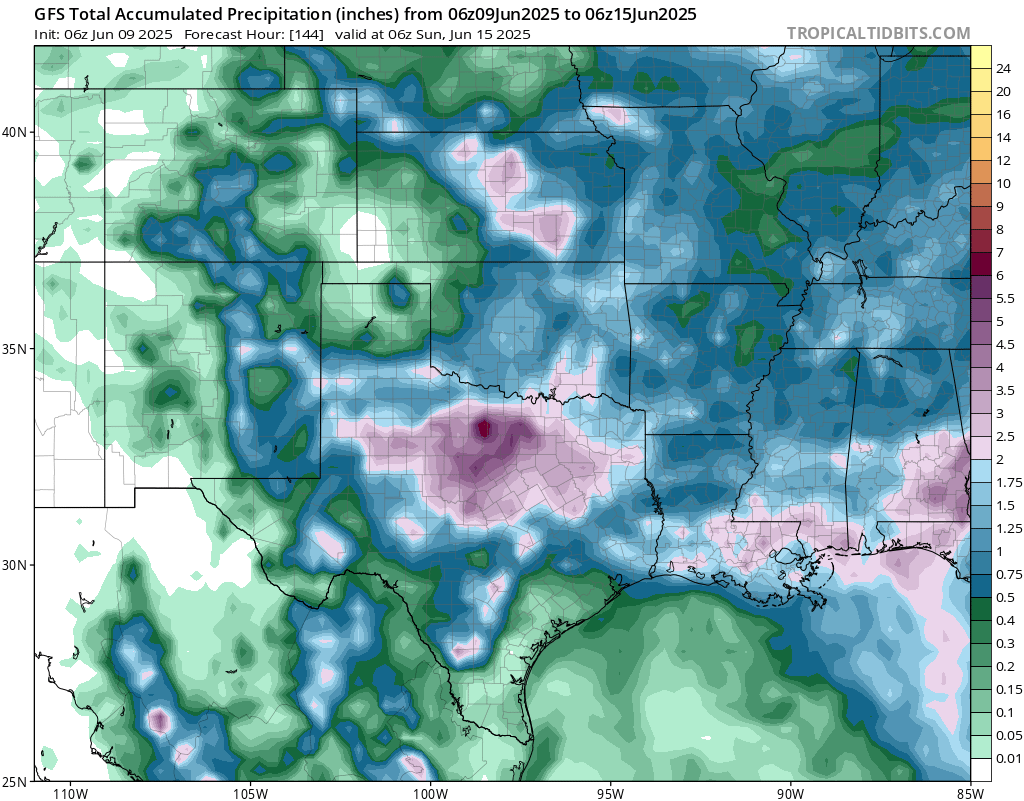
We are expecting many rounds of rain and thunderstorms this week in the central part of the country. The bullseye seems to be in north central Texas and southern Oklahoma. Flash flooding could definitely be a concern in the next week.
Eastern United States
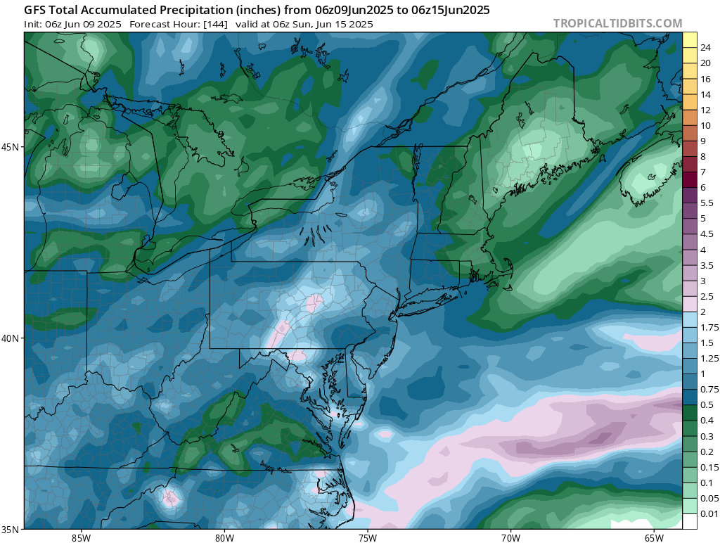
The northeast as a whole will see around a half inch to 3 inches. Multiple shortwaves are expected to come through the region this week, bringing some rain with it. Most of the rain here will fall today and this weekend. Yet again another weekend of rain!
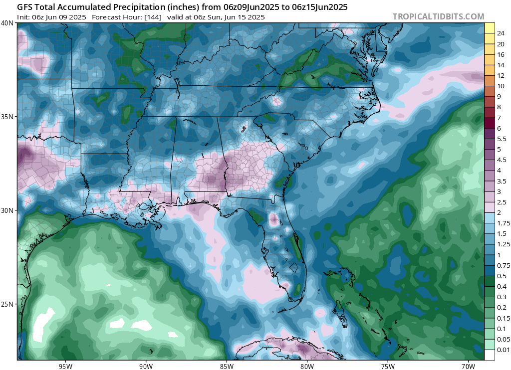
The southeast will be seeing lots of rain this week. We are in one of those unsettled patterns, with each day having some rain associated with it. The tropical moisture combined with shortwaves are the leading cause of these daily showers.
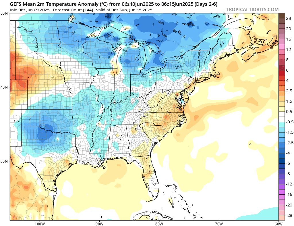
Temperatures in along the Atlantic coast are expected to be slightly warmer than average in the next week. Further inland, expect cooler than average temperatures, especially in the northern states, and the central part of the country, specifically the area of northern Texas and southern Oklahoma – due to the loads of rain that is expected to fall this week there.
Travel Outlook
If you are traveling today, you should be alert for severe weather hazards on across portions of west Texas, where the Slight Risk exists, especially along I-10 and US-87 near areas like Midland and San Angelo. The MCS could bring damaging winds, hail, and tornadoes. In the Marginal Risk area, including major routes like I-10 and I-20 from southern Louisiana through central Texas, storms may also produce heavy rain and lightning, reducing visibility. Along the East Coast, travelers on I-95 from southern New Jersey through the Carolinas to southeast Georgia should watch for gusty thunderstorms and localized flooding.
Extended Outlook
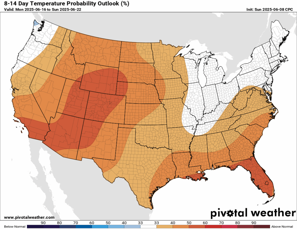
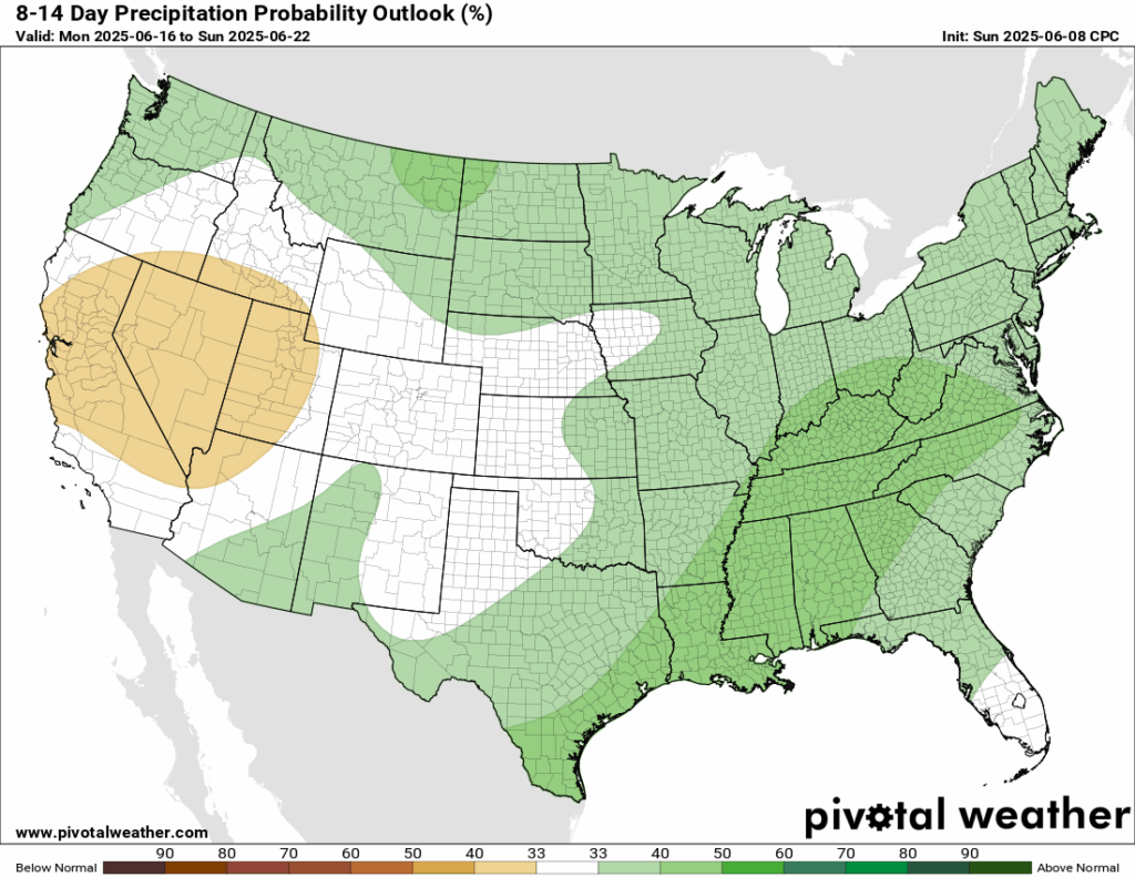
Looking ahead at the next 8-14 days, the Climate Prediction Center (CPC) is giving a high probability that most of the country will be warmer than average. The northeast and midwest regions are expected to stay near normal. Most of the country will also be experiencing above average precipitation in the next 8-14 days. The desert southwest into California is expecting to be slightly drier than average – following this weeks trend.
Thanks for tuning in to this National Forecast! Tune in to our local, tropical, and regional forecasts to stay updated on the latest!


