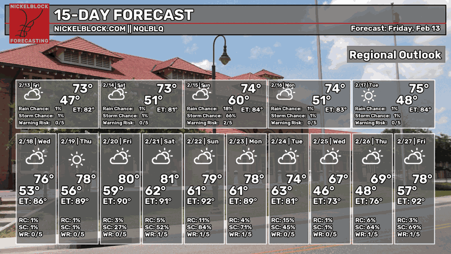
We’ve warmed back up after a brief cooler day yesterday, and that’ll be the upcoming trend for the next several days. A shortwave low pressure system is coming in tomorrow night bringing a chance for rain and thunderstorms with limited severe potential.
Overall, next week is looking very nice, albeit warmer than average for this time of year. We won’t really expect any storms until next weekend either, so stay tuned.

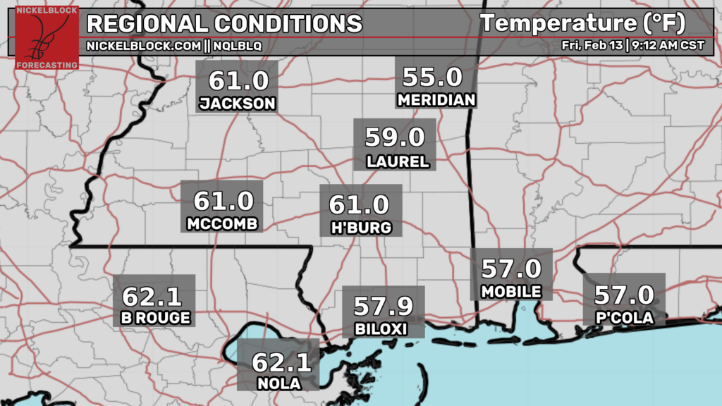
It’s fairly warm outside already as winds have shifted to the south. It’s already over 60 across much of the Pine Belt and above 60 in Louisiana. It’ll stay somewhat humid today as we progress through the day. The fog should lift by mid-morning.
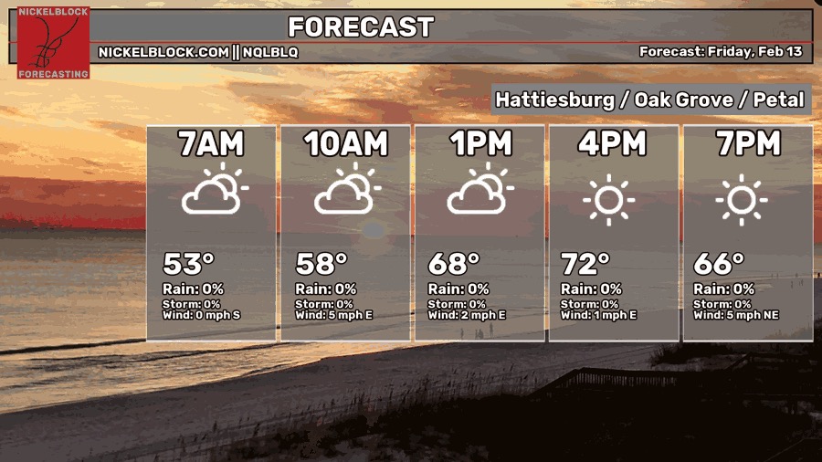
Overall, today will be fairly warm with some partly cloudy skies. Winds will shift from the south to the east as we wait on the incoming front tomorrow. Highs will be in the low 70s and lows will be in the low 50s.

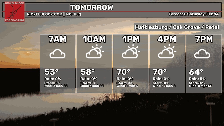
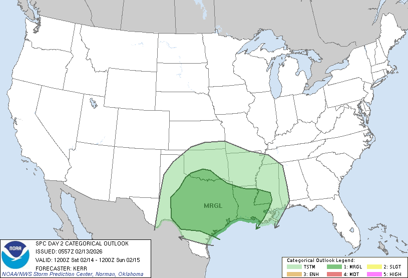
As we go into Valentine’s Day, cloud cover will be intermittent especially as we roll into the evening. Winds will shift back to the south with the incoming front pulling moisture from the Gulf. Temperatures will top out around 70 with some scattered showers across south MS/LA in the afternoon. The main system won’t move in until the late evening for the MS River Valley and around midnight for the Pine Belt. Severe potential is fairly low, but not zero. Tornado potential is low, but we may have to contend with high winds and locally heavy rain.
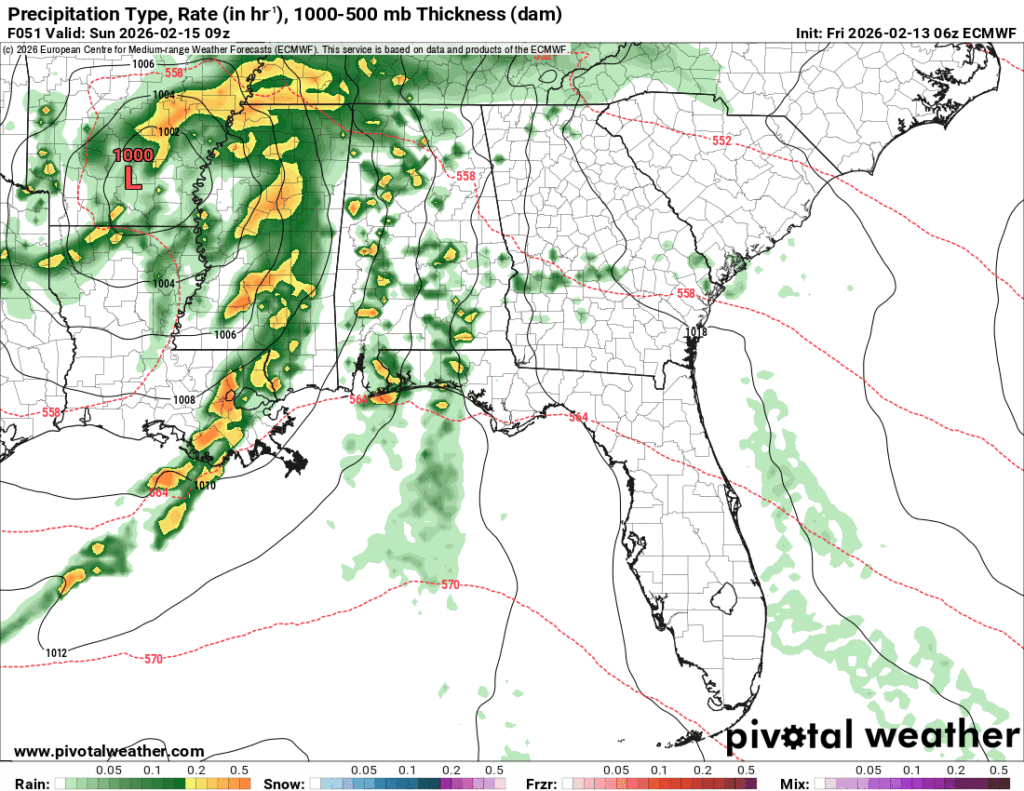
As the low moves over Mississippi, more showers are possible into Sunday afternoon, so bring your umbrella if you’re headed to church in the morning. The rain will taper off by mid-afternoon and clear things up a bit. Temperatures will be in the low 70s during the day and fall into the low 50s overnight.
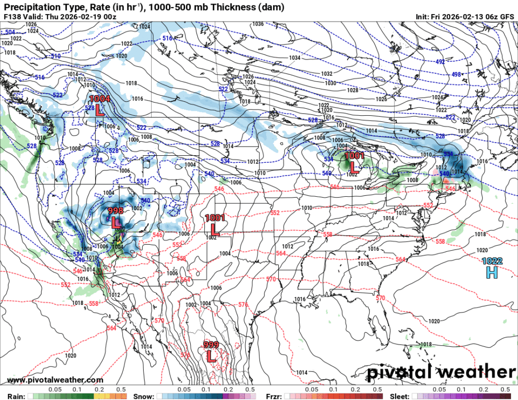
The next week will warm up slowly as the high pressure zone in the mid-Atlantic begins to block and slow an incoming low pressure system from the Rockies and Great Lakes. This will ramp up more southerly flow at the surface increasing temperatures gradually. We’ll likely hit the low 80s by Friday, so it’s going to be much warmer than normal! Lows will also increase from the upper 40s on Monday to 60 by Friday. Looking at the extended forecast, there’s also another chance for rain as the low pressure system I mentioned earlier will finally move in and bring some rain by next weekend.