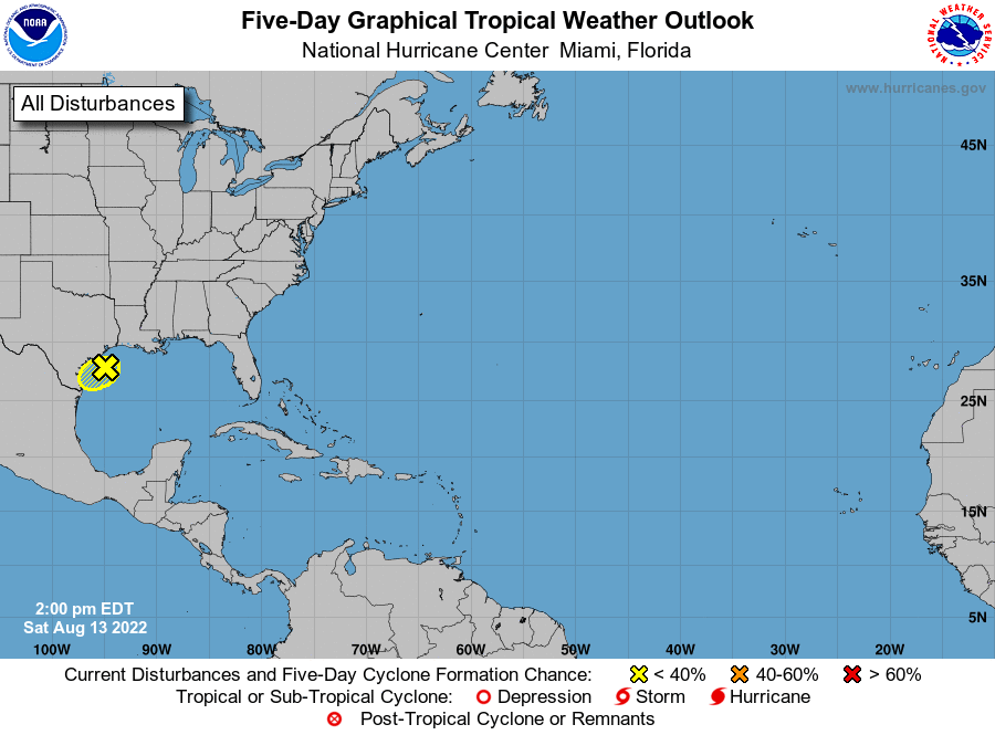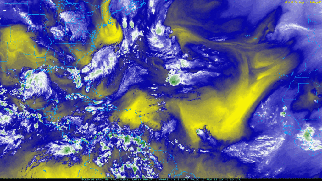
On this water vapor imagery map, we see two areas of high pressure in the tropical Atlantic (corresponding to the two big yellow areas over the Atlantic). There is also a high pressure system further north, around the latitude of Spain and Portugal and over the middle of the north Atlantic. There are a few storm systems scattered around the Atlantic, though there is not much activity over the tropical Atlantic. The system that has the best chance of developing into a tropical depression is the cluster of thunderstorms over the Gulf of Mexico.
A ridge is situated over the Great Plains, which will essentially block the Gulf system from moving in a northerly direction, and so the system will move toward the west-southwest and make landfall today.
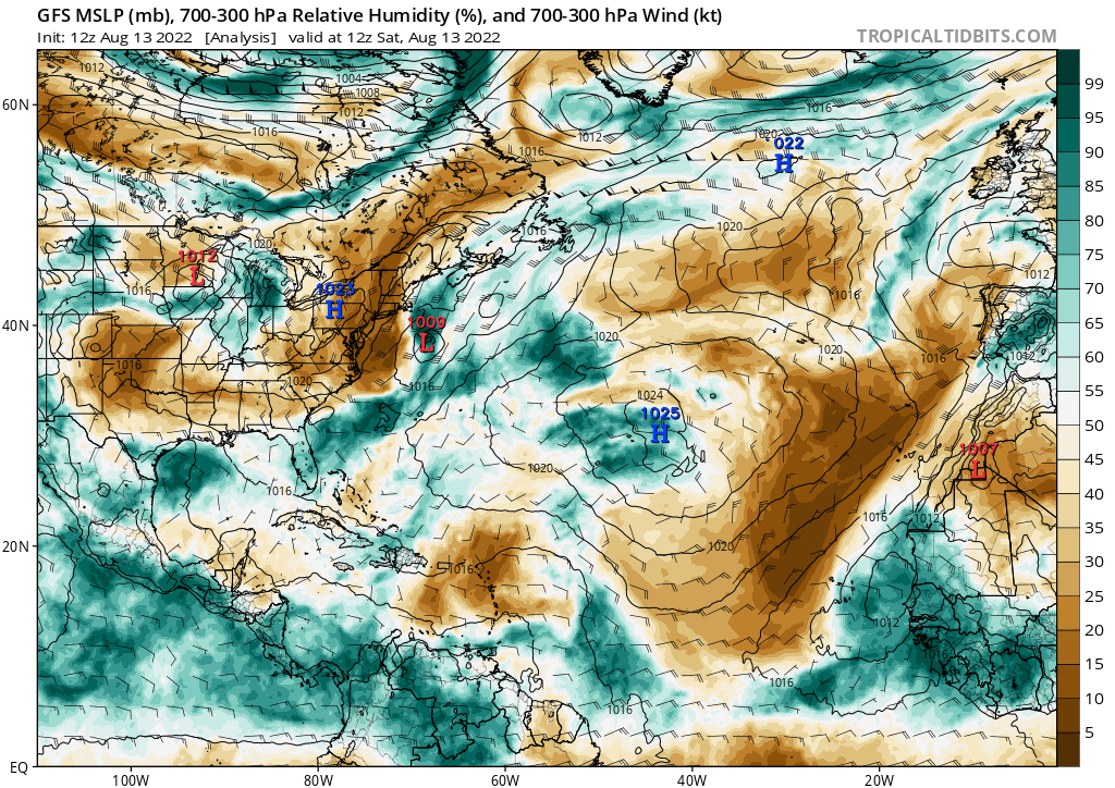
The humidity in the Gulf is favorable for development. As you can see on the map below, the western Gulf has ample humidity. This is why the National Hurricane Center gives a chance for development there.
Elsewhere on the map, in the central Atlantic off the west coast of Africa, dry air dominates and will stall any systems from developing.
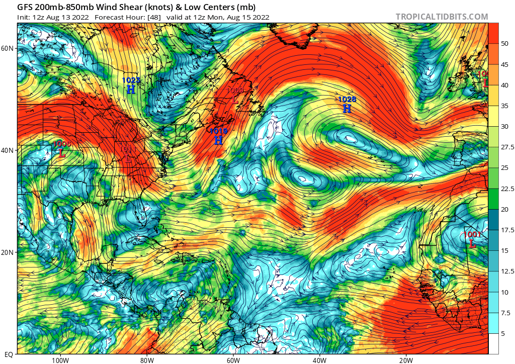
For the Gulf system, wind shear will be low to moderate. The wind shear could limit development some, but it is not extreme enough to eliminate the possibility of development. The wind shear will really limit development over the tropical Atlantic, though. As you can see on the map, there is a large area of strong wind shear off the west coast of Africa, which, to put it simply, will rip apart systems before they can even develop.
With the high wind shear and low relative humidity over the tropical Atlantic, the National Hurricane Center does not forecast any new development in that area over the next 5 days. The NHC gives the system a 20 percent chance of developing before it reaches land. The main issue is the lack of time that it has to develop before it makes landfall. Regardless, Texans should watch for high rainfall amounts and occasional gusty winds.