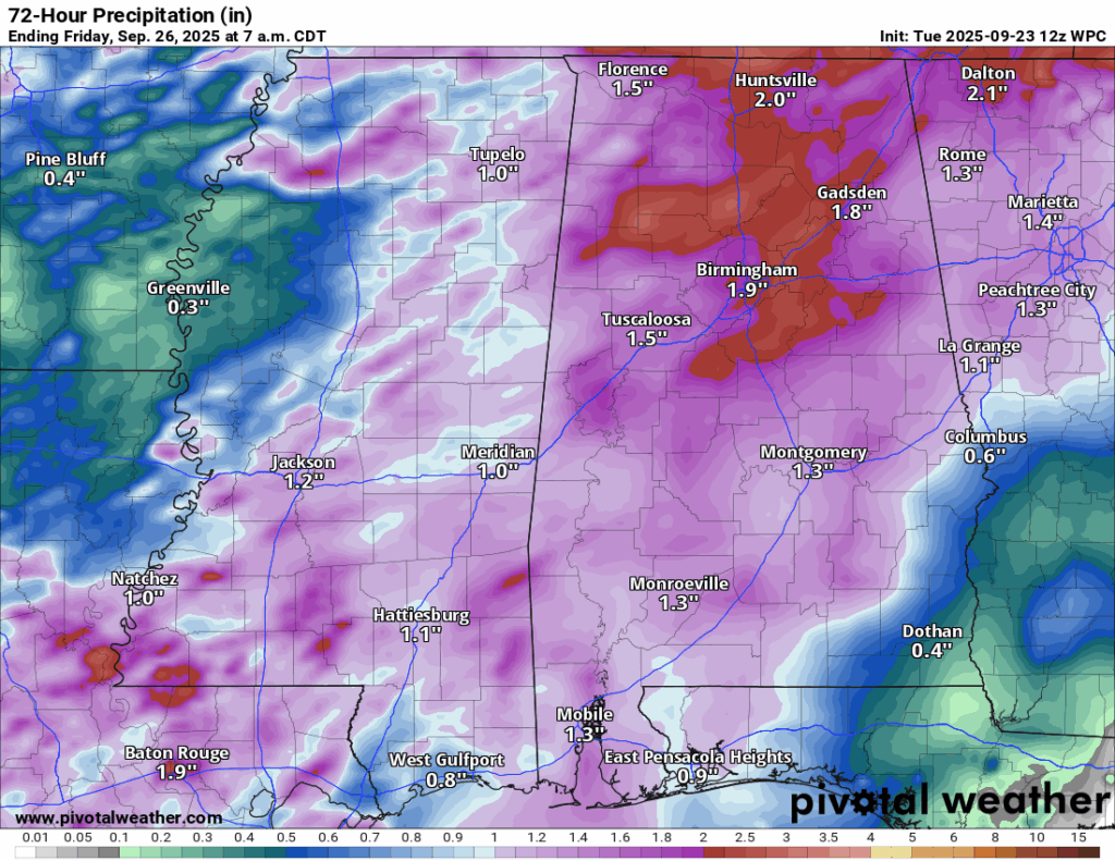
Some rain! Over the next few days we are going to see a cold front come through and bring us up to an inch of rain. This is not as much as we need, but it will certainly help alleviate the dry conditions we have been seeing.
Overall Setup
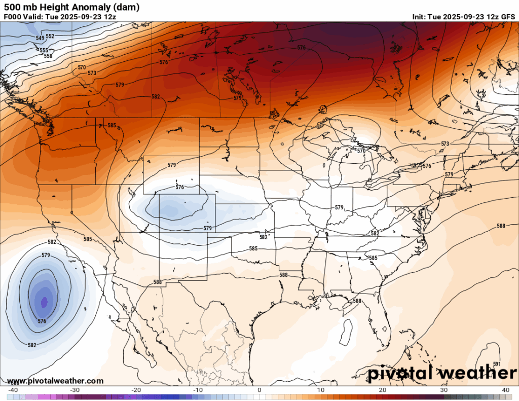
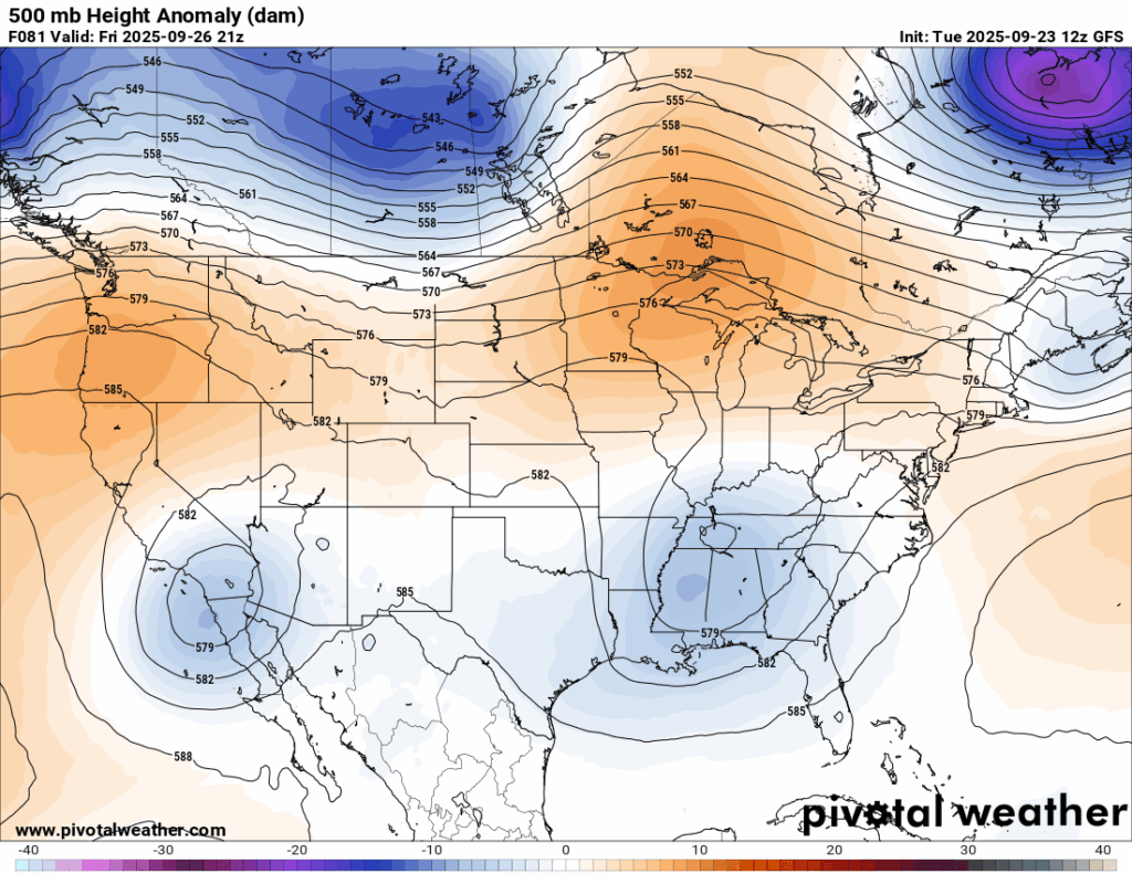
Above is a look at the 500 mb height anomalies for Today and Friday. In case you haven’t seen this plot before, this shows areas of troughing (blue contours) and areas of ridging (orange contours), the brighter the color, the more intense the anomaly is from average (white).
The setup today at 500 mb shows an area of ridging over our area, which is responsible for the hot and dry weather for today. The troughing over the central US is bringing a severe weather threat today over the central plains and into Mississippi and Arkansas, with quite a few strong tornadoes possible there. The troughing will dive into our area over the next few days, which will bring us some nice rain, but potentially some severe storms. We’re not looking at a tornado threat with this one, but mostly a wind threat if anything.
Let’s get into the details:
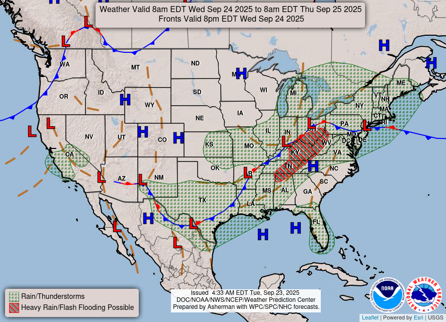
The trough is associated with a low pressure system that will track over Arkansas tomorrow. A cold front is strung below the low, and will move into our area bringing us the unsettled weather for tomorrow and Thursday.

Tonight’s Forecast
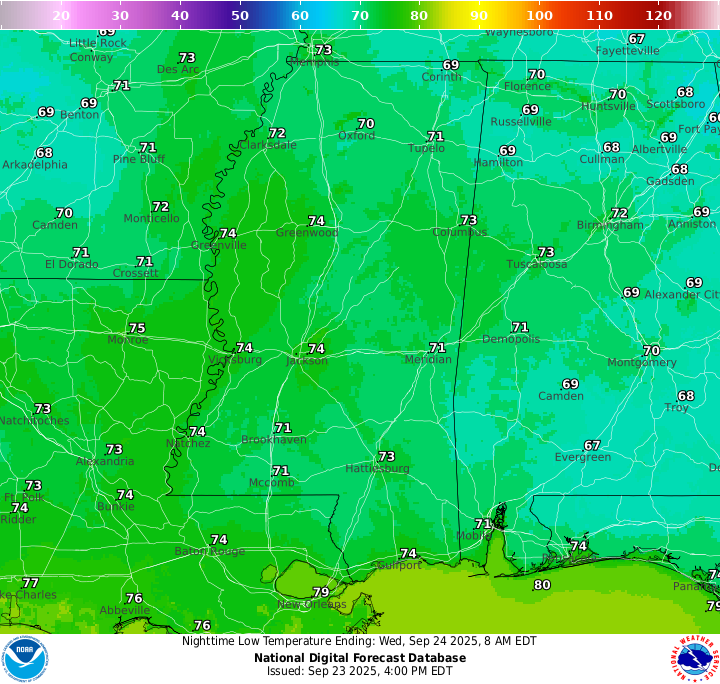
With a good amount of moisture flow from the Gulf out ahead of the cold front, nighttime lows will be in the low-to-mid 70s tonight and it will feel very muggy and sticky. Some scattered showers or thunderstorms could make it to our area overnight, but most of it will not fall overnight.
Tomorrow’s Forecast
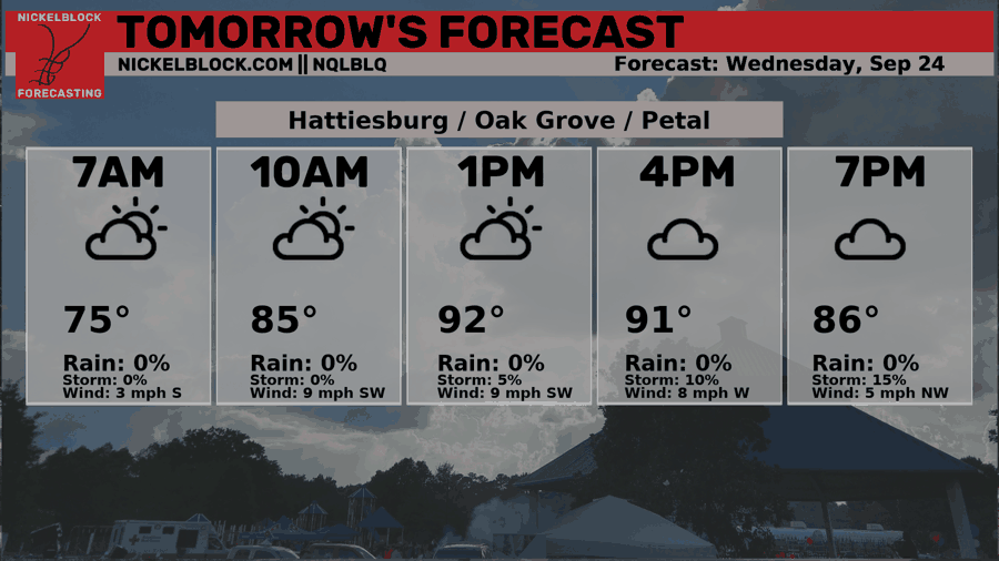
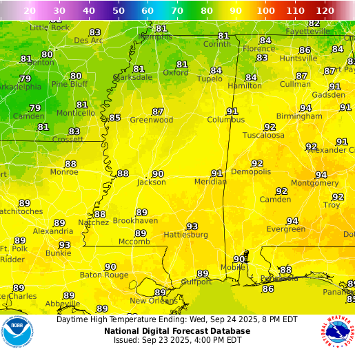
Before sunrise, some patchy fog is likely in southeastern MS, so be extra cautious from 5-9am if you will be on the road. In general for tomorrow, we are still out ahead of the front, so no relief yet for the heat or the humidity. High temperatures will be in the low 90s generally and lows will be similar to tonights in the low 70s.
Rain timing depends on your location… those in southwestern MS or northeastern LA looks to see the leading edge of the rain come through just after noon… those in south central MS, southeastern MS, or southwestern AL should see the rain come through after 4-5 pm generally. Some storms could feature some very heavy rain and strong gusty winds, which is why the WPC has issued a Marginal threat for excessive rainfall and the SPC has issued a Marginal threat for severe weather (wind-driven). Storms should become less organized and scattered by sundown.
Thursday’s Forecast
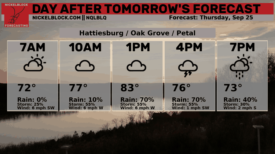
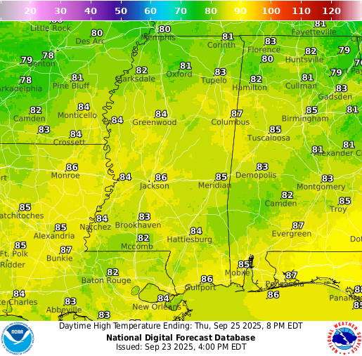
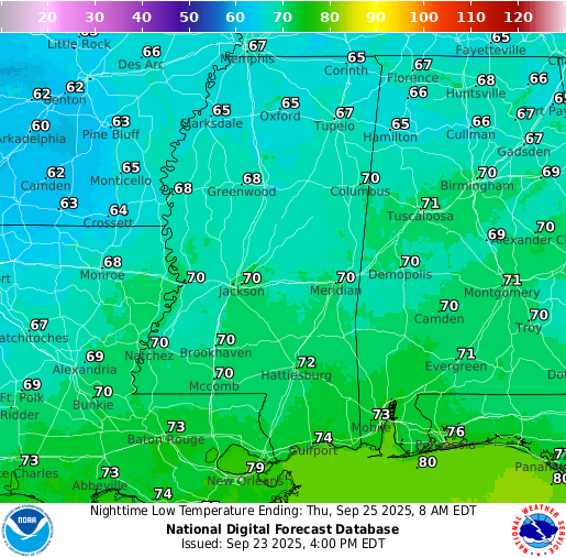
By Thursday, the front will still not have cleared our area! We will see some scattered showers and thunderstorms leftover from the round on Wednesday, but it doesn’t seem to be as widespread in our region. Because of the fully cloudy skies and rain, temperatures will be finally below to near-average, with low-to-mid 80s for the the high temperature. Humidity will still be very high and it will feel uncomfortably sticky.
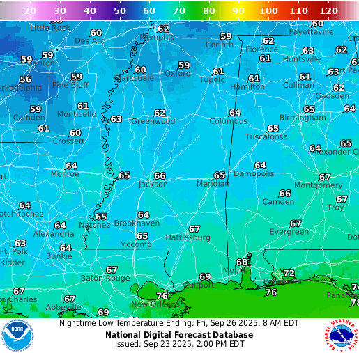
Sometime after midnight going into Friday, the front will finally pass through, bringing the humidity down and the nighttime lows back in the 60s.
Extended Local Outlook
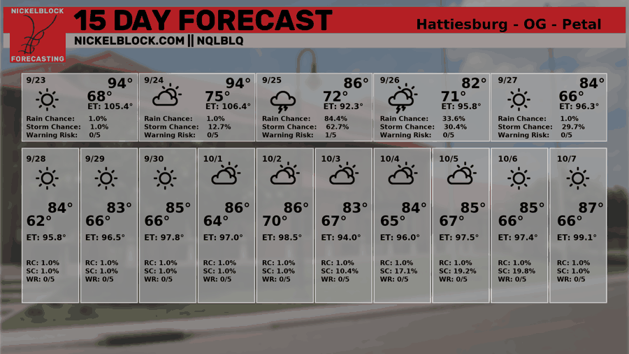
Friday will feel noticeably cooler, with highs only in the low 80s. A very isolated shower or storm can’t be ruled out, but overall we’ll return to a dry stretch afterward. Looking ahead, temperatures stay out of the 90s on the 15-Day Forecast, and humidity levels will be much lower. Still, the NQLBOT shows Experienced Temperatures (ET) pushing into the 90s – a reminder of how even modest humidity can make it feel hotter in our region.
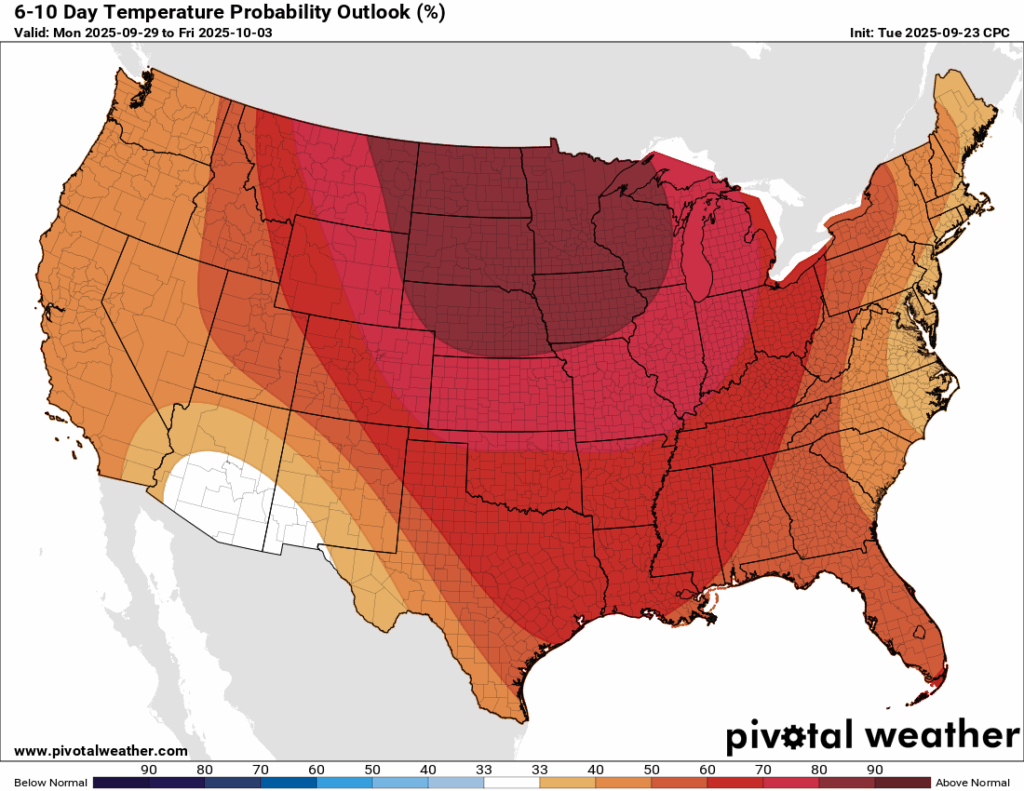
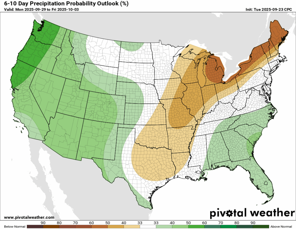
The average high in late September is usually in the mid-80s. Over the next 6-10 days, the CPC outlook keeps most days running a bit warmer than that, but thankfully only slightly above normal. Early October shouldn’t bring a return to the 90s. Rainfall is expected to come in near average, though we’re sitting right on the line between below-normal and above-normal chances

Latest Tropical Update
Atlantic:
The Atlantic Basin is quite busy at the current moment! We have Hurricane Gabrielle, which rapidly intensified earlier today into a Category 4 hurricane. It thankfully has missed Bermuda and will move to the east northeast into the Azores and Spain/Portugal as a subtropical storm by the weekend.
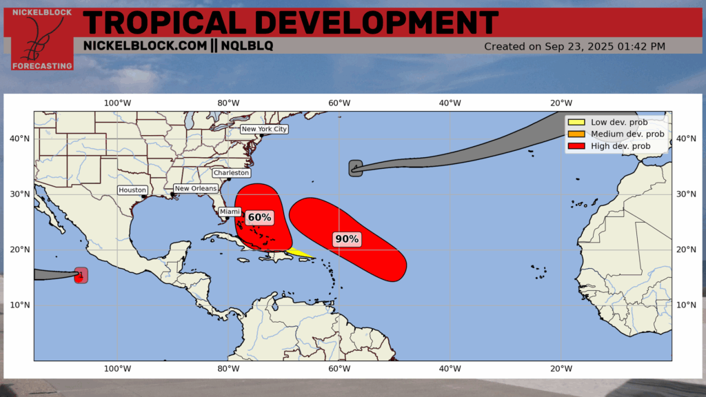
We also have two Invest areas close to the US, both with a high chance of development. Let’s take a dive into both of those:
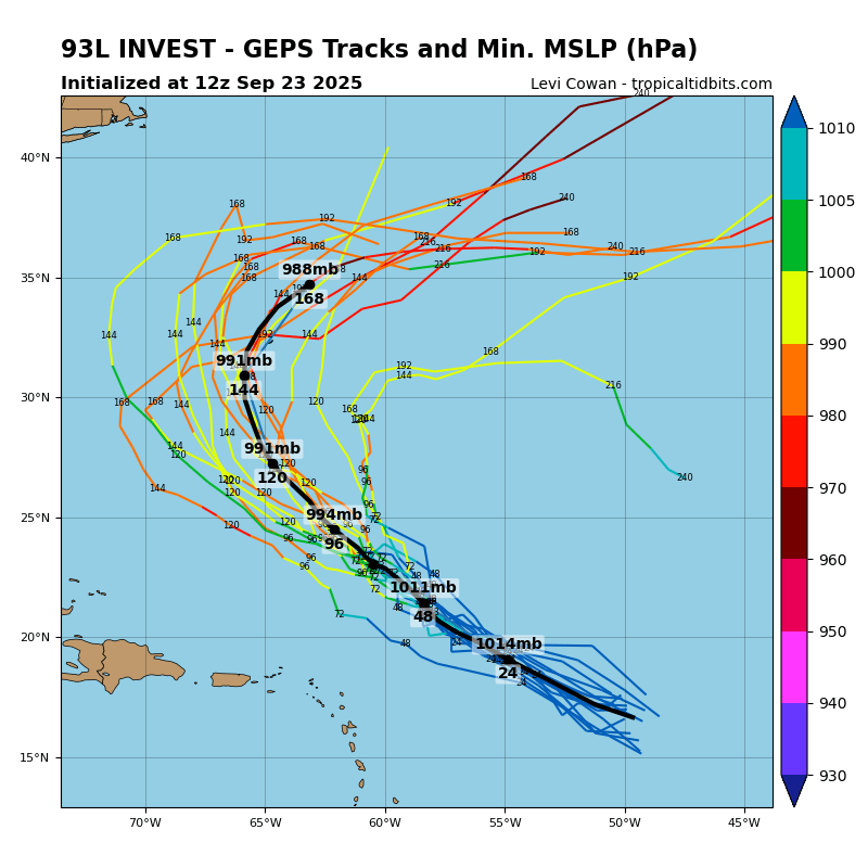
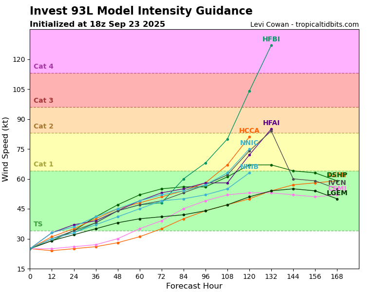
Models are not in the best aggreement about the exact track that Invest 93L could take, but they are all confident that it will intensify into a Tropical Storm in the next few days and potentially a Hurricane. Models are spreading tracks very close to Bermuda, as Gabrielle did, but this one could be an even closer call.
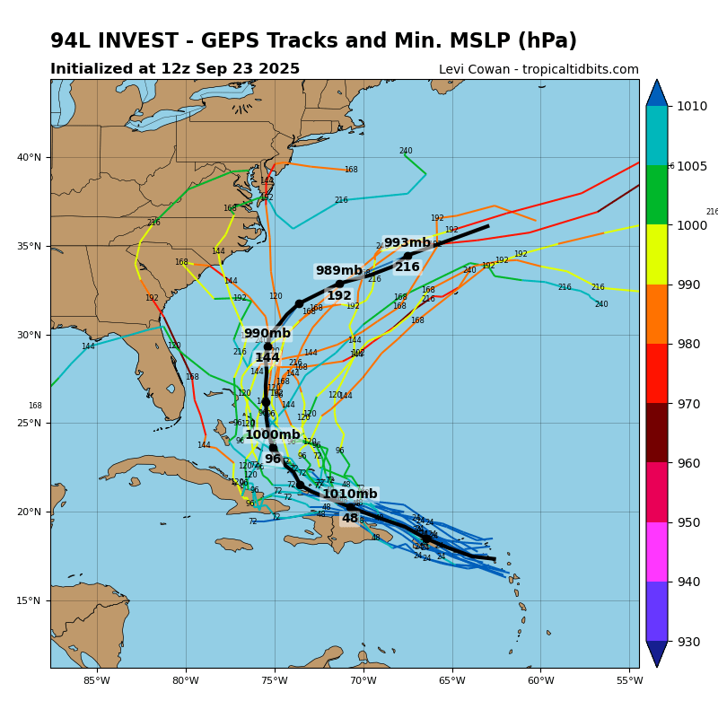
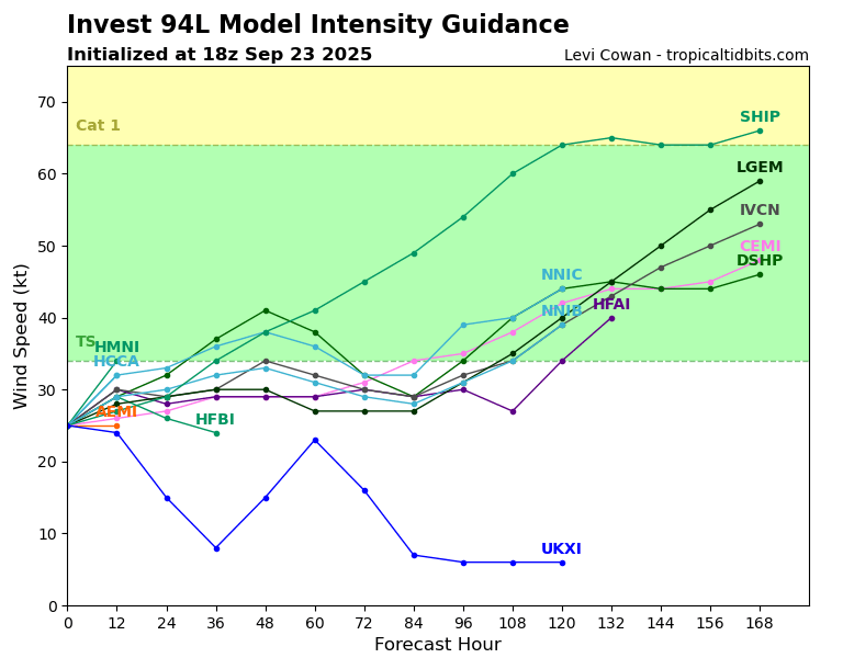
The eastern US should be more concerned with Invest 94L, which may have a slightly lower chance of developing, but could track very close to the mainland. Models are very confused with this system, with some models turning it out to sea completely, and others bringing it closer to the coast from Florida to Virginia. The reason the models are so confused is that the overall setup is complicated. For example, interactions with a trough that will come off the east coast (the same one that is making it’s way through our region), as well as the potential interaction with it’s neighbor (Invest 93L) make the forecast especially challenging.
The system will travel over some extremely warm water as it could travel over the Gulf Stream. Because of this, the entire east coast should be watching this and be alert for any changes. It’s becoming increasingly likely that there could be a hurricane off of the southeast Atlantic coast over the next 7 days.
Eastern/Central Pacific:
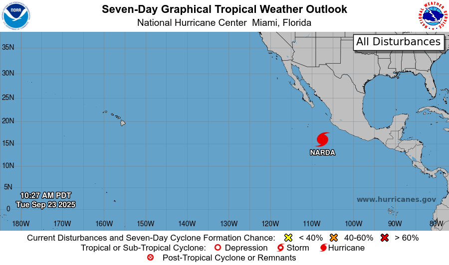
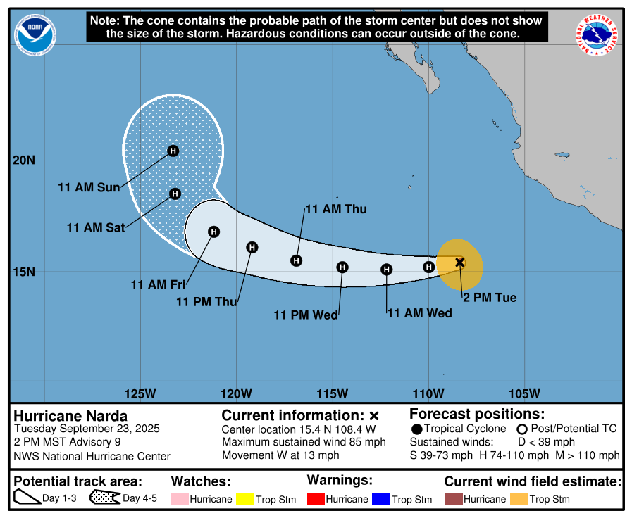
In the Eastern Pacific, there is Hurricane Narda which is currently a Cat 1 with winds at 85 mph and is moving west at 13 mph. This storm is expected to stay out to sea and not pose a threat to Mexico or the US.
REGIONAL DAY TO DAY FORECAST
Tonight: Partly cloudy with lows in the low 70s. South winds around 5 mph, becoming calm after midnight. Winds could gust as high as 20 mph.
Wednesday: Patchy fog before 9am. Showers and thunderstorms, mainly in the afternoon and evening. Increasingly cloudy skies with highs in the low 90s. South winds 5 to 10 mph. Chance of rain 70 percent.
Wednesday Night: Scattered showers and thunderstorms. Cloudy with lows in the low 70s. South-southwest winds around 5 mph. Chance of rain 50 percent.
Thursday: Showers likely, with a chance of thunderstorms. Highs in the low 80s. West winds around 5 mph. Chance of rain 60 percent.
Thursday Night: A chance of showers and thunderstorms. Mostly cloudy with lows in the mid 60s. West-southwest winds around 5 mph, becoming calm in the evening. Chance of rain 30 percent.
Friday: A slight chance of leftover showers and thunderstorms. Partly cloudy with highs in the lower 80s. Calm winds becoming north-northwest around 5 mph in the morning. Chance of rain 30 percent.
Friday Night: Mostly clear with lows in the low 60s. North winds around 5 mph, becoming calm.
Saturday: Sunny with highs in the mid 80s. North winds 5 to 10 mph.
Saturday Night: Mostly clear with lows in the low 60s.
Sunday: Sunny with highs in the mid 80s.
Sunday Night: Mostly clear with lows in the mid 60s.
Monday: Sunny with highs in the mid 80s.


