Overall Setup
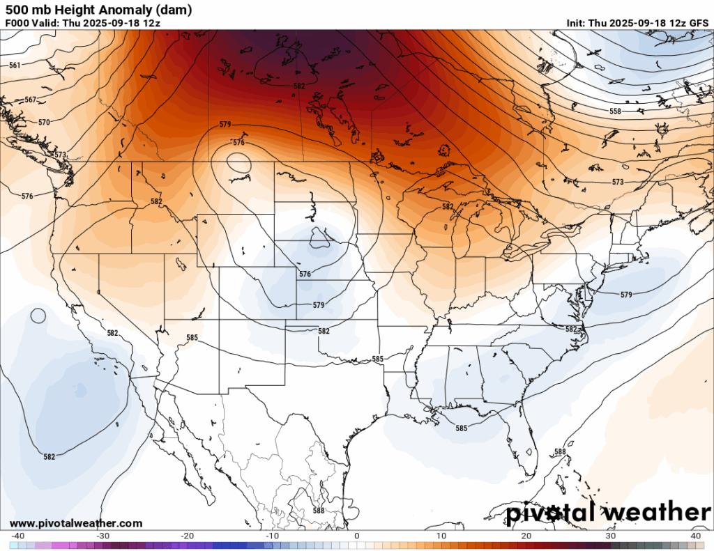
As you can see from the above plots, there is some slight troughing in the mid-levels of the atmosphere and well as a surface trough strung over our region tomorrow. You would think that would be enough instability (rising air) for a decent washout which we so desperately need.
Well, it turns out that there just isn’t enough moisture to work with to produce decent rain. The reason for this is that we have winds aloft from the northwest, which is more continental air compared to when we have southerly winds from the Gulf that bring us lots of moisture.
I think a few areas could see some sprinkles tomorrow, but not as many as we wish.

Tonight’s Forecast
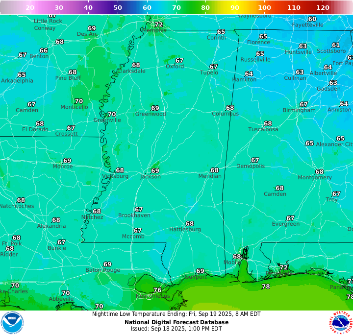
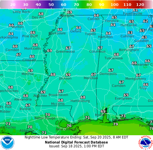
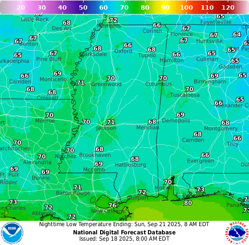
Low’s tonight will sit in the high 60s for most of us and a quick passing shower is not totally out of the question as the troughing tries to squeeze out as much moisture as it could get. Generally, though, skies will be partly cloudy and winds will be calm.
Tomorrow’s Forecast
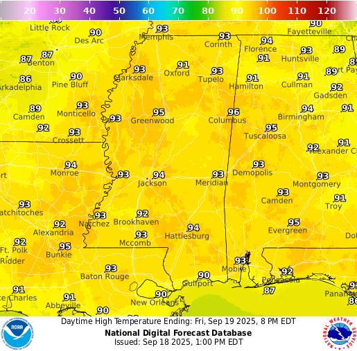
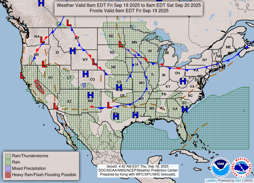
Tomorrow we will see some increased cloud cover as well as a few popup showers or thunderstorms throughout the afternoon and early evening. A cold front passing through northeastern Texas will try and sneak down some moisture to our area, but it will be very limited. Again, this will be very isolated and not everyone will see rain, but the chance is there.
Saturday’s Forecast
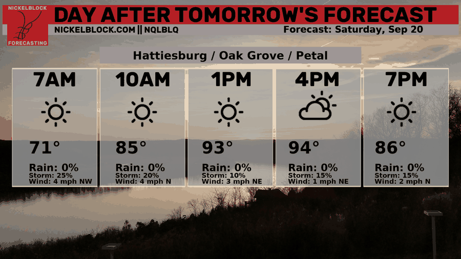
Previously, models were showing the chance of rain more on Saturday, but have timed it back more to Friday as the cold front from Texas moves faster than expected. We could still see some popup showers or thunderstorms in the afternoon, but I think they will be even more limited/isolated than Friday’s. Regardless, neither day looks to be a washout so any plans for the early weekend should be good to go, just check the NickelBlock radar and turn on instant lightning alerts!
Extended Local Outlook
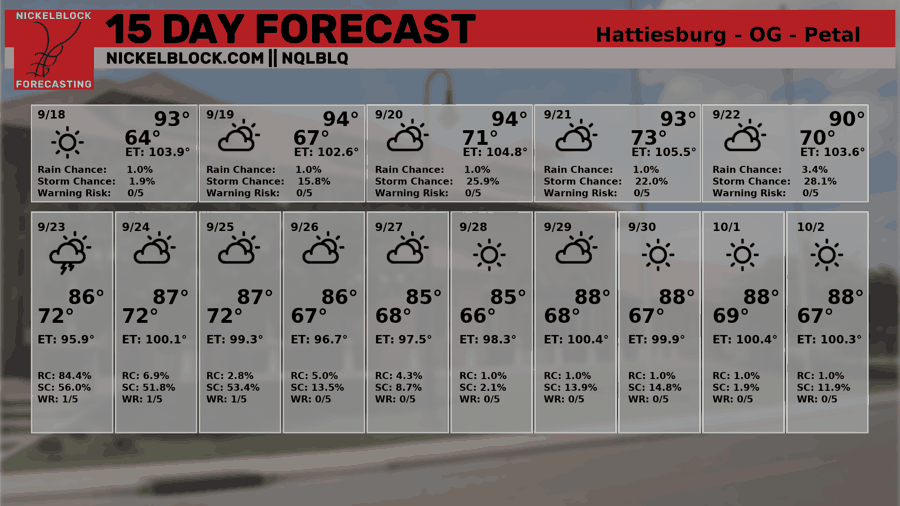
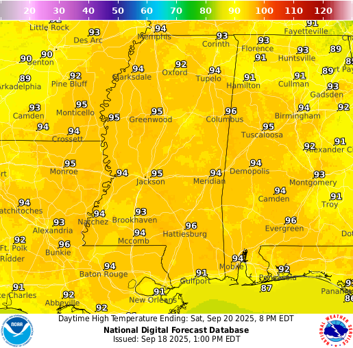
Sunday looks to have the same weather as Saturday, with hot temperatures and the chance of an afternoon shower or thunderstorm popping up. Feels-like temperatures are up to 105 for the weekend, so ensure you are staying hydrated.
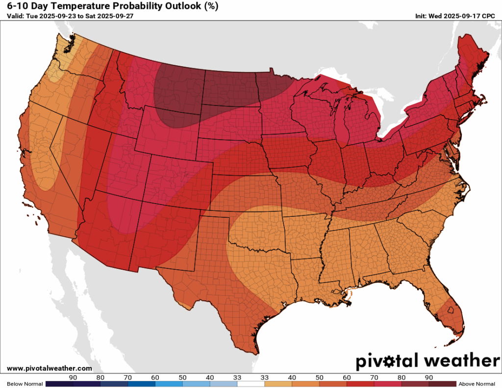
And for your 6-10 day outlook from the Climate Prediction Center, warmer than average temperatures are still expected. The cool down is not here yet, unfortunately. We will have to look into October to see if we could catch a break, or not.
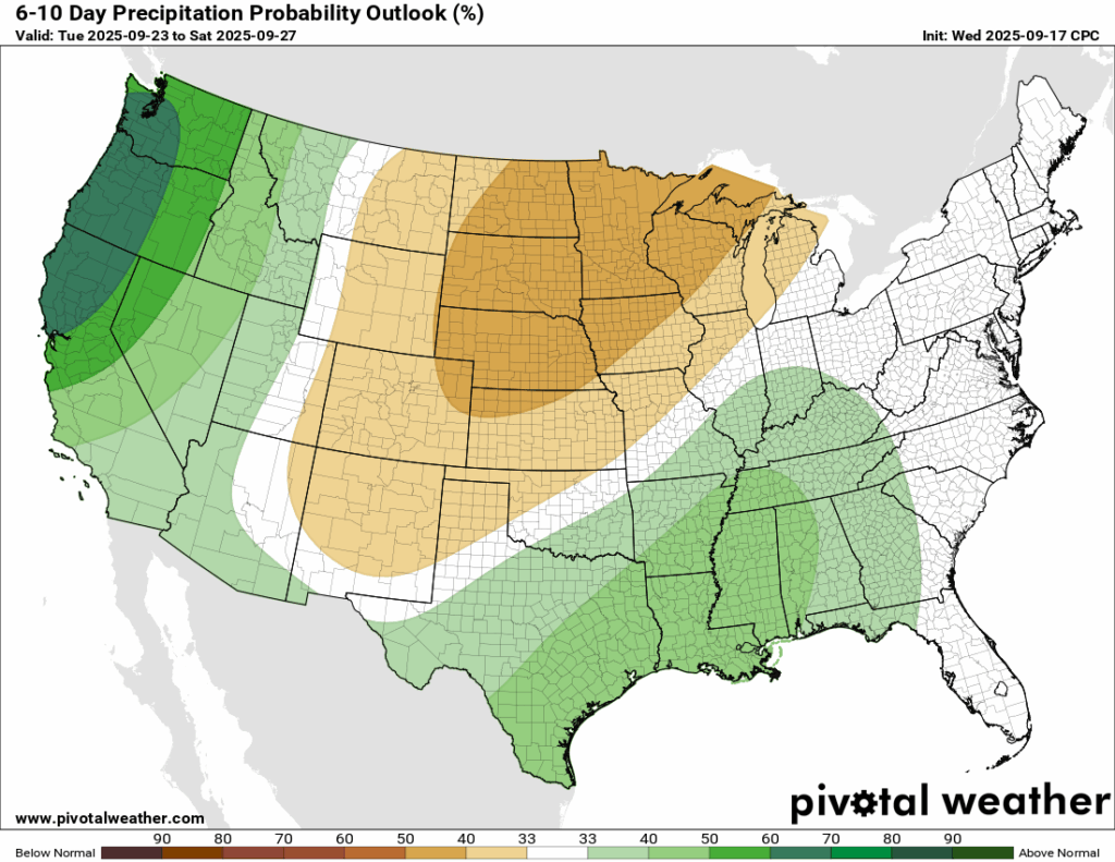
Rainfall, though, is on the above normal side of the anomaly. The beginning of next week could feature some increased rain chances. Specfically, the Euro model shows some decent rain on Tuesday. We will keep you updated with the latest throughout the weekend.

Latest Tropical Update
Atlantic:
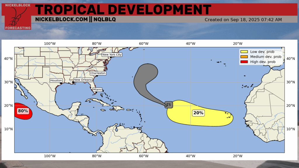
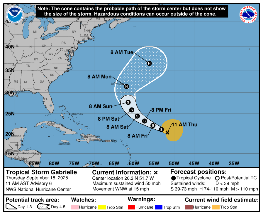
Tropical Storm Gabrielle is expected to track out to sea, but the forecast brings her close to Bermuda. Direct landfalls are rare for the island given its small size, yet Gabrielle’s projected path is close enough to warrant attention. As of the 11 AM update on September 18, the center is not expected to pass directly over Bermuda when the storm strengthens into a hurricane on Monday, but the margin is small and the long-term track remains uncertain.
Behind Gabrielle, there is still an area to watch that has a 20 percent chance of developing with the next 7 days. It’s a small chance of development, and it’s hard to tell where it would track before it even forms.
Eastern/Central Pacific:
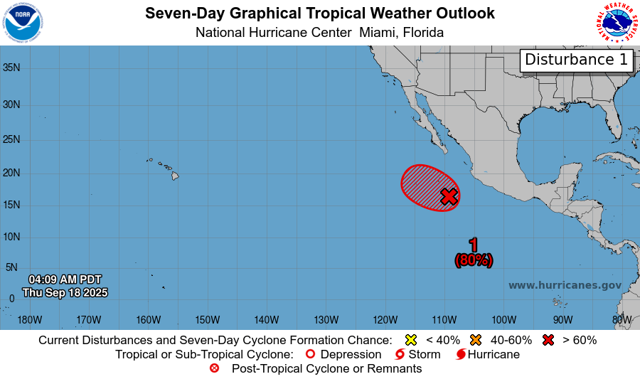
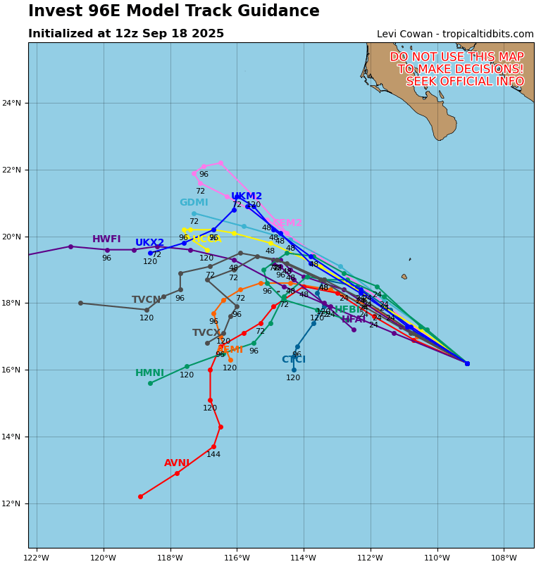
The Pacific Basin features one area to watch, Invest 96E, which has an 80 percent chance of developing into a tropical depression. Models are consistent with a turn to the west southwest due to being essentially ripped aprt by wind shear.
REGIONAL DAY TO DAY FORECAST
Tonight: A slight chance of showers and thunderstorms before 10pm. Mostly clear with lows in the upper 60s. Calm winds. Chance of rain 20 percent.
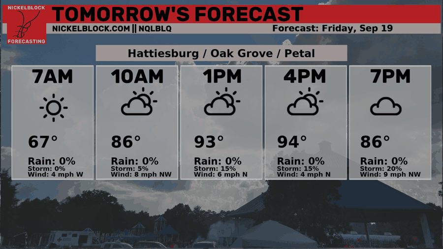
Friday: A slight chance of showers and thunderstorms after 1pm. Sunny with highs in the mid 90s. Winds light, becoming northeast around 5 mph. Chance of rain 30 percent.
Friday Night: Mostly clear with lows in the upper 60s. Calm winds.
Saturday: A slight chance of showers and thunderstorms after 1pm. Sunny with highs in the mid 90s. Winds light, becoming northeast around 5 mph. Chance of rain 20 percent.
Saturday Night: Partly cloudy with lows in the upper 60s. Calm winds.
Sunday: Mostly sunny with highs in the mid 90s. Winds light, becoming southeast around 5 mph in the afternoon.
Sunday Night: Mostly clear with lows in the upper 60s. South-southeast winds around 5 mph, becoming calm in the evening.
Monday: Sunny with highs in the low 90s. Winds light, becoming southeast around 5 mph in the afternoon.
Monday Night: Partly cloudy with lows in the upper 60s.
Tuesday: Mostly sunny with highs in the low 90s. Chance of rain 30 percent.
Tuesday Night: Mostly cloudy with lows in the upper 60s. Chance of rain 20 percent.
Wednesday: Mostly sunny with highs near 90. Chance of rain 30 percent.


