While it won’t be insanely hot for the first few days, the heat will be coming back by mid-week after a frontal boundary moves through the Deep South. The next few days will be hot and humid, but will at least have some relief with afternoon thunderstorms moving in during the afternoon. Let’s take a look.
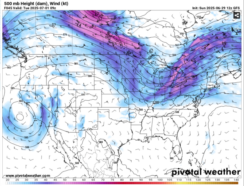
Another surface high is over us from the east and is providing westerly flow to allow more storms to form across the southeast. In the upper levels, a trough remains over the Great Lakes and will move south enough to move a front towards the southeast by mid-week. This afternoon, Monday, and Tuesday will be our main chances for rain and thunderstorms as the front will bring in northerly flow for the end of the week. By the weekend, southerly flow will return and bring in more heat.
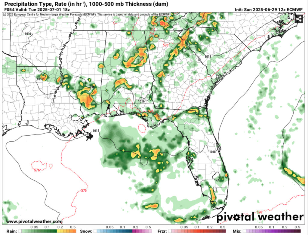
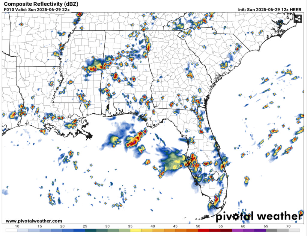
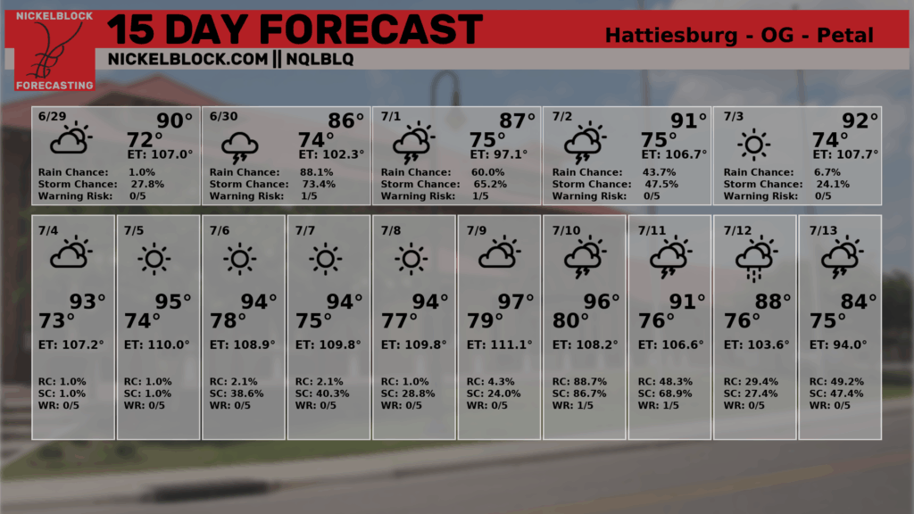
Rain chances will dwindle by Wednesday after the front passes. Highs will be in the upper 80s to low 90s with heat indices in the low 100s. Thunderstorms are already developing from the sea breeze and gust fronts further south this afternoon and will remain until this evening. Another round of afternoon thunderstorms will be likely tomorrow moving towards much of east Mississippi and western Alabama in the evening. Tuesday’s storms will be influenced more from the incoming front moving southward. Total rainfall amounts for the next 3 days look to be around 1.5-2”. Flash flooding doesn’t look to be a concern, but heavier amounts will be possible depending on the developing cells.
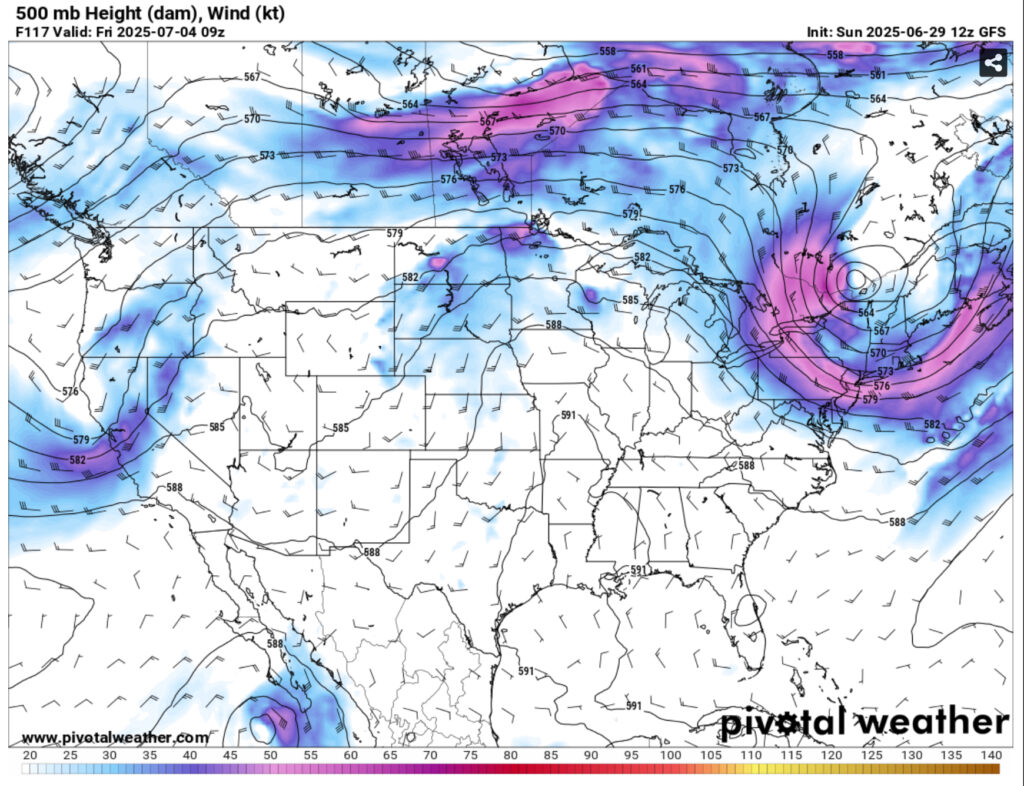
Afterwards, we’ll have a period of dry weather leading into Independence Day. It’ll be slightly drier with more northerly winds, but also hotter. Temperatures may reach the mid to upper 90s during the day with heat indices in the upper 100s. Lows will reach the low to mid 70s. Expect some more heat advisories by the end of the week into the weekend as it’s going to remain hot for the next several days. Keep some sunscreen and hydrating drinks on you if you’re going to be outside shooting fireworks or cooking on the grill!
The NQLBOT forecast pushes the rain chances a little further into Wednesday, however the front will likely suppress the rain chances by then. The interns and I will keep you updated if anything changes on the forecast. Otherwise, yeah, it’s going to be hot.
Regional Day-to-Day Forecast
This Afternoon – Showers and thunderstorms likely in the afternoon. Partly sunny, with a high in the low 90s. Heat index values as high as 98. Southwest wind around 5 mph. Chance of precipitation is 60%. New rainfall amounts between a tenth and quarter of an inch, except higher amounts possible in thunderstorms.
Tonight – Showers and thunderstorms possible into the overnight hours. Patchy fog after 4am. Otherwise, mostly cloudy, with a low in the low 70s. Southwest wind around 5 mph becoming calm. Chance of precipitation is 50%. New precipitation amounts between a quarter and half of an inch possible.
Monday – Showers and thunderstorms likely in the afternoon. Partly sunny, with a high near 90. Calm wind becoming west northwest around 5 mph in the afternoon. Chance of precipitation is 70%. New rainfall amounts between a tenth and quarter of an inch, except higher amounts possible in thunderstorms.
Monday Night – Showers and thunderstorms likely, mainly before sunset. Mostly cloudy, with a low in the low to mid 70s. Calm wind. Chance of precipitation is 60%. New rainfall amounts between a tenth and quarter of an inch, except higher amounts possible in thunderstorms.
Tuesday – A chance of showers and thunderstorms into the afternoon. High in the low 90s. West wind around 5 mph. Chance of precipitation is 80%. New rainfall amounts between a tenth and quarter of an inch, except higher amounts possible in thunderstorms.
Tuesday Night – Showers and thunderstorms possible before midnight. Patchy fog after midnight. Low around 73. West southwest wind around 5 mph becoming calm. Chance of precipitation is 60%. New rainfall amounts between a quarter and half of an inch possible.
Wednesday – A 30 percent chance of showers and thunderstorms, mainly in the afternoon. Mostly sunny, with a high in the low 90s. Calm wind becoming north northwest around 5 mph in the afternoon.
Wednesday Night – Patchy fog after 5am. Otherwise, partly cloudy, with a low in the low 70s. Calm wind.
Thursday – A 20 percent chance of showers and thunderstorms in the afternoon. Patchy fog before 7am. Otherwise, sunny, with a high in the mid 90s. Calm wind becoming north around 5 mph in the afternoon.
Thursday Night – Mostly clear, with a low in the low 70s.
Independence Day – A 20 percent chance of showers and thunderstorms. Sunny, with a high in the mid 90s.
Friday Night – Mostly clear, with a low in the low 70s.
Saturday – A 20 percent chance of showers and thunderstorms. Sunny and hot, with a high in the upper 90s.


