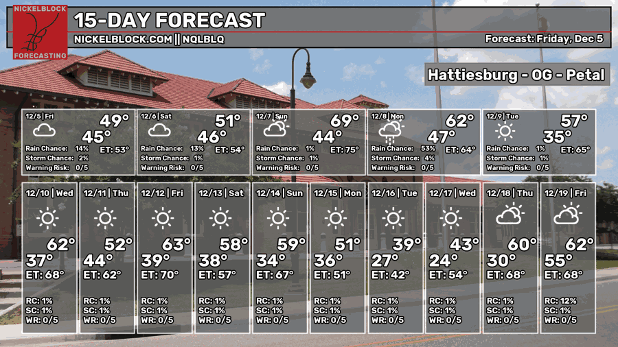
The rain continues for the next few days, albeit not as potent as originally anticipated. We received quite a bit yesterday morning and the rain tapered off by the afternoon. Rain chances will be on and off for the rest of the weekend as another front moves in by Sunday and quickly exits. Afterwards, it’ll be quite dry for most of the week next week.

This Weekend
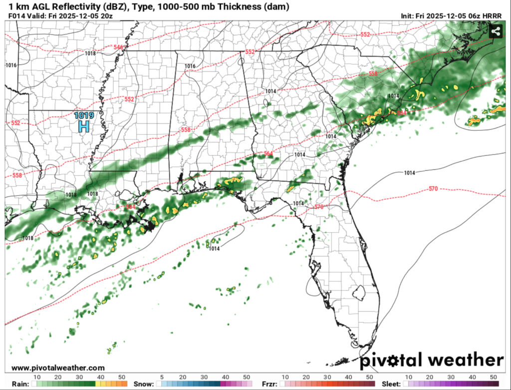
We can expect some on and off showers this morning for much of southern and central Mississippi before a more concentrated band of showers develops by the afternoon. As the front moves along, it’ll stretch the band between southwest Louisiana and central Alabama before moving further southeast by the evening hours. Overall a cooler day with temperatures just reaching the 50 mark. Overnight, temperatures will fall into the mid 40s with mostly cloudy skies.
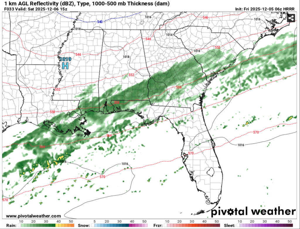
Saturday will start off foggy and rainy and eventually dissipate as the day goes on. The front will move further south and east. Otherwise it’ll be a damp day with mostly cloudy skies with highs in the mid 50s. Overnight, we’ll fall into the mid 40s with a slight chance of rain.
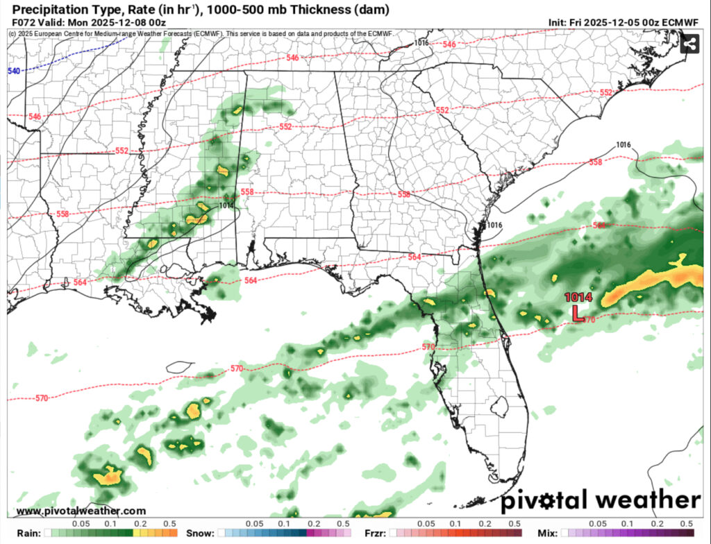
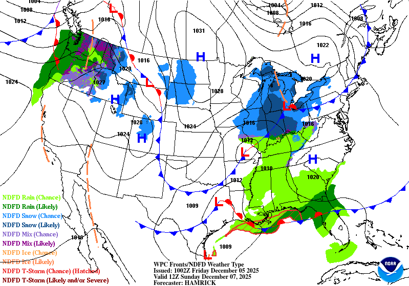
Sunday will be much warmer than the past few days as a warm front moves in towards eastern Texas. The rain will likely move in during the evening hours, so if you’re at Sunday night church, have your umbrella handy when you walk out the door. Highs will be in the upper 60s and lows in the low 40s.
Next Week
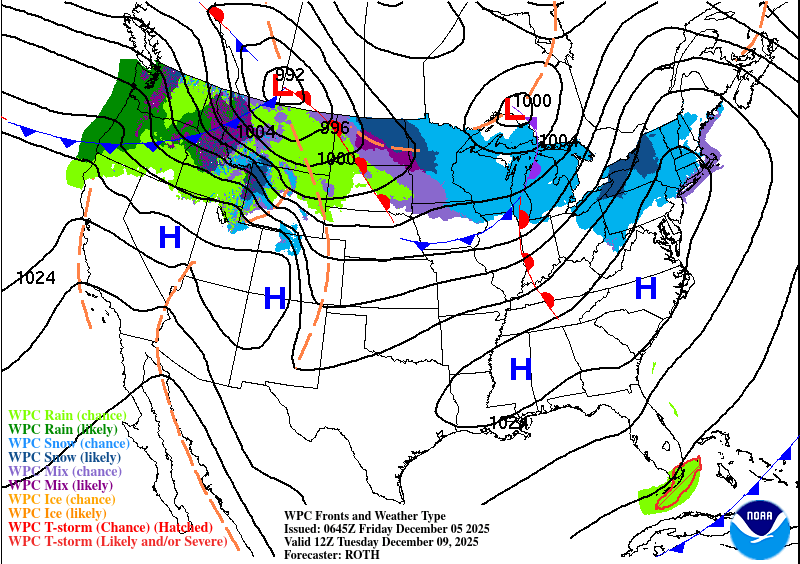
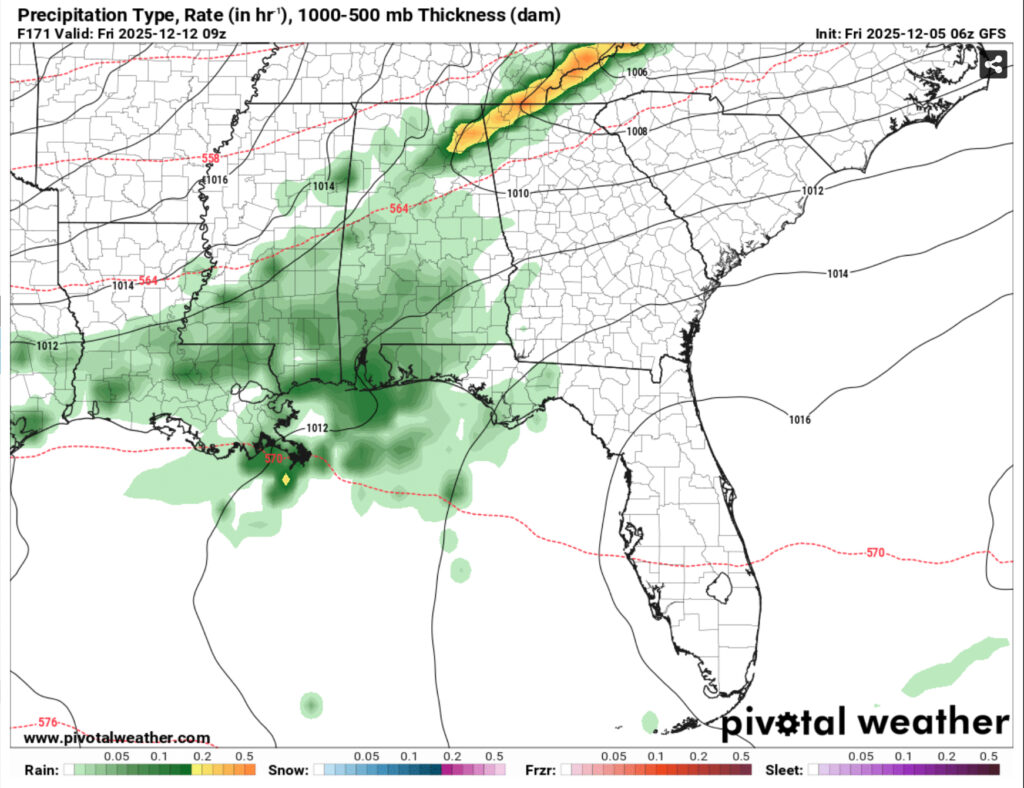
Next week will be a much nicer week with drier conditions and more mild temperatures overall. A large area of high pressure spanning from the southeast to the northwest will keep much of the moisture away from the southeast as several low pressure systems will move towards the Great Lakes regions. The only one in question is a front that moves in on Friday as both the GFS and ECMWF differ on whether there is enough moisture for rain and thunderstorms to develop across the southeast.
Temperatures will range from the mid to upper 50s on Monday and Tuesday with temperatures falling below freezing on Tuesday morning and just above freezing Wednesday morning. Afterwards, winds will shift towards the southwest on Wednesday bumping temperatures into the mid 60s and lows in the low 40s. Thursday will shift back into the upper 50s and Friday will warm up again as another front moves in moving the winds.