General Central/Eastern Kansas Forecast
Short-Term (Tuesday-Wednesday)
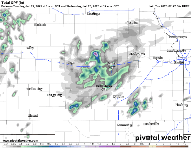
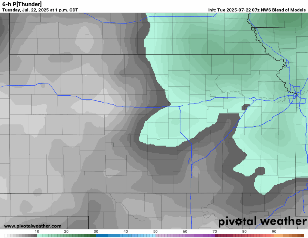
After a pleasant overperformance in rainfall yesterday morning, more isolated to locally scattered showers and thunderstorms may again be possible through the morning hours today. Another weak, transient mid-level disturbance will rotate around the ridge of high pressure over us and, paired with modest southerly flow dragging more moisture northward, will potentially help trigger/maintain existing scattered showers and thunderstorms. Given the amount of rainfall that fell yesterday, and the amount of moisture still present in the air, heavy rainfall and flooding will be a concern today particularly across northern Kansas along and north of I-70 with any storms. New rainfall totals through today will primarily be up to an inch but isolated amounts of 2+ inches will be possible. Elsewhere, rain chances will decrease with southern extent, with southern Kansas likely staying dry.
Tomorrow morning into early afternoon will look to stay mostly dry before scattered showers and thunderstorm chances return in the afternoon, mainly for central Kansas (west of US-77). Subtle perturbations may allow for isolated to scattered showers and thunderstorms to develop, although the overall chances are low at this time. If storms do form, new precipitation amounts look to be under an inch and precipitation overall will tail off as the sun goes down.

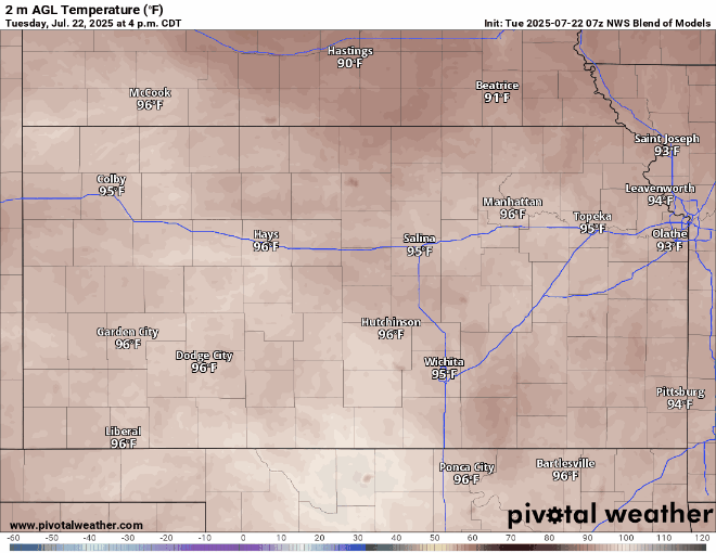
Temperatures with the uncertain rain chances through today and tomorrow may also vary greatly across the region. If rain does not form/is continuing through the morning, then high temperatures look to again reach the mid 90s to low 100s in the afternoon. If showers are ongoing, then those that do see this rain may see a cooler high temperature, reaching the mid 80s to low 90s. Winds will mainly be out of the south at 10 to 15 mph, but gustier winds up to 30 mph may be possible. Conditions will try to feel drier again, with relative humidity values ranging between 35-55%, but heat indices may again reach the low to mid 100s. Low temperatures overnight will be similar to recent days, dropping to the mid to upper 70s.
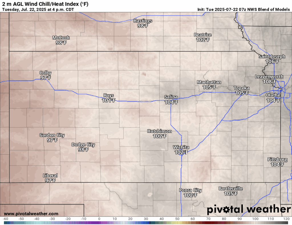

Temperatures tomorrow will largely be similar across the area, with highs in the mid 90s to upper 90s, with southerly winds of 5 to 15 mph. Heat indices will be only somewhat lower compared to today, reaching the upper 90s to low 100s. Low temperatures again will be in the low to mid 70s overnight tomorrow night.
Long-Term (Thursday-Monday)
Thursday will again look to stay dry and hot across the area before a cold front will pass through central/eastern Kansas Thursday night/Friday morning before stalling out somewhere between I-335 and US-77. This will increase chances for showers and thunderstorms across the area, although chances at this time remain low. Temperatures may take a slight dip into the upper 80s to low 90s during this time before increasing again through the weekend and into early next week back into the mid to upper 90s and potentially low 100s.
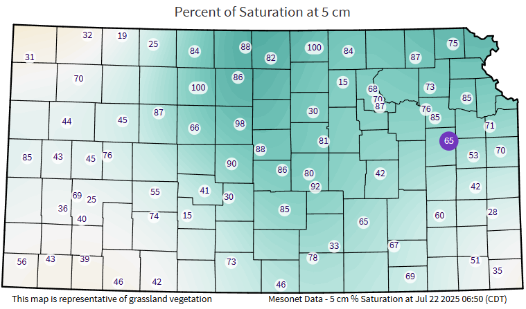
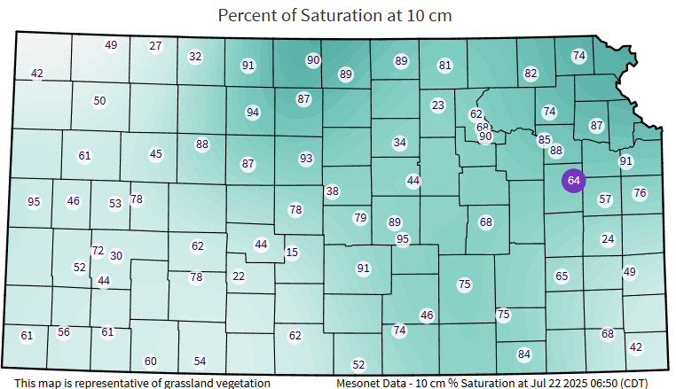
Regional Soil Moisture Outlook
After our surprise round of heavy rainfall, soil conditions across central and northern Kansas saw good improvement for the short-term. Additional rainfall will be possible through the week, which will help current drought conditions, before we dry out again by the weekend. Long-term guidance (weekend and into early next week) does suggest below average rainfall so once we get through the week and into the weekend, further expansion of drought and overall poor soil conditions may be possible if we do not get any more rainfall.