We start the week off fairly soggy, but the forecast turns around for the end of the week for the Fourth of July! Let’s dive into the detailed forecast:
Today’s Overall Setup

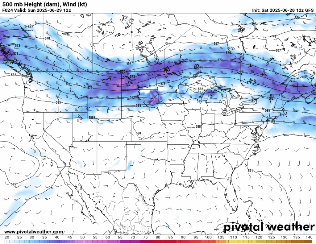
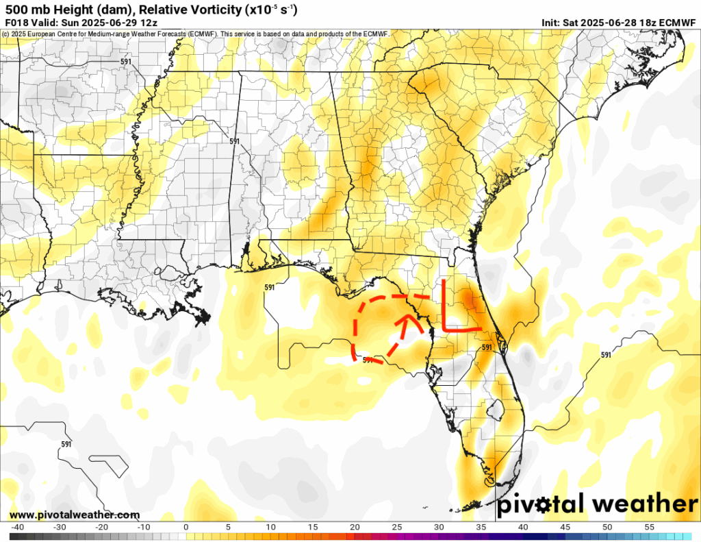
The overall pattern in the mid-levels of the troposphere is quite zonal, meaning the overall flow is generally west to east. Even though our area is still under a general ridge, there is lot’s of moisture transport from the gulf due to a low pressure system that has formed over northern Florida, and that is to blame for the rain we are seeing today and each day through the beginning of the week. The yellow/orange contours in the above plot show areas of spin in the atmosphere, and we can see that the spin associated with the low will be essentially stalling out and meandering in the northern gulf for the week. This spin is associated with vertical velocity, or rising air, which is what is setting up the stage for a wet few days to the beginning of the week.
Today’s Local Forecast
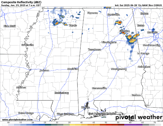
Today, we will see scattered showers and thunderstorms in our area as we get into the afternoon from north to south. Thunderstorms could stick around until around 10 pm and could contain some gusty winds, so stay vigilent tonight if you plan to go out. Storms will be scattered, so I would not consider today to be a washout. Keep an eye out on the radar!

Here’s an hourly look at the forecast for today for the region.
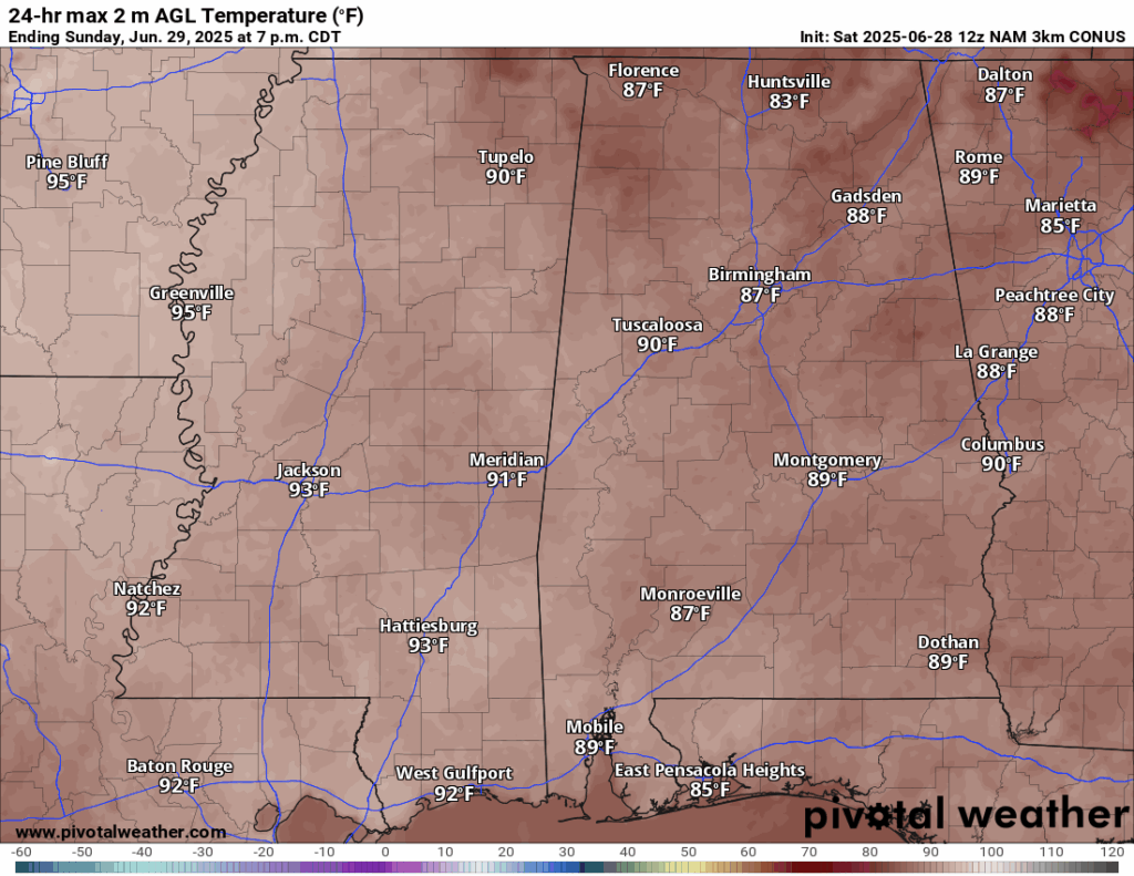
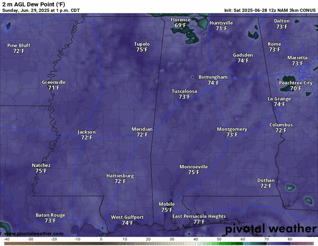
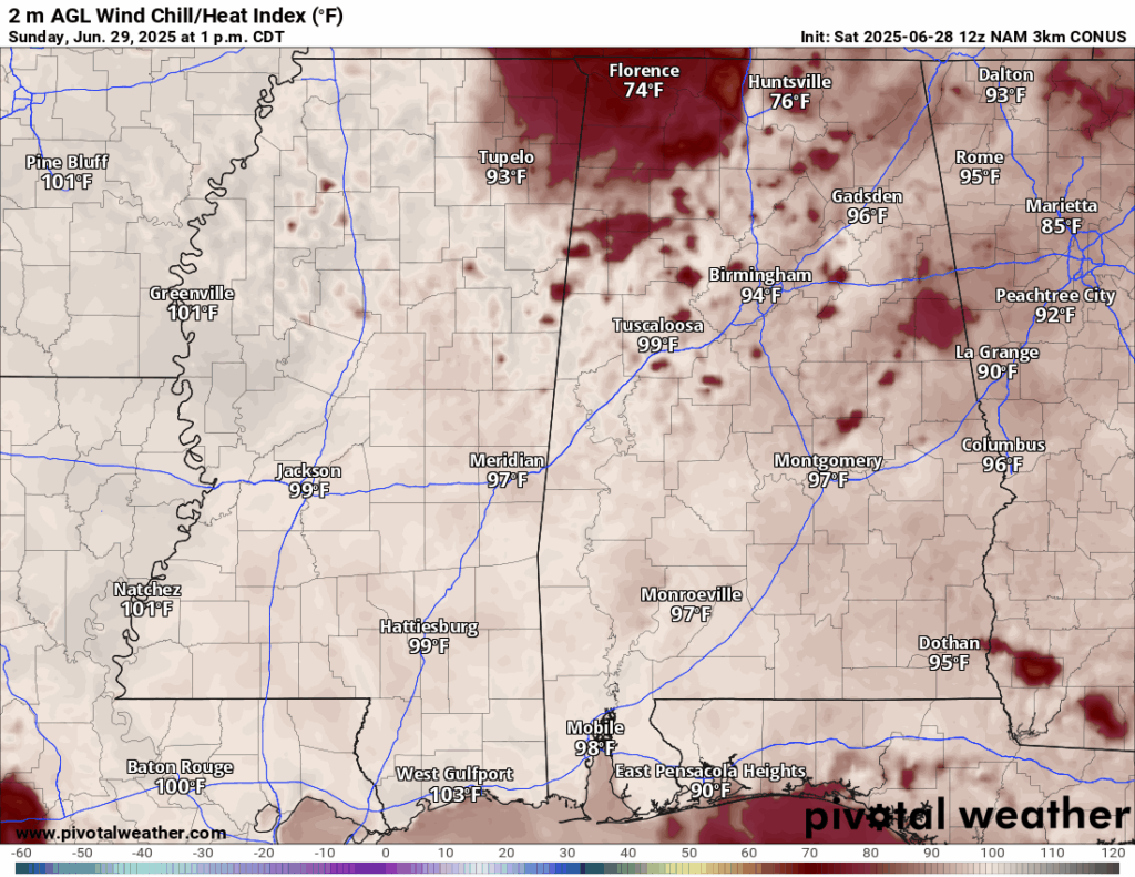
High temperatures today will be in the low 90s for our area. It will feel very muggy throughout the day, but not the most humid day we’ve seen so far this summer. Dew points will be in the low 70s, and during peak sunshine it will feel like the high 90s or low 100s. This is most definetly an improvment from the 110 degree heat index’s we have been seeing, but staying hydrated is something that still needs to be a necessity.
Monday-Wednesday’s Forecast
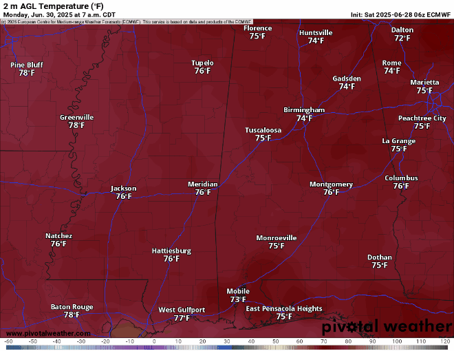
Looking into Monday and Tuesday, high temperatures are looking to be cooler than average, by 5-10 degrees in some locations! The reason for this is the showers and thunderstorms that are expected to come through during the early afternoon both days, which will cool down those high temperatures. The high heat returns on Wednesday, back into the 90s.
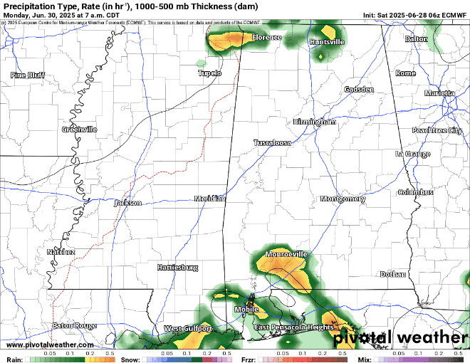
Timing out the rain this week, Monday and Tuesday are looking like the day’s with the most rain expected. Unfortunately, the rain may distrupt any outdoor activities, so you will most likely have to move those plans indoors for the first two days of the work week. Wednesday is not looking to be a washout. The sun will return and there will only be isolated thunderstorms throughout the morning and afternoon, and clearing by the evening.

The stalled out low pressure system over the northeast gulf will bring lots of rain over the next few days to northwest Florida and our region. The highest rain totals will be along the immediate gulf coastline, with up to 7-10 inches. Our area could see a general 3-5 inches, with localized up to 7 inches over the next few days. Most of the rain will fall prior to July 4th, so good news there!
Extended Local Outlook

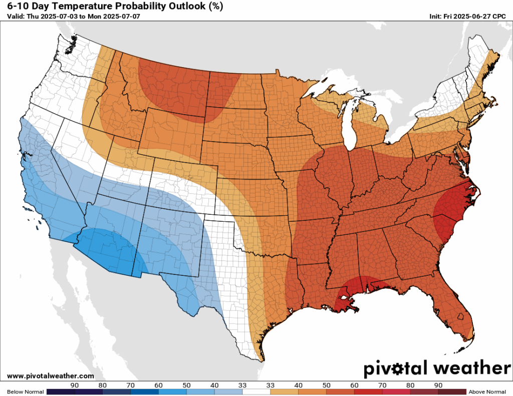
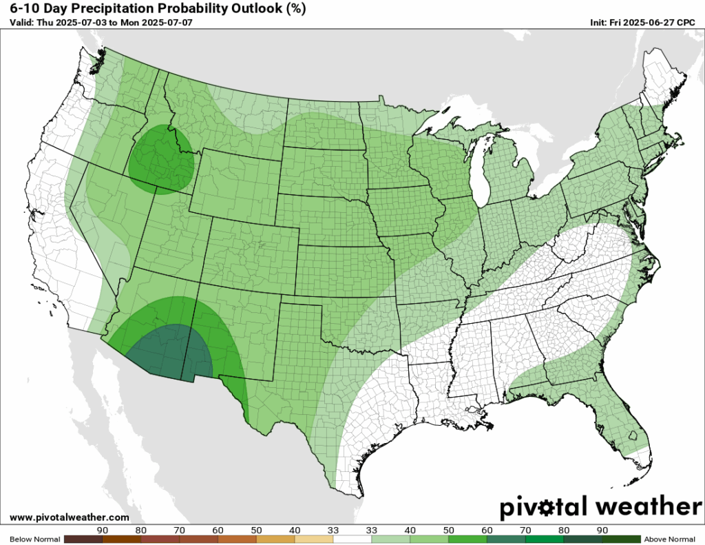
Looking ahead into next week, the CPC is going for a 60-70 percent chance of above average temperatures in our area. After the rainfall ends this week, next week is looking to be drier, or at least near-normal in terms of rainfall – all thanks to some more ridging that will be taking shape.
Latest Tropical Update

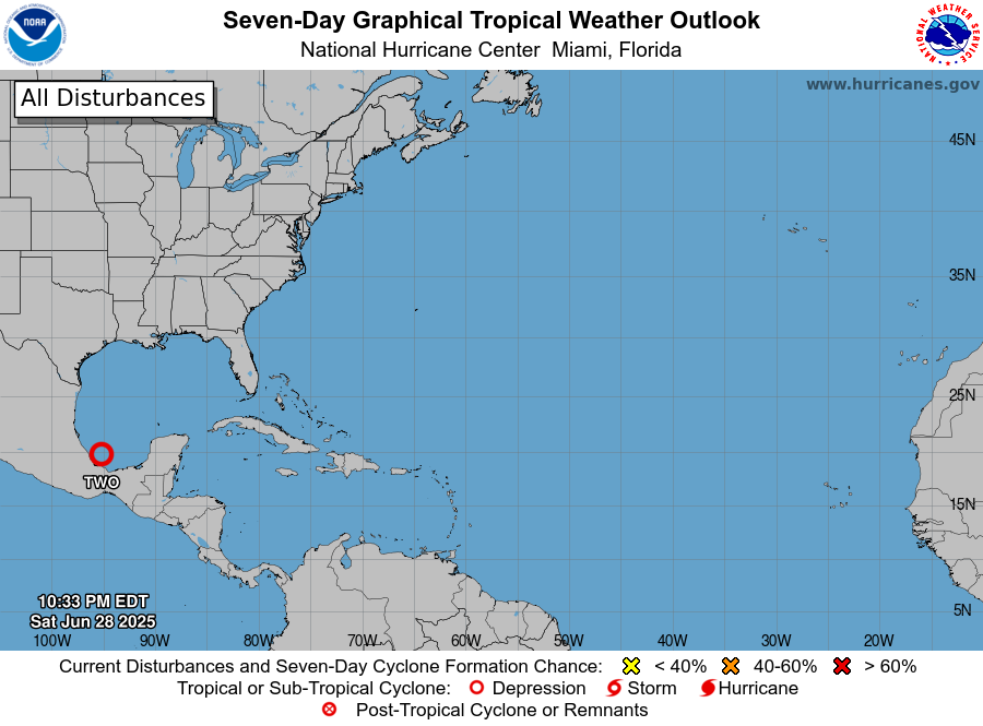
Currently in the tropics, we have Invest 95E which is expected to become Tropical Storm Flossie by today or tomorrow in the east Pacific. We also have newly names Tropical Depression Two in the southwest Gulf, which as of now is forecasted to make landfall in the gulf coast of Mexico as a tropical storm sometime tonight. This would be named Barry, only the second Atlantic tropical system to far this season.

Want the latest details on these systems? Check out our daily tropical updates for more in-depth information on the tropics!
REGIONAL DAY TO DAY FORECAST
Today: Mostly sunny, scattered thunderstorms. Highs in the low 90s. Calm winds becoming south southwest around 5 mph in the afternoon. Chance of rain 50 percent.
Tonight: Mostly cloudy, chance of showers between 10pm and 1am. Lows in the low 70s. Southwest winds around 5 mph. Chance of rain 30 percent.
Monday: Partly sunny. Scattered showers and thunderstorms. Highs in the high 80s. Calm winds becoming west around 5 mph in the afternoon. Chance of rain 70 percent.
Monday Night: Mostly cloudy. Chance of showers. Lows in the low 70s. South southwest winds around 5 mph. Chance of rain 30 percent.
Tuesday: Numerous showers and thunderstorms. Highs in the high 80s. Calm winds becoming west northwest around 5 mph in the morning. Chance of rain 80 percent.
Tuesday Night: Mostly cloudy. Chance of showers and thunderstorms. Lows in the low 70s. Calm winds. Chance of rain 30 percent.
Wednesday: Partly sunny. Scattered showers and thunderstorms in the afternoon. Highs in the low 90s. Calm winds becoming northwest around 5 mph in the afternoon. Chance of rain 60 percent.
Wednesday Night: Partly cloudy. Chance of showers and thunderstorms. Lows in the low 70s. Calm winds. Chance of rain 20 percent.
Thursday: Mostly sunny. Isolated showers and thunderstorms in the afternoon. Highs in the mid 90s. Chance of rain 40 percent.
Thursday Night: Partly cloudy. Lows in the low 70s.
Fourth of July: Mostly sunny. Isolated showers and thunderstorms in the afternoon. Highs in the mid 90s. Chance of rain 30 percent.
Fireworks Forecast: Partly cloudy. Lows in the mid 70s.
Saturday: Mostly sunny. Isolated showers and thunderstorms. Highs in the mid 90s. Chance of rain 30 percent.


