Overall Setup
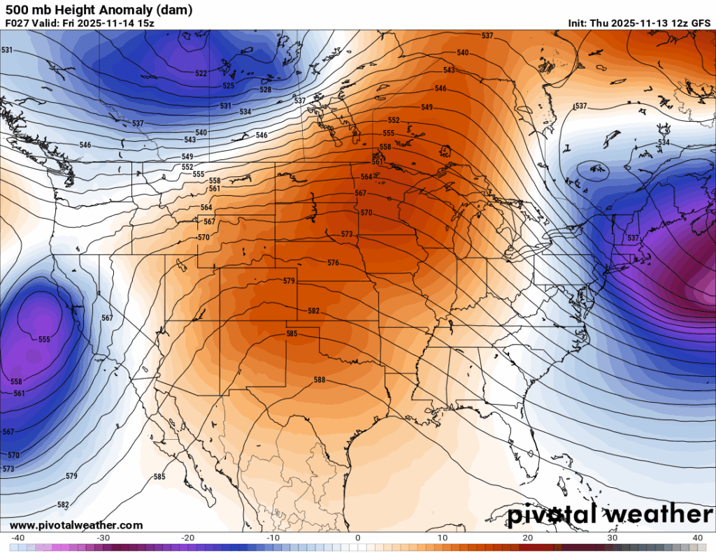
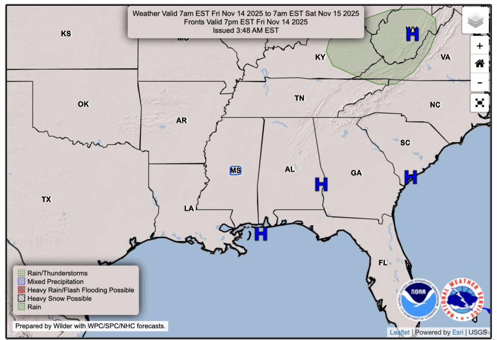
Who’s to blame for the above average temperatures and lack of rain? That would be the large area of ridging and high pressure that has moved into our region. Given that we are directly under a surface high pressure, and not in the gradient between a high and a low pressure system, our winds will be fairly calm over the next few days. As Noah said in his post, calm winds and overall milder than normal temperatures in the AM hours will lead to some patchy fog tomorrow and Saturday. By the time Sunday comes, winds should pick up again and prevent fog from forming.

Tonight’s Forecast
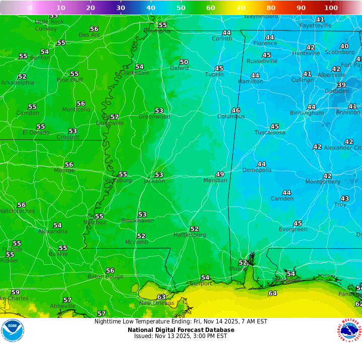
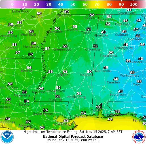
Our overnight low temperatures will reach the low-to-mid 50s, with some high 40s possible further from the coast. Skies are looking clear with no chance of rain, just that patchy fog after midnight, so be careful if you will be driving through it.
Tomorrow’s Forecast: Friday, November 14
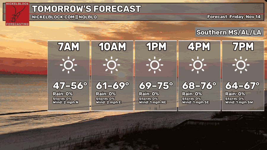
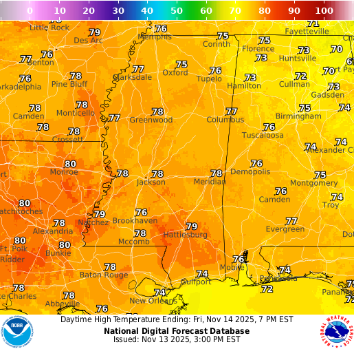
Temperatures are continuing above average for this time of year with highs in the upper 70s and perhaps a few 80s in some spots. Our average high is near and around 70 degrees, so we’re about 10 degrees or so above that average. Aside from the warmer than desired temperatures for our fall lovers, no weather impacts are in the forecast – just some partly cloudy skies!
Weekend Forecast: Saturday, November 15 & Sunday, November 16
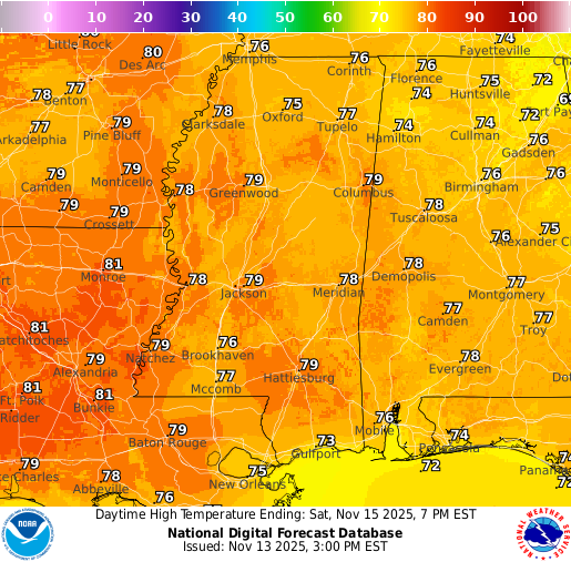
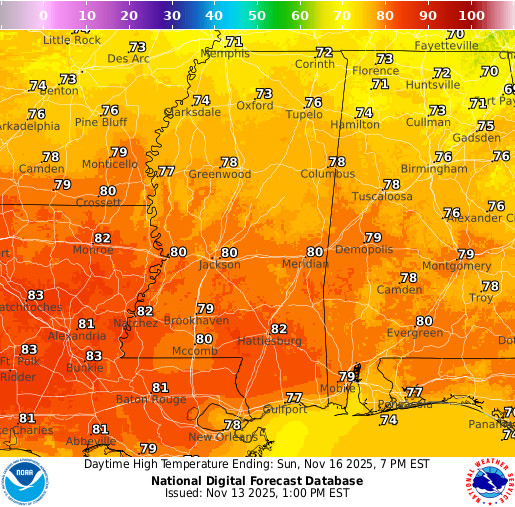
The weekend is looking clear as can be, with abundant sunshine on Saturday. Clouds try to fill in for Sunday, but there will still be plenty of sun. Sunday is currently looking to be slightly warmer than Saturday, with highs in the lower 80s. Enjoy your weekend, and dress for summer during the daytime! Maybe bring the jacket for the mornings.
Extended Local Outlook
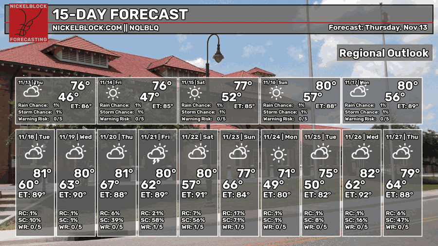
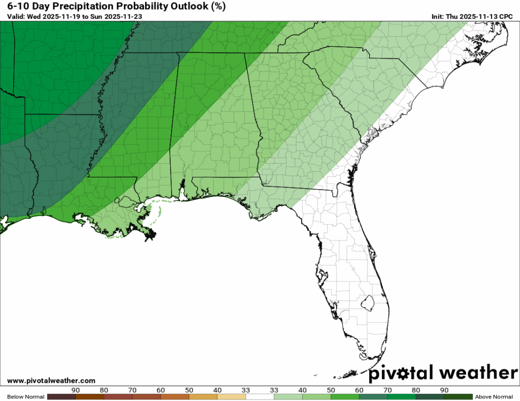
Looking ahead, we are looking at the potential for some rain and thunderstorms mid-to-late week next week. A low pressure systen could pass through and bring some heavy rain, at that. We are still about a week out, so we will keep you updated by the day.
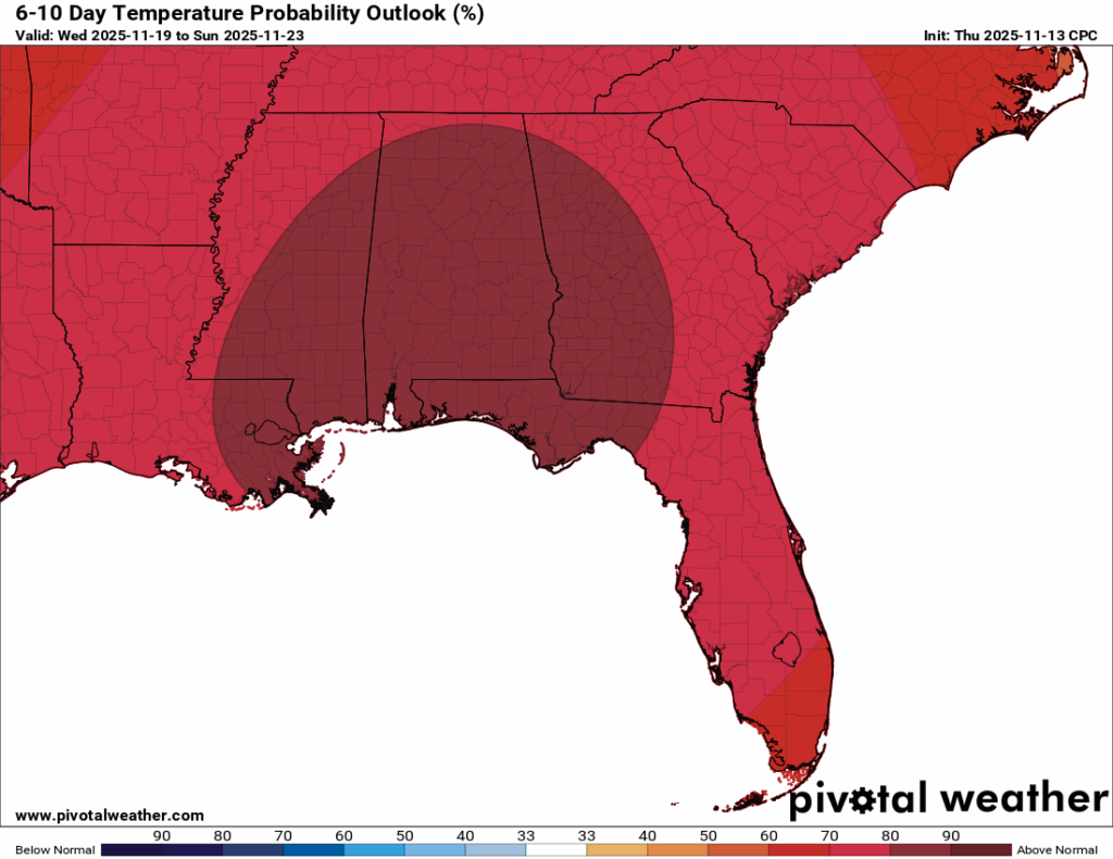
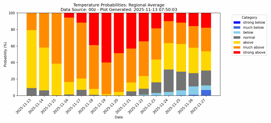
The warm trend does not seem to let up on the 6-10 day outlook OR on the temperature probability chart that Nick has made. We’re very likely going to stay above average for this time of year through about Thanksgiving. Confidence drops after that, but the pattern still leans warmer than colder for the near future.

REGIONAL DAY TO DAY FORECAST
Tonight: Patchy fog after midnight, otherwise mostly clear. Lows in the lower 50s. Calm wind.
Friday: Patchy fog before 8 a.m., otherwise sunny. Highs in the upper 70s.. Calm wind.
Friday Night: Patchy fog after 2 a.m., otherwise clear. Lows in the lower 50s. Calm wind.
Saturday: Patchy fog before 8 a.m., otherwise sunny. Highs in the upper 70s. Calm wind becoming southwest around 5 mph in the afternoon.
Saturday Night: Mostly clear. Lows in the mid 50s. South-southwest wind around 5 mph.
Sunday: Sunny. Highs in the lower 80s. West-southwest wind 5 to 10 mph.
Sunday Night: Mostly clear. Lows in the upper 50s. West-southwest wind around 5 mph becoming calm.
Monday: Mostly sunny. Highs in the lower 80s. Calm wind becoming south around 5 mph in the morning.
Monday Night: Partly cloudy. Lows around 59.
Tuesday: Mostly sunny. Highs in the lower 80s.
Tuesday Night: Partly cloudy. Lows around 61.
Wednesday: Mostly sunny with a slight chance of showers. Highs in the lower 80s. Chance of rain 20 percent.


