We’re still in the middle of an above average warm streak and that’s not going to end for a while! Despite mother nature’s best efforts, we’re going to keep temperatures in the 70s during the day for the upcoming week and beyond. The good news is that there isn’t much in terms of severe weather this weekend. Let’s take a look.

Today
It’ll be one of the warmest days of the year today with areas around south Louisiana reaching the upper 70s! For the rest of us, it’s still going to be warm with a slight chance of rain. Most of the rain will be concentrated north of I-20 and central Alabama, however we may see a stray shower or two as the evening progresses. Overnight, temperatures will fall back into the low 40s as the cold front moves in.

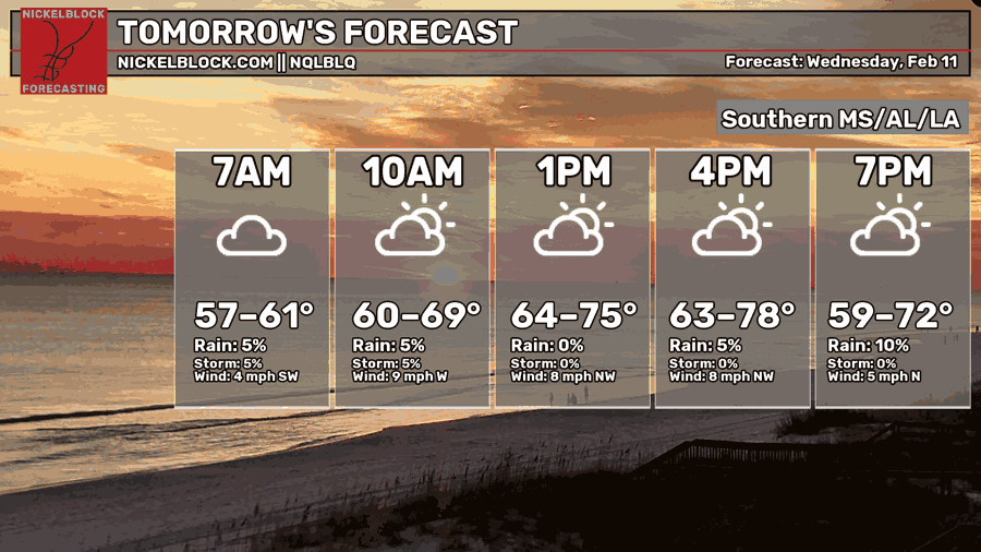
Tomorrow
We start it off cooler than we’ve been used to on Thursday, and temperatures will just stay out of the 70s during the day. Some clouds will roll in by early afternoon, but otherwise, another beautiful day! We’ll reach the mid 40s by Friday morning. Friday will warm up slightly to the low 70s with increasing clouds and a low in the low 50s.
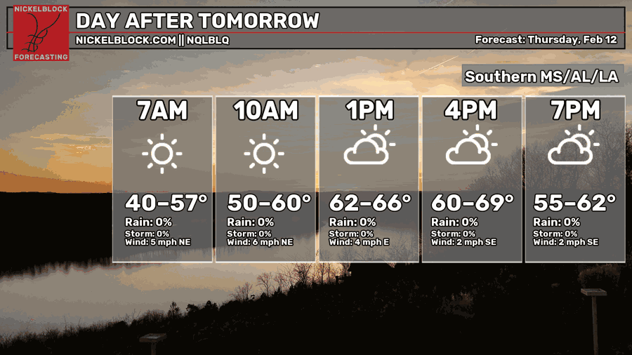
Valentine’s Day
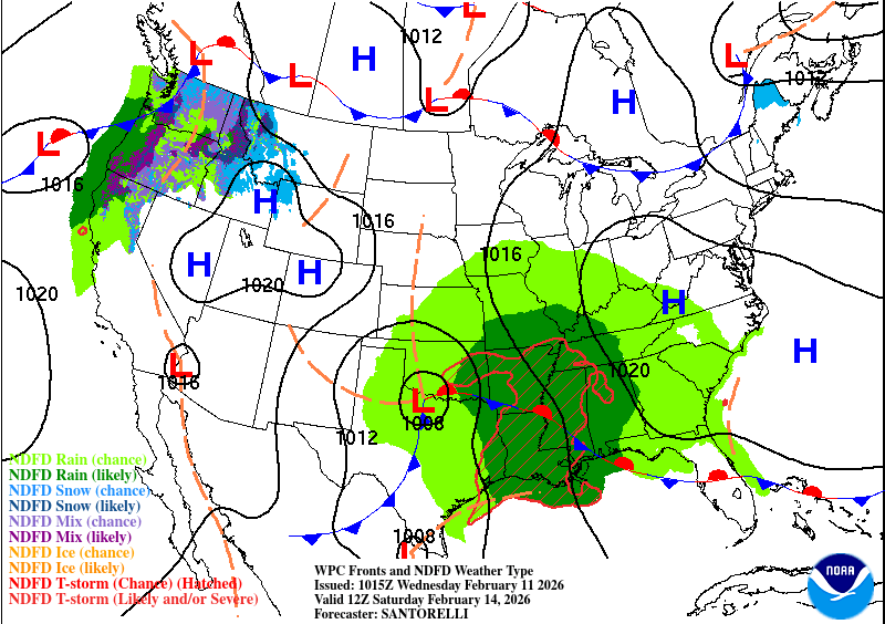
The good news is, not a lot of rain expected on Valentine’s Day! A few stray showers are expected during the day, but otherwise we won’t expect much until the front reaches us closer to midnight. The SPC has not put out any outlook on the incoming storm and right now, there doesn’t seem to be a lot of potential with these storms so far. Lightning, locally heavy rain, and wind gusts are the main risks associated with this system. Overall, it’s going to be a bit cooler during the day from the cloud cover, but severe weather potential looks fairly limited.
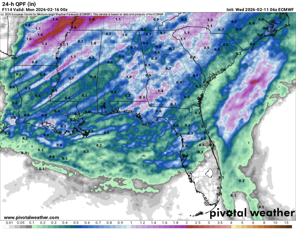
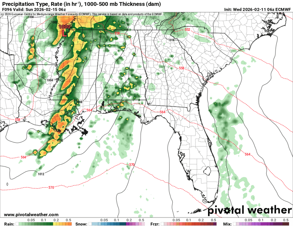
Sunday will start off soggy, then turn into a beautiful day shortly after. Highs in the 60s and a low in the mid to upper 40s.


