It’s been another beautiful and warm day out with only a few clouds in the sky and temperatures in the low 80s. Tonight, we’ll fall back into the low 50s before we get ready for the severe weather event Saturday evening into Sunday. Let’s take a look.

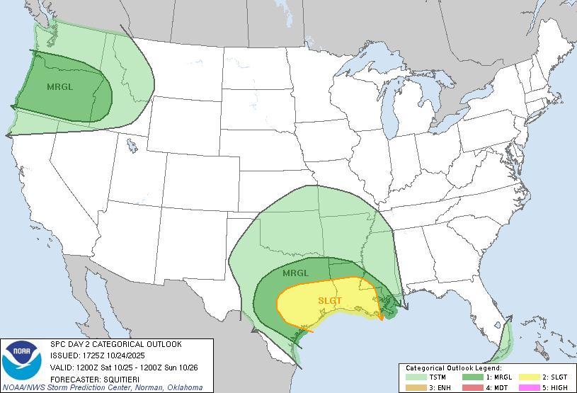
The looming severe weather threat for Saturday night and Sunday still remains low for much of the Pine Belt, while others further west around the latitudinal LA/MS border are under a slight (2/5) risk. Most of the ingredients for the severe weather are present for much of southeastern TX and southern LA. Part of it is the available moisture flow along with higher CAPE (instability).
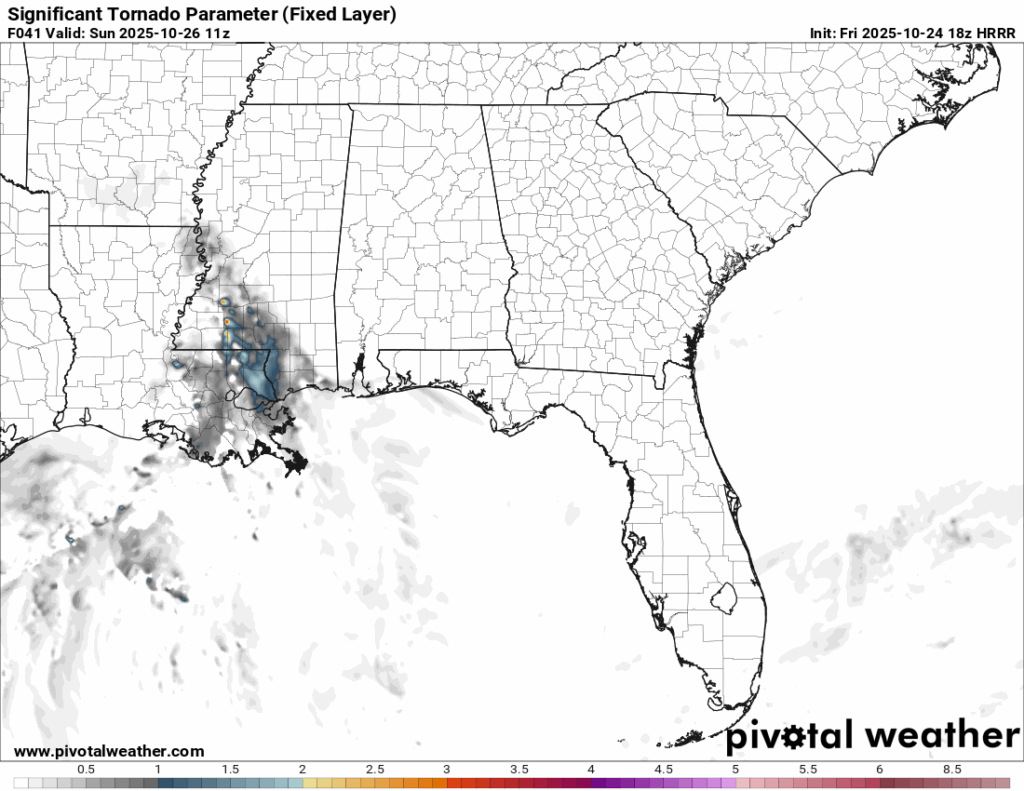
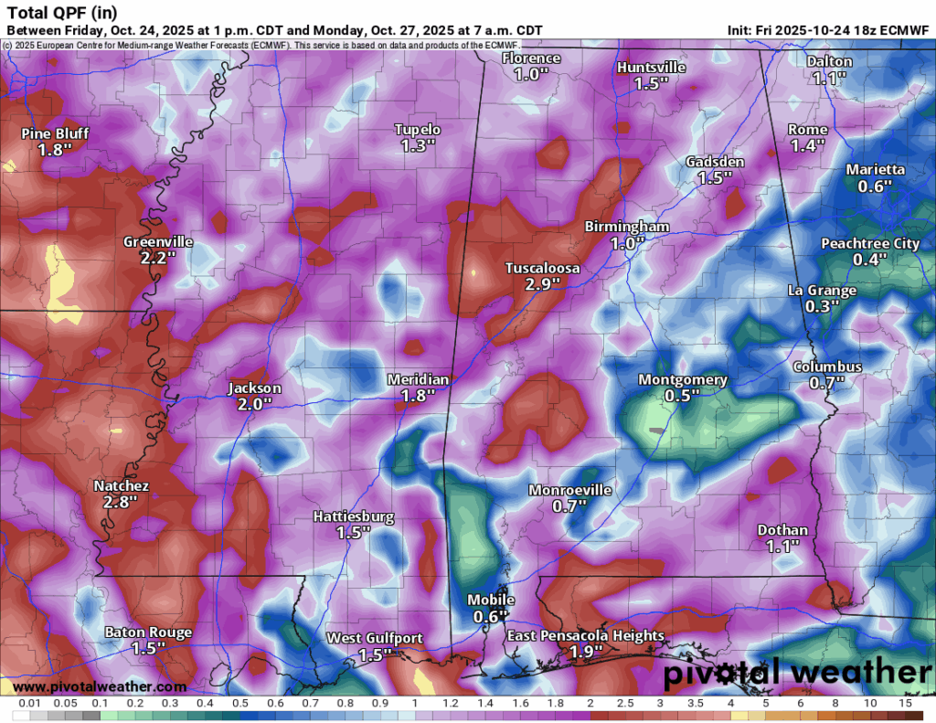
As the system moves further east, some discrete cells will form ahead of the main line in the overnight hours. While the significant tornado parameter is low, it is still possible to see a few develop. Strong winds ahead of the storms and flash flooding will be our main concerns. A fairly thick line of storms will form behind the cells and begin to merge in the morning before moving out in the afternoon. Significant rain is expected with this, averaging over an inch in many areas to over 3 inches in others.
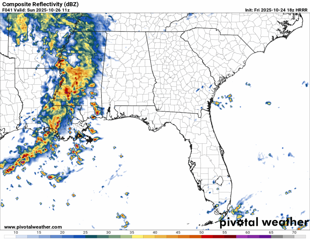
A few storms are possible closer to the coast Saturday afternoon. Highs will be in the low 80s with increasing clouds. After sunset into the midnight hours will be when the first few cells develop to our west. Afterwards, the early morning hours will have intermittent cells with possible severe weather mixed in. Afterwards, the main line will move in with heavy rain, thunderstorms and one last chance of some severe weather. This will last until the early afternoon for much of Mississippi and the later afternoon for Alabama.
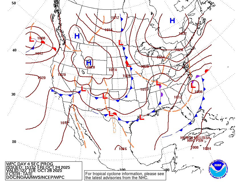
To start off the week, temperatures will reach the upper 70s Monday and Tuesday and lows in the 50s. An occluded dry front will move in and cool things off even further with highs in the upper 60s and lows in the low to mid 40s for the rest of the week. A large high pressure system will move in across the southeast from the Plains. We’ll see a slight warm up as we go into the weekend, but still cooler overall temperatures.
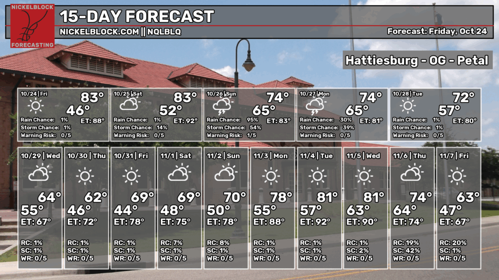
The 15-day forecast isn’t far off from my predictions except for a slightly cooler day on Thursday and low rain chance on Saturday, but that may be due to the timing of the rain. Expect cooler temperatures as soon as the front moves out on Tuesday into Wednesday.


