A stalled frontal boundary, essentially a cold front that has lost its forward momentum, is draped across the Deep South, stretching from eastern Texas through Louisiana, Mississippi, and Alabama. This front acts like a highway for disturbances, allowing waves of energy to ride along it and trigger rounds of showers and thunderstorms.
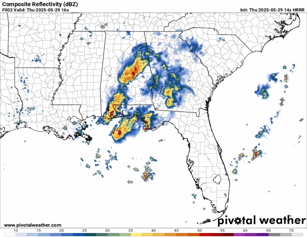
Rain chances for Thursday morning/early afternoon from the HRRR model //Courtesy: Pivotal Weather
Thursday to Friday, expect daily rounds of thunderstorms, especially in the afternoon and evening. Some storms will be strong, with gusty winds, frequent lightning, and torrential downpours. Localized flooding is a concern, especially in urban and low-lying areas. Friday Night into the Weekend, the stalled front finally begins to lift out as a ridge of high pressure builds in from the west. This shift will bring drier air, lower humidity, and more sunshine. While a few isolated storms may still pop up Saturday afternoon, the overall trend is toward calmer, more pleasant weather.

Rain chances for Friday evening from the NAM model //Courtesy: Pivotal Weather
Weekend Outlook
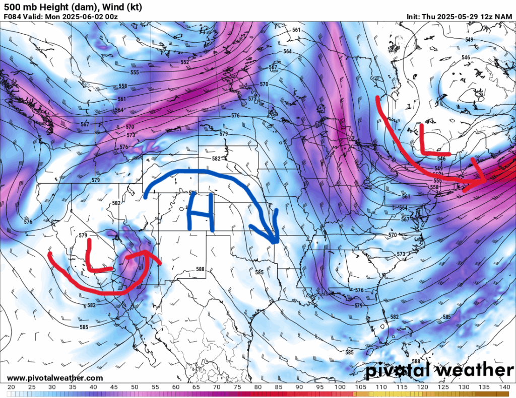
500 mb map for Sunday from the NAM model //Courtesy: Pivotal Weather
A ridge of high pressure builds in behind the departing front, bringing subsiding air (which suppresses cloud and storm development). Drier air filters in from the north and west, lowering dew points and making it feel more comfortable despite warm temperatures. Sunny to mostly sunny skies both days. Lower humidity means it will feel less sticky, especially in the mornings and evenings. Afternoon highs in the mid-80s, but with a light breeze and low dew points, it will feel quite pleasant. A stray pop-up storm is possible Sunday afternoon, especially inland, but most areas will stay dry.
Regional Day-to-Day Forecast
This Afternoon – It will be partly sunny with scattered thunderstorms developing by midday. Some storms may bring heavy rain, gusty winds, and frequent lightning. The high will be around 85, with a 60% chance of rain. Winds will be from the SW at 5 to 10 mph.
Tonight – Showers taper off after sunset, but a few may linger. Patchy fog possible by early morning. The low will be around 70 with a 40% chance of rain.
Friday – A final wave of energy brings scattered showers and thunderstorms, especially early. Gradual clearing with decreasing storm coverage. The high will be in the mid 80s with a 60 % chance of rain. Winds will be light and variable.
Friday Night – Storms clear out, leaving partly cloudy skies and cooler, drier air. The low will be in the mid 60s with a 20% chance of rain.
Saturday – Mostly sunny with a slight chance of an isolated afternoon storm. Much more pleasant with lower humidity. The high will be in the mid 80s with a 25% chance of rain. There will be a light breeze from the NW.
Saturday Night – Mostly clear and comfortable, the low will be in the mid 60s.
Sunday – Mostly sunny and warm. A pop-up storm is possible in the afternoon, but most areas stay dry. The high will be in the upper 80s with a 20% chance of rain. Winds will be calm out of the South.
Sunday Night – Clear to partly cloudy and mild, the low will be in the upper 60s.
Monday – Partly sunny with increasing humidity. A few isolated storms may develop in the afternoon. The high will be in the upper 80s with a 25% chance of rain. Winds will be from the S at 10-15 mph.
Monday Night – Partly cloudy and muggy, the low will be in the low 70s.
Tuesday – Partly cloudy with scattered thunderstorms, especially inland. The high will be in the upper 80s with a 30% chance of rain. Winds will be SE at 10-15 mph.
Tuesday Night – Lingering clouds with a few showers possible. The low will be in the low 70s.
Wednesday – Mostly sunny with isolated afternoon storms. The high will be around 90 with a 30% chance of rain. Winds will be SE at 10-15 mph.
Wednesday Night – Partly cloudy and warm. The low will be in the mid 70s.


