The persistent rain and thunderstorms across Southern Mississippi, Alabama, and Louisiana in early June are being driven by a multi-layered meteorological setup involving both surface and upper-atmospheric dynamics.
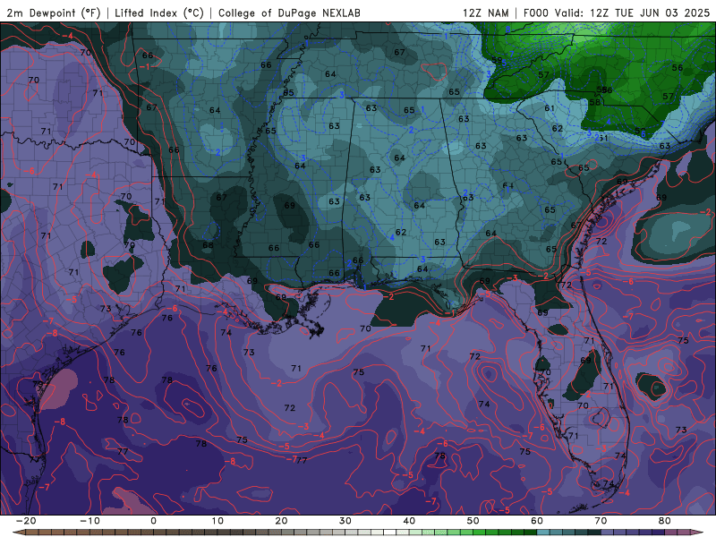
Tuesday through Friday, Dew Point Temperatures from the NAM model. //Courtesy: College of DuPage
A deep plume of tropical moisture is being funneled northward from the Gulf of Mexico into the southeastern U.S. A broad southerly flow in the lower atmosphere, and a moisture-rich air mass with high precipitable water values, can enhance rainfall efficiency, meaning storms can produce heavy rain in a short time.

The Surface Analysis map for Wednesday, 8:00 am (EST). //Courtesy: Weather Underground
A stationary front draped across the Gulf Coast is acting as a focus zone for repeated thunderstorm development. This boundary separates cooler, drier air to the north from warm, moist air to the south. Provides the lift necessary for storm formation. This boundary remains nearly motionless due to weak upper-level steering winds, allowing storms to repeatedly form over the same areas.
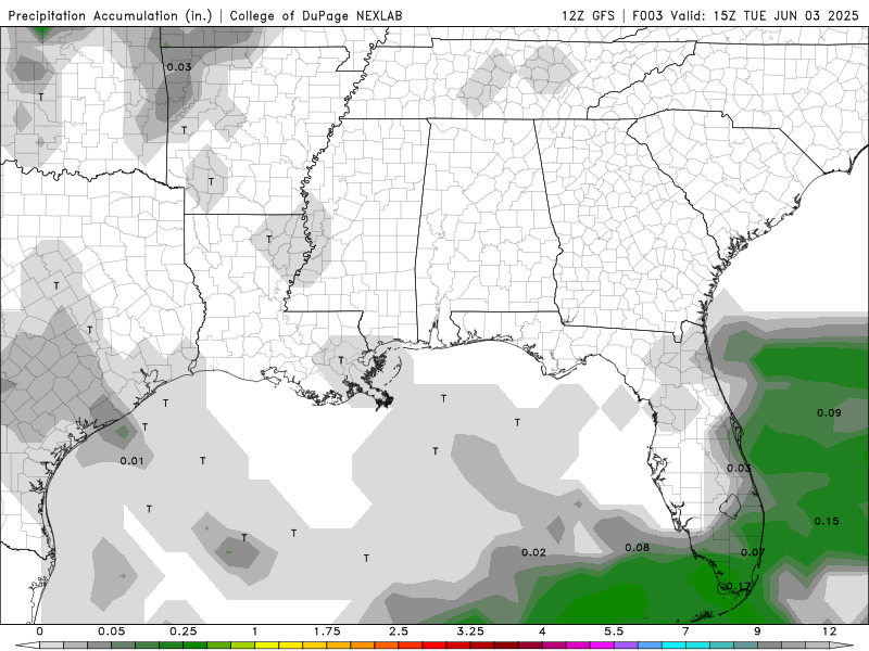
Precipitation Accumulation Tuesday through Monday of next week from the GFS model. //Courtesy: College of DuPage
This weather pattern is not driven by a single storm system, but rather by a series of atmospheric disturbances repeatedly moving through the region. Each wave brings renewed rounds of thunderstorms, compounding the impact of previous rainfall. With the ground already saturated, additional precipitation significantly increases the risk of flash flooding, particularly in urban and low-lying areas. Forecasts suggest up to 5 inches of rain could fall over the week, overwhelming drainage systems and leading to urban flooding. In addition, cumulative runoff may cause rivers and streams to rise, heightening the threat of widespread hydrological flooding.
Regional Day-to-Day Forecast
Tuesday – Partly cloudy with increasing clouds by afternoon. High near 88°F. Winds ESE at 10–15 mph.
Tonight – Mostly cloudy with scattered showers developing late. Low around 76°F. Chance of rain 60%.
Wednesday – Morning showers, then partly cloudy. High near 86°F. Winds ESE at 10–15 mph. Chance of rain 30%.
Wednesday Night – Mostly clear with a few clouds. Low near 75°F.
Thursday – Mix of sun and clouds. A stray shower or thunderstorm possible. High near 86°F. Winds SE at 5–10 mph.
Thursday Night – Partly cloudy, low around 77°F.
Friday – Mostly sunny with a few afternoon clouds. Slight chance of a thunderstorm. High near 88°F. Winds SW at 10–15 mph.
Friday Night – Partly cloudy. Low around 79°F.
Saturday – Partly sunny with a mix of clouds. High near 90°F. Winds SW at 10–20 mph.
Saturday Night – Mostly clear with a few clouds. Low around 79°F.
Sunday – Intervals of sun and clouds. High near 89°F. Winds SW at 10–15 mph.
Sunday Night – Partly cloudy early, with scattered thunderstorms developing late. Low around 78°F. Chance of rain 40%.
Monday – Scattered thunderstorms likely. High near 87°F. Winds SW at 10–15 mph. Chance of rain 50%
Monday Night – Continued chance of scattered showers and storms. Low around 76°F. Chance of rain 50%.


