A hot and humid week is ahead for the Gulf Coast, with daily thunderstorms driven by Gulf moisture, daytime heating, and weak upper-level disturbances. Scattered storms are expected through Thursday, with heat indices topping 100°F. Slightly fewer storms may occur Friday and Saturday due to weak ridging, but isolated activity will persist. A surge of tropical moisture Sunday and Monday will bring widespread storms and a risk of flash flooding. The unsettled pattern continues into Tuesday, with a slight drying trend by Wednesday, though storm chances and heat stress remain elevated.
Tuesday–Thursday: Moist and Unstable with Daily Thunderstorm Risk
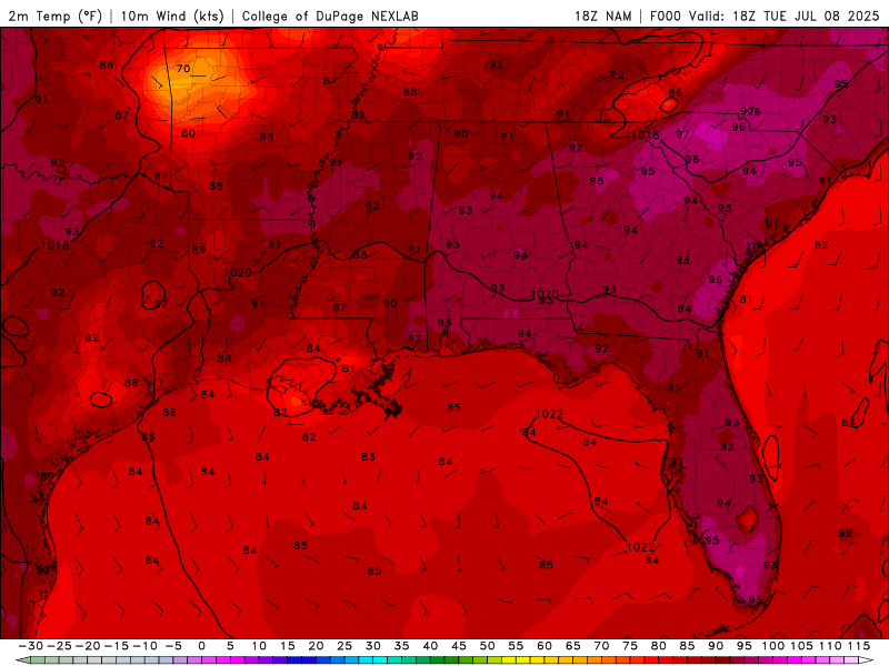
Surface temperatures for Tuesday to Saturday from the NAM model. //Courtesy: College of DuPage
Surface temperatures and dew points remain elevated, with highs in the upper 80s to low 90s and dew points in the mid to upper 70s. This will push heat indices into the 100–105°F range. A moist and unstable air mass continues to dominate, with scattered to numerous afternoon thunderstorms expected each day. These storms will be driven by diurnal heating, Gulf moisture advection, and weak upper-level impulses. Storms may be slow-moving, leading to localized flooding, especially in urban areas.
Friday–Saturday: Slight Mid-Level Ridging, But Storms Persist
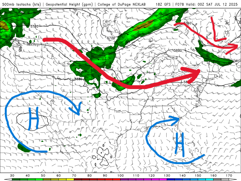
500 mb map for Friday from the GFS model. //Courtesy: College of DuPage
A modest mid-level ridge may build in from the west, slightly reducing storm coverage. However, sea breeze interactions and mesoscale boundaries will still trigger isolated to scattered afternoon storms, especially inland. Highs will reach the low to mid-90s, with heat indices again exceeding 105°F in areas with limited cloud cover. Expect brief downpours, gusty winds, and frequent lightning with stronger cells.
Sunday–Monday: Deep Moisture Surge and Widespread Storms
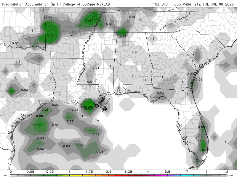
Precipitation accumulation from Tuesday to Tuesday of next week from the GFS model. //Courtesy: College of DuPage
A surge in tropical moisture will bring precipitable water values over 2 inches, signaling a period of enhanced convective activity. Expect widespread showers and thunderstorms, especially during the afternoon and evening hours. A weak frontal boundary may approach from the north on Monday, increasing lift and storm organization. Flash flooding becomes a concern, particularly in low-lying and poorly drained areas.
Storms Persist Tuesday, Heat and Humidity Build into Wednesday
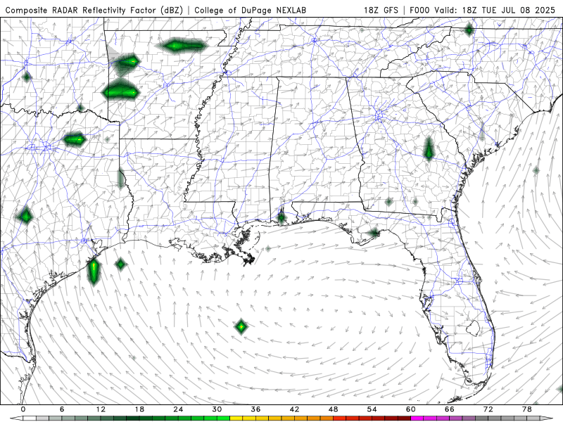
Composite Radar Reflectivity from Tuesday to Wednesday of next week from the GFS model. //Courtesy: College of DuPage
The unsettled pattern continues into Tuesday as a lingering frontal boundary keeps the atmosphere highly unstable. Expect numerous showers and thunderstorms throughout the day, with multiple rounds of rainfall possible. Some storms may be strong, producing gusty winds and heavy downpours. Highs will remain in the upper 80s to low 90s, with oppressive humidity. By Wednesday, a subtle drying trend aloft may begin to reduce storm coverage slightly, but abundant low-level moisture will still support isolated to scattered storms, especially along sea breeze fronts. Temperatures will climb into the low to mid-90s, and heat stress will remain a concern due to continued high humidity.
Regional Day-to-Day Forecast
Wednesday – Sunny, with a 40% chance of showers and thunderstorms in the afternoon. High near 91°F. Northwest wind 5–10 mph becoming southwest in the afternoon.
Wednesday Night – Mostly clear, with a 40% chance of showers and thunderstorms, mainly after 1 a.m. Low around 77°F. Southwest wind around 5 mph.
Thursday – Showers and thunderstorms likely, mainly between 10 a.m. and 1 p.m. Chance of precipitation is 60%. Mostly sunny, with a high near 91°F. Southwest wind 5–10 mph.
Thursday Night – Partly cloudy, with a 40% chance of showers and thunderstorms, mainly after 1 a.m. Low around 76°F. Southwest wind around 5 mph.
Friday – Showers and thunderstorms likely, mainly before 1 p.m. Chance of precipitation is 60%. Mostly sunny, with a high near 90°F. West wind 5–10 mph.
Friday Night – Partly cloudy, with a 30% chance of showers and thunderstorms, mainly after 1 a.m. Low around 77°F. Southwest wind around 5 mph.
Saturday – 50% chance of showers and thunderstorms. Partly sunny, with a high near 91°F. Winds light and variable.
Saturday Night – Partly cloudy, with a 30% chance of showers and thunderstorms. Low around 76°F.
Sunday – Partly sunny, with a 50% chance of showers and thunderstorms. High near 89°F. Winds SSE at 5–10 mph.
Sunday Night – Partly cloudy, with a 20% chance of showers. Low around 76°F.
Monday – Partly sunny, with a 60% chance of scattered thunderstorms, especially in the afternoon. High near 89°F. Winds SW at 5–10 mph.
Monday Night – Partly cloudy, with a 30% chance of showers. Low around 77°F.
Tuesday – Mostly sunny, with a 20% chance of isolated afternoon thunderstorms. High near 92°F. Winds W at 5–10 mph.
Tuesday Night – Mostly clear, with a 10% chance of rain. Low around 76°F.


