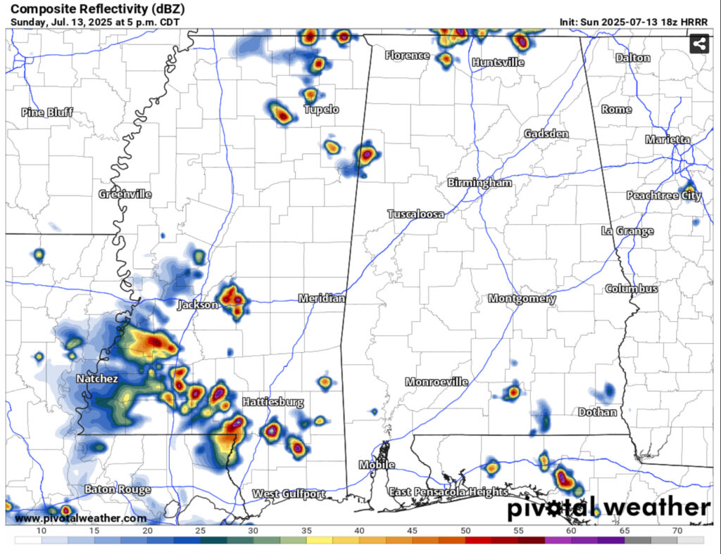
Today has been another hot one with more storms developing across southwestern Louisiana moving northeast across southwest Mississippi and the Pine Belt. Expect these to hit by mid-afternoon and last until around sunset. Highs will reach the 90s with a heat index around 100 before the storms cool things off.
Starting off the week, the surface high in the Gulf will move further west towards Louisiana and Texas. Conditions will be more humid with highs in the low to mid 90s and heat indices topping out around 100 on Monday and up to 105 by Tuesday. Rain chances will be suppressed a bit due to the high’s location, but we can expect at least a few isolated thunderstorms tomorrow across the area. Tuesday will be a similar story with a few popping up during the afternoon.

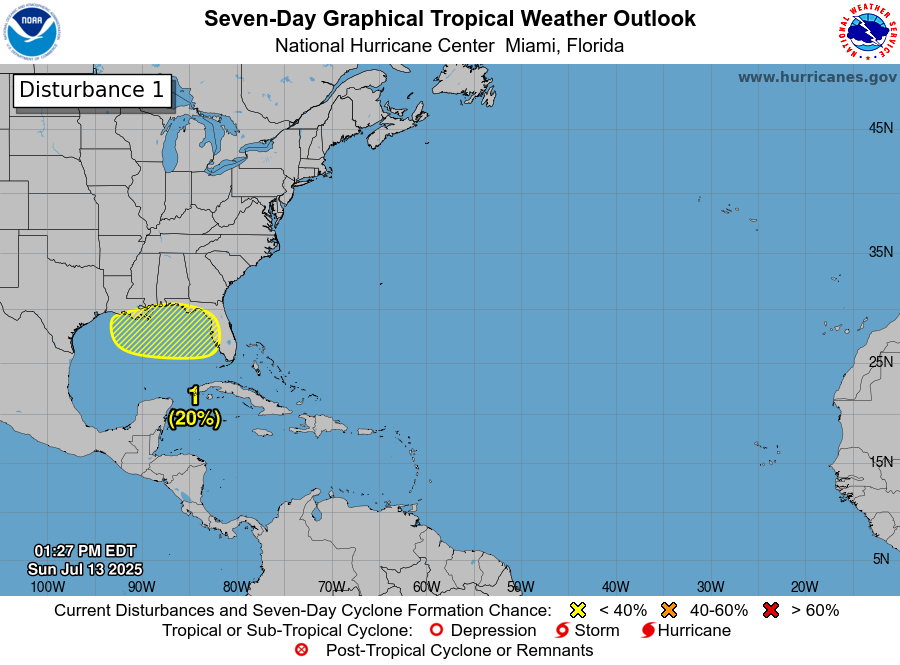
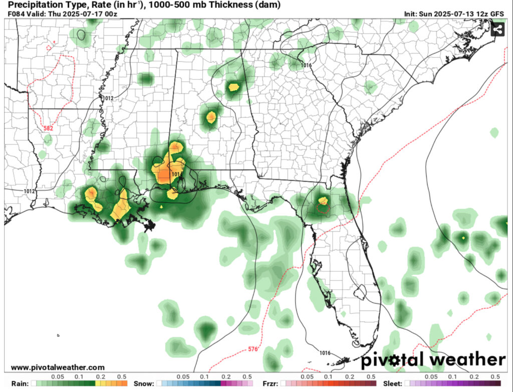
Our main story is this guy right here. So far, it’s a tropical disturbance, but it’s not quite in the Gulf just yet. It’s currently moving from South Carolina southward towards Florida and eventually into the northern Gulf. The disturbance will slowly overtake the Gulf high and make landfall by the weekend. Till then, it’ll give us some more rain during the latter part of the week. Most of it looks to be concentrated towards the coastline, but inland areas will still see some storms move in. Rainfall totals so far look to be over 3 inches around the coastline and up to an inch further inland, but this could chance depending on whether the disturbance weakens or strengthens.
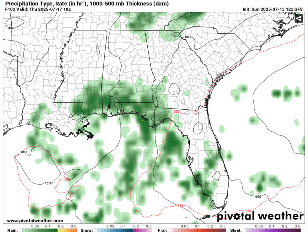
In spite of the incoming tropical disturbance, it’s still going to be hot for the next several days. Highs will reach the low to mid 90s with the heat indices reaching up to 100 and over 100 in some areas, so not everyone will get a break from the heat. Not only this, an Atlantic high is building behind it adding to the humidity. Expect it to stay hot during the weekend as rain chances begin to wane, but we’ll still see our normal pop-up thunderstorms mixed with some southerly wind influence.
Regional Day-to-Day Forecast
This Afternoon – Showers and thunderstorms likely in the afternoon. Sunny, with a high in the mid 90s. Heat index values as high as 100. Calm wind becoming south southeast around 5 mph.
Tonight – A chance of showers and thunderstorms before sunset. Patchy fog before 2am, then patchy fog after 3am. Otherwise, mostly clear, with a low in the low 70s. South southwest wind around 5 mph becoming calm.
Monday – Showers and thunderstorms likely in the afternoon. Patchy fog before 7am. Otherwise, sunny, with a high in the low to mid 90s. Heat index values as high as 100. Calm wind becoming south southwest around 5 mph in the afternoon. New rainfall amounts of less than a tenth of an inch, except higher amounts possible in thunderstorms.
Monday Night – A 30 percent chance of showers and thunderstorms before sunset. Mostly clear, with a low in the low 70s. Southwest wind around 5 mph becoming calm.
Tuesday – Showers likely and possibly a thunderstorm in the afternoon. Sunny, with a high in the low to mid 90s. Calm wind becoming southwest around 5 mph in the afternoon. Chance of precipitation is 40%. New rainfall amounts of less than a tenth of an inch, except higher amounts possible in thunderstorms.
Tuesday Night – Mostly clear, with a low around 74. Southwest wind around 5 mph becoming calm.
Wednesday – Showers and thunderstorms likely in the afternoon. Sunny, with a high in the low to mid 90s. Calm wind becoming west southwest around 5 mph in the afternoon. Chance of precipitation is 50%.
Wednesday Night – A 30 percent chance of showers and thunderstorms, mainly before sunset. Mostly clear, with a low in the low 70s. West southwest wind around 5 mph becoming calm.
Thursday – Showers and thunderstorms likely, mainly in the afternoon. Mostly sunny, with a high in the low to mid 90s. Calm wind becoming west southwest around 5 mph in the morning. Chance of precipitation is 60%.
Thursday Night – A chance of showers and thunderstorms into the overnight hours. Partly cloudy, with a low in the mid 70s. Chance of precipitation is 30%.
Friday – Showers and thunderstorms likely. Mostly sunny, with a high in the low 90s. Chance of precipitation is 60%.
Friday Night – A 20 percent chance of showers and thunderstorms. Mostly cloudy, with a low in the low 70s.
Saturday – Showers and thunderstorms likely. Mostly sunny, with a high in the low to mid 90s. Chance of precipitation is 50%.


