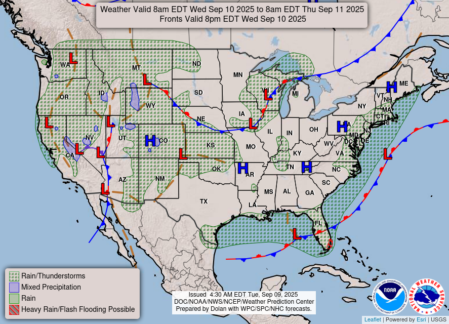
Some scattered showers and thunderstorms popped up this afternoon and are now starting to fade as they drift north. Notice that thin green line moving from south to north? That’s an outflow boundary, and it helped fire off a few more storms as it passed through. It also collided with another outflow boundary from the Jackson area, and sparked some convection between Saint Joseph and Hazlehurst. Pretty cool to watch!
Overall Setup
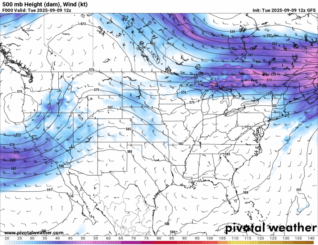
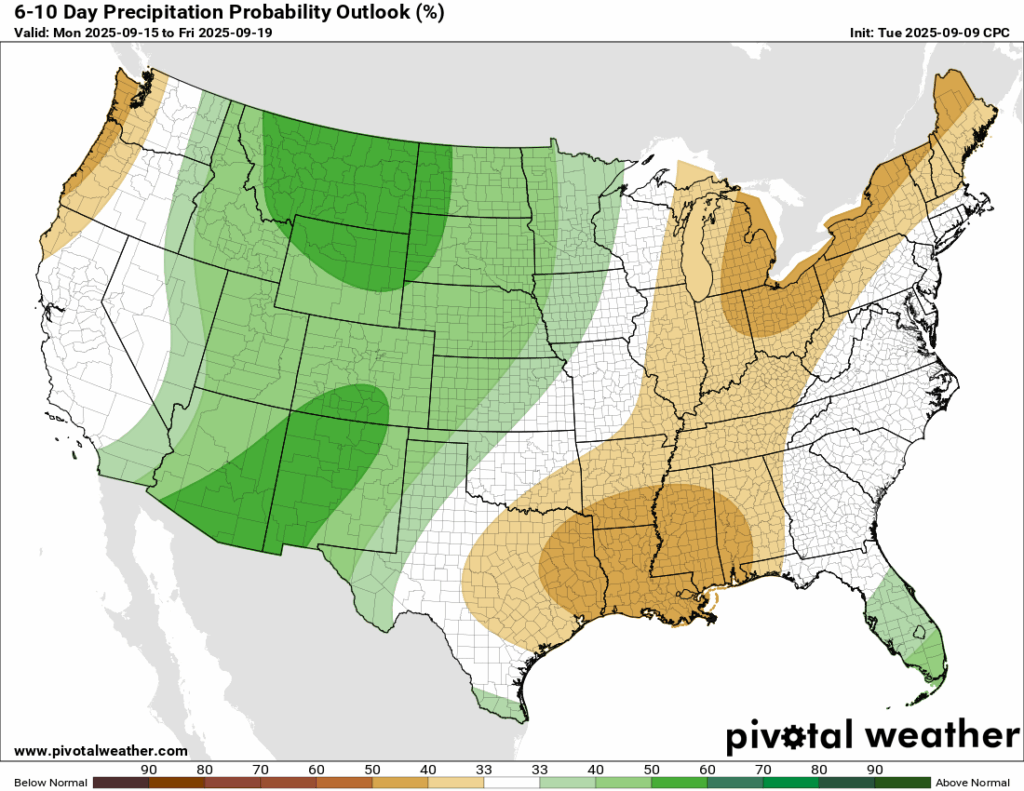
We currently are under some high pressure at the surface which is keeping us mainy dry, asides from the isolated thunderstorms this evening, and holding temperatures in the low-to-mid 90s this week. A ridge in the mid-levels of the atmosphere is currently in place over the western US. This will move east over the coming days and stick around for quite a while. The ridge will not allow for much rain at all and will keep temperatures well above average for at least the next 2 weeks.

Tonight’s Forecast
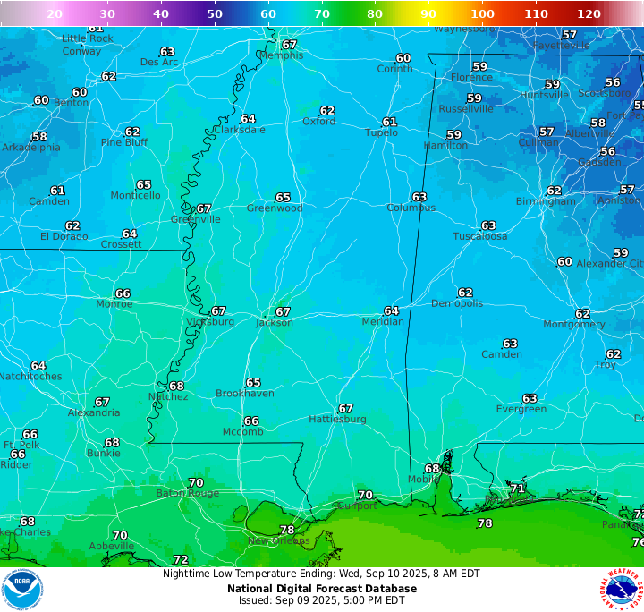
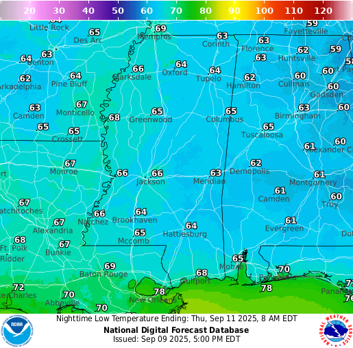
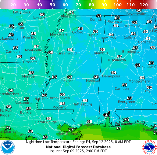
Skies are clear tonight with temperatures in the mid-to-high 60s for the region. Those closer to the Gulf will see lows more in the 70s. Nothing in the way tonight if you will be on a late night drive!
Tomorrow’s Forecast
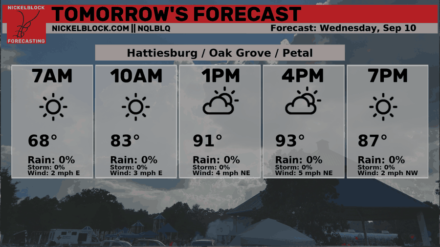
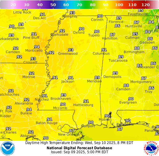
Asides from the heat, tomorrow will be quite nice with mostly sunny skies as high pressure dominates the region. Temperatures will be around normal for this time of year and humidity won’t be too much to deal with, but will still be noticable. Dew points will be in the high 50s and low 60s, which is much better than the 70s and 80s we saw in mid summer. Northerly winds are responsible for the lower humidity as well as the nightime lows sitting in the low 60s!
Thursday’s Forecast
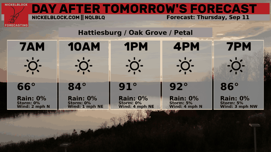
High pressure sticks around for Thursday keeping us completely dry. Temperatures will again be in the low-to-mid 90s with just moderate humidity. An overall hot and dry middle of the week for us!
Extended Local Outlook
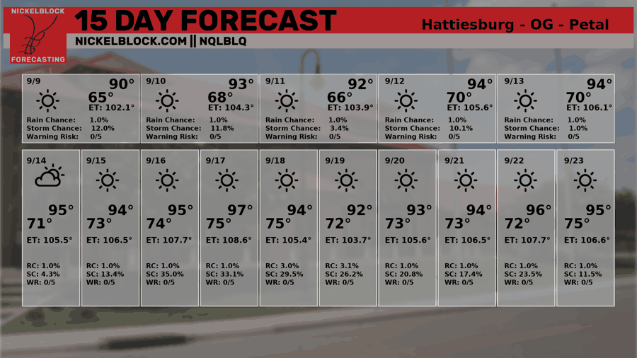
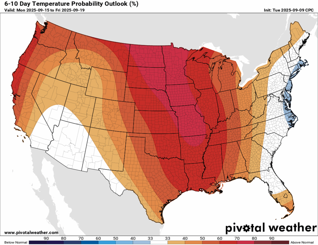
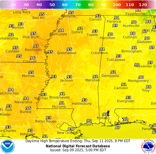
Temperatures do not cool down in the next 6-10 days. More heat with temperatures in the mid 90s and dry weather in the forecast for the region will make it feel as if summer is still here. For reference, our average high temperature for Hattiesburg in September is 89-90 degrees, so we will be 5-6 degrees above normal for most of this month. Looking in the long range, the rest of September unfortunately looks to show a similar pattern.
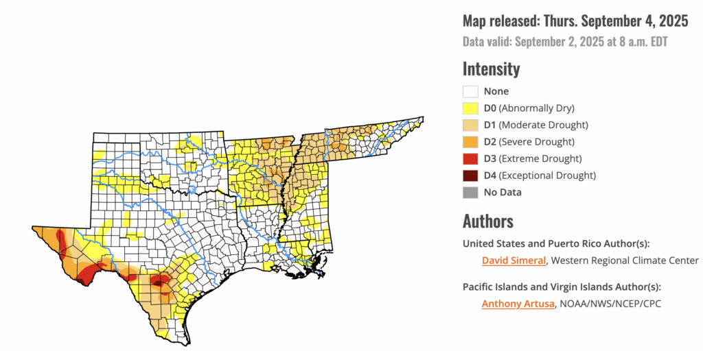
The lack of useful, ground soaking rain has put some of our area in a moderate drought, or “abnormally dry” conditions for the areas not technically in a drought yet. I expect the drought to worsen if the trend continues. Any burning should be done very carefully given the dry conditions.

Latest Tropical Update
Atlantic:
As Nick mentioned in his tropical update on Facebook, the hyped Invest 91 which had a 90 percent chance of development last week has diminished into a zero percent chance. This shows just how quickly conditions could change and how that could impact development or not. What happened? Well, the cluster of showers and storms was essentially suffocated with dry Saharan dust. Convection was quickly shut down and prevented it from developing. Turns out our next named system, Gabrielle, will come some other time…
The Central American Gyre is a large, broad spin of low pressure that sometimes sets up over Central America. It’s not a tropical system itself, but it creates a moist, unstable environment where storms can form more easily. Over the next couple of weeks, this setup could help spark tropical activity in the western Caribbean or Gulf of Mexico. We will be keeping an eye on the Gulf closely as we have the peak of Hurricane Season tomorrow, 9/10!
Eastern/Central Pacific:
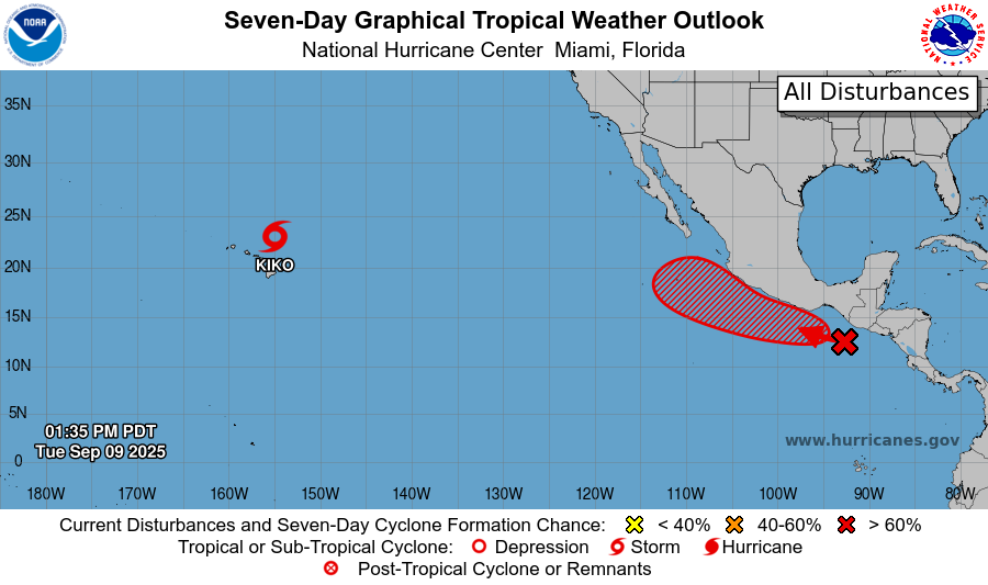
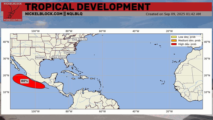
There is an area to watch just off the western coast of Central America and southern Mexico that has an 80 percent chance of development in the next 7 days. The NHC is confident that this will move to the northwest parallel to the Mexican coast and eventually will move out to sea.

Tropical Storm Kiko is forecast to pass north of Hawaii and continue to weaken as it moves away. Thankfully the only threats are high surf and dangerous rip currents, which is much better than a landfalling system for the island chain. The above image shows that tropical storm force winds will NOT impact Hawaii.
REGIONAL DAY TO DAY FORECAST
Tonight: Mostly clear with lows in the upper 60s. East northeast winds around 5 mph, becoming calm in the evening.
Wednesday: Sunny with highs in the low 90s. Northeast winds around 5 mph.
Wednesday Night: Clear with lows in the mid 60s. Calm winds.
Thursday: Sunny with highs in the low 90s. Winds light, becoming northeast around 5 mph in the afternoon.
Thursday Night: Clear with lows in the mid 60s. Calm winds.
Friday: Sunny with highs in the mid 90s. Winds light, becoming northeast around 5 mph in the morning.
Friday Night: Clear with lows in the mid 60s. Northeast winds around 5 mph, becoming calm.
Saturday: Sunny with highs in the mid 90s. Winds light, becoming northeast around 5 mph in the afternoon.
Saturday Night: Mostly clear with lows in the mid 60s.
Sunday: Sunny with highs in the mid 90s.
Sunday Night: Mostly clear with lows in the upper 60s.
Monday: Sunny with highs in the mid 90s.
Monday Night: Mostly clear with lows in the upper 60s.
Tuesday: Sunny with highs in the mid 90s.


