It’s been another dry and warm one today with highs topping out in the mid 80s across the Pine Belt. Conditions won’t change too much until we reach the latter part of the weekend with a subtropical front bringing us a brief chance of rain.
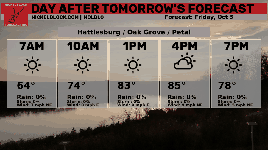
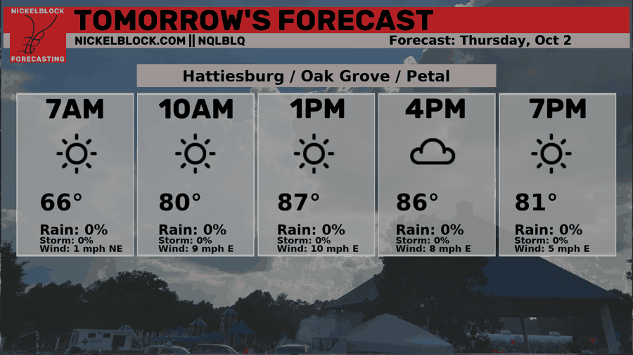
A dry front is expected to move over us in the next couple of days and will drop temperatures just a hair into the mid 80s. For tomorrow, however, we’ll see temperatures in the upper 80s and lows in the mid 60s. After the front moves through, we can expect the winds to pick up and possibly gust to 20mph in some areas.

The trend continues on into Saturday as we’ll have another sunny and slightly windy one. Highs will top out in the upper 80s with east northeast winds around 5-10mph.
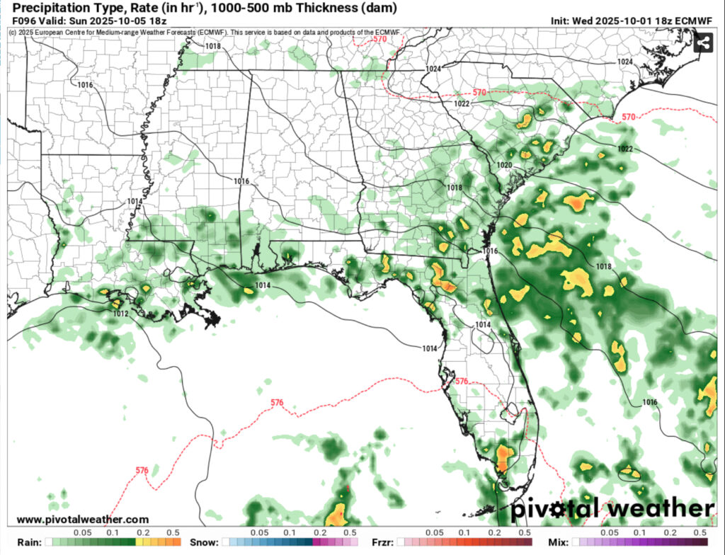
The big story for us is, yes, the chance of rain. It’s looking a little on the slim side, but I wouldn’t doubt we’ll get some scattered thunderstorms across much of the coastal South on Sunday. Highs will reach the upper 80s and fall into the low 70s. Overall, more humid conditions and this will continue on into next week.

Tomorrow’s Forecast
Friday’s Forecast