A Look Back at Yesterday
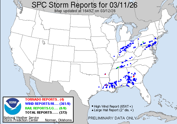
Hey everyone! I hope everyone stayed safe and made it through yesterday’s nasty thunderstorms. I wanted to start by taking a quick look back at the event, since our region saw plenty of wind damage reports as that line of storms pushed through. The main story with these storms was the strong straight-line wind, which brought down trees and limbs, caused scattered damage, and left some customers without power even into today.
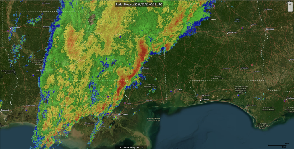
The radar image below really shows how impressive and organized that line was as it moved across the area, and both the storm reports and outage map help tell the story of just how impactful yesterday’s storms were.

Current Setup
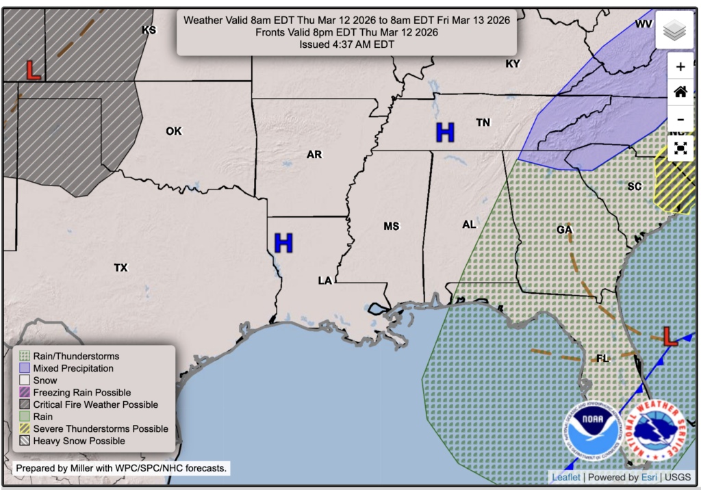
If you noticed that today feels a lot less humid, you are absolutely right. Behind the rain and storms we saw last night, a cold front moved through and dropped temperatures down into the 50s while also bringing in much drier air. You can really see that on the low-level water vapor imagery, which shows a dry, sinking airmass spilling in from the north and taking over across our area.

Tonight’s Forecast
Tonight will be cold and clear, with temperatures falling quickly after sunset. Most inland areas will drop into the upper 30s to lower 40s by daybreak, while the immediate coast stays milder in the lower to middle 50s. Definitely a much colder night than recent nights!

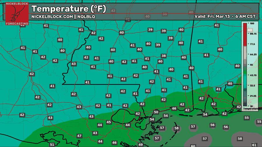
Tomorrow’s Forecast: Friday, March 13
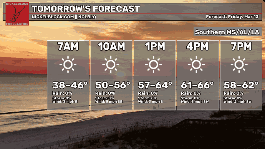
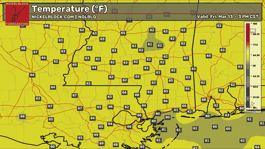
Expect abundant sunshine to continue on Friday, with temperatures warming a bit more as a weak southerly flow returns. Afternoon highs should make it into the lower to middle 60s across the region, which will feel pretty nice after the cooler air in place tonight. Even with that southerly wind coming back, humidity will not be much of an issue. Dew points will stay in the 50s, so the air should still feel comfortable and mostly dry through the day. Lows will dip into the mid-40s.
This Weekend’s Forecast
For Saturday, expect more sunshine with very little cloud cover, with highs warming back into the lower to middle 70s. It should be another really nice day across the region, and then by Saturday night, lows will fall back into the middle 50s.
By Sunday, we will start to see increasing clouds and humidity, with highs climbing into the lower 80s. A few light showers will be possible around the region as moisture increases ahead of another cold front. This front is not expected to bring a line of severe thunderstorms or anything like what we saw the other night, but it will help bring back drier air for the start of next week. Along with that drier air, cooler temperatures will return as well, so we will be back to a more refreshing feel to begin the week.

Extended Local Outlook
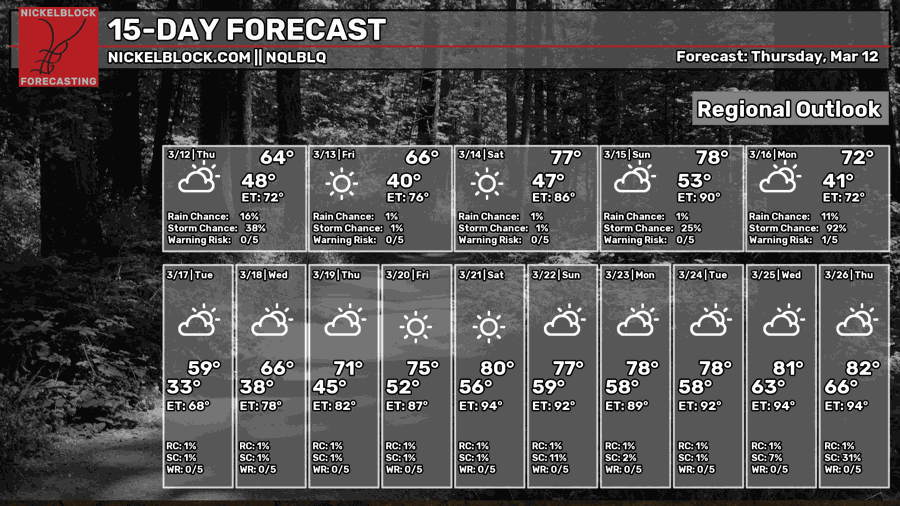
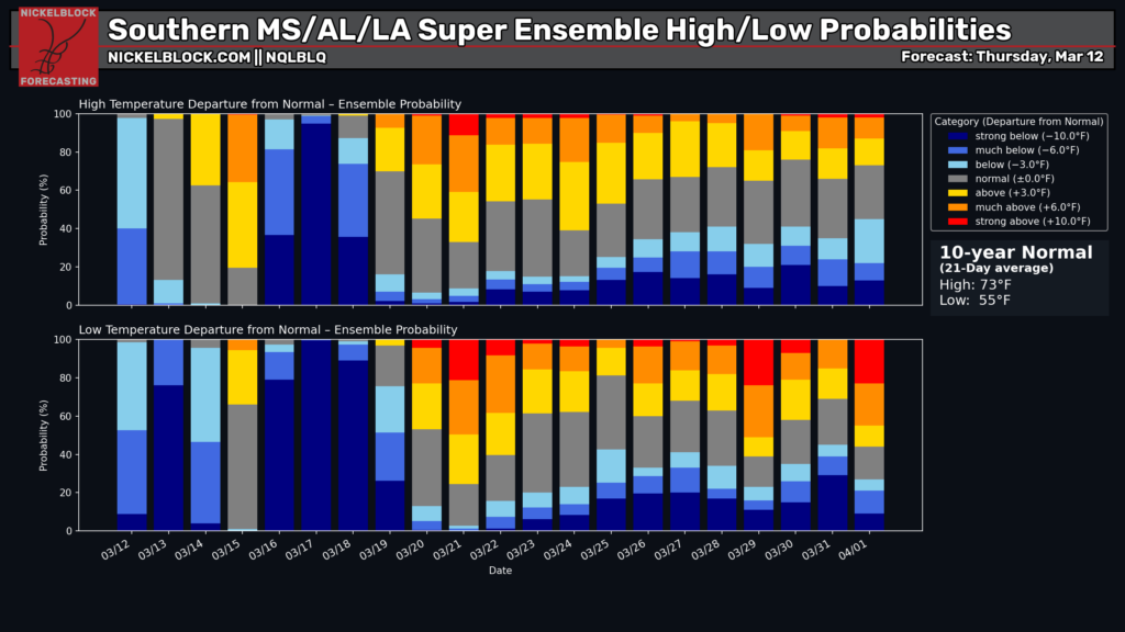
Again, next week starts cooler and drier once Sunday’s front moves through. One note on Monday, the regional outlook shows a high in the 70s, but that will happen overnight before the front moves through. During the day on Monday, temperatures will fall into the lower 50s. Tuesday and Wednesday are also looking below average in the 50s and 60s. After that, we warm back up pretty quickly, with 70s returning by midweek and upper 70s to lower 80s possible later next week into next weekend. The super ensembles support that warmer trend next weekend, though there is still some uncertainty as we get closer to the end of the month.