
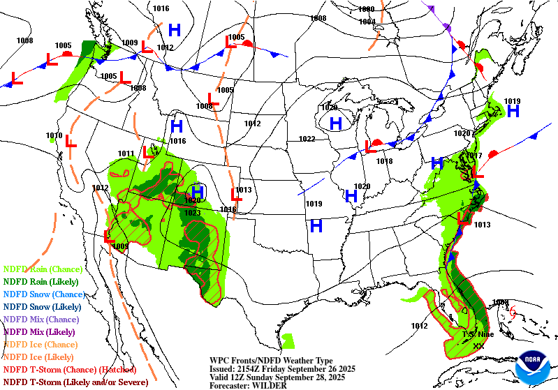
Alright, well, this should be a fun one. It’s been a very pleasant day outside with highs in the mid 80s and hardly a cloud in the sky. We’ll continue the dry weather for the next several days as a strong surface high pressure system moves in front of the cold front we just experienced. Overall, not much will change in the week ahead, but we’ll get a slight warm up as the week progresses.
This weekend should be very nice for outdoor plans as we’ll have few clouds in the sky and highs in the mid to upper 80s across the area. The evenings should be just as nice as temperatures fall in to the low to mid 60s, so if you can eat out on the patio or get out on the back deck in the evenings, do it!

The rest of next week will slowly warm up to the upper 80s and around 90 by Friday and lows scaling from the mid 60s to the upper 60s. Clouds will be on the increase as well as we go through the week. Overall, it’ll be a warm week. I wouldn’t be surprised if we go into another burn ban by next week as we won’t have any rain for a while longer. Friday may fall into the mid 80s as a dry front moves in.
Tropical Update
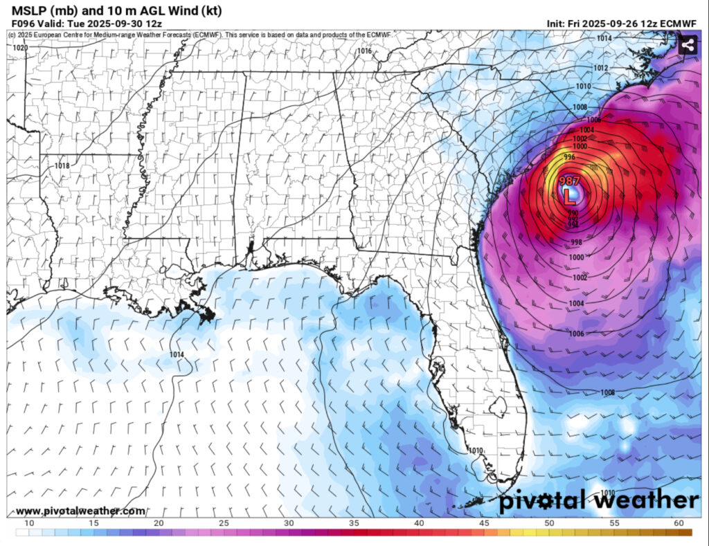
//Courtesy: Pivotal Weather
I know I already alliterated to this earlier, but part of the reason we’re having such good weather is the tropics. A system in the Caribbean (AL94) has a 90% chance of developing in the next 48 hours and it looks to follow the Atlantic current since the waters are very warm right now. It has a fairly direct path up the Atlantic, but models have this system going one of two ways. The first is a direct shot to the mid-Atlantic states, notably South and North Carolina, where it may stall before it moves inland. The other is a slightly weirder one, but it stalls the storm out in the Atlantic before it moves out to sea.
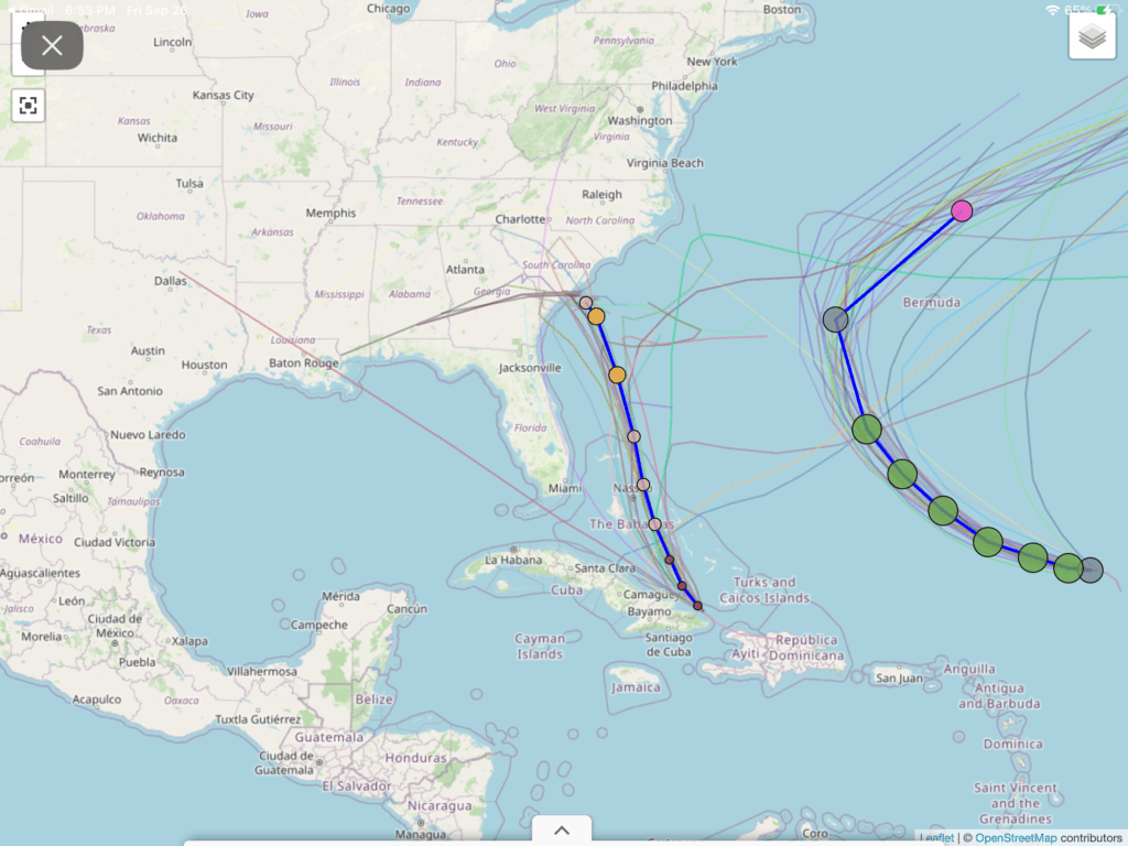
Plots have 94L reaching on average Category 1 hurricane status. If you’re in the coastal GA/SC/NC area, I would watch out for storm surge, flooding, and high winds if this thing makes it. This isn’t to overhype or scare anyone, but there is a likelihood that this system will make it somewhere up the Atlantic coastline.

Regional Day-to-Day Forecast
Tonight – Mostly clear, with a low in the mid 60s. North northwest wind around 5 mph becoming calm in the evening.
Saturday – Sunny, with a high in the upper 80s. Light north northwest wind becoming north 5 to 10 mph in the morning.
Saturday Night – Mostly clear, with a low in the low 60s. North wind around 5 mph becoming calm in the evening.
Sunday – Sunny, with a high near 90. North northeast wind 5 to 10 mph.
Sunday Night – Mostly clear, with a low in the mid 60s. North northeast wind around 5 mph becoming calm in the evening.
Monday – Sunny, with a high around 90. North northeast wind around 5 mph.
Monday Night – Mostly clear, with a low in the mid 60s. North northeast wind around 5 mph becoming calm.
Tuesday – Sunny, with a high in the low 90s. Light north wind increasing to 5 to 10 mph in the morning.
Tuesday Night – Partly cloudy, with a low in the mid to upper 60s. North wind around 5 mph becoming calm in the evening.
Wednesday – Sunny, with a high near 90.
Wednesday Night – Mostly clear, with a low in the mid 60s.
Thursday – Sunny, with a high in the upper 80s.
Thursday Night – Mostly clear, with a low in the mid 60s.
Friday – Sunny, with a high in the mid 80s.


