Hey everyone! Happy first day of June! As you can see from the title, we are back into the 90’s this week! While this weekend felt cooler and drier, the week ahead will feel much warmer with higher humidity. There is a chance for scattered showers and thunderstorms for each day this week, but it’s definitely not looking like a washout. Let’s get into the details!
Today’s Overall Setup
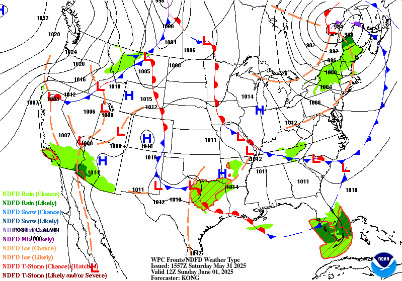
Here’s a look at our overall synoptic setup today. We are generally clear in our area for today, asides for a popup shower or two in the afternoon. The low pressure stationed over northern Texas is bringing in a severe threat for that region, but the system is simply too far to our west to see any impact from it today. Tomorrow is when we could see some rain from that system, once that warm front slides east – but nothing severe is expected.
Today’s Local Forecast
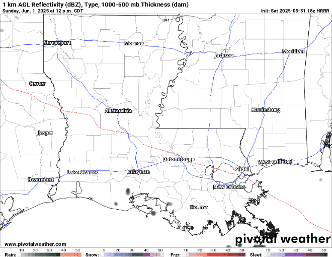
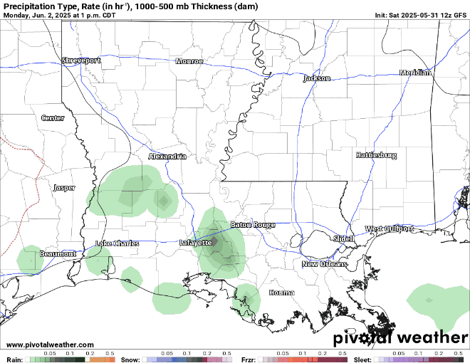
Here’s an hour by hour look at your rain forecast for today. Some patchy rain and thunderstorms are expected to come through the region after 12:00 PM, and will stay scattered through the end of the day into the night. The Storm Prediction Center (SPC) does not have a severe thunderstorm risk set up for our area, so just some typical summertime downpours are expected during this time tomorrow. There simply is not enough instability or moisture to make these storms severe in nature. Not everyone will see rain, just those unlucky enough, or lucky if you enjoy it!

Here’s an hourly look at the forecast for today for the region.
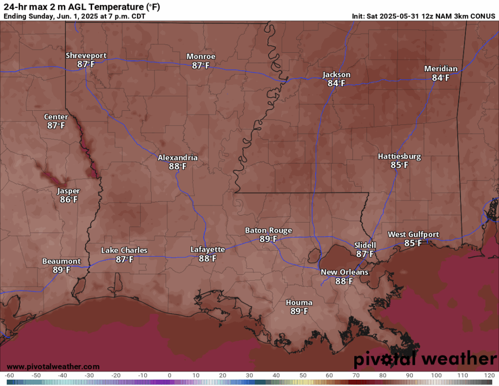
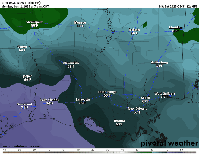
Temperatures today are creeping up close to the 90’s. Mid to high 80’s are the forecasted high temperatures today. Dew points are in the 50’s and low 60’s today, making it not too muggy out there. Enjoy it while you can today! Remember, these very warm temperatures make it easy for any available moisture to form a quick heavy thundershower – so stay alert.
This Week’s Forecast
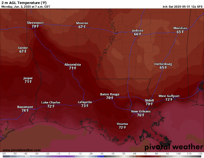
Once you get into the work week, you can expect those temperatures to go into the 90’s again! The nighttime lows will be in the 60’s and 70’s this week, depending on your location. Enjoy those warm nights!
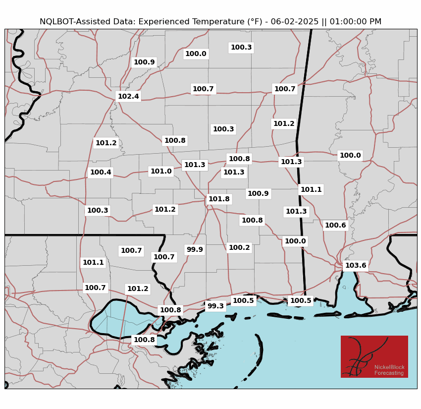
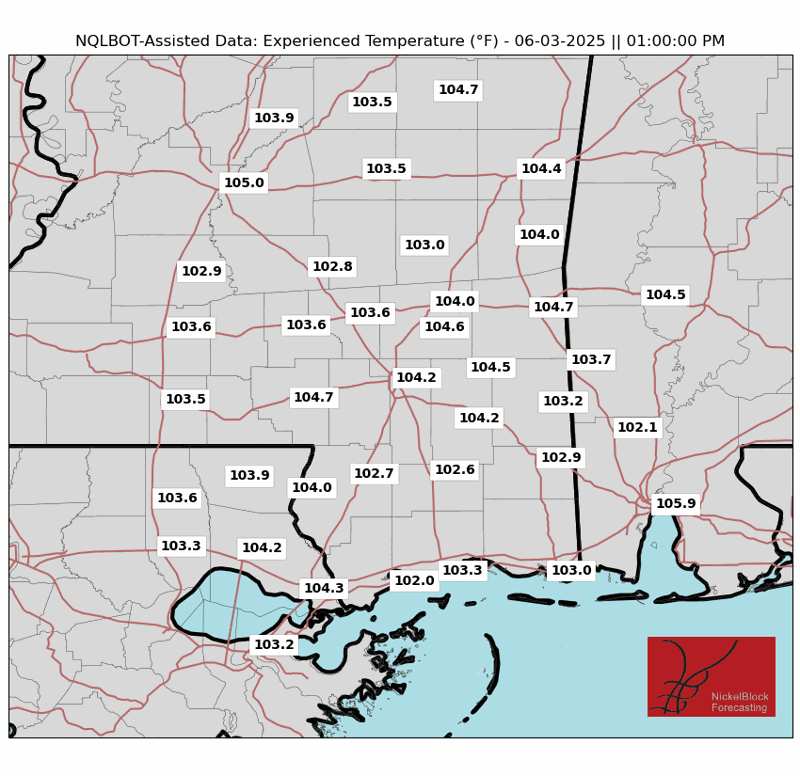
Dew points are also expected to go back into the high 60’s and 70’s for the rest of the week, so it will definitely be difficult to stay outside for extended periods of time. Make sure you stay hydrated this week! Those in Louisiana will experience the intense humidity each day during the week. However, those in Mississippi will have some days with not as unbearable humidity, and other days with worse humidity. For those in Mississippi, Monday and Tuesday look to be the best days to go outside! Those “experienced temperatures”, essentially the heat index, will be into the 100’s this week! Monday’s and Tuesday’s experienced temperatures are similar to those for the rest of the week. It will be a steamy one, for sure!
Although we are are underneath a ridge this week, a small amount of rain is possible for Wednesday in the afternoon and evening. There is lots of moisture transport coming from the Gulf, and it is feeding into a cold front just to our north. This will bring us the chance for some summer-like afternoon thunderstorms on Wednesday. Again, this will not be a washout event, so I wouldn’t necessarily cancel your outdoor plans – just be sure to keep your eye on the radar.
Extended Local Outlook

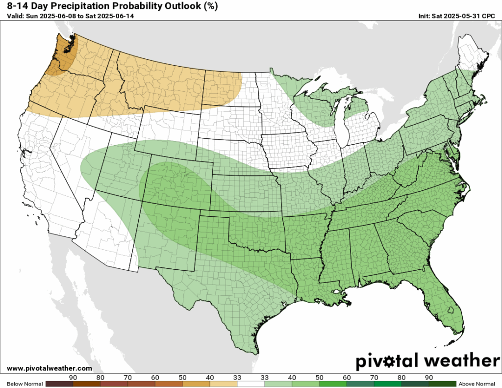
Looking further ahead into the second week of June, we are looking to be in a slightly more active pattern. The Climate Prediction Center shows increased probabilities for above average precipitation for the next 8-14 days, mainly due to increased troughing mixed with lot’s of tropical moisture transport during this time.
Tropics Are Brewing!
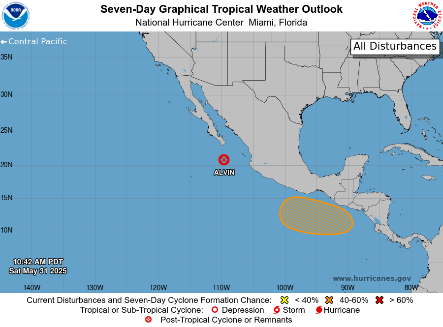
At this time, Tropical Storm Alvin as been downgraded to a Post-Tropical Storm and is expected to weaken significantly before it’s moisture moves into Cabo San Lucas. Alvin has entered a harsh environment – full of wind shear and cool water temperatures. This essentially is pulling Alvin apart. Behind Alvin, there is an area to watch, with a 40% chance of formation in the next 7 days. Tune into our Tropical Forecasts for more information!
REGIONAL DAY TO DAY FORECAST
Today: Chance of afternoon thunderstorms. Highs in the higher 80s. Calm winds becoming west around 5 mph. Chance of rain 20 percent.
Tonight: Mostly cloudy, then clearing overnight. Lows in the mid 60s. Calm winds.
Monday: Sunny. Highs in the lower 90s. Calm winds becoming east around 5 mph.
Monday Night: Mostly clear. Lows in the mid 60s. Calm winds.
Tuesday: Sunny. Highs in the lower 90s. Calm winds becoming southeast around 5 to 10 mph.
Tuesday Night: Mostly clear. Lows in the lower 70s. South southeast winds around 5 mph becoming calm.
Wednesday: Chance of afternoon thunderstorms, otherwise sunny. Highs in the lower 90s. Southeast winds around 5 to 10 mph.
Wednesday Night: Partly cloudy. Lows in the low 70s. South southeast winds around 5 mph becoming calm.
Thursday: Mostly sunny, chance of afternoon thunderstorms. Highs in the upper 80/lower 90s. Chance of rain 50 percent.
Thursday Night: Partly cloudy. Slight chance of showers and thunderstorms. Lows in the lower 70s. Chance of rain 20 percent.
Friday: Mostly sunny. Chance of showers and thunderstorms. Highs in the lower 90s. Chance of rain 50 percent.
Friday Night: Partly cloudy. Slight chance of showers and thunderstorms. Lows in the lower 70s. Chance of rain 30 percent.
Saturday: Partly sunny. Showers and thunderstorms likely. Highs in the low 90s. Chance of rain 60 percent.
Saturday Night: Scattered showers and thunderstorms. Highs in the low 70s. Calm winds. Chance of rain 40 percent.
Next Sunday: Scattered showers and thunderstorms. Highs in the low 90s. South southwest winds 5 to 10 mph. Chance of rain 40 percent.
Next Sunday Night: Scattered showers and thunderstorms before midnight, then clear. Lows in the low 70s. Calm winds. Chance of rain 40 percent.
Next Monday: A mix of sun and clouds. Highs in the lower 90s. Southwest winds 5 to 10 mph.
Next Monday Night: Partly cloudy. Chance of a shower or thunderstorm. Lows in the low 70s. Calm winds. Chance of rain 30 percent.
Next Tuesday: Mostly cloudy with thunderstorms. Highs in the lower 90s. South winds around 5 to 10 mph. Chance of rain 40 percent.


