The world is in a dead zone as we await the New Year, but we’re stuck with work and other menial tasks to hold us out until then. We await 2026, but for now, some of us may catch up on tv shows or movies, clean the house, or just relax as there’s no direction until then. But anyways, here’s your forecast!

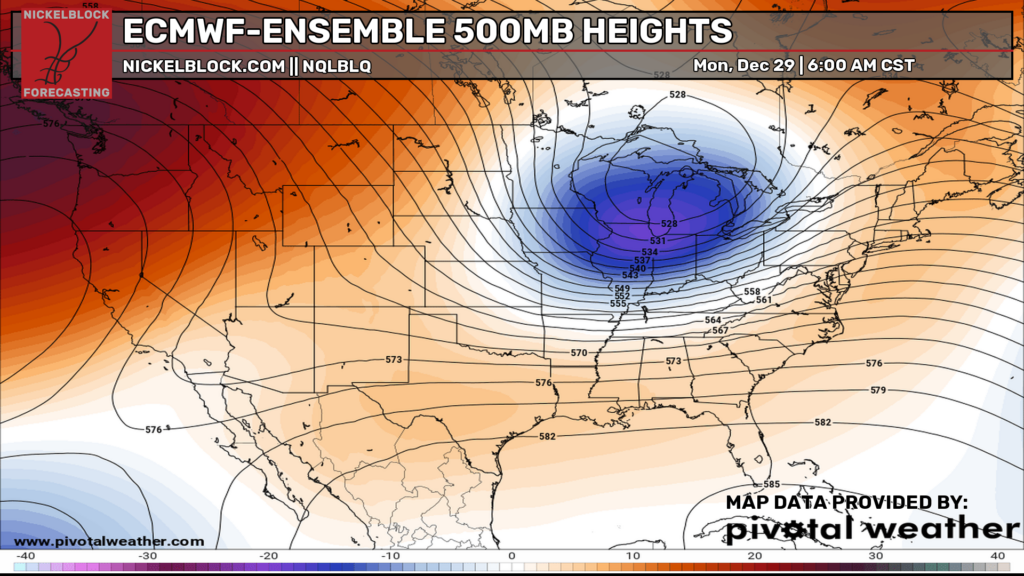
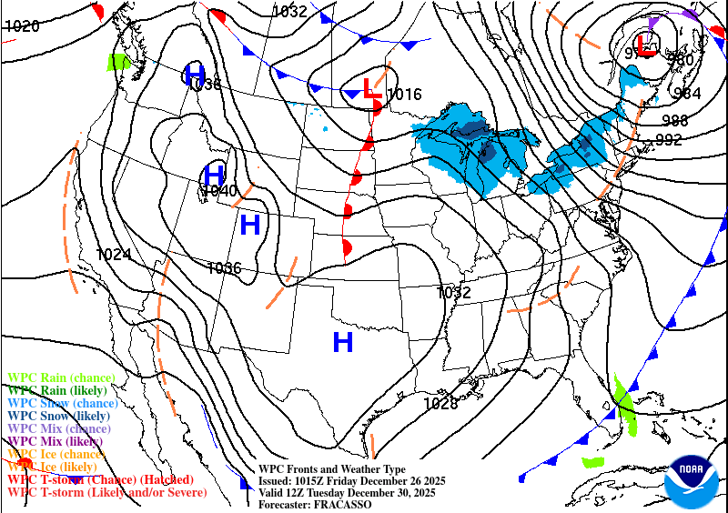
We’re currently on the outward trend of a large high pressure system over the southeast and large ridge in the upper levels. Looking at the graphic above, a large shortwave trough is going to move in over the weekend and disrupt the ridge’s pattern. Afterwards, that shortwave trough will help drive in a long wave trough bringing northwesterly air from Canada to the Southeast. This will eventually fade as another ridge moves in and a large trough moves in by next Monday.
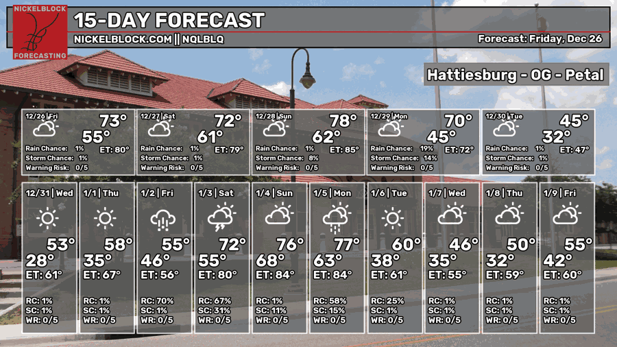
This Weekend
Conditions will still overall be warm this weekend as the high pressure dome remains over us. A front in the Great Lakes region will squeeze the pressure a bit allowing for higher overall winds today moving from the southwest. Tomorrow will be a similar story with winds still moving in from the southwest and cloudy skies. Highs will be in the mid to upper 70s and lows in the upper 50s. As the low pressure system approaches on Sunday, we can expect winds to ramp up a bit more and temperatures in the upper 70s. The rain won’t arrive until late Sunday night.
Next Week
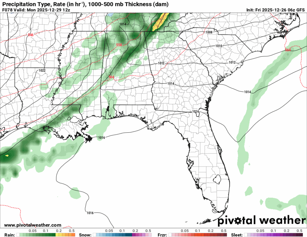
Starting off the week, the front I mentioned earlier will be moving in early Monday morning bringing a brief chance for rain until mid-morning. We won’t get too much of it, but enough to keep things damp in the morning to afternoon. If you’re heading back to work, bring your umbrella just in case. Highs will taper off by the early afternoon as the cold front breezes in and drops temperatures pretty quickly. It’ll drop from the 60s to the 40s over a few hours as the wind from the north rolls in.
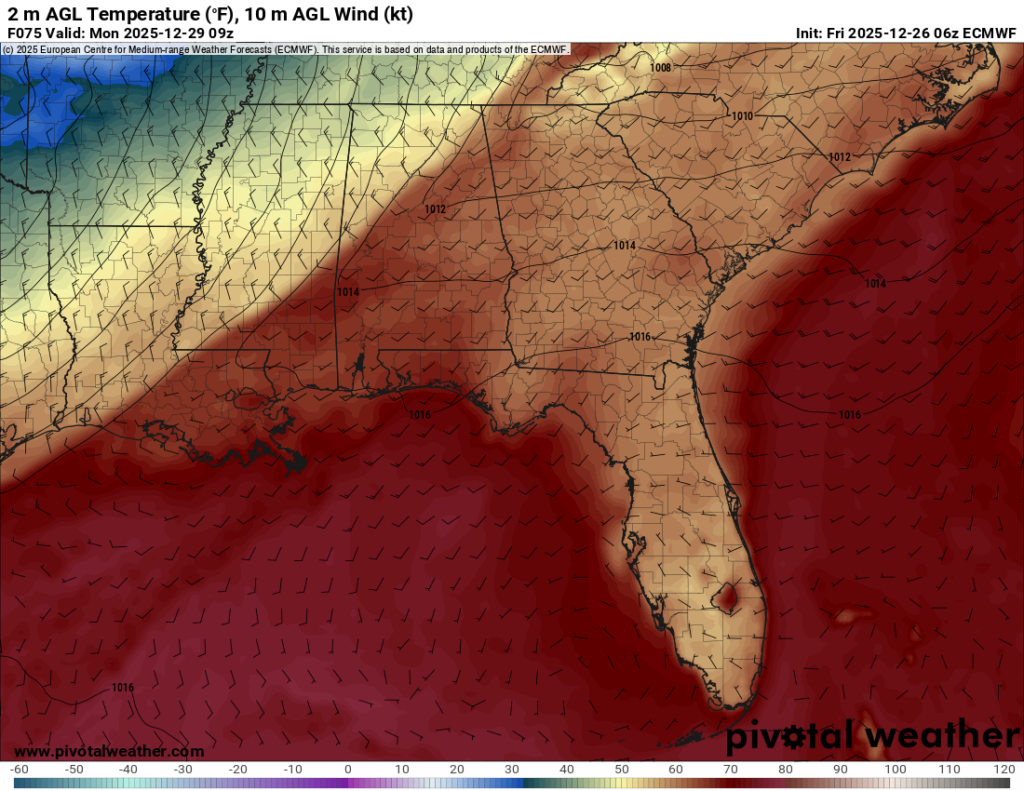
We can expect temperatures to drop below freezing Monday and Tuesday night, so be sure to cover your pipes and bring your pets in. Overall highs will fall to the mid to upper 40s across the area. By Wednesday, the clouds will clear out and we’ll have a more average winter day with highs in the low 50s and a low in the low 30s. If you’re out somewhere to ring in the New Year, be sure to bring a jacket and possibly a beanie.
New Years Day and Friday will be a return of the warmer temperatures as the high pressure system moves east, bringing more southerly winds again. Temperatures will reach the low 60s on Thursday and upper 60s by Friday with lows in the low to mid 40s. We can also expect rain on Friday as a weak front moves in bringing rain from the southwest. So far, this looks to be a mundane rain event but will happen during the mid-morning to mid-afternoon, so bring your raincoat if you’re out and about.
I hope you all had a Merry Christmas and I’ll be looking forward to the New Year!