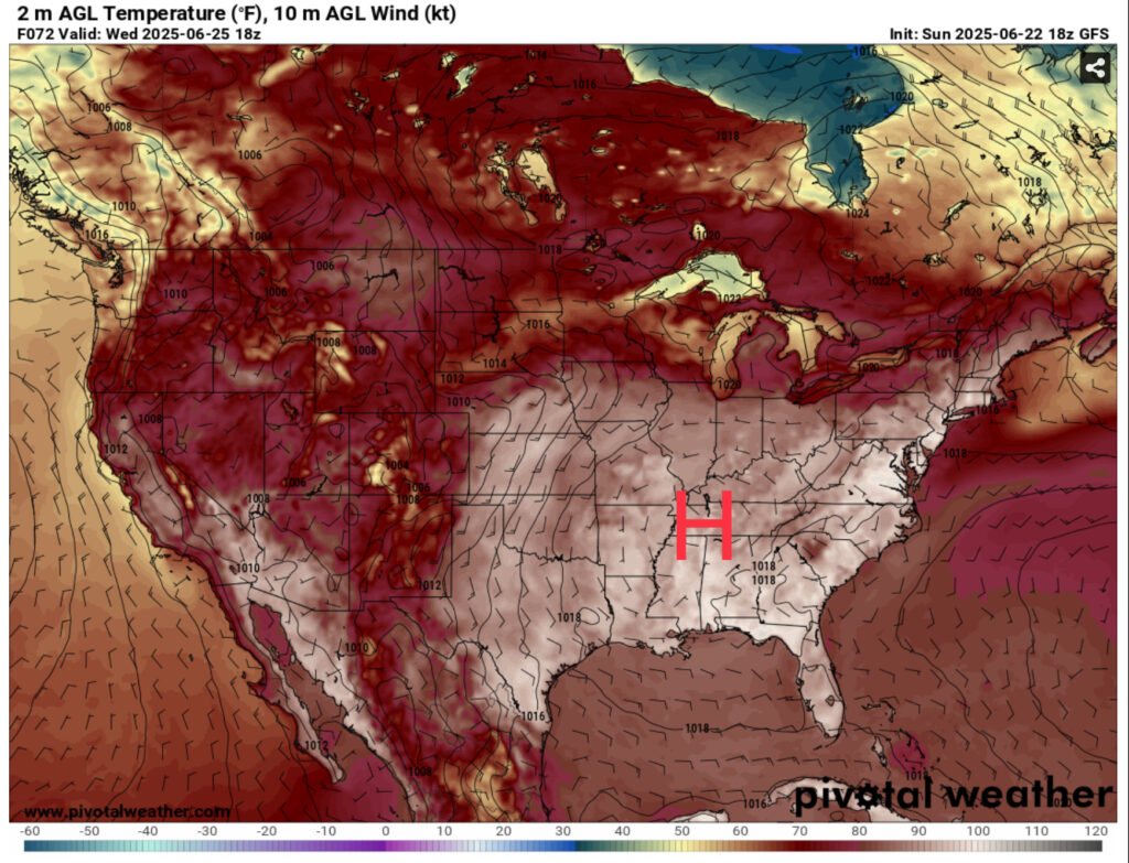
The longest day of the year has passed, and that means we’re going to get some long, hot days. The only cool off will be those afternoon thunderstorms we all know and love in the summer. Since there isn’t much to move the heat dome out of the way, we’ll be stuck with it for a while.
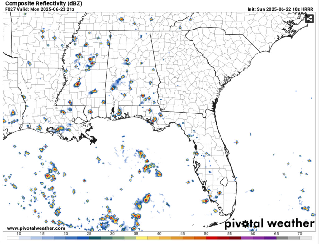
The beginning of our week will start off hot with temperatures in the mid 90s and heat indices in the upper 90s to around 100. Afternoon thunderstorms will move in from the southeast near the middle of the afternoon before dissipating by sunset. Due to the leftover rain, we may also have some patchy fog possible in the early morning hours.
Near the middle of the week, the high pressure system will center over the eastern US which will limit convective development in the afternoon. Rain chances will take a dip for a bit while the temperatures and heat indices ramp up. I won’t be surprised if the NWS issues a heat advisory by the middle of the week as the heat index will reach the low to mid 100s in most of the Southeast. While the UKMET model suggests more normal afternoon thunderstorms, the ECMWF model is implying that an MCS from a system moving into the Gulf may affect the coast by the end of the week.
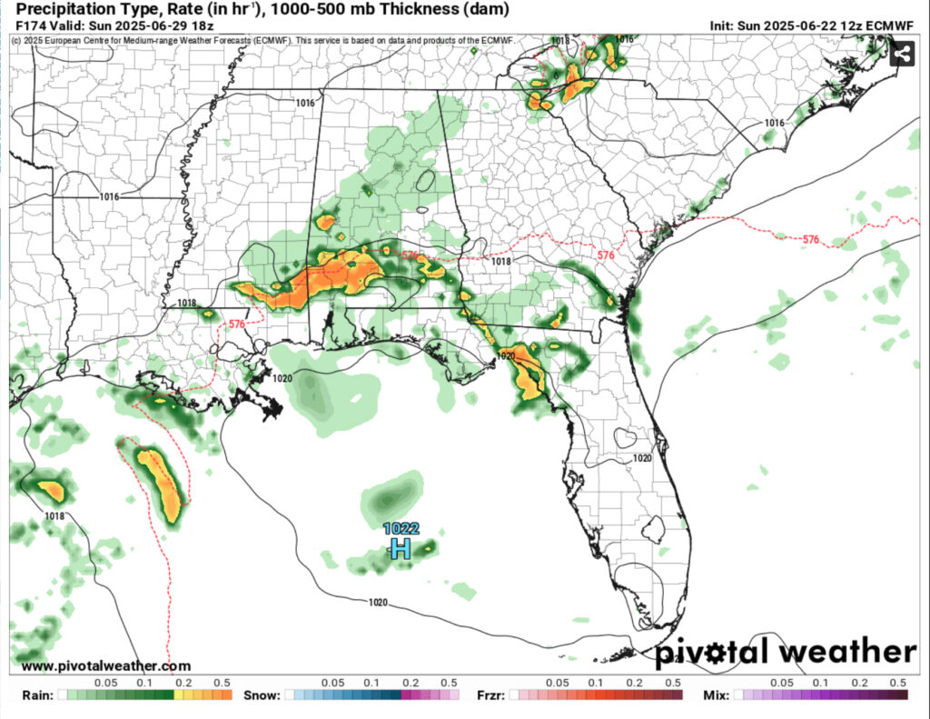
The weekend looks to be a bit more widespread in terms of rain chances due to that shortwave I mentioned. A few MCS’s are possible throughout Saturday and Sunday afternoon. Despite that, we’ll still have some hot days ahead with temperatures in the mid 90s and heat indices in the 100s.
Please be careful being out in the heat and be sure to cool down however you can. Whether it’s the shade, air conditioning, or the pool, be sure to cool off and drink plenty of water and electrolytes.
Tonight – A 20 percent chance of showers and thunderstorms before sunset. Patchy fog after 1am. Otherwise, mostly clear, with a low in the low 70s. Calm wind.
Monday – A 40 percent chance of showers and thunderstorms in the afternoon. Sunny, with a high in the low to mid 90s. Heat index values as high as 101. Calm wind becoming east around 5 mph in the afternoon.
Monday Night – Patchy fog after 2am. Otherwise, mostly clear, with a low in the low 70s. Calm wind.
Tuesday – A 30 percent chance of showers and thunderstorms in the afternoon. Sunny, with a high in the mid 90s. Heat index values as high as 100. Calm wind becoming east around 5 mph in the afternoon.
Tuesday Night – Mostly clear, with a low in the low to mid 70s. Calm wind.
Wednesday – A 20 percent chance of showers and thunderstorms in the afternoon. Sunny and hot, with a high in the upper 90s. Calm wind becoming east northeast around 5 mph.
Wednesday Night – A 20 percent chance of showers and thunderstorms before midnight. Partly cloudy, with a low in the low 70s. Calm wind.
Thursday – A 30 percent chance of showers and thunderstorms in the afternoon. Mostly sunny, with a high in the mid 90s. Calm wind becoming north northeast around 5 mph.
Thursday Night – A 20 percent chance of showers and thunderstorms before midnight. Partly cloudy, with a low in the low to mid 70s. Calm wind.
Friday – A 50 percent chance of showers and thunderstorms in the afternoon. Mostly sunny, with a high in the low to mid 90s.
Friday Night – A 20 percent chance of showers and thunderstorms. Partly cloudy, with a low in the low to mid 70s.
Saturday – Showers and thunderstorms likely. Mostly sunny, with a high in the low 90s. Chance of precipitation is 70%.
Saturday Night – A 20 percent chance of showers and thunderstorms. Partly cloudy, with a low in the low 70s.
Sunday – Showers and thunderstorms likely. Mostly sunny, with a high in the low 90s. Chance of precipitation is 70%.


