General Central/Eastern Kansas Forecast
Short-Term (Thursday-Friday)
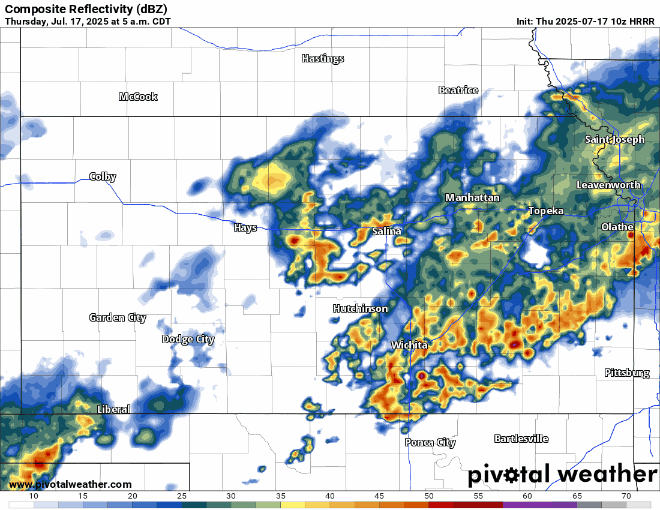
A cold front will continue to work its way through the state this morning and will eventually completely move through by around 10am. Scattered showers and thunderstorms will still be in progress leading and along the front across southern and southeast Kansas during the morning hours, and along with this, further showers and thunderstorms look to develop behind the front further north across central Kansas (at around 2-3am) as a mid-level disturbance moves through and spurs this activity. These storms will move east across the state through the morning before weakening by the early afternoon hours (around 12-1pm). Locally heavy to very heavy rainfall may accompany this activity, with peak rainfall rates reaching to 1.5 or even 2 inches per hour. If this is to be realized and thunderstorms hit the same area multiple times through the morning, then flash flooding will be a concern in low-lying areas. As this activity tapers off in the afternoon, any showers that are able to maintain themselves or do develop again in the afternoon and evening will be more isolated in nature.
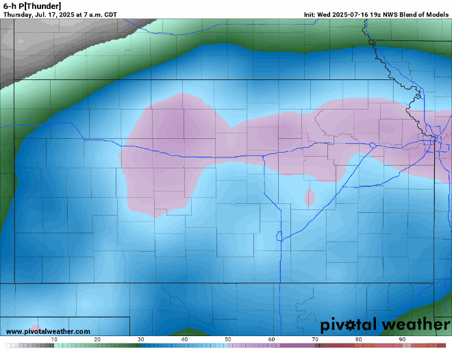
By tomorrow, the cold front will lift back north through our area again and southerly flow will return. This will continue to funnel moisture northwards, as well as supply warm air advection (dragging warm air up from the south) to raise our temperatures again. A weak disturbance does move through in the morning hours on Friday across central and northern Kansas, which may help provide a focus for convective development, but otherwise, rain chances will be more scattered in nature like it has been over the previous couple of weeks.

Enjoy the relief from the heat today, because one day is all it looks to last. Temperatures today will range from the upper 70s to mid 80s through the afternoon, with light and variable winds. By the overnight hours, temperatures will be very mild, staying in the mid 70s throughout much of central/eastern Kansas. By tomorrow, high pressure will start to steadily build over us and restart our warming trend. Temperatures tomorrow afternoon will be back in the low to mid 90s, with southerly winds of 5 to 10 mph. The humidity will again be a problem as well, with relative humidity ranging between 50-70%, which will contribute to our heat indices reaching the upper 90s to low 100s.
Long-Term (Saturday-Wednesday)
Precipitation chances will become less likely through the weekend and into next week as high pressure over the southeast US continues to encroach and expand over the state. Daily temperatures will consistently make runs into the upper 90s to low 100s through the middle of next week with no relief in sight. Heat indices by next week may start to approach advisory criteria, as current forecasted heat index temperatures will regularly be in the upper 90s to mid 100s (advisory criteria for this area is around 105 degrees).
Climate Outlook
Beginning next week will start the trend of high pressure building over us that will bring our dry and hot conditions that we are accustomed to for July and August. Slightly warmer than normal temperatures and slightly drier than normal conditions will be favored over the next 4 weeks or so with this pattern. Due to the strength of this high-pressure system, it will be hard for any large-scale systems to break it down/displace it enough to allow for widespread rain chances, so any rain chances that do materialize will be mostly isolated and short-lived in nature.
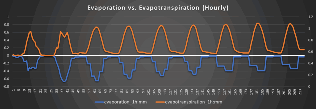
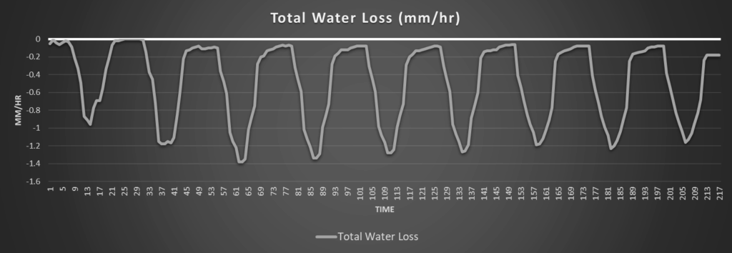
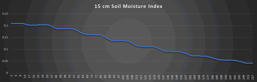
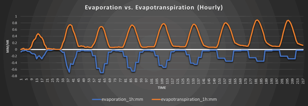
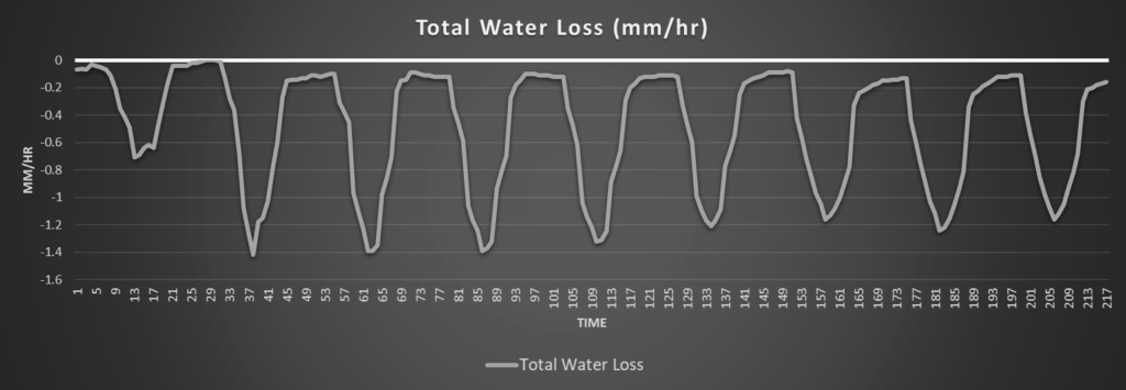
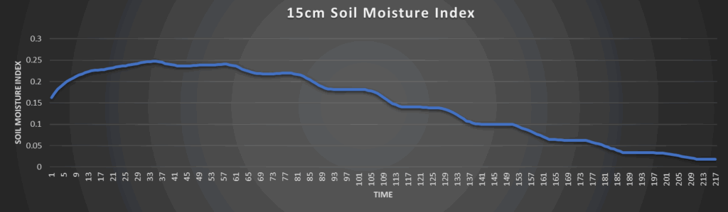
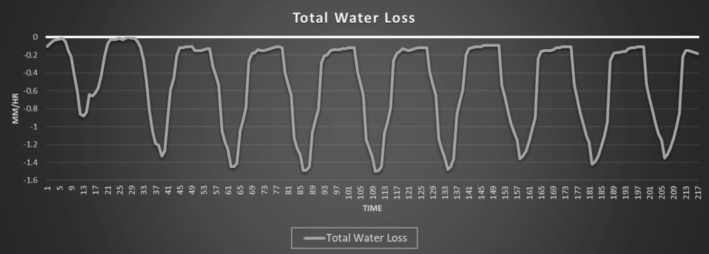
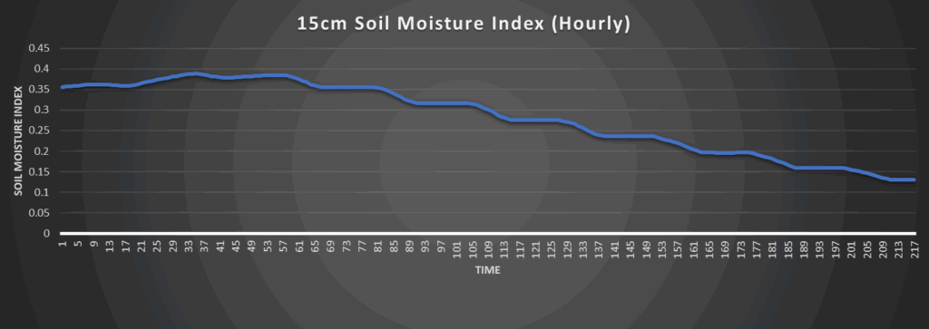
Regional Soil Moisture Outlook
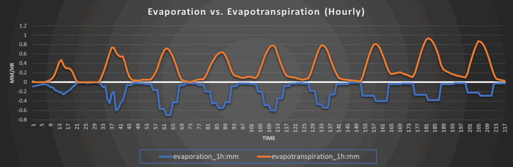
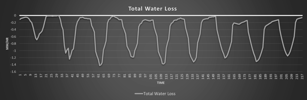
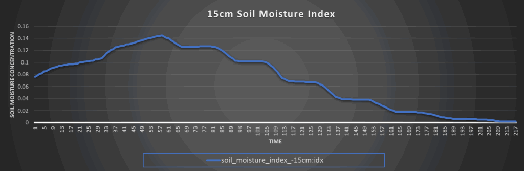
Some soil moisture recovery will take place over the next couple of days with the passing showers and thunderstorms, but this will all be just short-term relief before the rain shuts down next week. By the weekend, the lack of rain chances and the climbing heat will cause water loss rates to increase substantially to between 1.3 to 1.5 mm/hr daily and really dry out our soils. Abnormally dry conditions may develop next week as a result so trends will have to be monitored, especially once the heat sets in.
Around Westmoreland
Around Scranton
Around Burlington
Around Altoona