An active pattern in the eastern CONUS for the beginning of this week will lead to a drier pattern for the weekend and next week. Severe weather is expected today along a cold front for much of the east, with damaging winds being the main threat. Plus, an early look at the 4th of July forecast is below! Let’s take a look at all of the details:
Today’s Overall Setup
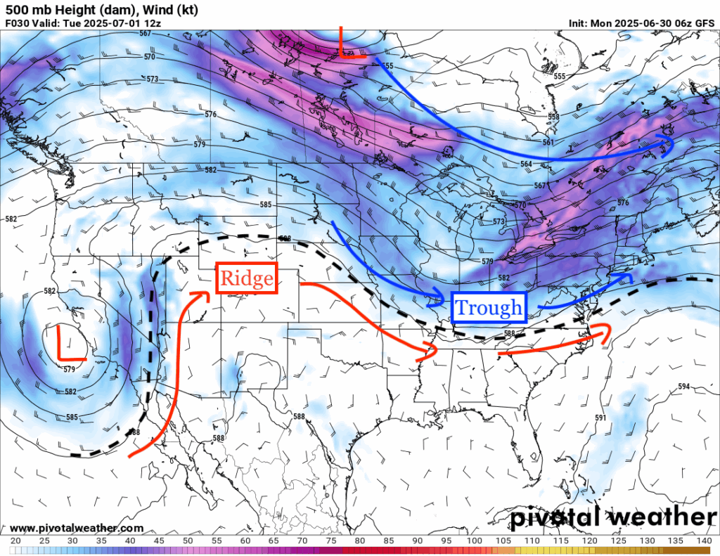

The overall mid-level setup for the CONUS today involves a trough over the east and a ridge over the west. The troughing and low pressure will move into the northeast later this evening and will bring with it a cold front that will bring some severe weather. Much of the eastern CONUS will see some rain today along the cold front, but the main severe weather threat is more focused in the mid-Atlantic and northeast.

Here’s a look at your high temperatures for today. The trough over the midwest can definitely be seen given the dip in temperatures in the 70s and 80s. This cooler airmass also brings with it less humidity, with dew points in the 50s and 60s. Just outside the troughing, though, temperatures are soaring in the 90s for most of the country, and it is very humid!
Today’s Severe Weather Threat


Today’s severe weather threat is focused in the mid-Atlantic and the northeast. There is a Marginal (1/5) risk of severe weather from Mississippi northeastward into southern Maine and a Slight (2/5) risk of severe weather from central Virginia into all of New Jersey. Severe winds are the greatest threat, with a 15 percent risk in the Slight zone, and a 5 percent risk in the Marginal zone. There is less than a 2 percent risk of hail or tornadoes with these storms.
Breaking it down with the high-resolution HRRR modeled composite reflectivity for later today, storms will fire up in the afternoon along the cold front and make its way into the Slight risk zone in the evening into nighttime, organizing themselves pretty well. These storms could contain very gusty winds, with a potential for “water-loaded downdrafts capable of damaging wind producing microbursts”, warns the SPC. Ensure you tie down any outdoor furniture and take the necessary precautions to be indoors during these storms. We will keep you updated with any upgrades to the severe weather outlook from the SPC.
Fourth of July Forecast
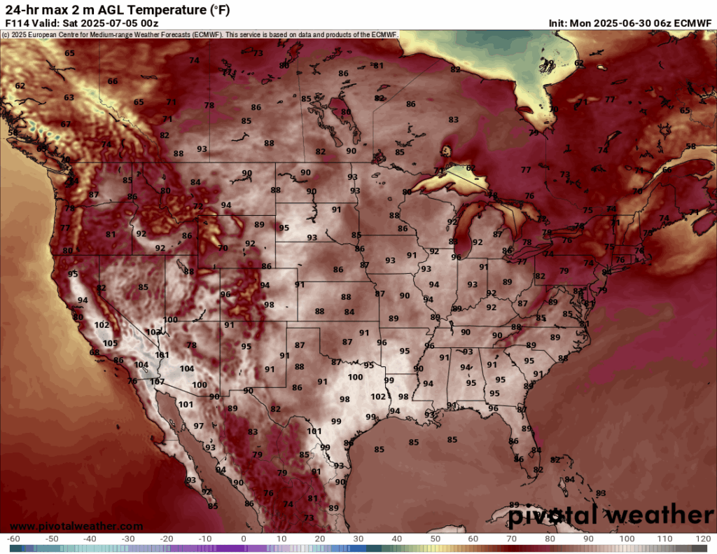
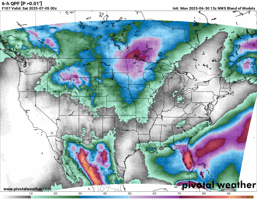
Here’s your exclusive Fourth of July forecast! It will feel quite hot for much of the CONUS, with temps in the high 80s, 90s, and some 100s. More comfortable temperatures will be felt in the northeast, with 70s and 80s in the forecast. Much of the Northeast, Tennessee Valley, and eastern Texas are looking dry and pleasant with little to no rain expected, and skies should stay mostly clear around fireworks time. California and much of the Southwest will also enjoy quiet weather and good visibility. However, parts of the Northern Rockies and central to northern Plains may see showers and more clouds, which could affect evening plans. Florida and nearby Gulf Coast states also have a high chance for scattered rain and overcast skies through the day and evening due to the sub-tropical system in the Gulf.
CONUS Weekly Precipitation Outlook
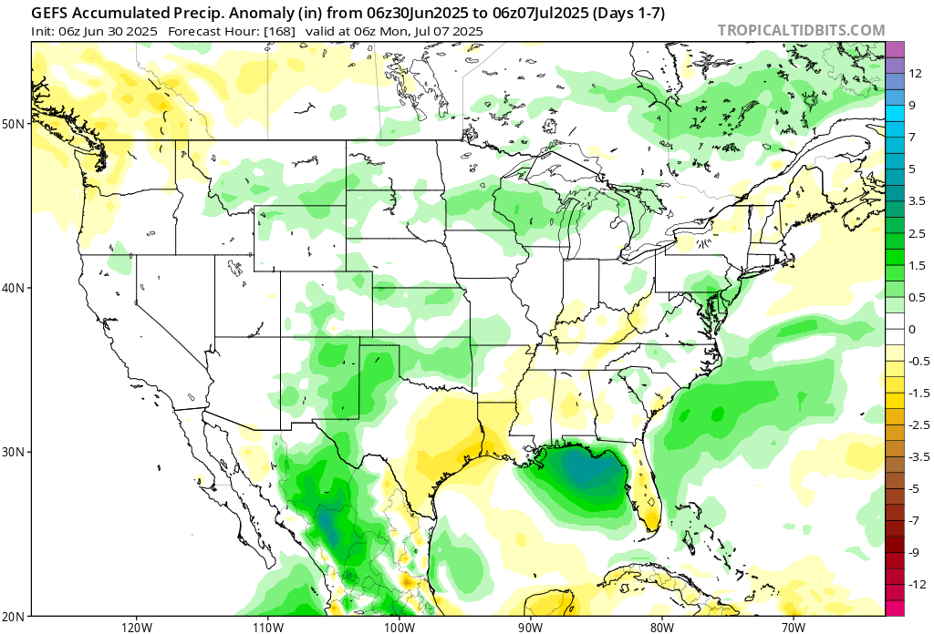
Here’s a look at the GEFS modeled precipitation anomalies through July 7th 06z. Green indicates above average precipitation, white indicates average precipitation, and yellow indicates below average precipitation. Let’s look into the details by region:
Weekly Outlook: Western United States

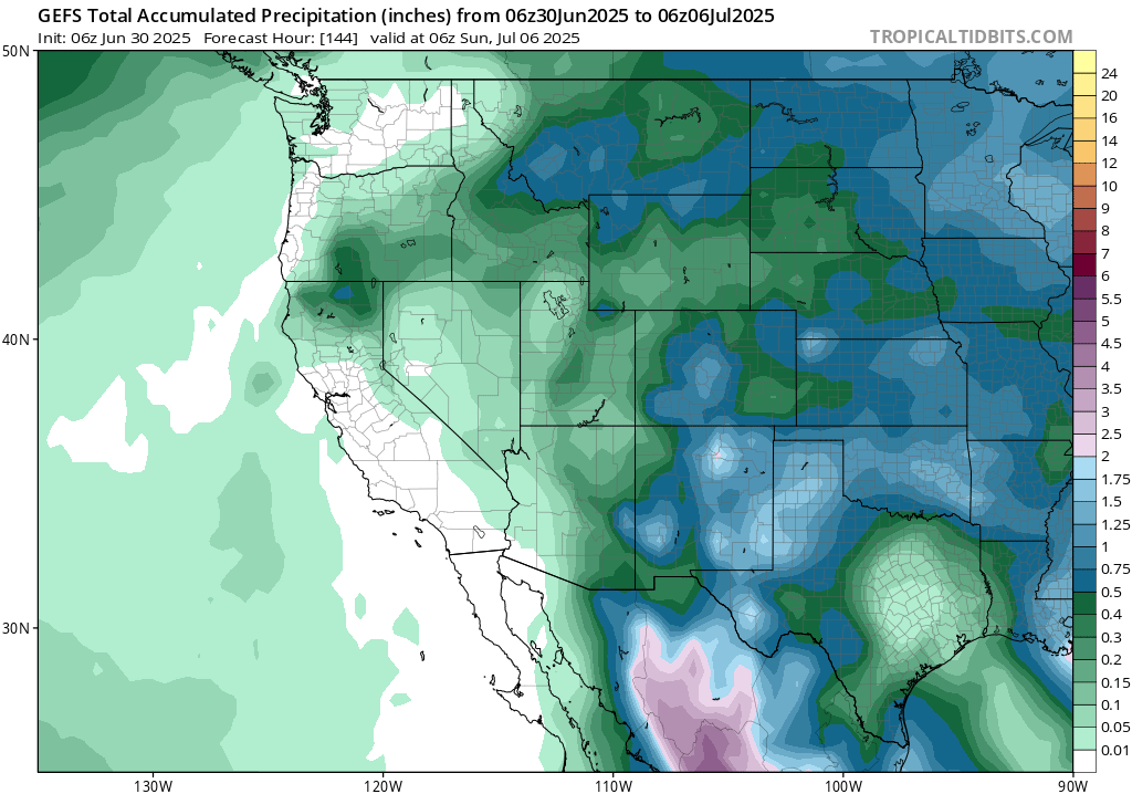
Looking at the weather this week in the western CONUS, temperatures will be much cooler than average in southern California, right around Los Angeles, and rainfall will be very minimal. A shortwave trough will move into the region early this week, bringing cooler temperatures; but it is looking to be a dry one. The northwest will see temperatures above average this week due to ridging that will be taking shape – today and Wednesday will be the day’s with the warmest weather in that region. For western Texas, more rain than average is expected, which brings with it cooler than average temperatures
Weekly Outlook: Central United States


A series of shortwaves will track over the northern and southern plains this week, brining anywhere from 1-3 inches, with locally higher amounts possible.
Weekly Outlook: Eastern United States

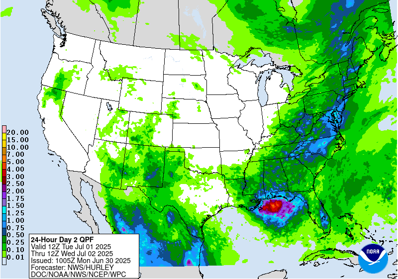
The mid-Atlantic will be seeing rain today, Wednesday, and Thursday, which is bringing a Slight (at least 15 percent) chance of excessive rainfall and flash flooding to the area. The most rain will fall today, during the severe threat, so remember – turn around, down drown!
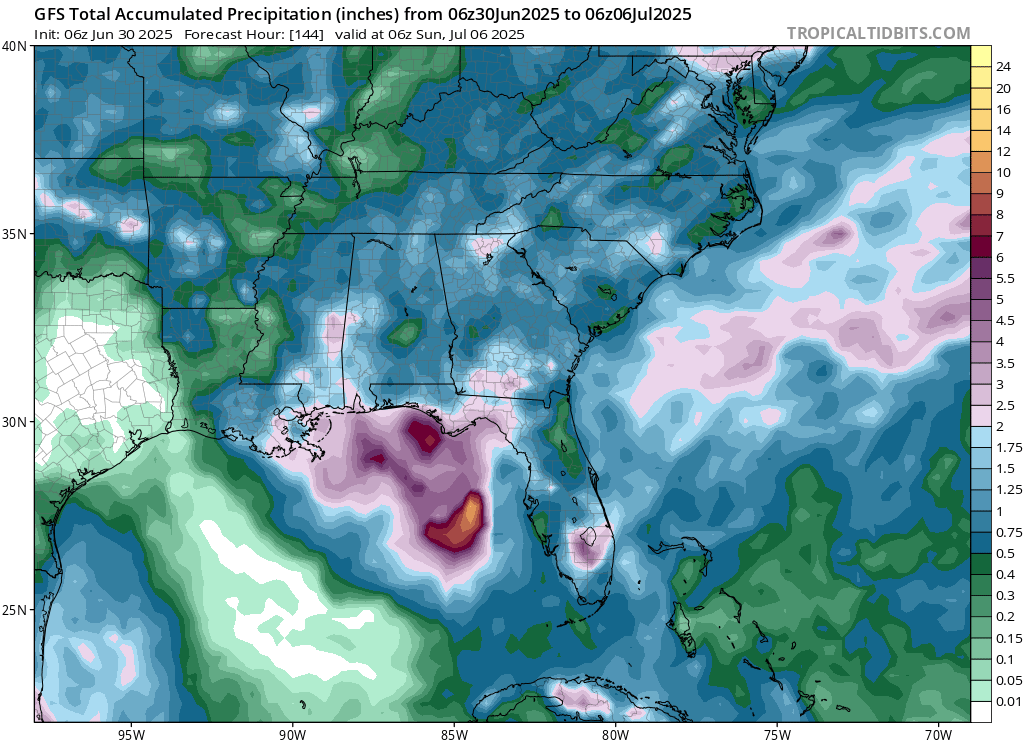
Our tropical disturbance in the northeastern gulf is brining loads of rain to the southeast. Thankfully, the most intense rainfall amounts will be off the coast, but some areas on the coastline could see a good amount of rainfall and a flood threat. Exactly where the low pressure sits will determine where the heaviest rainfall sets up.
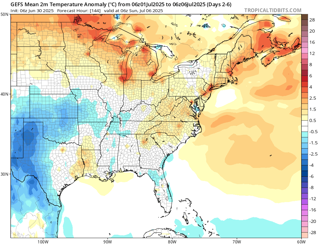
After the trough moves off the Atlantic and is replaced by the ridge currently over the Southwest, temperatures across the eastern CONUS – especially in the north-central, Midwest, Northeast, and Mid-Atlantic regions – will trend warmer than average. Temperatures will be cooler than average in Florida, with the invest low pressure that is parked over the northeastern gulf this week.
Travel Outlook
If you’re traveling along the East Coast or inland today, keep an eye on the weather from this afternoon into the evening. Scattered strong to severe storms are expected, especially in the Mid-Atlantic.
Main interstates impacted include:
- I-95 from Virginia through New Jersey
- I-81 across Virginia and central Pennsylvania
- I-70 through Maryland and into Pennsylvania
- I-55 and I-65 from Mississippi into Tennessee
As mentioned above, storm threats include gusty winds and very heavy rain. Plan for slower travel and possible delays during the afternoon and evening hours.
Extended Outlook
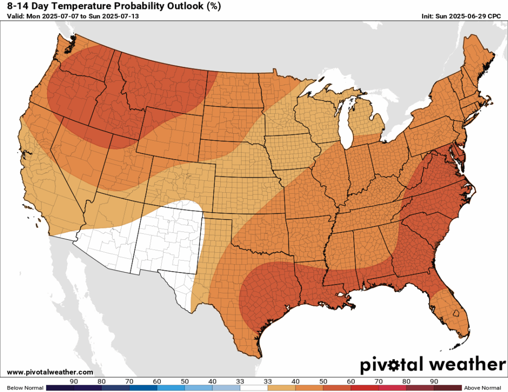
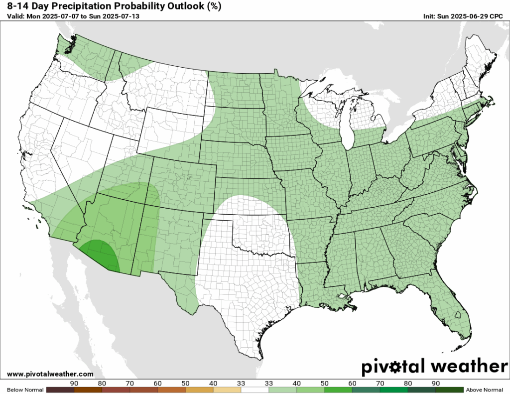
Looking into next week, temperatures are trending above average for ALL of the CONUS. Rainfall is looking slightly above average, but there’s not much confidence about that.
Thanks for tuning in to this National Forecast! Tune in to our local, tropical, and regional forecasts to stay updated on the latest!


