Hey everyone! I’m here with your forecast for tonight through the end of the week, and I’ll give you a brief look at what we could be looking at this weekend regarding potentially damaging freezing rain for some folks and maybe just some cold rain for others. Let’s take a look!
Overall Setup
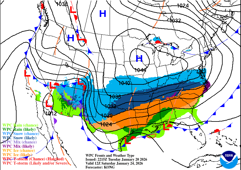
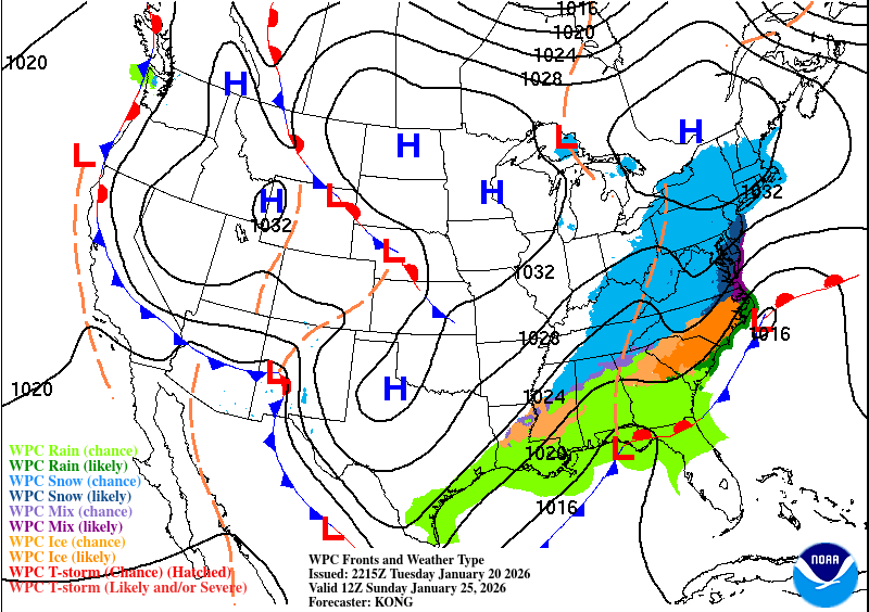
Where is this system coming from? It will be a combination of a few different pieces. There will be a large Arctic high-pressure system positioned over the Upper Midwest that will funnel very cold air into the Midwest and parts of the South and Southeast. An upper-level low will also come ashore from the Gulf, bringing in a lot of Gulf moisture, which will clash with the cold air and produce heavy snow across Oklahoma, northern Texas, Arkansas, Tennessee, and eventually the Northeast.
South of the snow threat, temperatures at the mid-levels of the atmosphere will be above freezing, leading to sleet in some areas. Farther south, locations with surface temperatures at or below freezing beneath this warm layer will see freezing rain, with the potential for historic ice accumulations. Below that, some areas will see plain rain.
It’s a tricky forecast, especially because a few miles could mean the difference between an inch of ice and just plain rain. Stay with us through the week as the forecast becomes more fine-tuned. More details will be down below!

Tonight’s Forecast
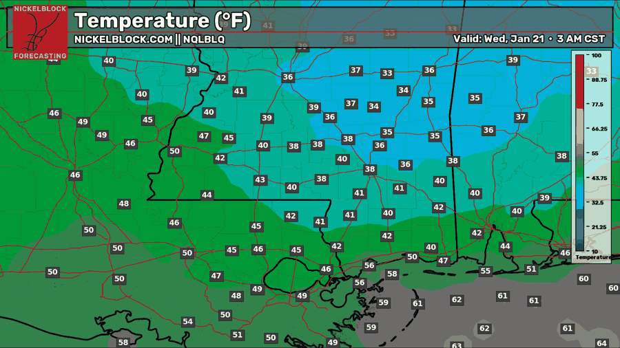
Tonight, we’ll see a wide range of low temperatures across the region. For those closer to Hattiesburg and Jackson, expect a high somewhere in the upper 30s. The further south and west you go, the closer you get to the 40s, then the lower 50s. The reason being? Southerly flow and moisture will begin to move into our region tonight, coming in from the southwest.
Tomorrow’s Forecast: Wednesday, January 21
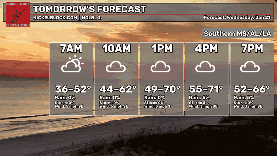
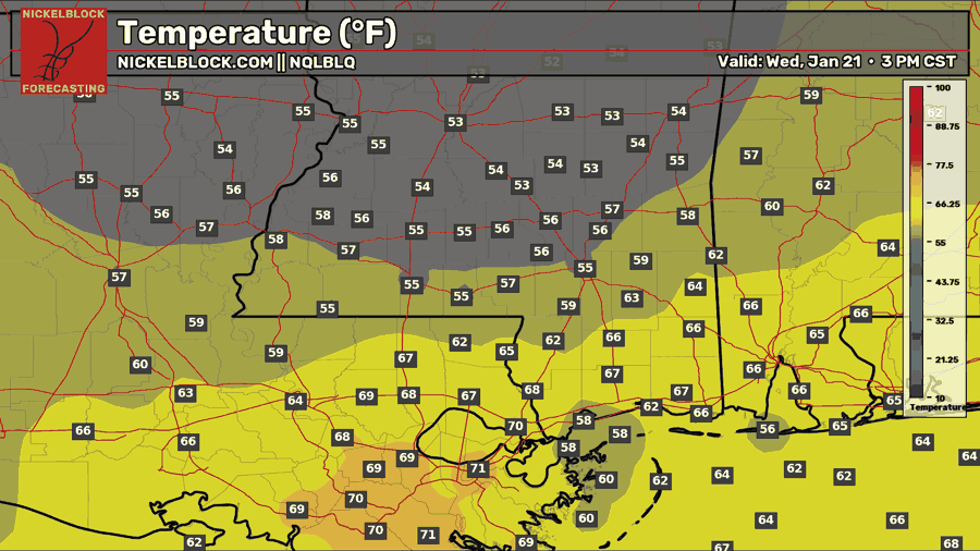
For your Wednesday, things are looking cloudy and a bit rainy as we will have some scattered showers in the area out ahead of a cold front, the same cold front that will supply the cold air for This Weekend’s mess. This isn’t a rainout for everyone, but more likely for those north of Hattiesburg in the afternoon and evening hours. Because of the rain, highs will also be variable, ranging from the upper 50s to the lower 70s.
Thursday’s Forecast: January 22
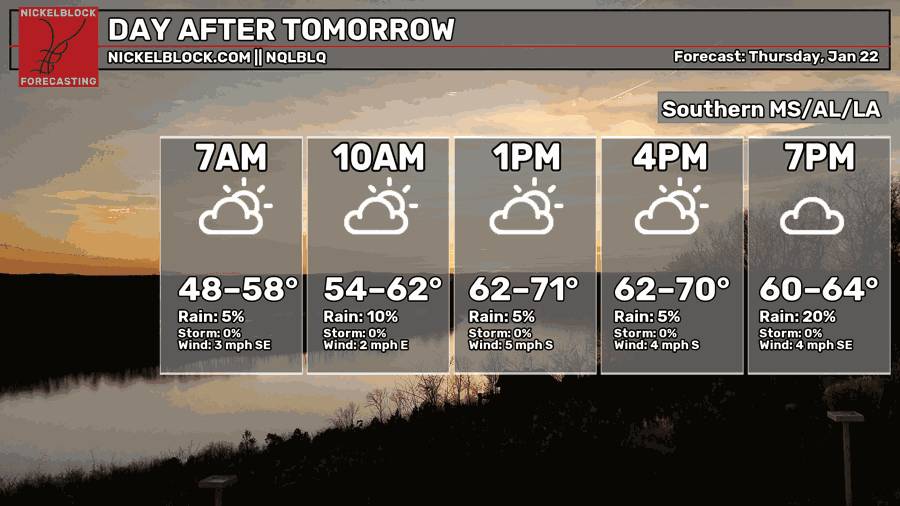
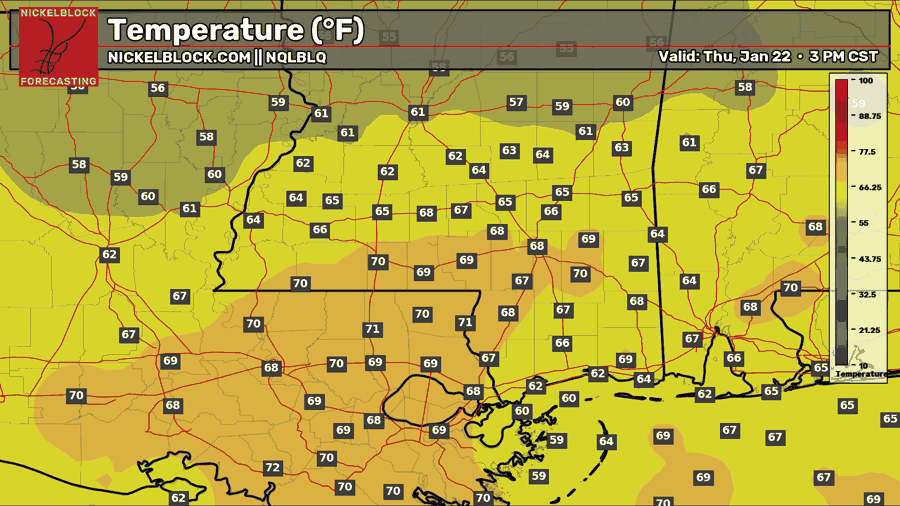
A similar temperature is expected for Thursday, maybe a bit warmer than Wednesday, since southerly flow will be maximized and we will still be ahead of the cold front at that point. Scattered showers will continue on Thursday, and it will likely stay mostly cloudy all day.
Weekend Wintry Mess?
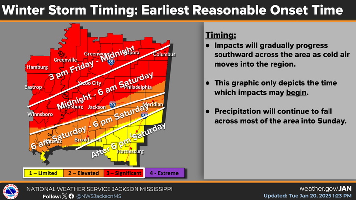
The NWS in Jackson has created this image showing the earliest reasonable onset time of wintry precip this weekend. While these start times are not 100 percent accurate, since models are still disagreeing on the timing and coverage of the different precipitation types, it should give you a good idea of when impacts could start at your location.
Again, models are currently in disagreement, but the overall message is that someone in the mid-to-deep South will see major impacts from ice accretion from freezing rain.
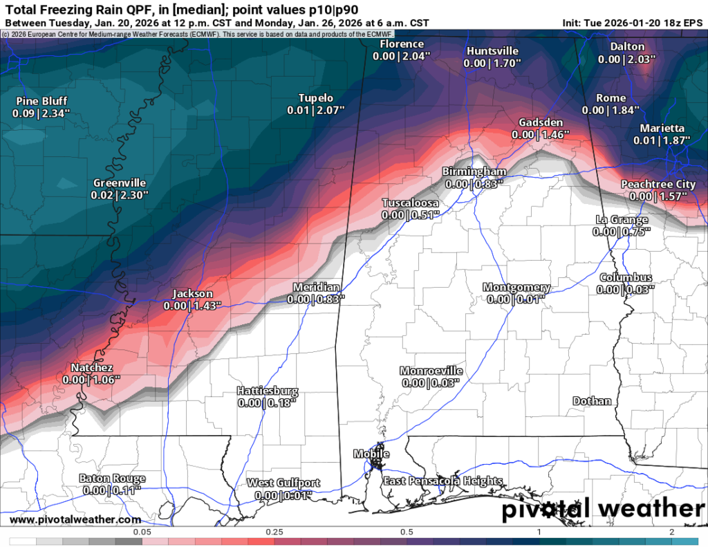
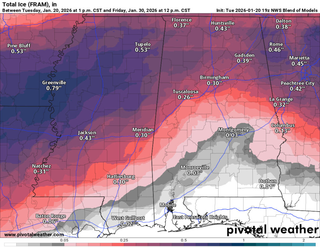
As Nick has mentioned many, many, many times before, it’s important to look at ensemble data, rather than a specific model run, to understand potential impacts from winter weather or any weather event at that. The first image above shows the Euro Ensembles’ total freezing rain forecast for this weekend, along with the low-end and high-end amounts in inches. As you can see, as well as in the second image which shows the national blend of models, there will be a gradient somewhere through Mississipi of some areas seeing hours of freezing rain, leading to significant ice buildup on the roadways, powerlines, and all surfaces, versus others who see just cold rain, and maybe a quick glaze towards the end of the storm.
It’s a complicated setup, and the line could shift in the models at anytime before the storm. That’s why it’s so important to prepare now and take the necessary precautions to stay safe this weekend.
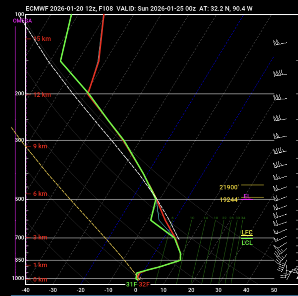
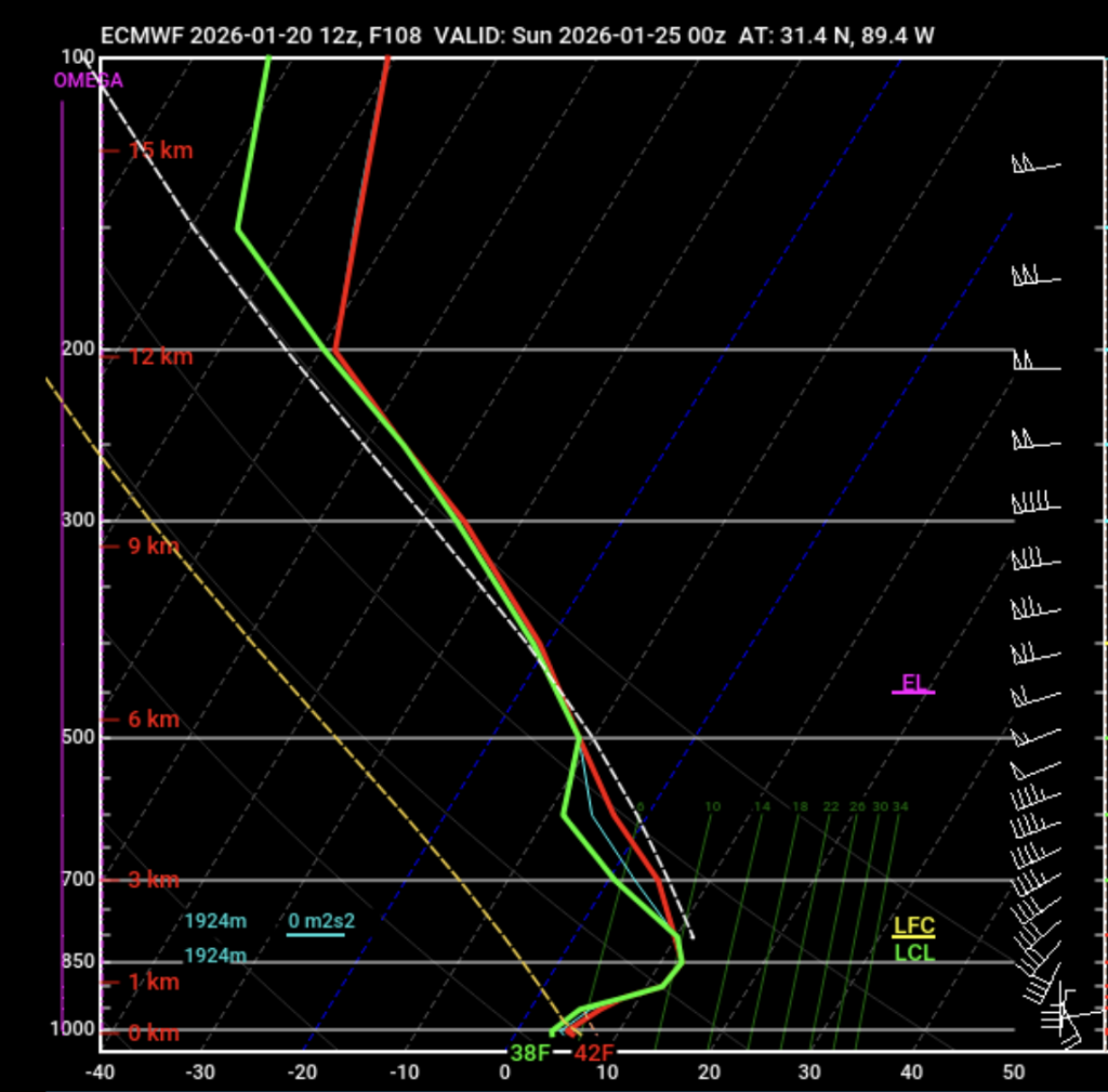
Another important thing with this system will be surface temperatures. To be honest, surface temperatures will be the number one factor on who sees freezing rain and who sees rain. Let’s walk through an example above.
I have attached two Euro modeled soundings for 6 pm on Saturday. The first is for Jackson, and the second is for Hattiesburg. Both of these soundings have similar-looking profiles, but there is one big difference between them. What’s the same is that temperatures start below freezing, higher up in the atmosphere.
Then, between 700 and 850 mb (approximately 1-2 miles above the surface), there is a prominent warm nose, or temperatures becoming above freezing. So, since we’re saturated at the upper levels and below freezing, precip will fall as ice crystals or snow, then melt into raindrops in the warm nose, and then this rain will fall to the surface. The temperature at the surface comes into play here because if temperatures are 32 or below, the falling rain will freeze on contact with surfaces. If surface temperatures are above 32, then it will not freeze on surfaces, and you’ll see just cold rain.
So, with the Euro’s model run on this Tuesday afternoon, Jackson would see the freezing rain and Hattiesburg wouldn’t see it as extreme, all because of differences in surface temperatures.
Above is a look at the timeline of modeled surface temperatures this weekend during the storm, again from the Euro model. This is not perfect, or even accurate this far out, given that these storms tend to wobble and temperatures will vary as a result. It will be interesting to see where the freezing point ends up, as it will be one of the storm’s most important features.

Extended Local Outlook
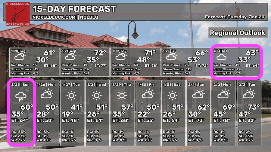
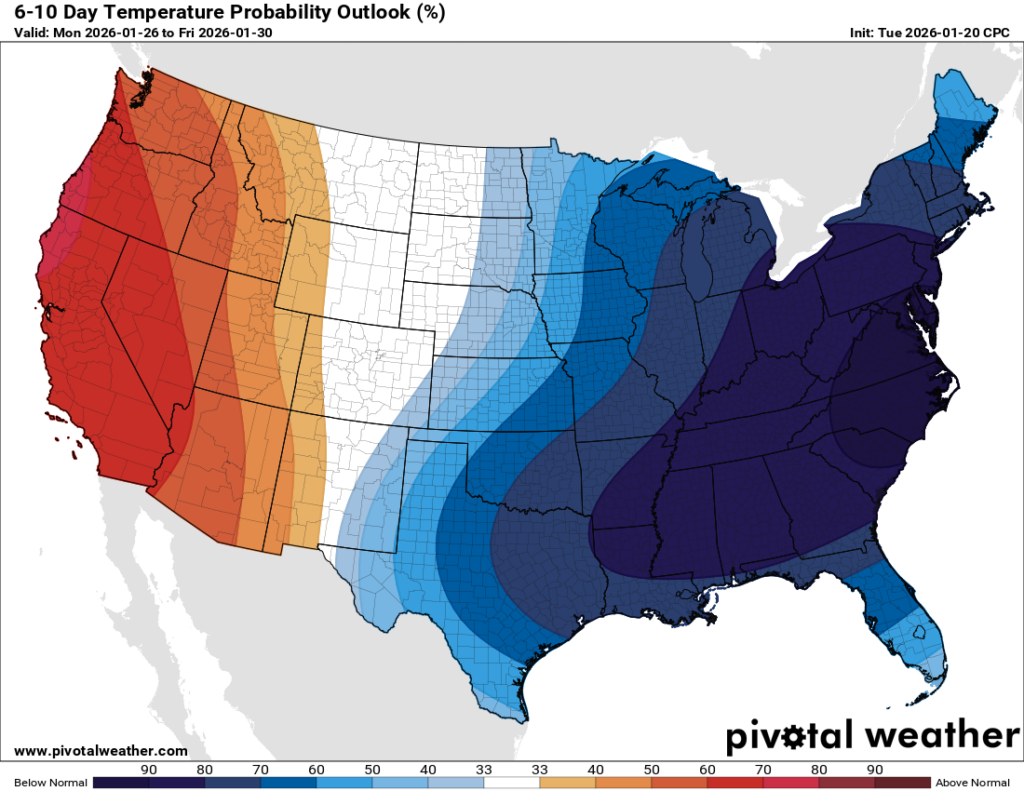
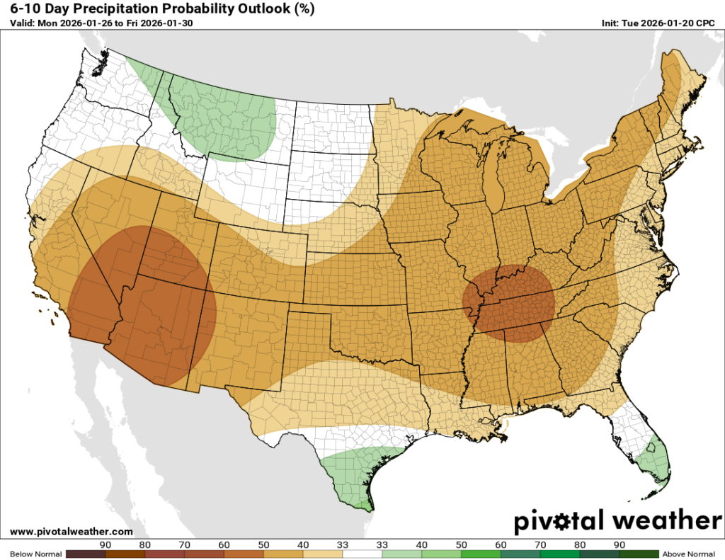
Looking ahead to next week, we’re seeing a clear signal of below-average temperatures across the entire eastern half of the country, with a very high probability in the deep South as well. The NQLBOT doesn’t see temperatures above our average high of 60 until February 1st! It looks like a drier stretch as well, with high pressure expected to dominate as we close out the month.


