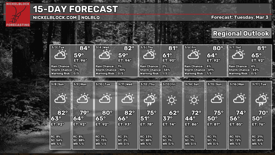
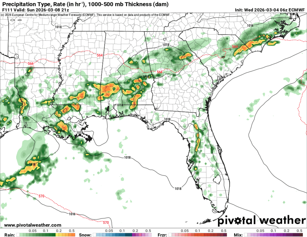
The good news is that the air quality has improved over the past couple of days! There still are some that may be affected by the current conditions, though. The next few days are going to be much warmer than average, and southerly winds will contribute to the incoming moisture flow for the rounds of showers and thunderstorms this weekend.

Today
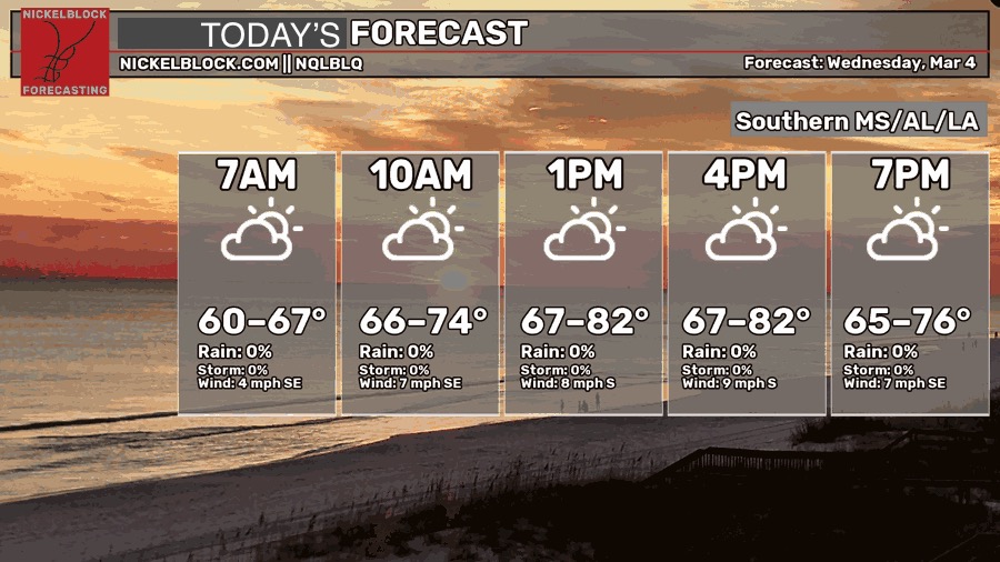
We still have some patchy fog across the area that will soon lift by mid-morning. Upper and lower level clouds will hang around during the day with warm conditions across the Gulf south and the Pine Belt. Temperatures will be in the low 80s today with winds out of the south around 5-10 mph. Overnight, we’ll fall back into the low 60s.

Tomorrow
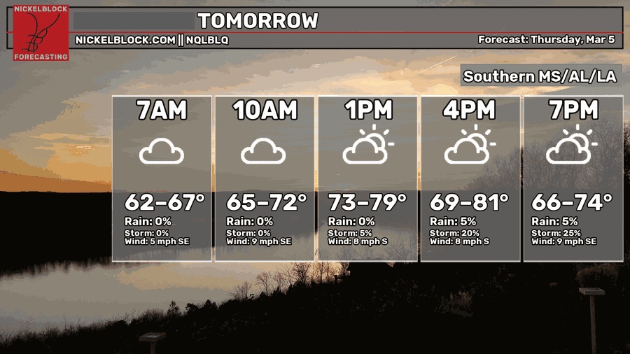
Tomorrow is going to be a similar story but with a slight chance of rain in the evening. It’s a very slight chance with some isolated/scattered cells coming from the south. Otherwise, we’ll end off the evening fairly humid. Temperatures will be in the low 80s during the day with a low in the low 60s.
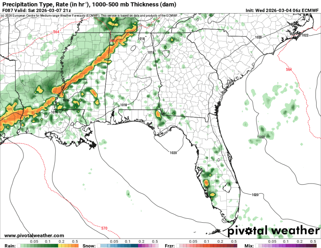
Friday

A slightly higher chance of rain is possible Friday with more influx of Gulf moisture to contend with. It’ll be another warm day with showers starting in the early morning and lingering until the evening. A few overnight showers are possible as well. Highs in the low 80s and a low in the 60s.
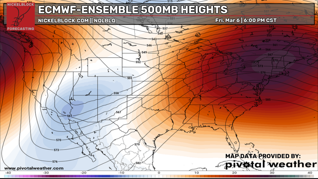
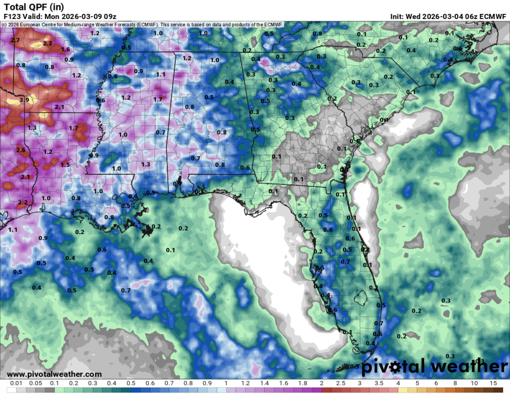
Looking at the upper levels (above), we can see a trough developing in Southern California. This will pinch off and eventually move in by next week, however the incoming cold front (really stationary front) will weaken without much of a push from the upper levels. The good news is that severe weather is very limited, so this is mainly rain and a few thunderstorms that we’ll be expecting this weekend.
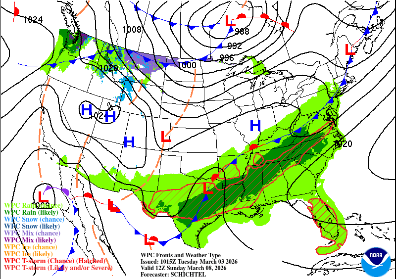
From what the NWS in Jackson says, this will be more “beneficial” rain than anything else and I would agree. While the Pine Belt isn’t in a full drought, many areas around the Mississippi River are and would benefit from the incoming rain. The other good news is that it wouldn’t come all at once, so flooding isn’t as big of a concern. The European model has been much more aggressive with the rain chances and the front’s propagation, so let’s hope that holds.