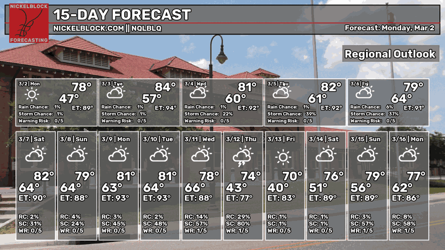
It’s gonna be a warm start to March! We’re going to be in the low 80s for the next few days before some rain chances come in closer to the weekend. Low temperatures will also increase as southerly winds will dominate and increase the inflow of Gulf moisture and close the diurnal temperature range. Air quality is also going to be a factor this week with several controlled burns and forest fires across Mississippi contributing to higher PPM (parts per million) and affecting people who are sensitive to air quality drops.

Today
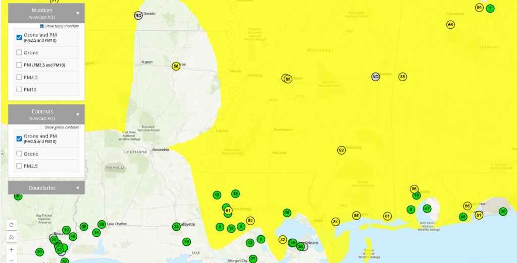
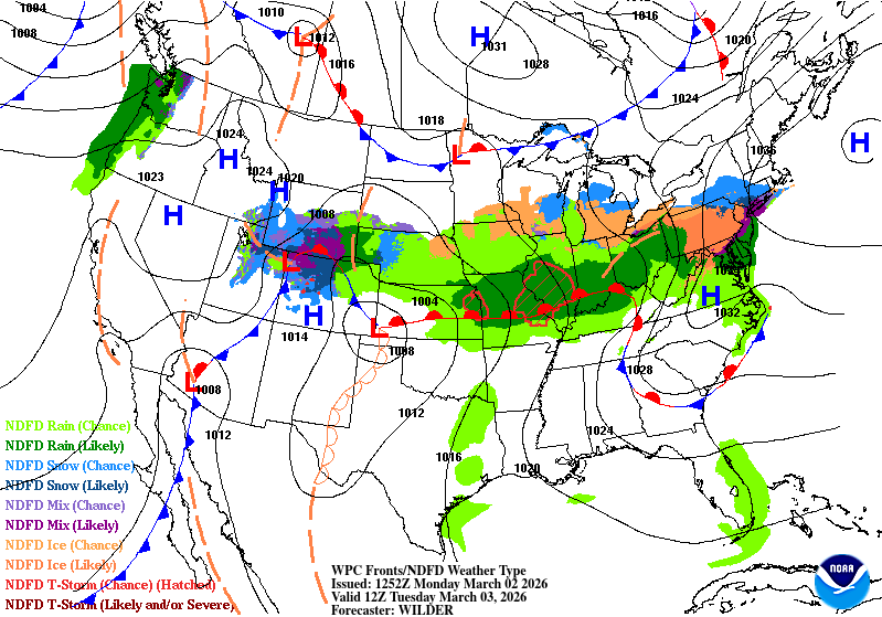
With many fires across part of the DeSoto National Forest and south Louisiana combined with southeasterly flow, air quality will take a dive across much of the Gulf South region. Those that are sensitive to the higher amounts of particles in the air will need to stay indoors today. Part of this is due to the capping inversion across the southern part of the state contributing to the low clouds and fog this morning.
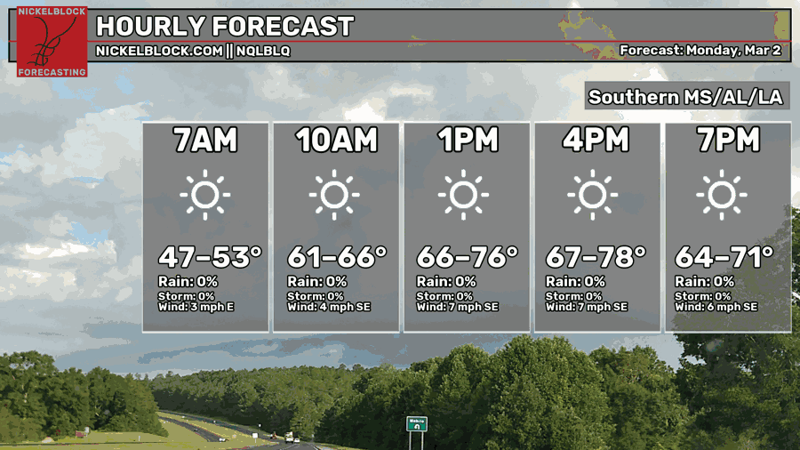
Otherwise, it’s going to be a sunny day today with temperatures in the mid to upper 70s across the area. We’ll have a small breeze from the southeast contributing to some warmer air. Overnight, temperatures will fall back into the mid 50s with increasing clouds.

Tomorrow
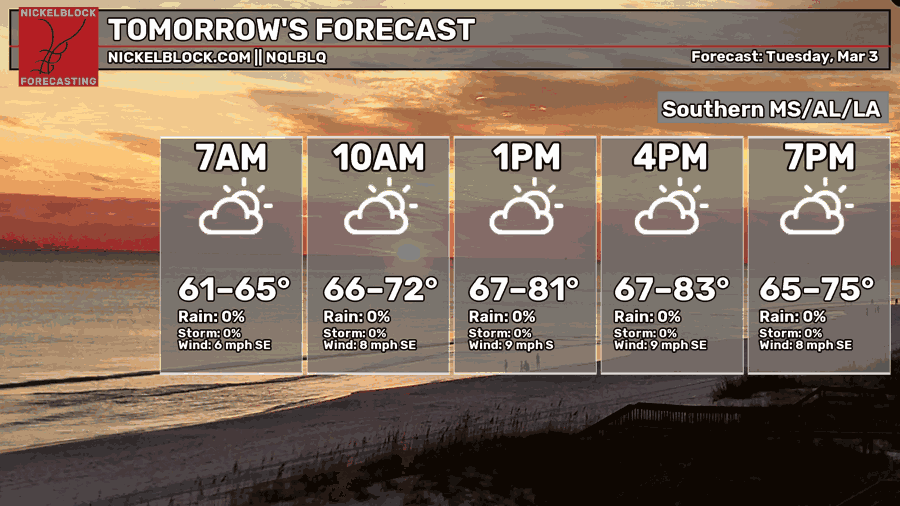
A tighter gradient between a low in the mid-Plains and the mid-Atlantic high will contribute to some gustier winds across the Gulf South. Expect some wind gusts tomorrow, so if you’re planning on burning, I probably wouldn’t. Temperatures will reach the low 80s in some areas by mid-afternoon. Overnight, we’ll only fall back to the upper 50s to around 60.
Wednesday
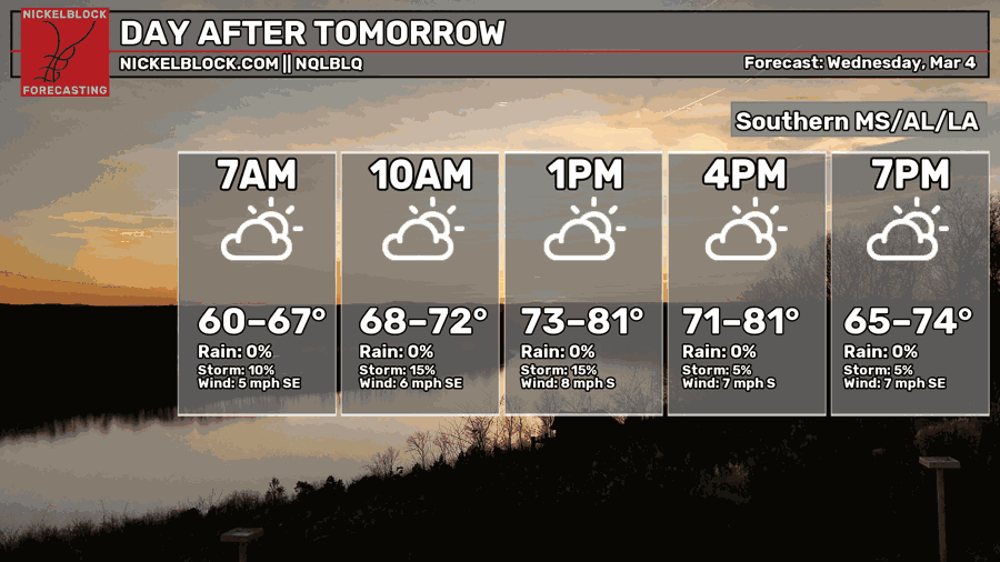
Temperatures will reach the low 80s again on Wednesday with winds calming down a bit compared to Tuesday. A few stray showers are possible during the day, but otherwise, it’s going to be warm and partly cloudy. We’ll fall back into the low 60s overnight.
After Hump Day
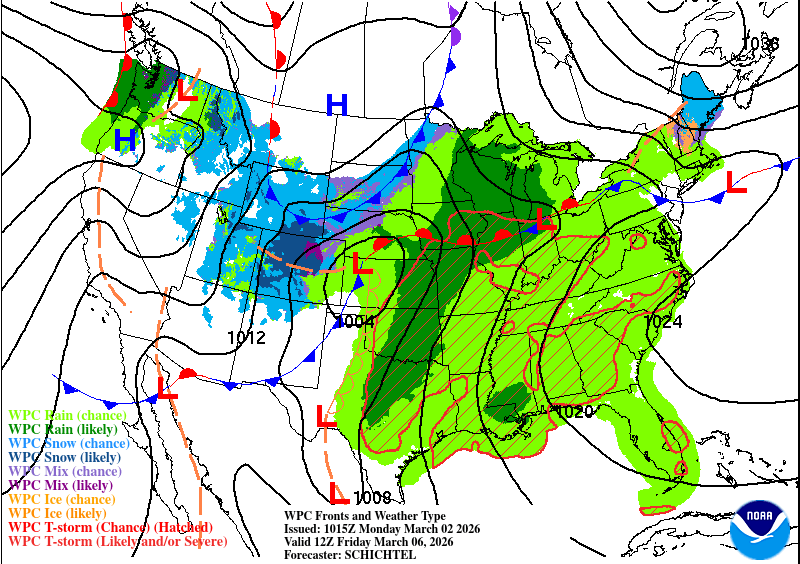
Thursday and Friday will both be fairly humid with warmer temperatures thanks in part to more Gulf moisture inflow. Stray showers are possible on Thursday and a higher chance of showers by Friday. Temperatures will be in the low 80s on Thursday and upper 70s on Friday with lows in the low 60s.
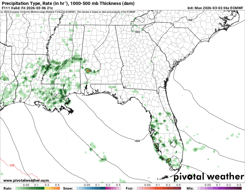
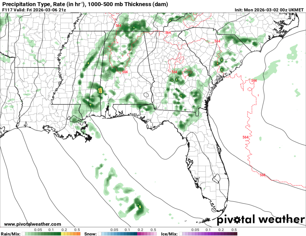
Model guidance is going to take some time to come into agreement with each other. Looking at the ECMWF and UKMET models above, they tell a similar tale to each other but slightly different interpretations, if you will. Both contribute the moisture from the Gulf into the equation; however, the Euro model shifts the moisture flow broader to the west compared to the UK model. I do think we’ll have a decent shot for rain across SE LA/MS on Friday, but how much rain we’ll receive is still up for debate until model guidance intersects closer to Friday.