We are back to a low-range, warmer than average temperatures for the next few days. It’s going to be muggy and warm as the southern winds prevail from an incoming low pressure system and the mugginess won’t go away until the end of the weekend. Along with that, we’ll also see some possible severe weather over the early part of the weekend that we’ll need to keep an eye on.

Today
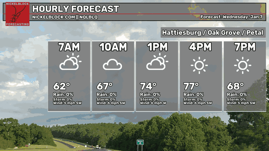
We’re starting off today with some dense fog still around in some areas. This will lift by the mid-morning hours and the clouds will gradually clear out by the late afternoon. Highs will be in the upper 70s and a low in the low 60s tomorrow morning. Winds will be out of the southwest around 5mph.
Tomorrow
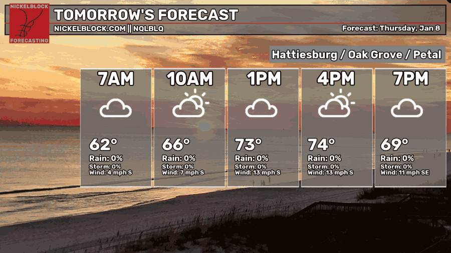
As the gradient tightens from the low, we can expect a gustier day tomorrow with winds from the South. It’ll be another mostly cloudy one with a high in the mid 70s and a low in the low 60s.
Friday
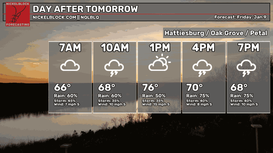
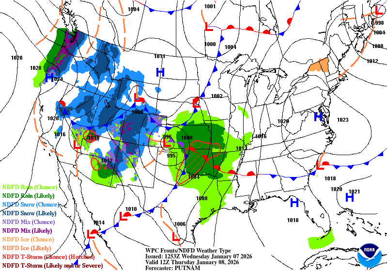
Friday’s severe weather is a bit of a messy situation as we’ll multiple rounds of rain throughout the day. Modest instability and dewpoints in the mid 60s are the main ingredients we have to contend with for severe weather potential. Our first round of rain comes around the mid-morning hours that coincides with the warm front.
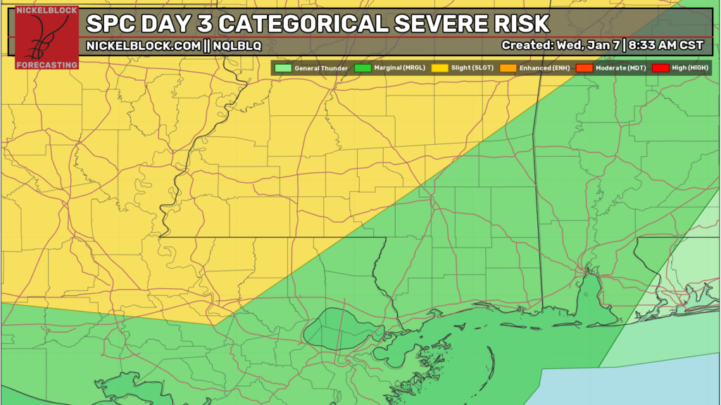
There will be a brief break from the rain in the early afternoon which may contribute to some instability needed for the next round of storms in the late afternoon and overnight hours. So far, it looks like our main chance for severe weather is in the evening hours as another round of cells move in from the south. So far, severe weather parameters look to be heavy rain and flash flooding, lightning, hail and high winds. A limited threat for tornadoes is also possible, so I think we can expect a few tornado warnings across Louisiana and Mississippi. The highest instability looks to be around south Louisiana to south Mississippi.
Otherwise, temperatures will be in the upper 70s during the day and fall into the mid 60s overnight with south/southeastern winds.
Saturday
Storms will continue on into Saturday morning. They should clear out by the early afternoon, so expect a soggy start to the day. Overall, there is still a slight chance for severe weather as the cold front passes through. Highs will be in the low 70s with cloudy skies throughout the day. As the cold front moves in, we’ll feel more of a chill in the air and temperatures will fall into the mid 40s overnight.
By Sunday, we’ll go back into the more winter-like temperatures as the clouds clear out and highs top out in the mid 50s. Overnight, we’ll drop to the freezing mark with clear skies.


I am so ready for 2 good weeks of winter. I am tired of these concrete sweating conditions.