Overall Setup
We’re currently experiencing an influence from a large ridge of high pressure, as shown in the orange colors in the first picture. Do you see the “ball” of troughing off the west coast, though? That is the main piece of energy that will bring us a severe weather threat on Friday night into Saturday morning, as it slides east into our area.
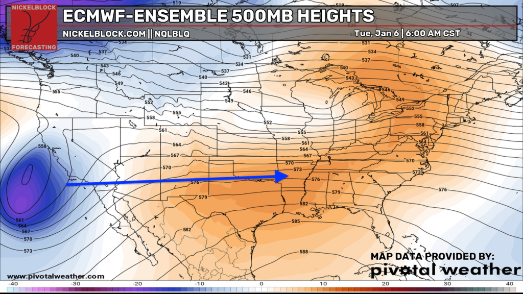
The trough won’t do it all by itself, but it will help a surface low-pressure system strengthen as we head into the weekend, bringing a more active stretch of weather. No need to panic, we’ll walk you through the timing and what to expect step by step.

Tonight’s Forecast
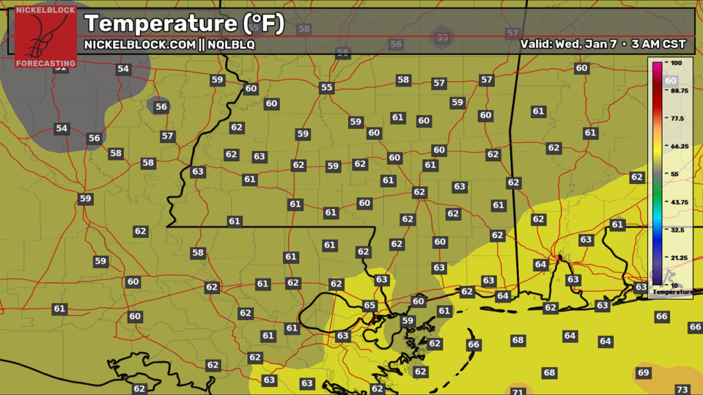
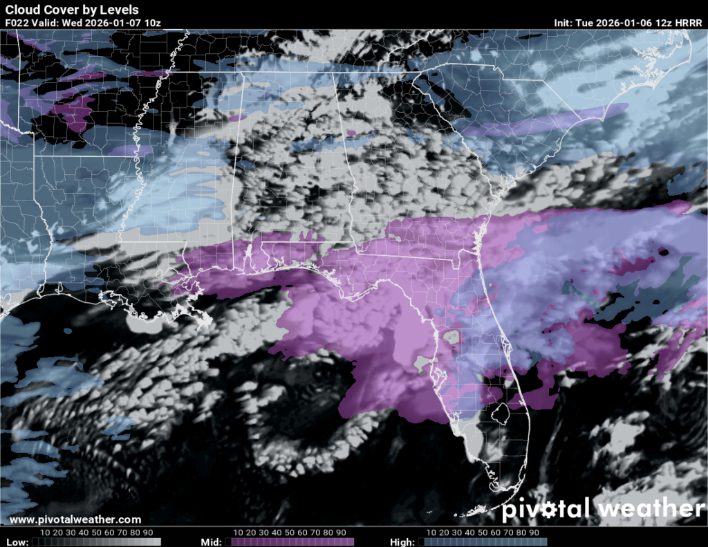
Tonight, we’re expecting mostly cloudy skies and a low temperature in the lower 60s. There’s an elevated chance of dense fog tonight into tomorrow morning, sometime between 5-10 am, so take it slow during the morning commute.
Tomorrow’s Forecast: Wednesday, January 7
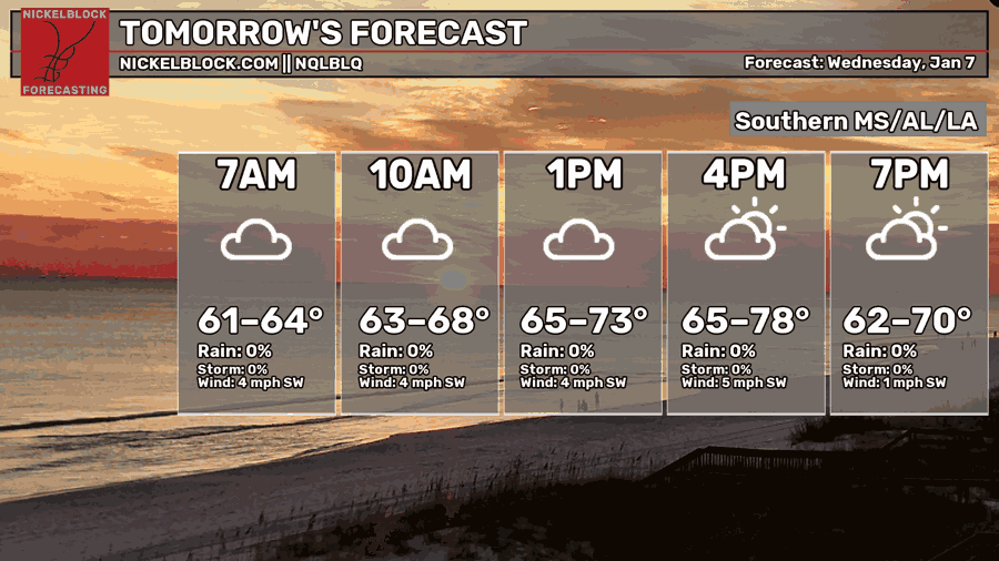
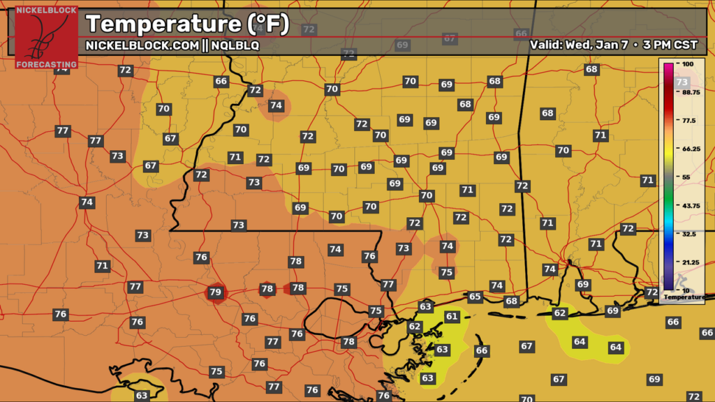
Tomorrow will start as grey as can be, with fog through around 10 am or so. The fog will burn up as temperatures rise throughout the day, but we’ll still maintain a good amount of mid-upper cloud cover. The sun will try to peak out for the mid-to-late afternoon. For our high temperatures, we will see a large range depending on your location, but generally high 60s/lower 70s for Mississippi, and mid-to-upper 70s for Louisiana. Low’s will follow a similar pattern, but generally lower 60s for everyone.
Thursday’s Forecast: January 8
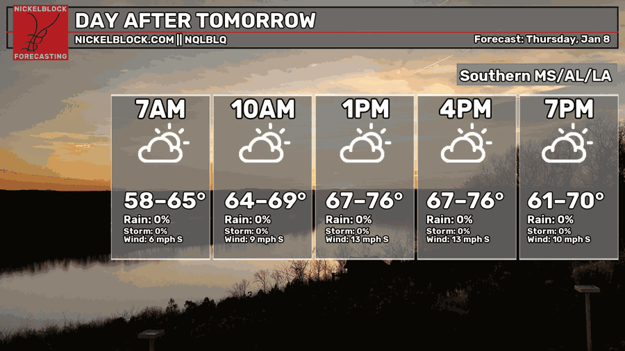
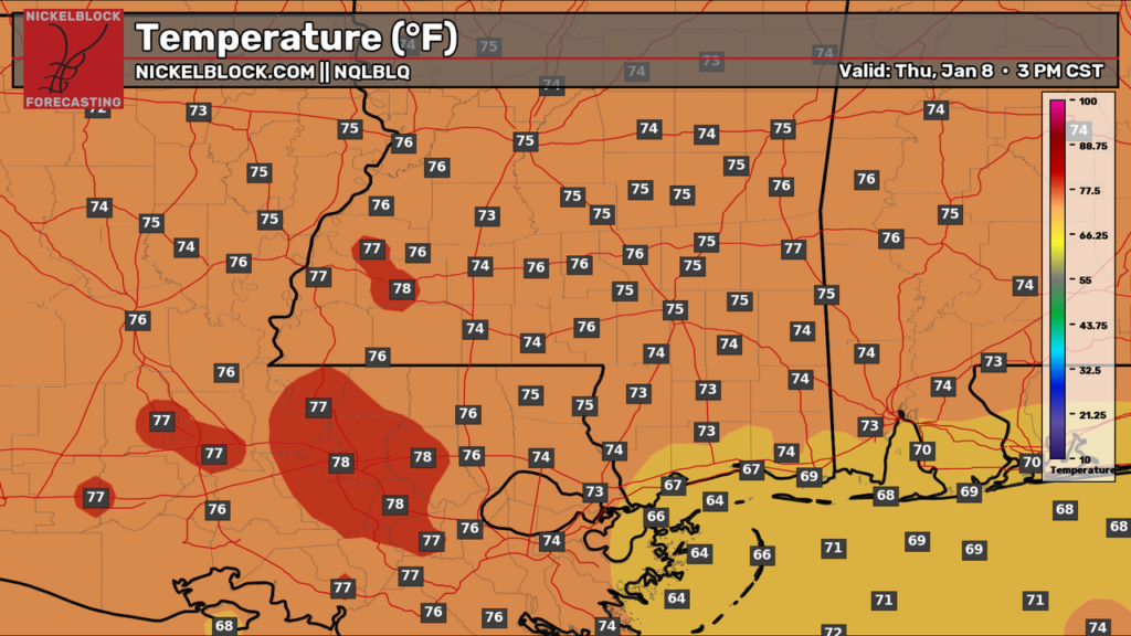
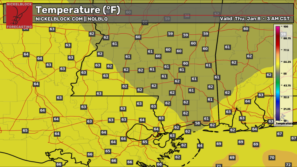
For Thursday, we’ll see the increasing clouds sticking around, with a mix of sun and clouds throughout the day. Highs will be in the mid-to-upper 70s for most, except the Mississippi Coast, which will see upper 60s. A quick sprinkle is not out of the question, but the main rain event will come in on Friday and into Saturday.

Friday/Saturday Severe Storms
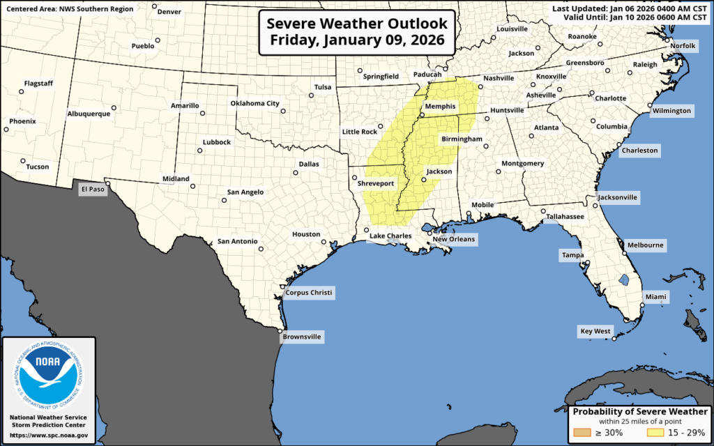
The Storm Prediction Center (SPC) has highlighted parts of our area for a severe weather threat on Friday night into Saturday morning. This far out, the SPC doesn’t assign Categorical Outlooks, such as Marginal, Slight, Enhanced, Moderate, and High Risk. Instead, they issue Probabilistic Outlooks, based on the percent chance of severe weather 25 miles from a point in the highlighted risk zone. As of today, Day 4, we have a 15-29 percent chance of severe weather in that yellow risk zone, and 25 miles in any direction from it. That’s pretty impressive this far out!
Tomorrow, when we move into Day 3, the SPC will switch to a categorical risk. A Slight risk (2 out of 5) is definitely possible, and if confidence grows in more widespread severe storms, Enhanced isn’t off the table somewhere in the region.
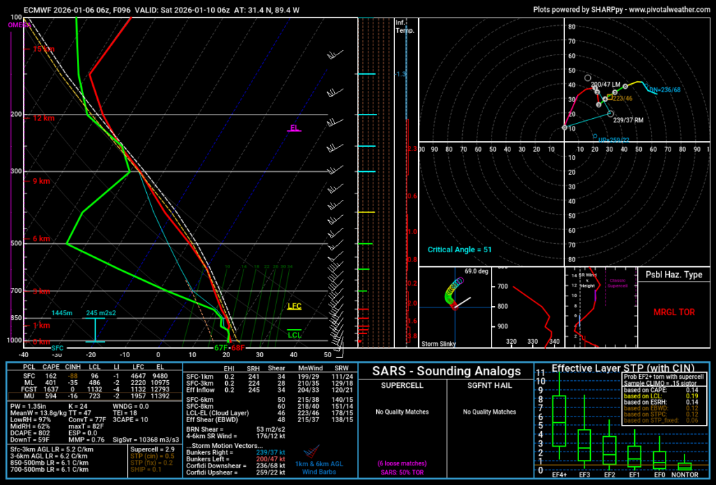
It’s important to look at atmospheric soundings when looking at a severe threat, so I pulled up the one above for around midnight Saturday near Hattiesburg. What we can interpret from the sounding is that while CAPE (Convective Available Potential Energy) is limited, there is a good amount of shear, meaning the winds get stronger with height and also change direction. Additionally, SRH (storm-relative helicity), which is basically a way to measure how supportive the atmosphere is for storms to rotate, is on the higher side. PWAT (precipitable water) is also elevated, showing there’s plenty of moisture available to work with, as dew points will be well in the 60s. There are a few other parameters on this sounding that also point us in the direction of severe weather, so this is something to certainly keep our eyes on. We know that the atmosphere will be conducive to rotating storms, and we need to watch out for damaging winds and the possibility of tornadoes. We’ll have a more detailed look at this throughout the week.
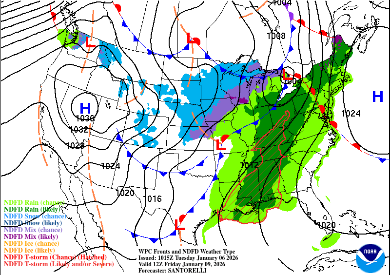
Here’s the Euro’s current thinking of how the system will play out:
Extended Local Outlook
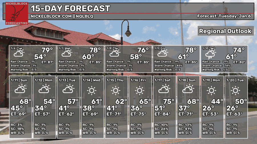
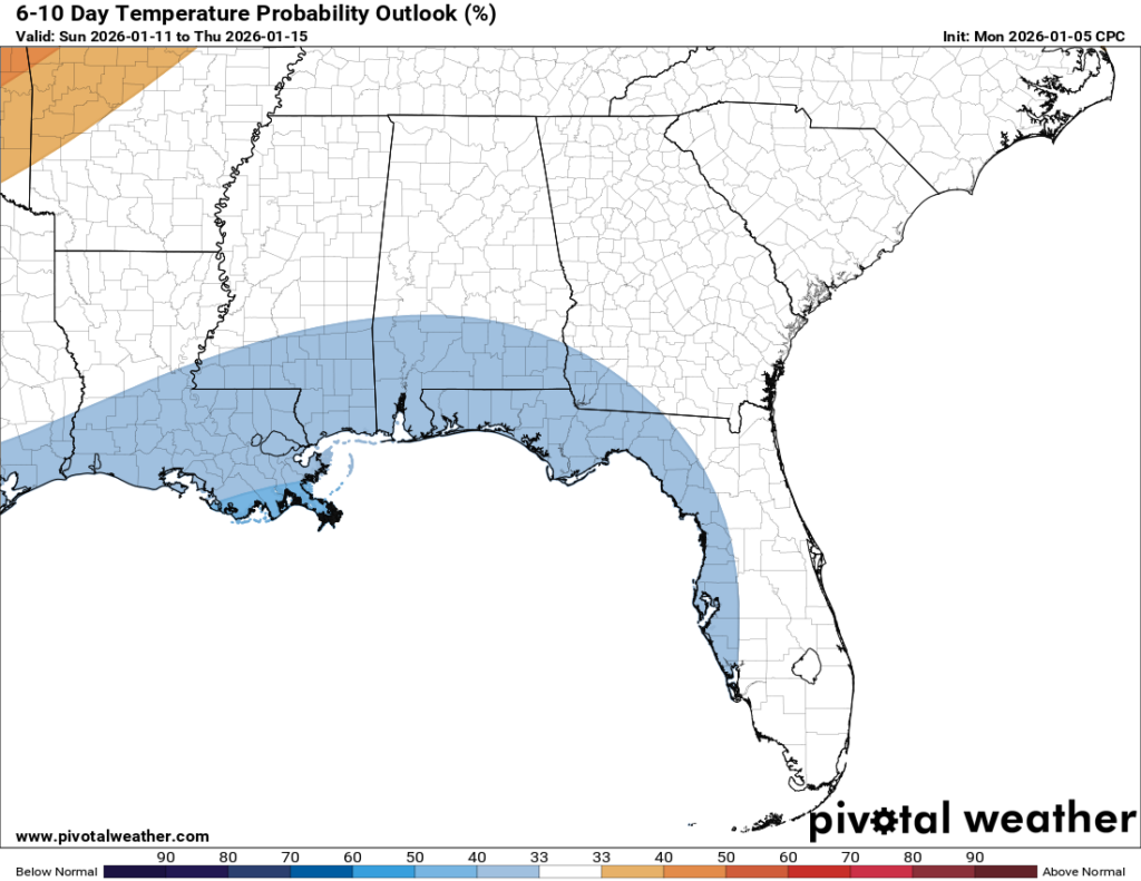
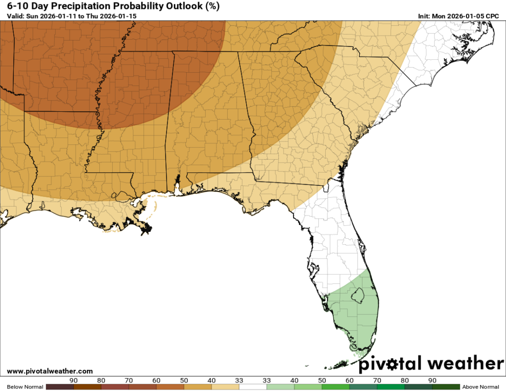
Sunday is expected to stay dry, with a mix of sun and clouds and a high temperature in the upper 60s, which is cooler than the days before it. We’ll see an even bigger cooldown on Monday and Tuesday, with highs in the 50s. Finally, some blue on the 6-10 day temperature outlook! Temperatures do look to fluctuate as we get into the middle of January, though, with some cooler days and some warmer days. What does look consistent, at least for the next 6-10 days, is drier than normal weather, especially after our weekend severe weather event.


