General Central/Eastern Kansas Forecast
Short-Term (Friday-Saturday)
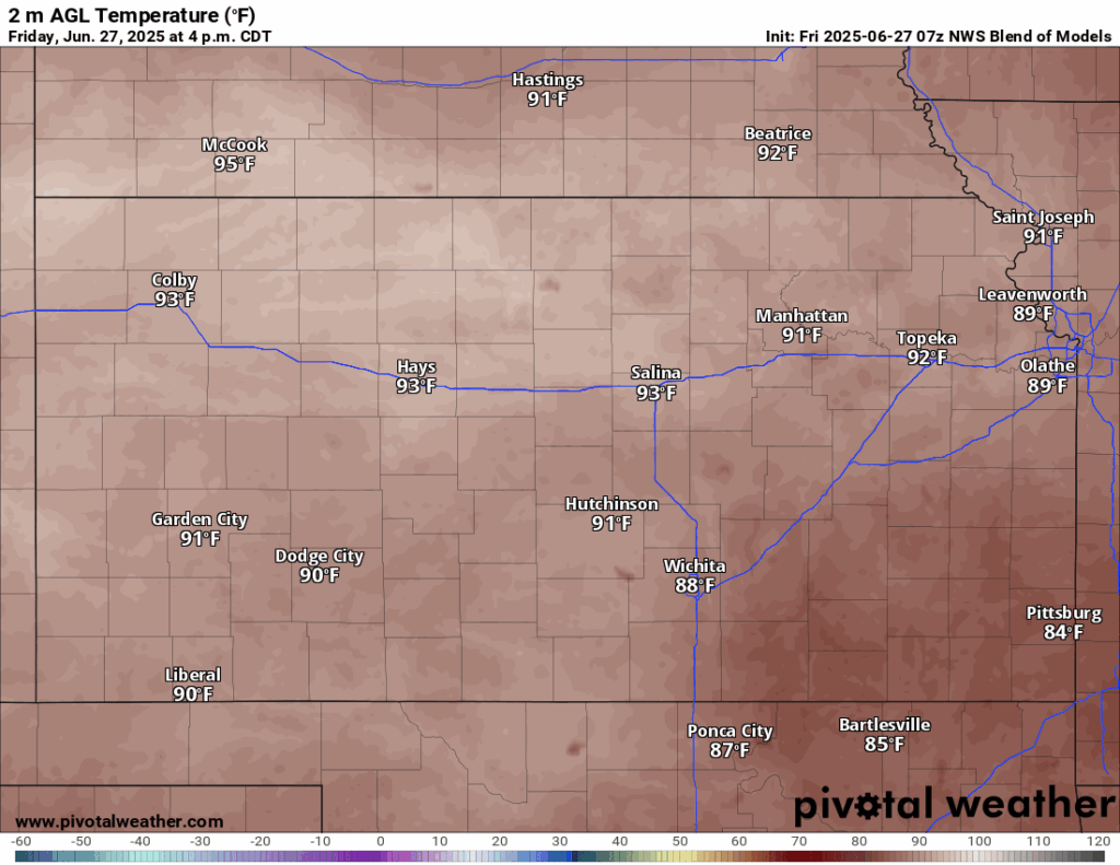
Attention for showers and thunderstorms will largely shift to along and south of I-35 today, as existing outflow boundaries from yesterday’s showers and storms drift southward and help trigger more precipitation. New rainfall totals will amount to between 0.5 to 1 inch, but isolated amounts of 2+ inches will be possible. Minimal severe activity is expected, but heavy rain will remain possible with any storm that does form. Any chances for storms north of I-35 will be more isolated in nature and less scattered compared to yesterday. Otherwise, temperatures again will be in the upper 80s to low 90s, with southerly winds at 5 to 15 mph. The humid feel to the air will continue to stick around, especially in areas that see rainfall today, with relatively humidity between 50-65%. Heat indices again will reach the mid to upper 90s today. Overnight lows tonight will dip back down into the low 70s.

Tomorrow is essentially wash, rinse, and repeat of today. Isolated showers and thunderstorms will be possible throughout the afternoon and evening hours across eastern and southern Kansas with diurnal heating, but overall chances will remain low. Temperatures will be in the upper 80s to low 90s, with southerly winds of 5 to 10 mph. Heat indices will again largely be in the mid to upper 90s throughout the day. Low temperatures tomorrow night may be slightly warmer than tonight, being in the low to mid 70s.

Long-Term (Sunday-Thursday)
More organized thunderstorm activity is possible Sunday, as a “cold front” (more of a wind shift than anything) drifts southward into the state. A mid-level disturbance will traverse over the state and help trigger thunderstorm activity across central and eastern Kansas by the afternoon and evening hours. Some of these storms may be severe, but the primary hazard will be heavy rainfall given an extremely moist airmass in place over us. These showers and thunderstorms will continue through the overnight hours and into Monday, getting shoved to the south by the advancing front. Behind the front, temperatures will be a touch cooler (in the mid 80s to low 90s) for the rest of next week. Sporadic chances for isolated showers and thunderstorms will still exist daily throughout the afternoons and evenings, but otherwise widespread precipitation is not anticipated for the week of the Fourth of July.
Drought Update
Some minor drought improvements have been made in northeast Kansas from last week to this week, with portions of Rice, Dickinson, Riley, Morris, and Shawnee counties improving to no reported drought conditions. Between last week and this week, Jewell was the sole county to marginally increase in drought coverage. Otherwise, no changes have been made to the overall drought conditions in the state, with the worst of the drought still found across northern Kansas along the Nebraska border. Looking ahead for the rest of next month, drought conditions along northern Kansas look to persist but no new areas of drought are expected to develop at this time, as the pattern still remains favorable for occasional rain chances throughout the month of July. Some abnormally dry conditions may redevelop further south into central Kansas, but overall development of severe drought conditions are low.


Regional Soil Moisture Forecast
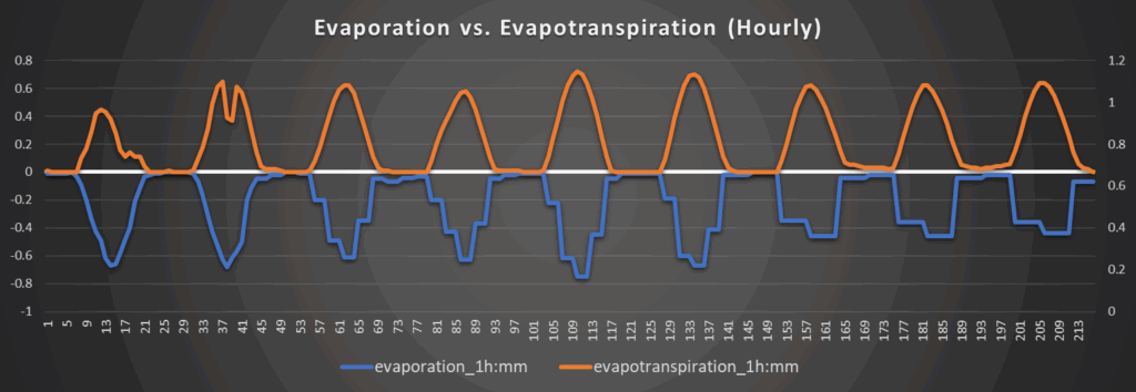
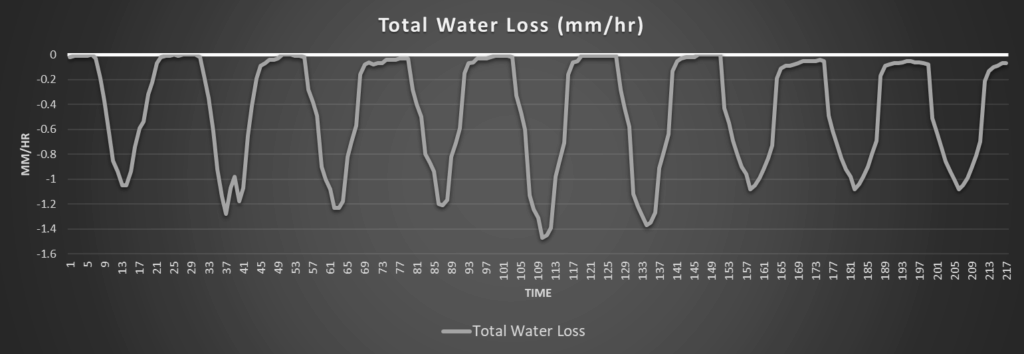
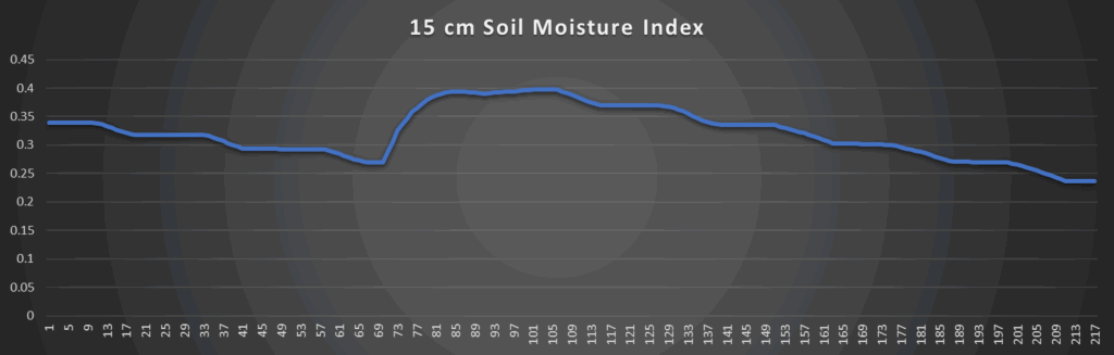
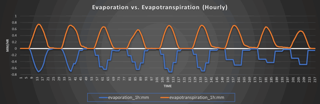
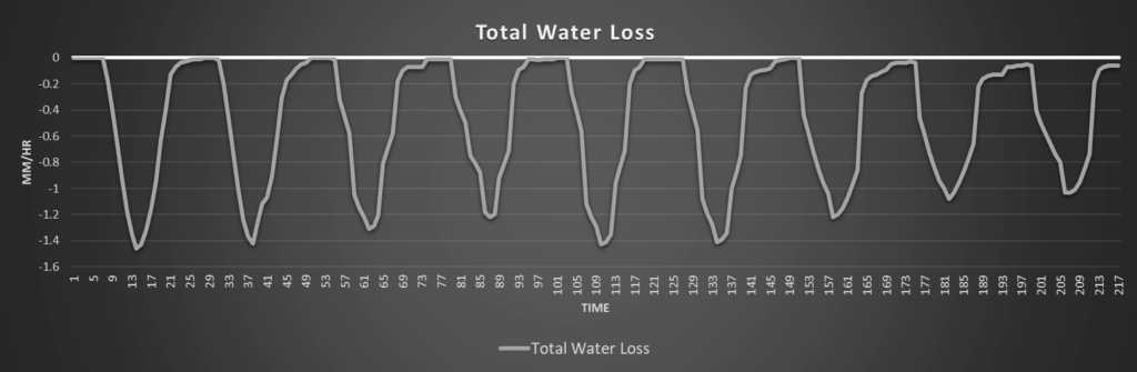
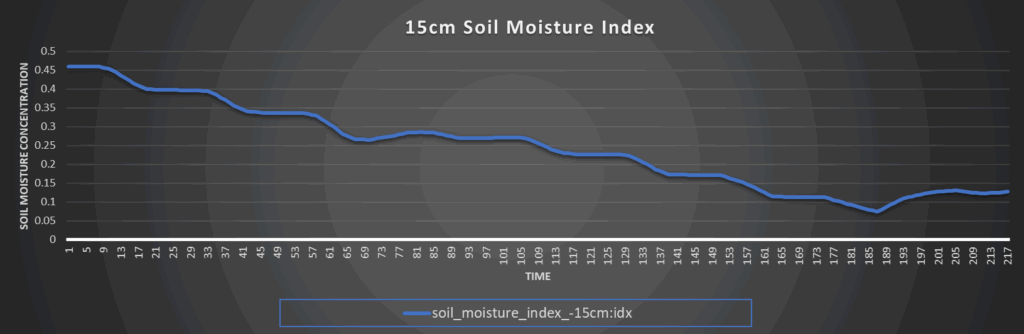
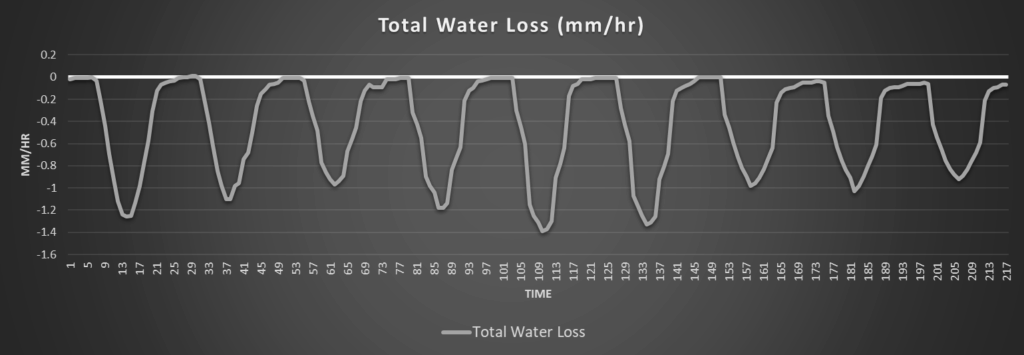
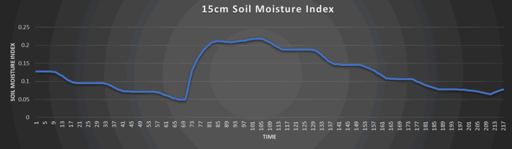
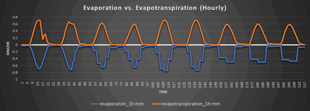
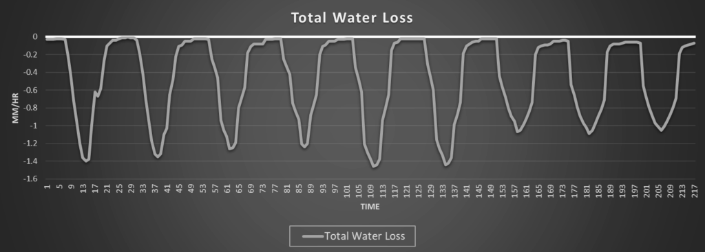
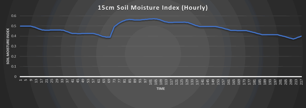
Overall, steady drying with occasional remoistening due to isolated showers and thunderstorms of soils will continue throughout the next 7 days. Daily water loss rates will continue to fluctuate between 1 to 1.5 mm/hr every day. Soils in central to northern Kansas may dry out enough to pose some problems again (given the current drought situation), while southern Kansas will stay relatively more saturated.
Around Westmoreland
Around Scranton
Around Burlington
Around Altoona