Hi everyone! If you’ve been on social media lately, you’ve probably noticed how confusing things have been, with a lot of conflicting information about this weekend’s storms. That can definitely make things feel stressful or uneasy.
We always want to give you the most accurate forecast possible, but as we’ve been talking about, this is a tricky setup. With an extremely tight baroclinic zone, which essentially is a sharp temperature contrast, it’s difficult to pin down exactly which towns will see specific impacts until we get a little closer. Nick gave a region-wide update earlier today, providing a general idea of timing and precipitation types. I’ll include some of that here, and dive a little deeper down below!

Tonight’s Forecast
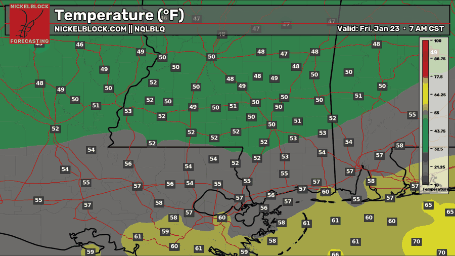
Tonight, we are well ahead of the cold front, meaning we’ll see a slightly milder night, generally in the upper 40s to the 50s. Some more scattered showers will linger in the area, since our moisture feed is funneling in from the south.
Tomorrow’s Forecast: Friday, January 23
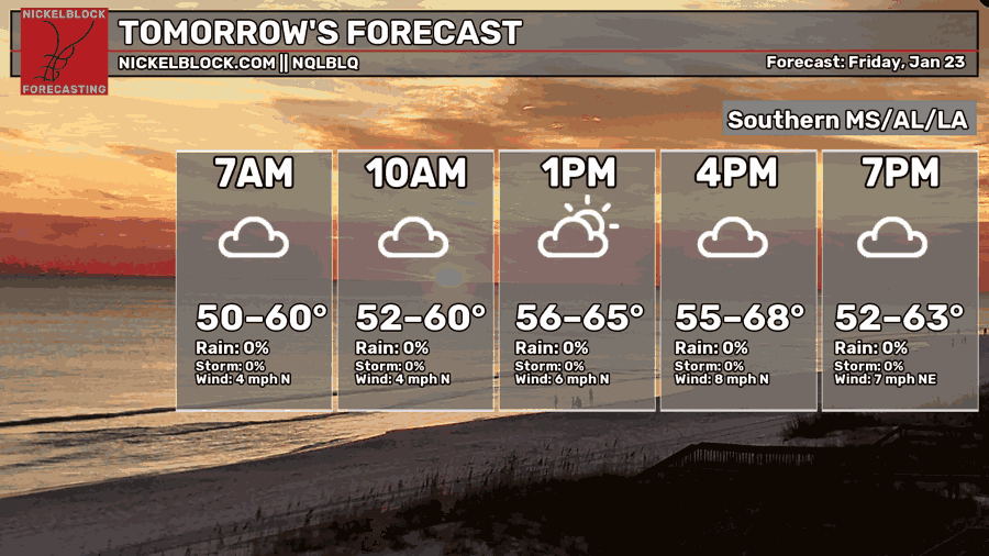
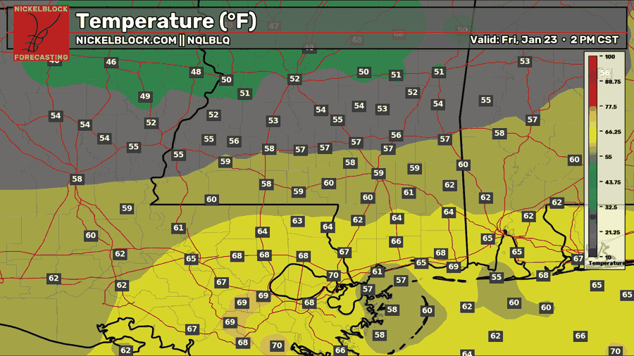
By the morning and throughout the day on Friday, skies will be overcast, but it’s looking like a mostly dry day. It’ll be a gray day, with a pretty big temperature contrast, as I mentioned earlier, which could help us understand who might see what by the time Saturday and Sunday come along. Mid to upper 50s for those north of Hattiesburg, and mid to upper 60s and low 70s for those further south.
Weekend Update
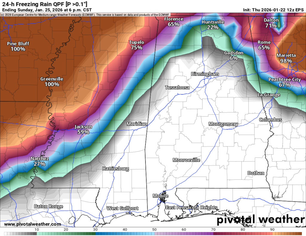
The good news is that the freezing rain threat has been taking a northward push in the model runs. There’s still a threat of freezing rain across the counties we cover, but the chance has decreased. For example, the EPS, which is an ensemble of model runs, shows the percent chance of freezing rain amounts being greater than 0.1″ above.
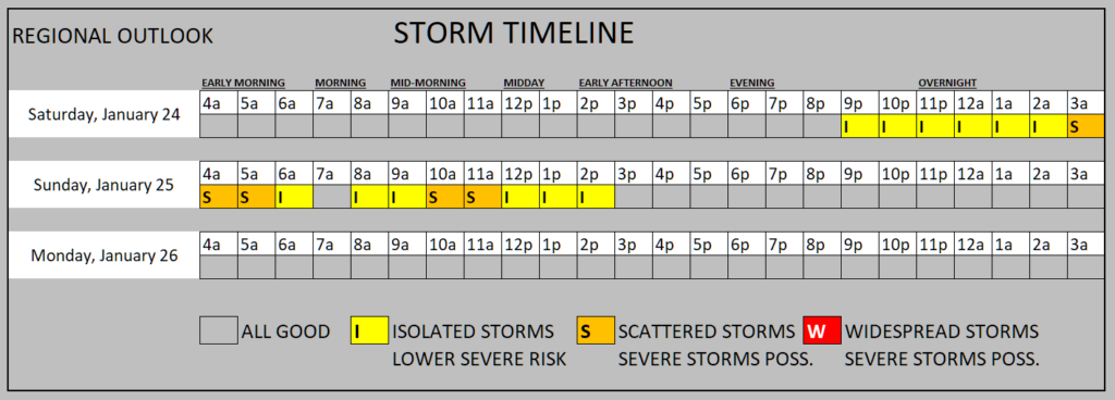
As you can see, the closer to the north northwest you are, the greater the chance at accumulating freezing rain. You can also see that areas east of Baton Rouge, through coastal MS, up through southern and central Alabama, are showing a 0% chance of freezing rain accumulation. This is because temperatures are looking to be well above freezing during the event, and widespread rain is likely, with some scattered severe weather possible as well. What kind of severe weather? Any of these cells can become severe ahead of the cold front, where there is a lot of moisture and some wind shear. So gusty winds are definitely possible, and an isolated tornado or two is not out of the question. While we cannot tell you where tornadoes may spawn, the general idea is that any storm in the warm sector could produce one.
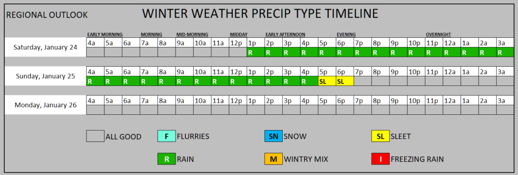
Here is a general timeline of regional impacts from this storm, created and posted by Nick himself earlier this afternoon. Again, most of the region we cover is expecting mostly rain this weekend, but if you are tuning in from maybe Jackson or points further northwest, freezing rain accumulation is still in play for you, so please take the extra precautions now.
Now, as the timeline suggests, once the cold front pushes through, temperatures are expected to plummet to below freezing quickly, meaning if there’s any moisture left, we could all see a quick round of freezing rain, or as Nick mentioned before, ice crystals that have not made it into the traditional snowflake shape. This, along with the rain that has fallen, is expected to freeze into black ice overnight Sunday into Monday morning, so travel might be tricky at the beginning of the work week.

Extended Local Outlook
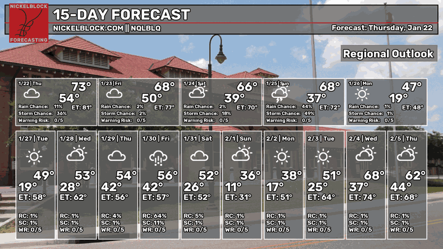
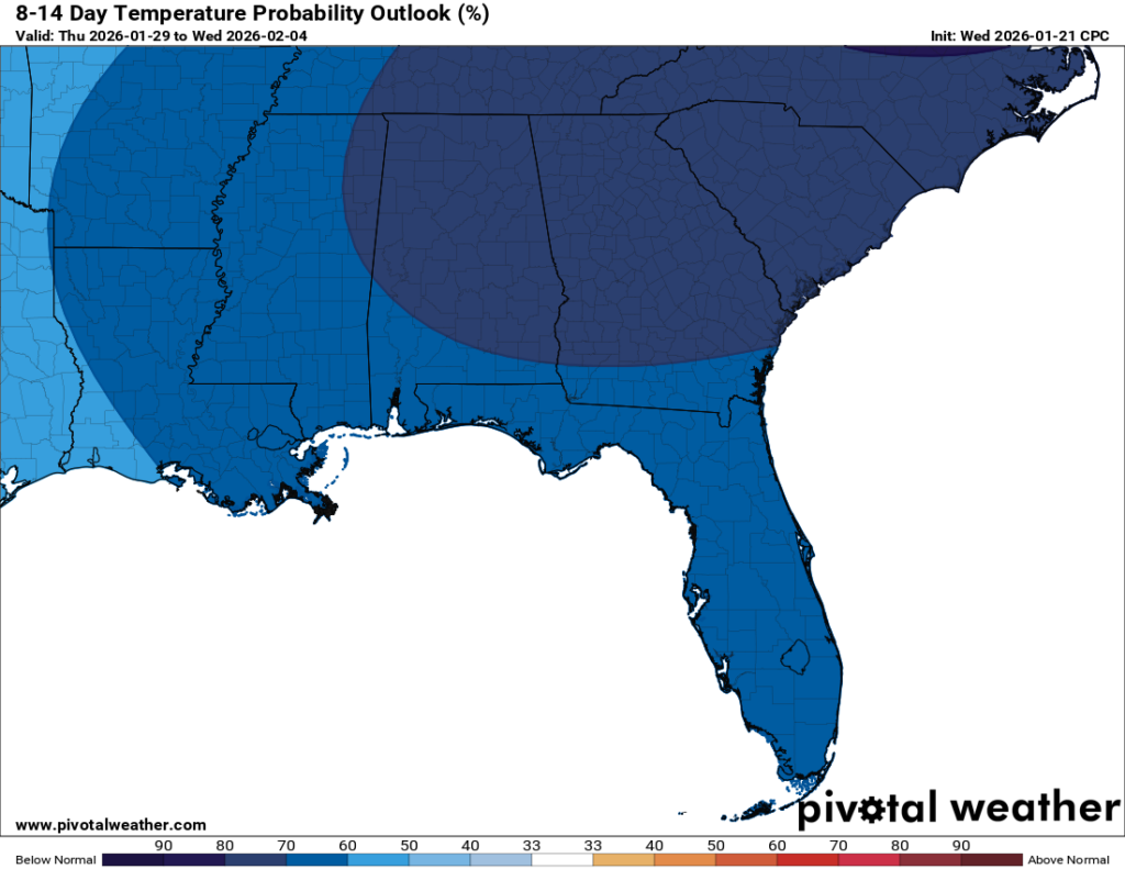
LOTTA BLUE! After this weekend, temperatures will be quite cold, especially on Monday morning and Tuesday morning. We’re currently forecasting an average low of 19 degrees. Your jacket, along with maybe a hat and some gloves, will certainly come in handy on those days. Mid-week, we do warm up into the 50s, but that is still below average. Not much precipitation is expected, but maybe something will come around by Friday next week.
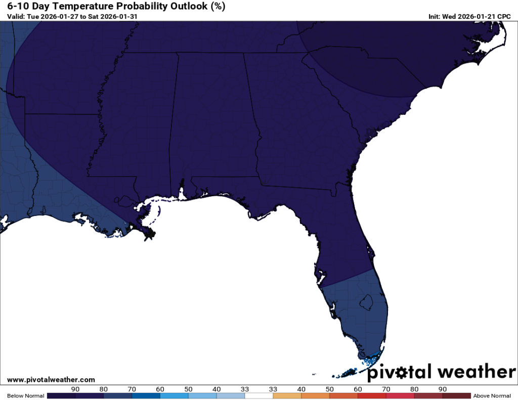
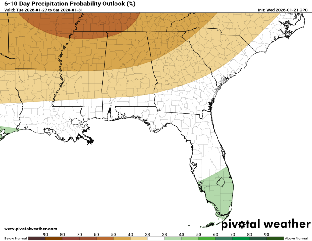
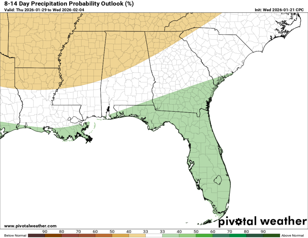
I’ve also attached the 8-14 day temperature and precipitation outlook, which shows we are staying in a below-average trend through the beginning of February. Welcome to winter!


