Overall Setup
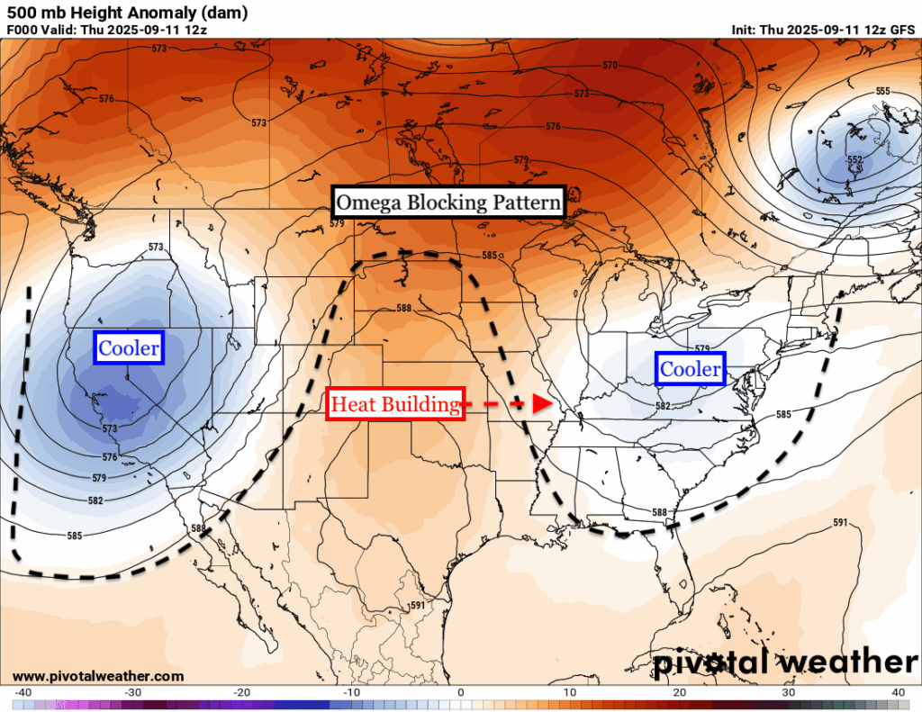
An OMEGA BLOCK is setting shape over the US with a ridge of high pressure building in the center of the country and two dips in the jet stream over the east and west. The ridge of high pressure will move east over the coming days and will bring up temperatures well above average to most of the plains, and eventually deep south and the midwest.
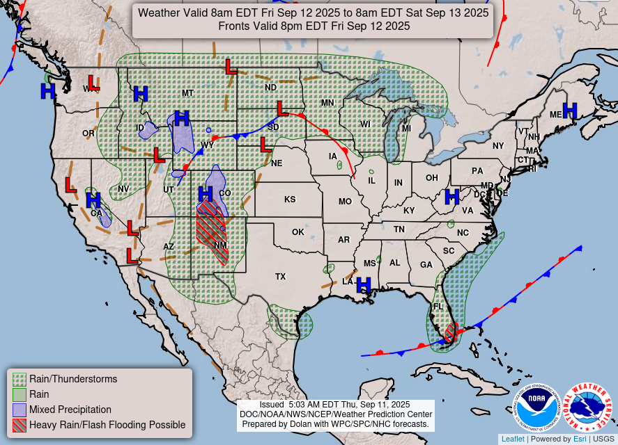
As you can see, areas in between the ridging and troughing near the Rockies are seeing a bunch of unsettled weather tomorrow. They have multiple fronts, a flash flooding potential, and even snow in the high elevations! This is typical for areas between ridges and troughs and it seems that will verify tomorrow.
For our region, high pressure continues to dominate and keep us mainly dry. A very weak surface trough may try to sprinkle a few rain drops in the afternoon, but it’s a very small chance. Let’s get into the specifics:

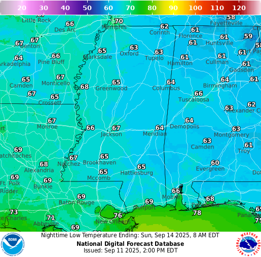
Tonight’s Forecast
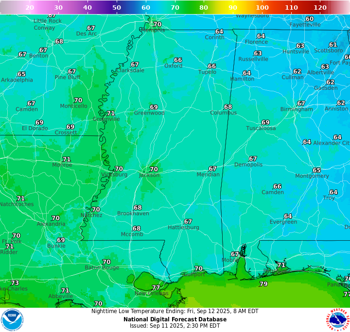
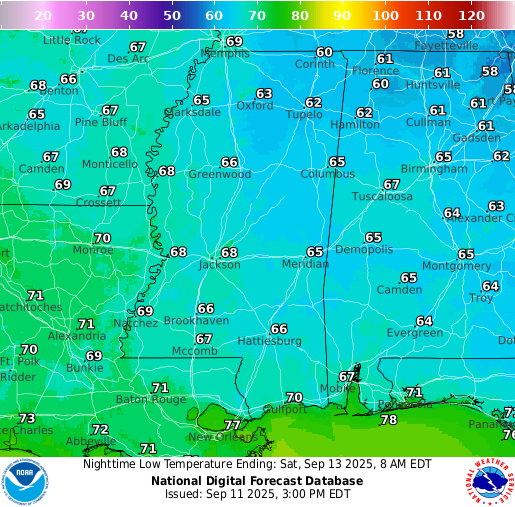
Low temperatures overnight tonight sit in the high 60s near Hattiesburg and into the 70s closer to New Orleans. Expect a very clear sky tonight with very few clouds at all, and certainly no rain.
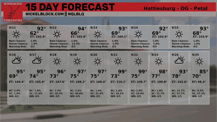
Tomorrow’s Forecast
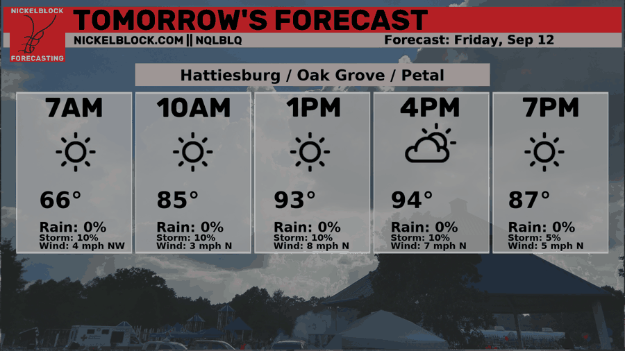
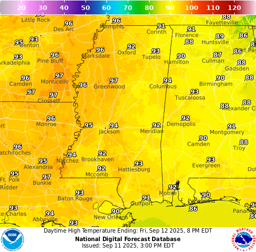
Tomorrow morning will be sunny with temperatures rising to the low-to-mid 90s in the afternoon. Partly cloudy skies remain for the rest of the afternoon through the evening and into the night. A quick isolated shower is not out of the question, as that surface trough tries to move in. Most will not see any rain, but very few could see this light sprinkle in the afternoon when the clouds build more.
Saturday’s Forecast
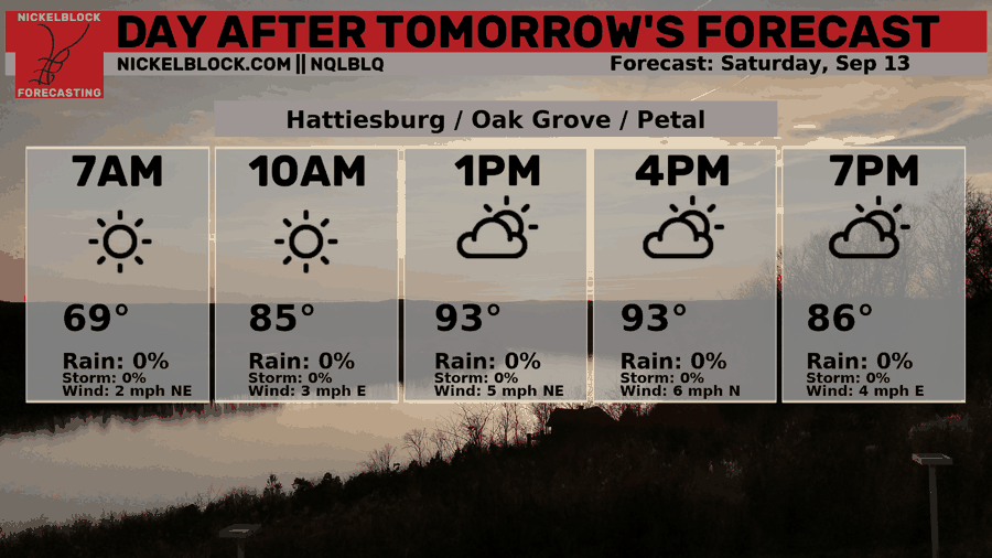
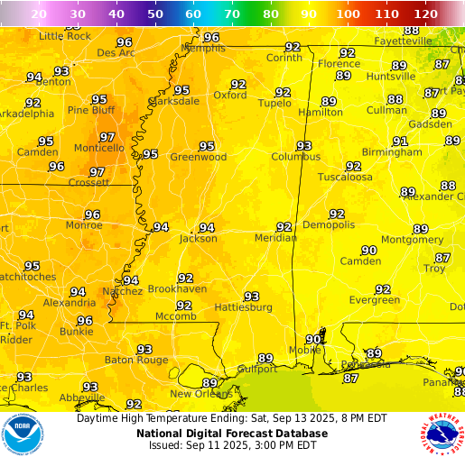
Saturday is looking very similar in terms of the weather. Temperatures in the low-to-mid 90s, low-to-moderate humidity, and sunny skies stick around through the weekend. Enjoy it, but ensure you stay hydrated given the heat!
Extended Local Outlook
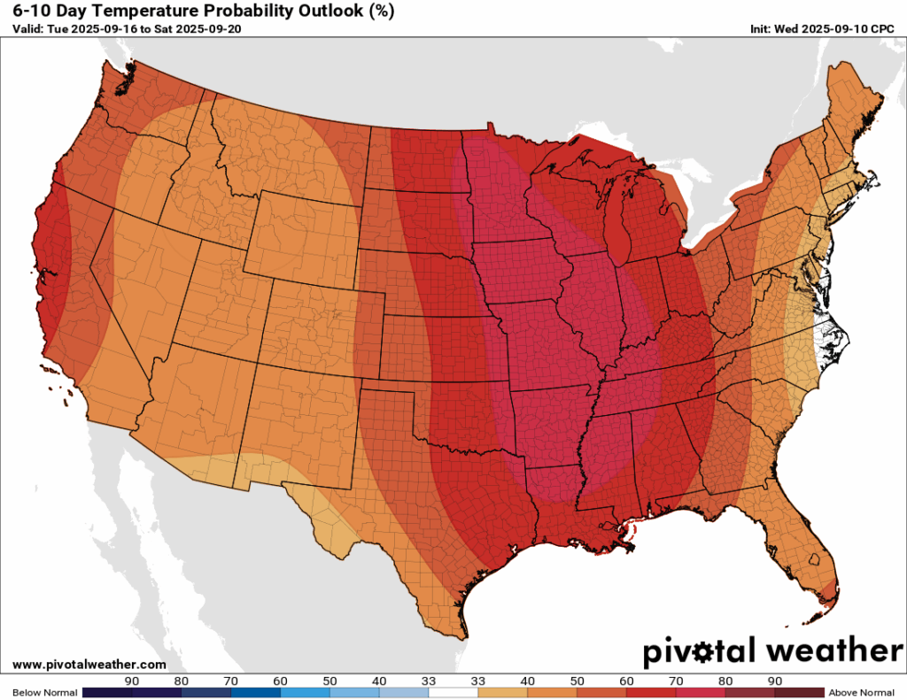
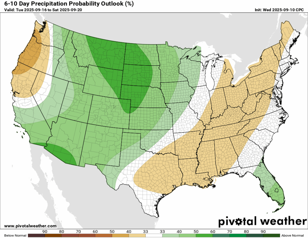
There is no end in sight for the heat and lack of rain for us. The next 6-10 days from the Climate Prediction Center shows a very high probability of above normal temperatures for us as the ridge builds out east. Rainfall is also expected to be below normal, which could worsen our drought conditions…
Updated Drought Monitor
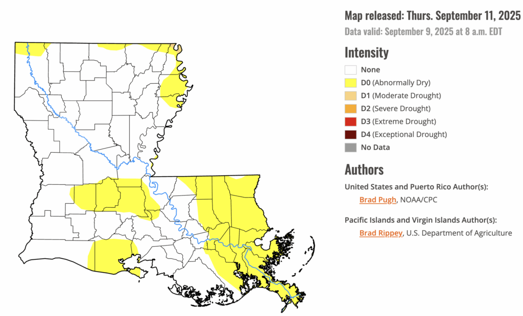
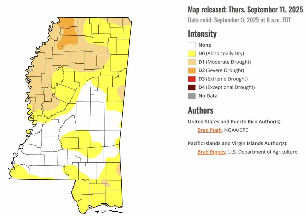
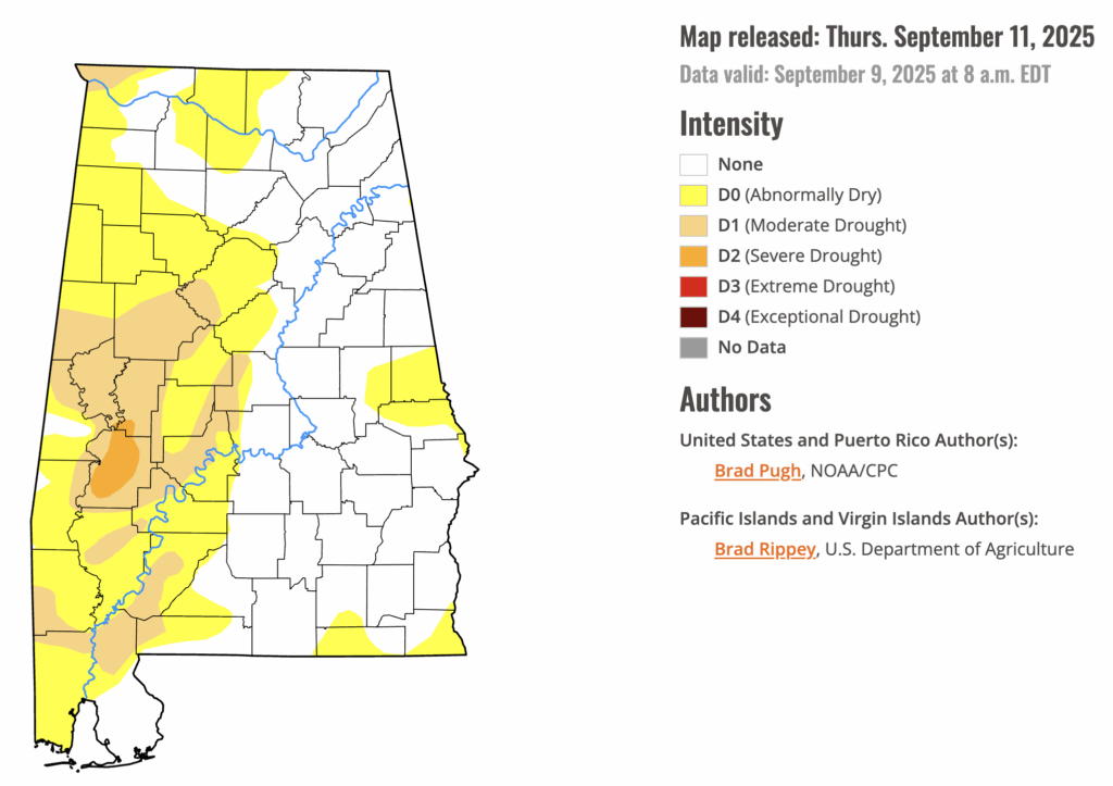
The drought monitor has been updated as of today and shows that each of the states in our region are experiencing a drought. This makes it easy for any fire to spread very quickly and get out of control. Ensure that burning is done very carefully and stay hydrated! We really could use some rain!!

Latest Tropical Update
Atlantic:
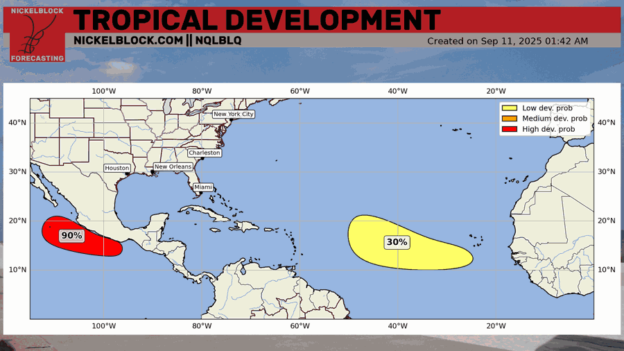
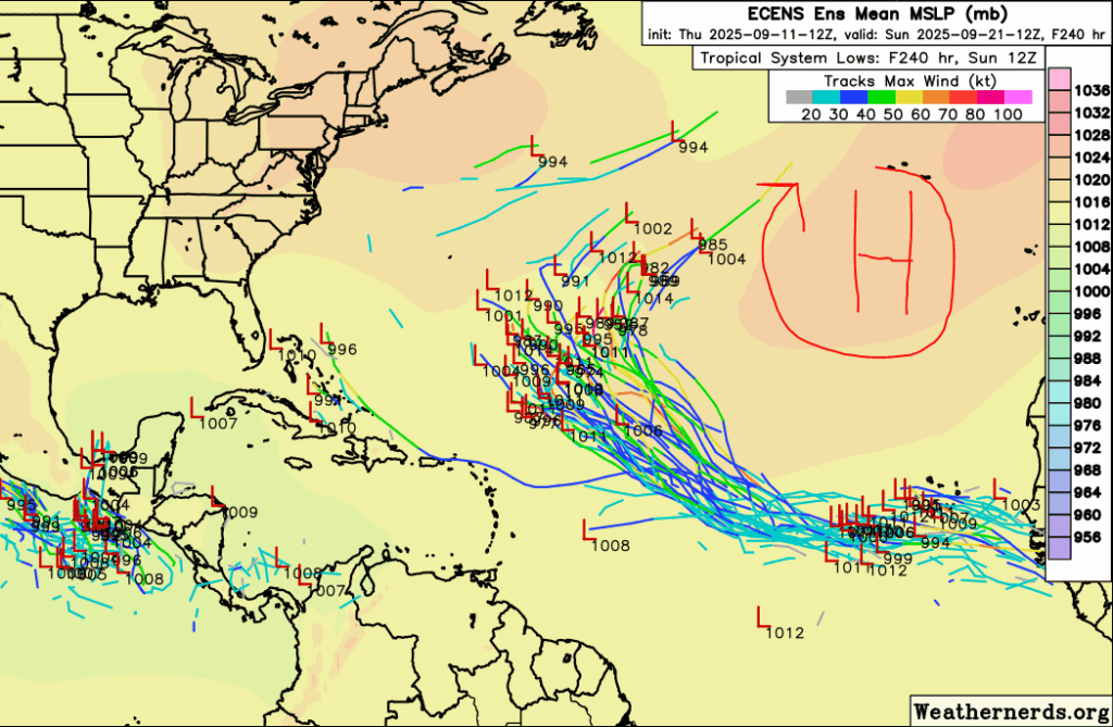
A 30 percent chance area of development has been highlighted in the eastern Atlantic by the NHC. Models are currently in agreement that any development would turn out to sea around the Atlantic High, which is very far east. If the high is strong enough, and if the system is north enough, it will be pulled around the high and out to sea in the open Atlantic. As we know, things could change so we are keeping an eye on this.
Eastern/Central Pacific:
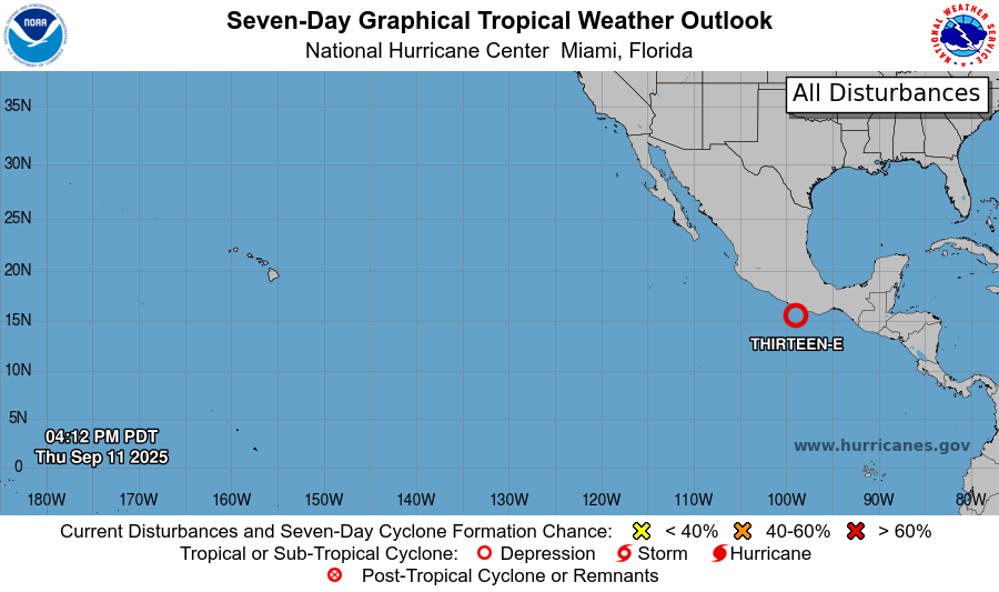
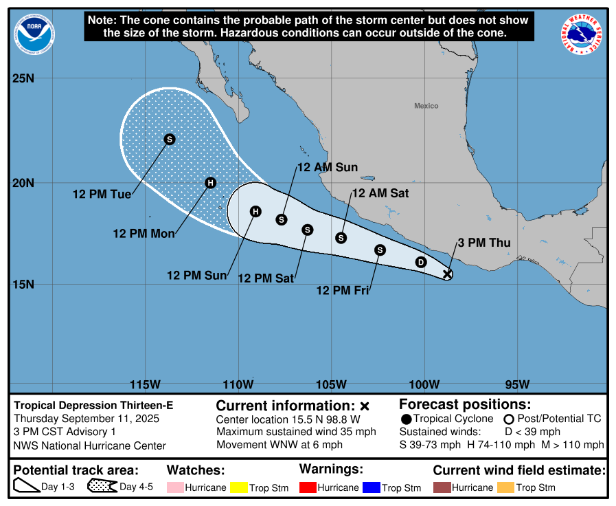
Tropical Depression Thirteen-E has formed in the Eastern Pacific just off the coast of Mexico. Winds are only 35 mph at the moment but there is a lot of rain with this system as it is fairly convective. Up to 6 inches of rain is expected over the western Mexican coast, which will bring the threat of mudslides and flash flooding. Winds shouldn’t be a huge problem since the center of circulation is expected to stay offshore as it rides up the coast, but some tropical storm force gusts are certainly possible.
REGIONAL DAY TO DAY FORECAST
Tonight: Clear with lows in the upper 60s. Calm winds.
Friday: Sunny with highs in the low 90s. Winds light, becoming north-northeast around 5 mph in the afternoon.
Friday Night: Mostly clear with lows in the mid 60s. North-northeast winds around 5 mph, becoming calm.
Saturday: Sunny with highs in the low 90s. Winds light, becoming east-northeast around 5 mph in the afternoon.
Saturday Night: Mostly clear with lows in the mid 60s. East winds around 5 mph, becoming calm.
Sunday: Sunny with highs in the low 90s. Winds light, becoming east around 5 mph in the afternoon.
Sunday Night: Mostly clear with lows in the mid 60s. Calm winds.
Monday: Sunny with highs in the low 90s. Winds light, becoming east-northeast around 5 mph in the morning.
Monday Night: Mostly clear with lows in the mid 60s.
Tuesday: Sunny with highs in the mid 90s.
Tuesday Night: Mostly clear with lows in the mid 60s.
Wednesday: Sunny with highs in the mid 90s.


