Scenario
A closed-low off moving through California will track east through the southern Rockies and into Texas. As it does so, it will increase the chances for wintry precipitation across New Mexico, Texas and Oklahoma. The main threats are for heavy snowfall, freezing rain and treacherous travel conditions.
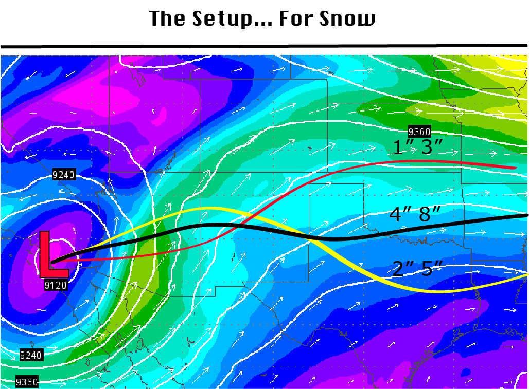
As the area of low-pressure moves toward Texas it will increase the chances for significant snowfall across New Mexico, the Texas panhandle, Oklahoma panhandle, and western Oklahoma. It will also create the opportunity for a freezing rain / snow mix for parts of West Texas and North Texas. Right now it appears that a thick layer (up to 1/2″) of freezing rain is likely in both North Texas and Central Texas.
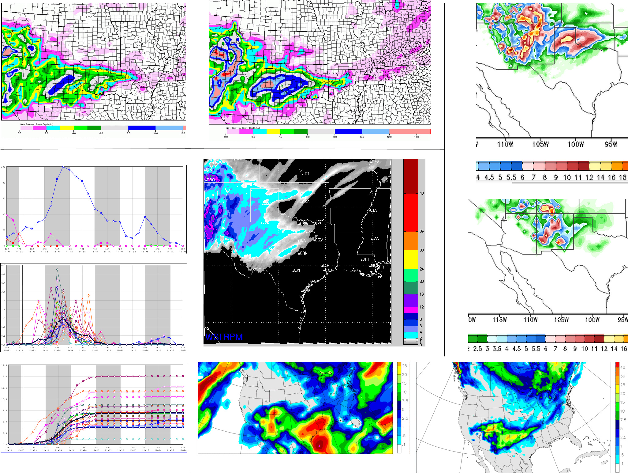
The main concern for the high plains of the Texas and Oklahoma panhandle – as well as eastern New Mexico – is the threat for heavy snowfall. Right now the models are still in disagreement with the track of this system, but estimates have come back between the 2″ and 3″ range and tallies as high as 12″ of snowfall.
Right now, I’m leaning more toward the 3″ to 6″ range in Amarillo and surrounding areas with lighter amounts north and heavier amounts south.
Detailed Forecast
Saturday Morning
Cloudy and Cold with temperatures in the teens and 20s. A few stray flurries and light snow showers around the high plains. these will drop a dusting or a 1/2″ at most. Winds from the north at 5 to 15mph.
Saturday afternoon / evening
Cloudy, still cold with increasing precipitation. Likely starting as a freezing rain / snow mix. Precipitation increasing from west to east. Accumulations during this time will be between 1/2″ to 2″ of a freezing rain / snow mix. Winds north at 5 to 15mph.
Sunday morning
Snow, heavy at times. Mixing with sleet and freezing rain at times. Accumulations during this time period will be between 1″ and 3″ (up to 5″ locally). Winds east at 5 to 15mph.
Sunday afternoon / evening
Snow, heavy at times. Wind shift could result in heavier snow bands. Accumulations during this time period will be between 2″ and 4″ (up to 6″ locally). Winds southeast at 5 to 15mph.
Summary
It is a difficult forecast to say the least. This is a unique weather setup and the likelihood of the high plains getting “slammed” with snow is about 20-percent. There is a better chance (around 50%) of just 2″ to 4″ of snow and no more.
That said, i can’t ignore recent history and the propensity for these lows to slide across the top of the Texas panhandle, which would put the heavy snow right on top of places like Amarillo, Childress, Pampa, Dalhart and Clovis.
I’m going to settle with a forecast for 3″ to 6″ of snow possible in the city of Amarillo through Monday morning. I’ll add that there will be greater amounts – between 5″ and 8″ – to the southwest and lighter amounts – between 2″ and 4″ – to the northeast.
But please keep in mind, if the system decides to get a “mind of it’s own” so to speak and push through along over the top of us, those totals could need to be as much as doubled.


