While we are still recovering from the last round of storms, we ahve another shot for rain adn storms today.
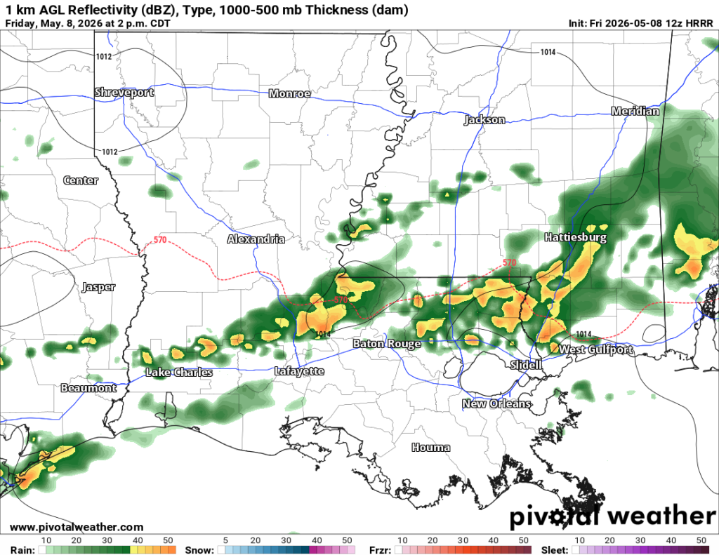
An active weather pattern is expected through the weekend as warm, humid Gulf air moves back into the region. Scattered thunderstorms could develop later today and tonight, especially across southern areas. A few storms may become strong to severe, with the main threats being damaging wind gusts up to 60 mph and hail around the size of quarters. While heavy downpours are possible, widespread flooding is not expected at this time.
And we can’t fully rule out a weak and brief tornado. But the risk for big tornadoes like the ones we saw the other day are not likely.
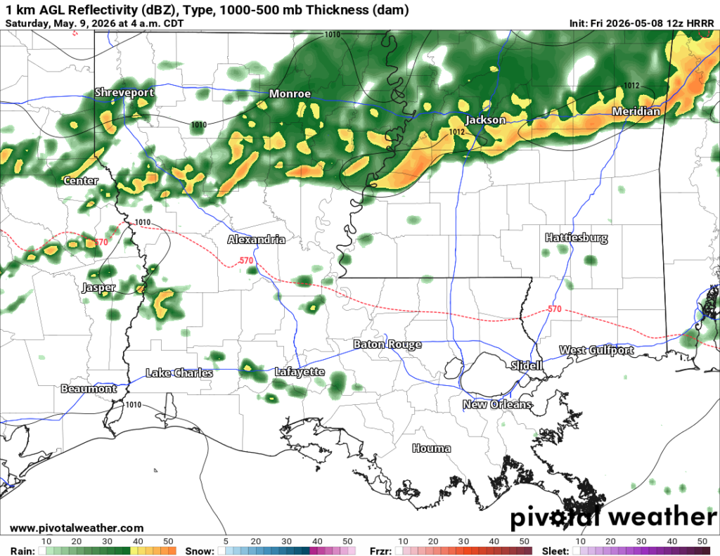
Another round of storms may develop overnight tonight into Saturday morning as a larger cluster of thunderstorms moves in from the northwest.
The shot for rain will continue at times through Sunday night before a cold front pushes through the area.


