The radar is filling in and it looks like the heavy rainfall that the WPC was worried about this morning may be finally showing up. Originally, I thought scattered storms would become more numerous, but it looks like they’ve all congealed into a line to the west and are starting to push through the area.
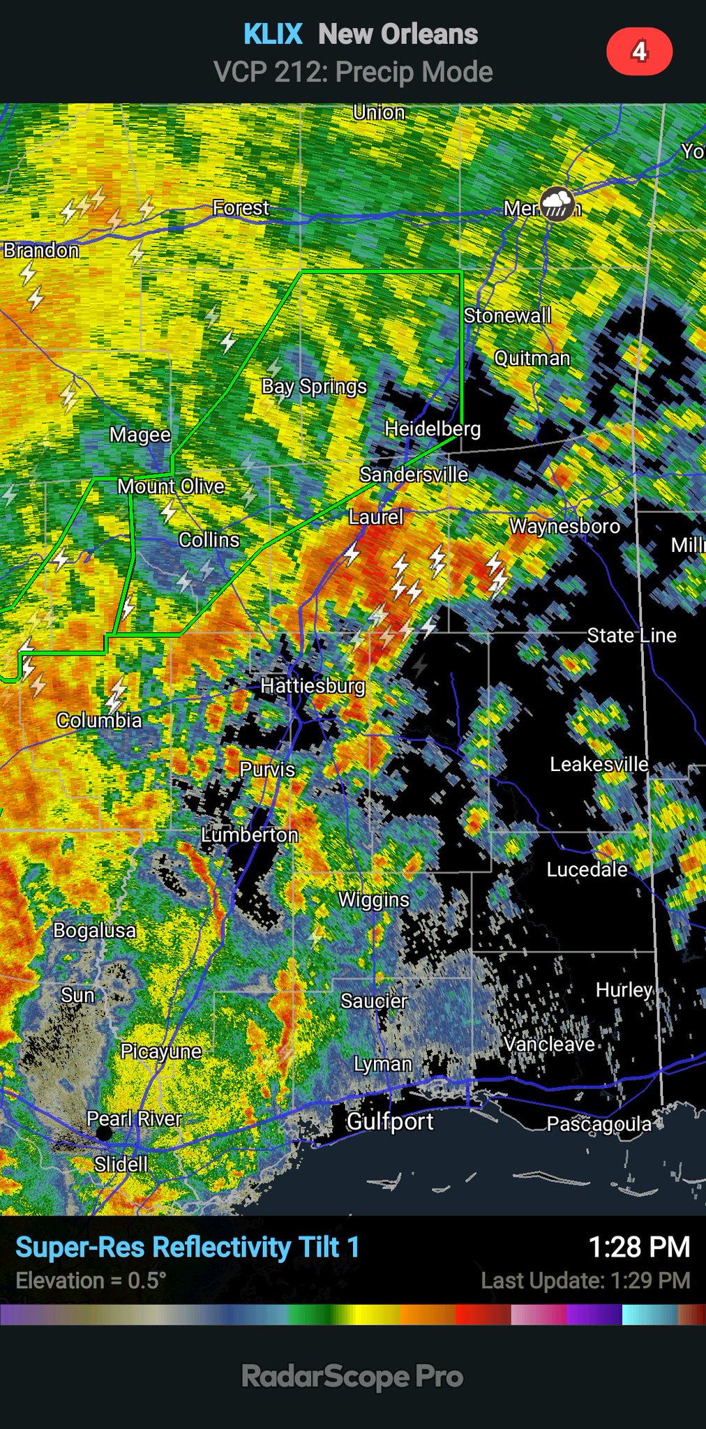
As these storms move through the area flash flooding may become more of a concern. Still not thinking “catastrophic” flooding, but water coming up in your yard or topping the roads in some places may be possible.
The Bottom Line
Storms will move through during the next 3 to 6 hours. Rainfall rates of up to 2″ per hour may be possible. So the rain may be VERY heavy at times. If you get stuck under one of these very heavy downpours, you may experience some brief flash flooding.

In total, model guidance shows 1″ to 5″ of rain possible – depending on your location – across parts of South Mississippi through midnight tonight.
The heaviest of the rain will likely be along and south the Highway 84 corridor, but given the splotchy nature of storms nearly everyone has a semi-equal chance of getting the higher-end of the rainfall totals.
I wish I could be a bit more precise, but sadly, I cannot.
But hang in there, friends. The heavy rain makes for good napping weather! And if water does start to rise in streams, creeks, rivers or even in your backyard and it starts to look a bit more dangerous, check with the warnings from the NWS and, if needed, seek higher ground.


